Elevation: 6,818 ft
Prominence: 678

This Granite Mountain (one of 12 Granite Mountains/Peaks in Idaho) is not in the book. Anna Goring provided the first entry which covers the most popular route to the summit. Livingston Douglas climbed the peak from Peak 5687 which allows one to enjoy a two-peak outing. Updated October 2025
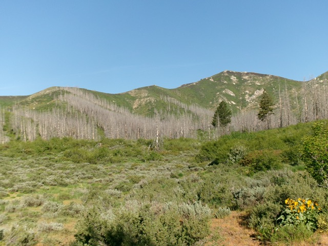
This peak is located due south of House Mountain on a long north/south ridge line. This area was recently ravaged by a forest fire. The peak rises up steeply above the South Fork Boise River. USGS House Mountain
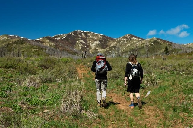
Approaching Granite Peak from the east. Anna Gorin Photo
Southeast Ridge-Northeast Ridge Traverse by Anna Goring
Access
Wilson Creek trailhead which is approximately 2.5 miles northeast of Anderson Ranch Dam on FS-114/South Fork Boise River Road [(E)(2.1) on Page 155].
Southeast Ridge-Northeast Ridge Traverse, Class 2
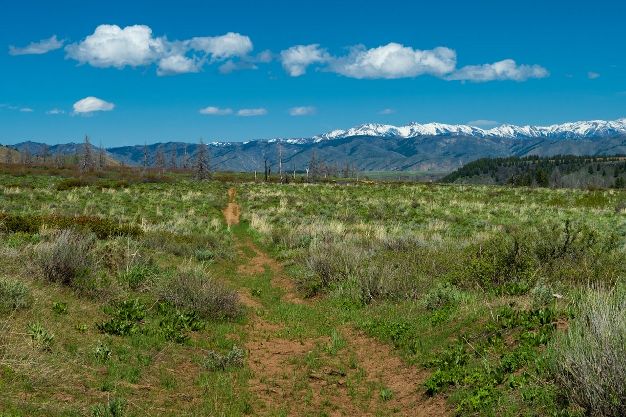
From the trailhead, we followed the 2-track road (FS-113G) along the creek, up the ridge to Wilson Flat and west to the base of Granite (about 4.5 miles of pretty easy walking), at which point we picked a ridge and made the final slow and steep 1,500-foot slog to the summit.
This route covers 11+ miles with about 3,000 feet of elevation gain round trip. There are views of the reservoir, the Danskins, the Soldier Mountains, etc. I am surprised that this peak doesn’t get much attention, especially with the fairly good trail access for the approach!
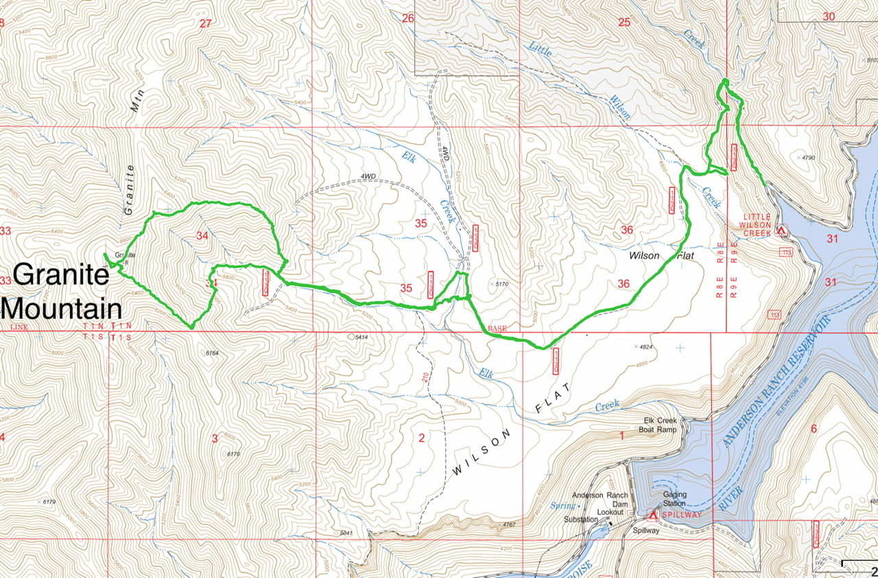
Anna’s GPS track
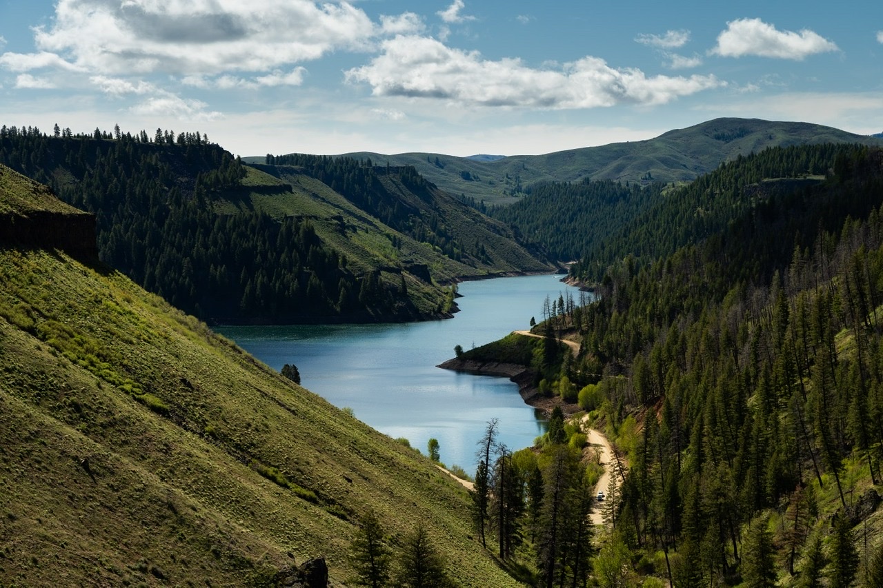
Anderson Ranch Dam as viewed from Trail#606. Anna Gorin Photo
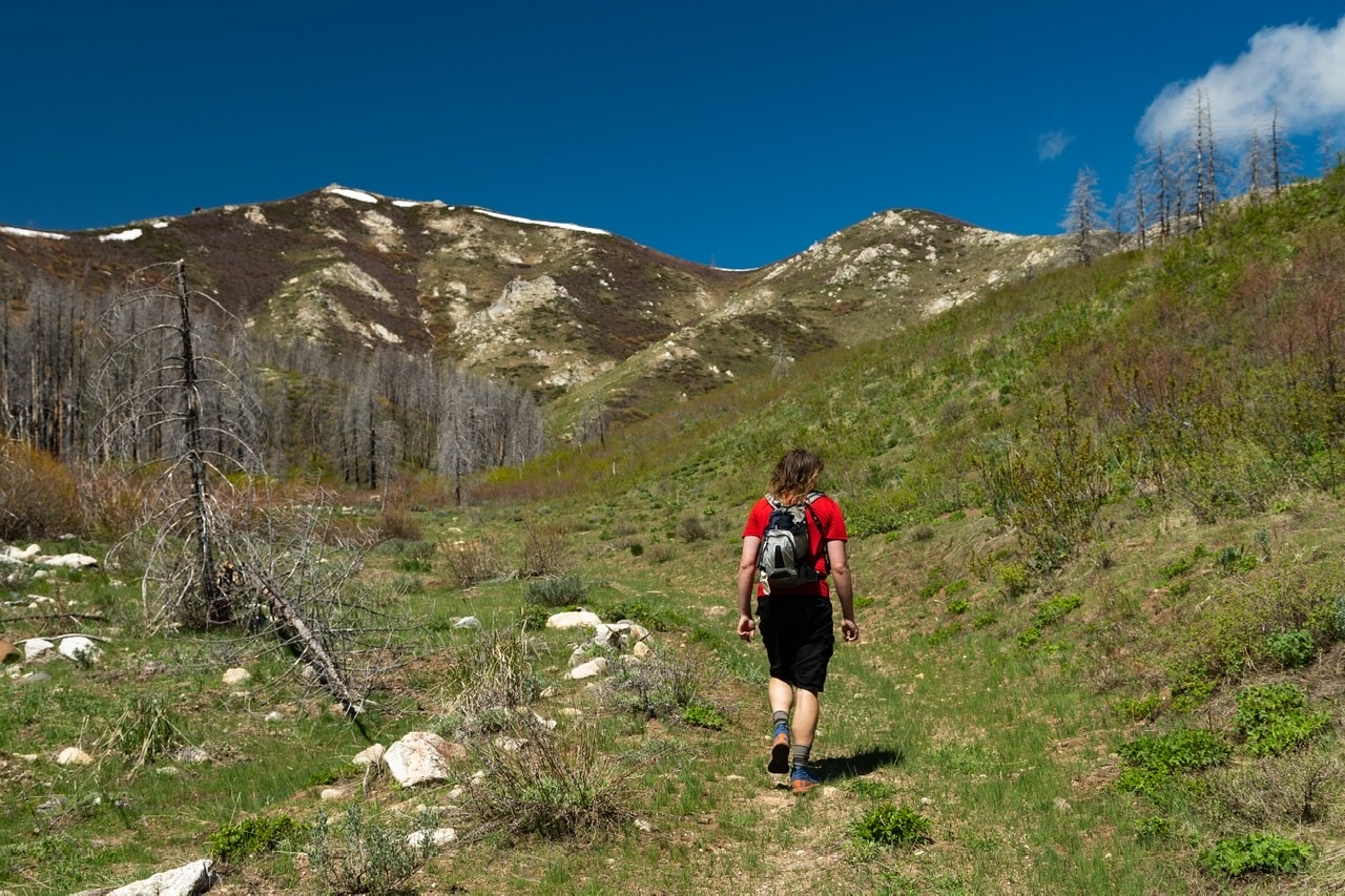
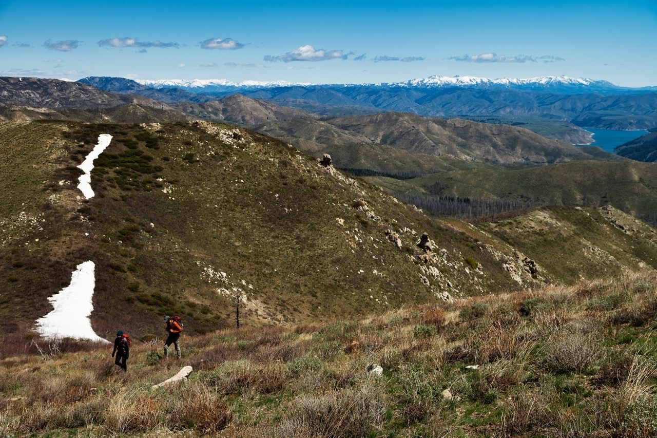
The remnants of very faint Trail#612 and Granite Mountain straight ahead (with the snow). Anna Gorin Photo
Climbing the final northeast ridge to the summit. Anna Gorin Photo
Looking toward the Soldiers going east on the way back. Anna Gorin Photo
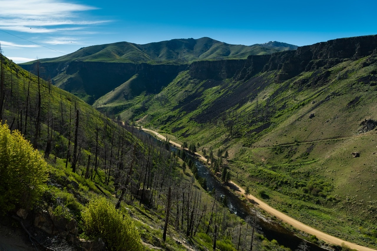
Granite Mountain (the one with the snow) overlooking the canyon as seen from the road up from Anderson Ranch Dam. Anna Gorin Photo
East Gully/North Ridge by Livingston Douglas
Granite Mountain as viewed from Peak 5687 to its east. Livingston Douglas Photo
Granite Mountain is a big mountain that sits at the head of Sproule Flat. It separates the Granite Creek drainage from the Elk Creek Drainage. Granite Mountain towers over the South Fork Boise River. This area is entirely public land, mostly National Forest land.
Access
Same as for Peak 5687. This is the second leg of a 2-peak adventure that includes Peak 5687 and Granite Mountain. It covers 10.0 miles with 3,350 feet of elevation gain round trip.
Map Updates
The “jeep trail” on the USGS topo map is now a poorly-maintained foot trail (FST-606). It doesn’t seem to join FST-609 at a sharp bend as the USGS topo map shows. FST-609/611/612 does exist as a single footpath that deteriorates as you go farther west. This trail is unsigned and is not maintained. It ends in a side drainage (the east gully of Granite Mountain) at about 5,515 feet, at the toe of a shoulder.
East Gully/North Ridge, Class 2
The Climb
Once across Elk Creek, quickly reach the old road that is FST-609 on the NF map. Contrary to maps, I found no junction/connection between FST-606 and FST-609. FST-609 is your ticket to Granite Mountain. Head southwest then west on FST-609 which is an old 2-track road that is now, at times, just a foot trail. FST-609 heads over into a different drainage—a feeder stream for Elk Creek. This feeder stream drainage (which soon goes bone dry) is the east gully of Granite Mountain.
FST-609 becomes FST-611 then FST-612 but there is no signage or maintenance of this single trail. Follow the old 2-track/trail to its end at about 5,515 feet at the base of a nice shoulder on the right/north side of the east gully. If the veg/brush wasn’t so thick early on from here, I would stay in the dry gully all the way west then northwest to the summit ridge. But it is. Leave the gully and scramble northwest up the reasonable veg on the shoulder on the right/north side of the gully. The crest of the shoulder has decent gaps and lanes in the veg on its left/southwest side.
Higher up, the shoulder gets thick with veg/brush. Leave it and traverse left/west across a minor gully in semi-open scrub/gravel to cross another minor shoulder and reach the east gully. Scramble up the surprisingly good scrub/gravel in the center of the gully (or on semi-open scrub/gravel on its sides) to reach the summit ridge at a saddle. Find a game trail in the thick-ish brush/veg and head southwest up the north ridge. Move to the right/west side of the ridge crest for less-thick scrub. The ridge soon thins out and becomes an easy scrub/gravel scramble up to a minor ridge point.
Skirt the right/west side of this rocky point and head right-ish/west directly at the nearby summit hump. The rocky summit of Granite Mountain has a decent cairn, triangulation wood/wiring, and a USGS benchmark on the high point. To return to the Wilson Flat trailhead, retrace the ascent route back down to Elk Creek. Cross the creek and find FST-606 and follow it south, then east, then northeast across Wilson Flat. Continue following FST-606 as it heads north then drops into the Wilson Creek drainage and heads south to the Wilson Flat trailhead. It is much easier to climb Granite Mountain solo from the west via FSR-121 and the Granite Creek Trail. Bushwhack up the northwest ridge from there.
Granite Mountain (summit is right of center) and its lengthy southeast ridge (left of center) as viewed from the Elk Creek drainage. Livingston Douglas Photo
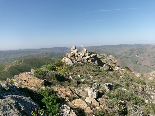
The summit of Granite Mountain. Livingston Douglas Photo
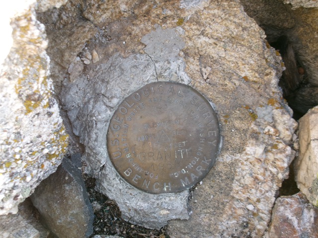
The USGS benchmark atop Granite Mountain. Livingston Douglas Photo
Additional Resources
Regions: Boise Mountains->WESTERN IDAHO
Mountain Range: Boise Mountains
Longitude: -115.4997 Latitude: 43.3749