Elevation: 5,119 ft
Prominence: 2,814
This peak is not in the book.
This P2K summit is one of the least-known 2,000-foot prominence peaks in Idaho. It is located near the southern end of the Idaho Selkirks south of the Pend Oreille River. The peak is almost entirely privately-owned. USGS Blanchard
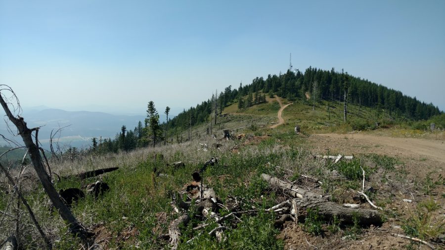
Hoodoo Mountain. Ken Jones Photo
Access and Route Information by Ken Jones
This was a drive-up with high clearance. It would take a skilled and aggressive driver to get a passenger sedan up the final mile and a half or so (above the turn just above 4,400 feet) but we saw a small car on its way down, so apparently it can be done.
We left ID-41 turning northeast onto the Clagstone Cutoff (signed). Then turned sharp left after almost a mile onto the Blanchard Cutoff (mapped in Benchmark Atlas, I think there was a sign). Then turned right/north onto FSR-2550 (small green sign reading “2550” that was almost hidden among a number of other, larger signs). All of this can be seen on the GPS track/map set out below.
The GPS track shows our driving route. There were no postings, and I believe that this is a public right-of-way to access Forest Service land. Two notes – (1) there is a gate at about 3,400 feet (open at the time of our visit) and (2) just before the left fork leading to the peak, there is a logging spur road with a gate on the left (also open at the time of our visit) ; we mistakenly headed down this road briefly before realizing it was not the summit road. In season (with the gates open), a passenger car should be able to drive to 4,400 feet and high-clearance vehicles should be able to get to, or close to, the summit.
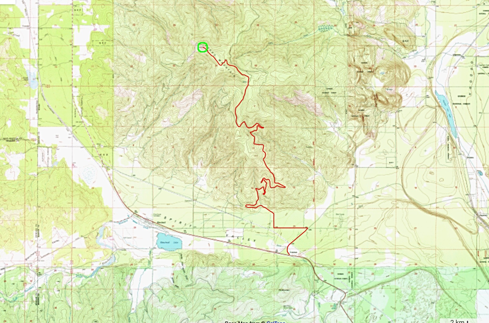
Ken Jones’ GPS track.
Additional Resources
Regions: NORTHERN IDAHO->Selkirk Mountains
Mountain Range: Selkirk Mountains
Longitude: -116.95359 Latitude: 48.07859