Elevation: 7,253 ft
Prominence: 1,073
This peak is not in the book. Published June 2021
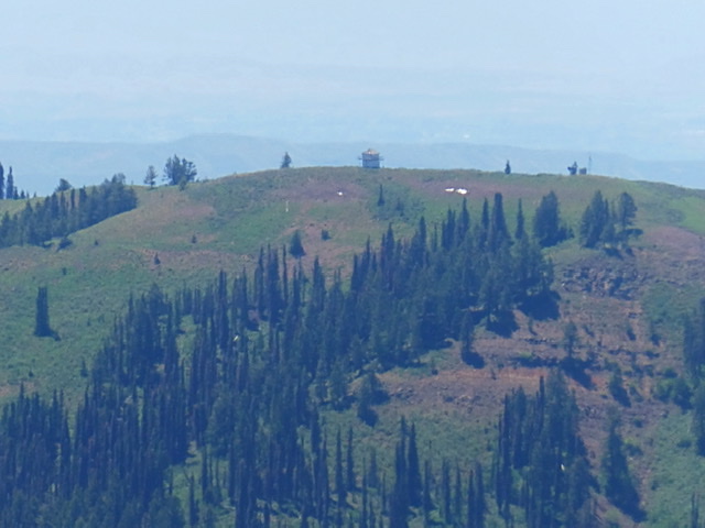
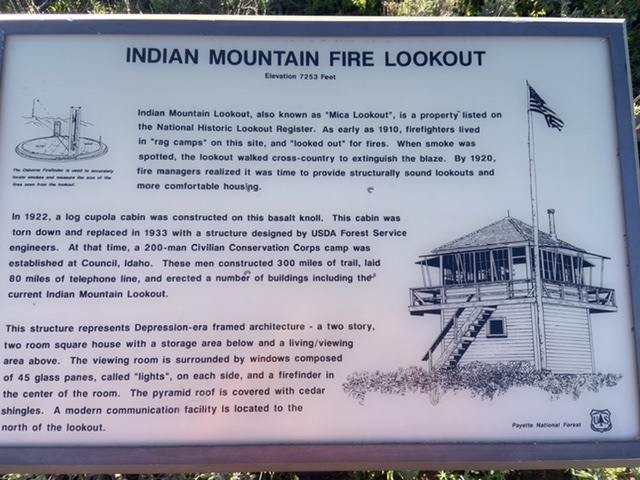
Indian Mountain is a big, whale-shaped peak located west of the main West Mountains Crest. It sits on basalt-based ridge inexplicably called Mica Ridge by the mapmakers. Because of its prominence, it was chosen as a fire lookout site in the 1920s. As you would expect, the views from the top (especially to the west) are endless. USGS Cold Spring Ridge
Indian Mountain as viewed from the east
Access and Route, Class 1
This is a drive up. Google Maps provides workable directions from Donnelly or Cambridge, Idaho. In order to maintain my sanity, I am not going to write up the directions. Instead, I will just provide a few comments which may aid your journey. Carry an up-to-date Payette National Forest map with you. If you choose to use Google Maps and are coming from Donnelly, use the southern option since the northern option is blocked by private property. If coming from Cambridge, the option shown works well. Note that there is a second option which is not shown but uses the west end of FSR-214.
The main Forest Service roads used to reach Indian Mountain Road/FSR-243 are frequently maintained but are narrow with too many curves to count. This area sees periodic logging so always check with the Payette National Forest to make sure that the road is not closed for logging. FSR-243 is signed at its junction with FSR-214. The sign gives the mileage to the lookout as 4.0 miles. It is actually 5.2 miles. FSR-243 is a good road for the first two miles but then deteriorates. At a minimum, you will want a high-clearance vehicle to drive to the top. Cattle graze on the peak and they sometimes make it all the way to the lookout.
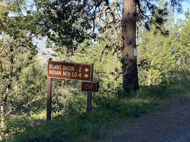
The sign at the junction of FSR-214 and FSR-243.
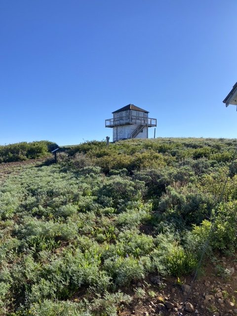
The lookout has been repaired recently.
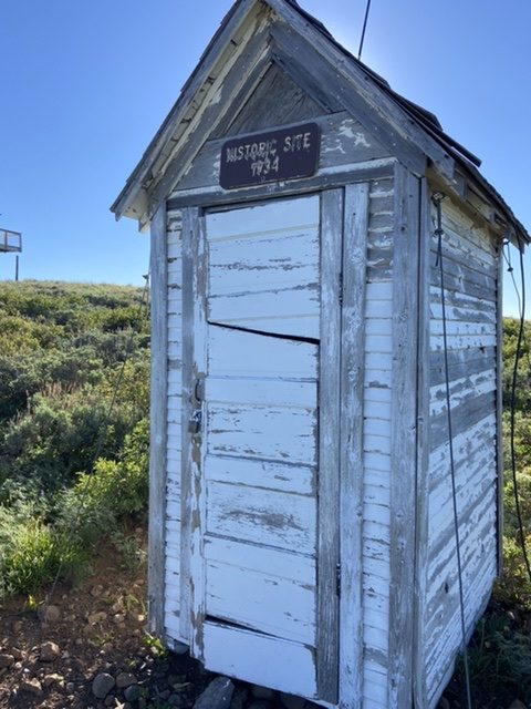
The outhouse is also on the Historic Landmark register.
Additional Resources
Regions: West Mountains->WESTERN IDAHO
Mountain Range: West Mountains
Year Climbed: 2021
Longitude: -116.24929 Latitude: 44.59929