The West Mountains are discussed on Pages 104-108 of the book. The book only covered the main West Mountain Crest. In addition to updates on the main crest peaks the website also includes the southwest West Mountains peaks.
The West Mountains are a north-south trending mountain range, which is the westernmost extension of the Idaho Batholith. The range is separated from the main body of the Salmon River Mountains by the Little Salmon River and the North Fork Payette River in the east. The range forms a 75-mile long upland that runs from New Meadows, ID in the north to a south terminus near Emmett, ID on Squaw Butte. Use this link to see all West Mountains peaks covered on this website: West Mountains Peaks.
Looking north from Granite Mountain to Wilson Peak.
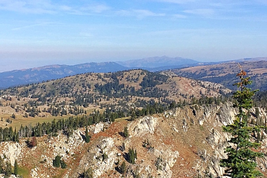
The range’s highest peaks are found along its eastern crest. A complicated series of ridges and drainages varies in width from 10 to 20 miles. Snowbank Mountain is the highest summit at 8,322 feet. The area around Snowbank Mountain is an exceptional area of high country with large attractive meadows and a lot of exposed granite.
The higher eastern summit viewed from Granite Peak.
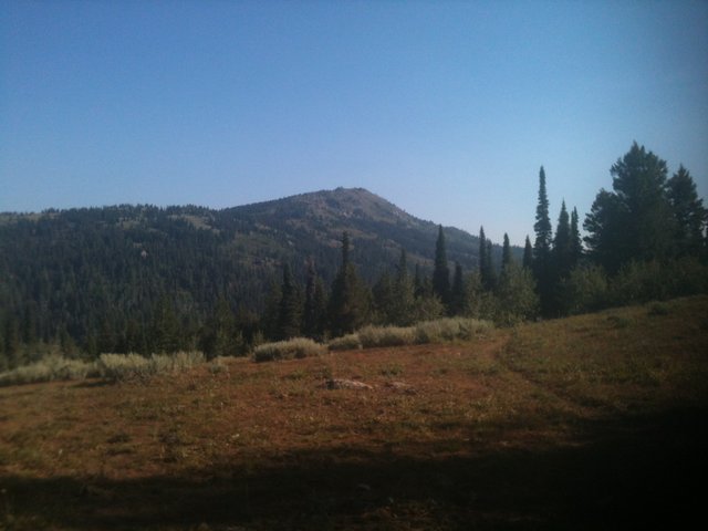
Tripod Peak as viewed from the trail leading in from the south. The southern route is not in the book and involves an 11.6-mile round-trip hike.
Southwestern West Mountains
The southwestern end of the range is located west of the main crest and the Sweet and Ola Valleys which are drained by Squaw Creek. Squaw Creek begins high the main crest of the West Mountains at roughly 7,483 feet and then wiggles north and west before turning south to flow through the Ola and Sweet Valleys and into the Payette River at the Black Canyon Reservoir east of Emmett. The creek markedly separates the main crest from the Southwestern West Mountains.
Arguably, this group deserves its own separate range name because it is, for the most part, detached from the main West Mountains crest. Alas, the geographers have failed to provides us with a name. This area is composed of three groupings of low, rugged peaks. Two of these groupings are north/south trending, parallel, 20-mile long ridges, Cherry Ridge and Willow Ridge. The third and larger group is a difficult to define conglomeration of ragged smaller ridges and peaks located west of Willow Ridge.
Cherry Ridge
Cherry Ridge runs from Dodson Pass in the north to its highest point on Squaw Butte massive in the south. Cherry Spring Benchmark, with over a thousand feet of prominence, is the highest point. It is located mid-ridge. Peak 4970 is the northernmost ranked summit on the ridge. The ridge does not have an official name. Squaw Creek which runs through the beautiful Sweet Ola valley is the primary drainage on the east side of the ridge. The Big Flat Valley is located on the west side of the ridge. Access from the east, with the exception of Sweet Butte, is blocked by private land. In the west private land also impacts access but there are numerous locations where public land runs from the public road to the ridge crest. There are several 4WD/ATV trails running through this country and, in places, on the ridge crest. These routes are poorly mapped and unsigned.
Squaw Butte is the southern terminus of the middle ridge and the ridge’s most rugged expression. Four points on Squaw Butte have more than 300 feet of prominence.
Willow Ridge
Willow Ridge is the westernmost of the two parallel ridges. The high point on this ridge is Willow Peak at 5280 feet. This peak is found in the middle section of the ridge.The Payette County High Point is found near the south end of the ridge. The Big Flat Valley is located on the east side of the ridge. Private property blocks access on the east side. Four Mile Creek and the Four Mile Creek Road runs along the west side of Willow Ridge. There is good access from this road.
Weiser Mountains
The third group covers a large diverse area with numerous peaks and drainages, many of which are tributaries of the Weiser River. It is bounded by the Four Mile Creek Road in the east, US-95 and the Weiser River in the west, ID-52 in the south and Weiser River in the north. I have only explored the peaks accessible from Four Mile Creek Road. Private property encompasses much of this western stretch of mountains and is scattered throughout the remaining areas. This, of course, complicates access to many of the peaks.
Southwestern West Mountains
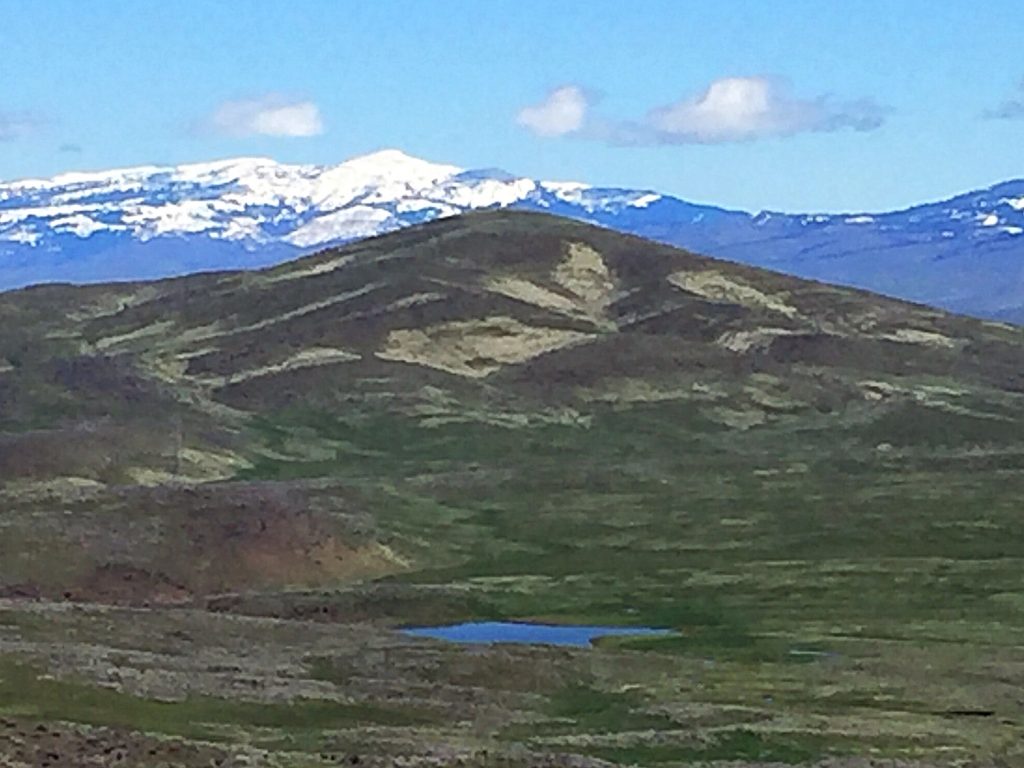
The eastern escarpment of Willow Ridge.
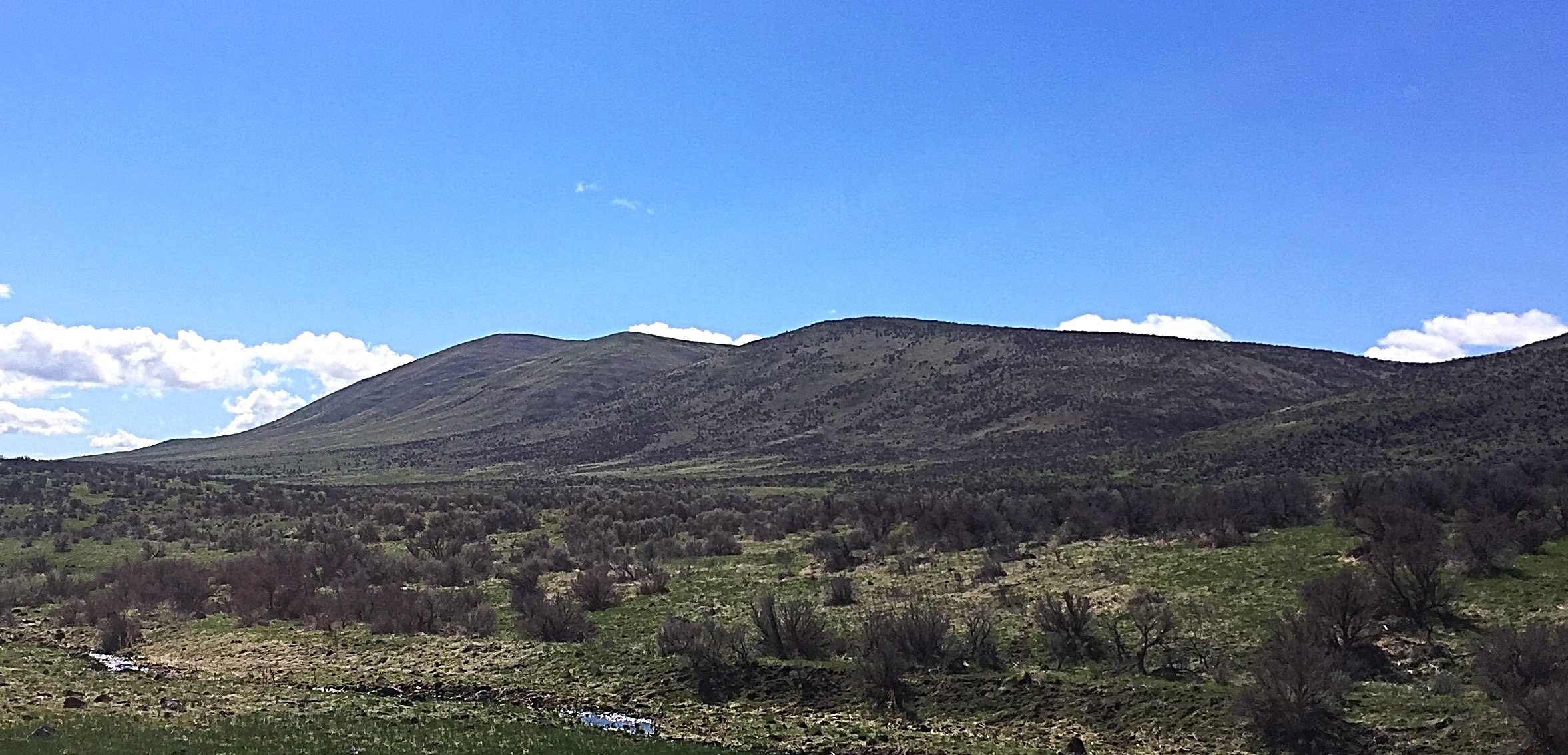
Riley Butte sits at the very end of Willow Ridge.

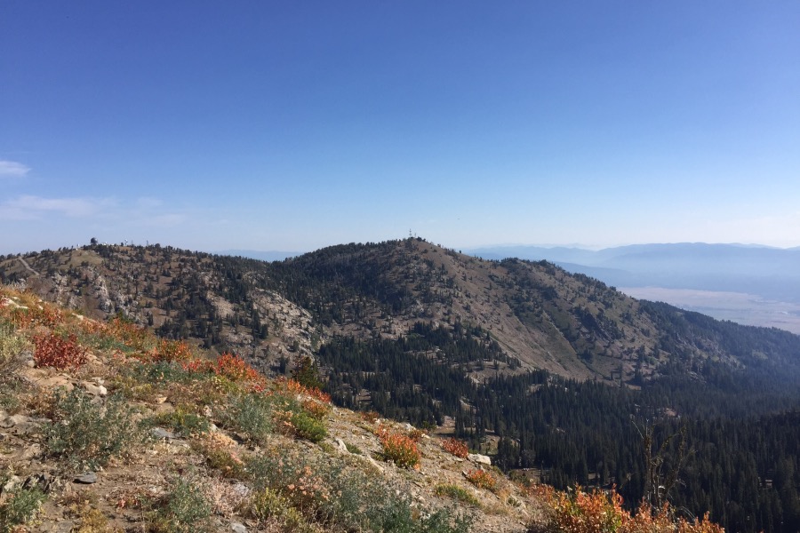
Looking north along the West Mountains Crest from Dry Buck Mountain to Tripod Peak. This section of the West Mountains is mostly between 5,500 and 6,000 feet and is covered with dense forest.
Regions: West Mountains->WESTERN IDAHO
Mountain Range: West Mountains