Elevation: 5,280 ft
Prominence: 1,490
This peak is not in the book. Published June 2018
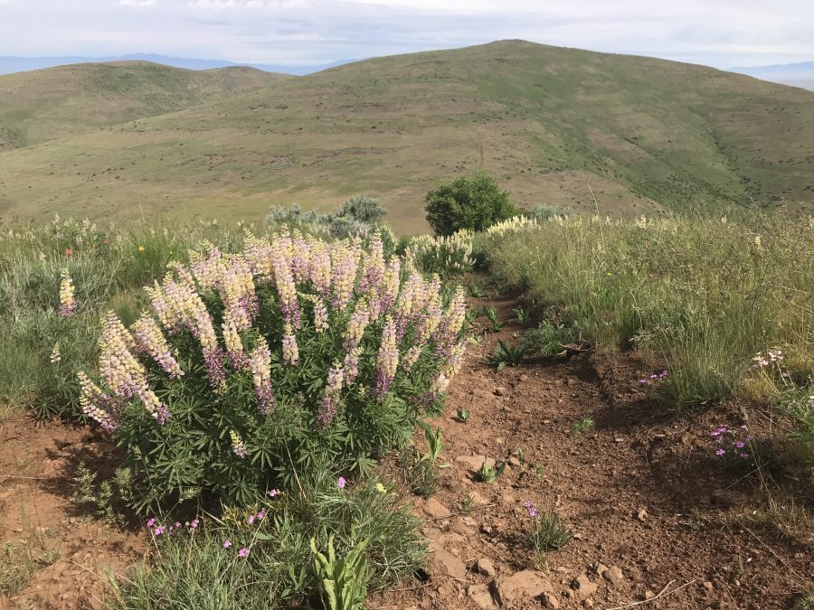
Willow Peak is the highest point on Willow Ridge, which is major north-south trending ridge in the Southwest End of the West Mountains. This peak has over a thousand feet of prominence and a corresponding massive view. There are few trees on Willow Ridge and much of the ridge is managed by the BLM as wildhorse habitat. This is a great Spring hiking area. Later in the year, the fire danger will be extreme. USGS Coonrod Gulch
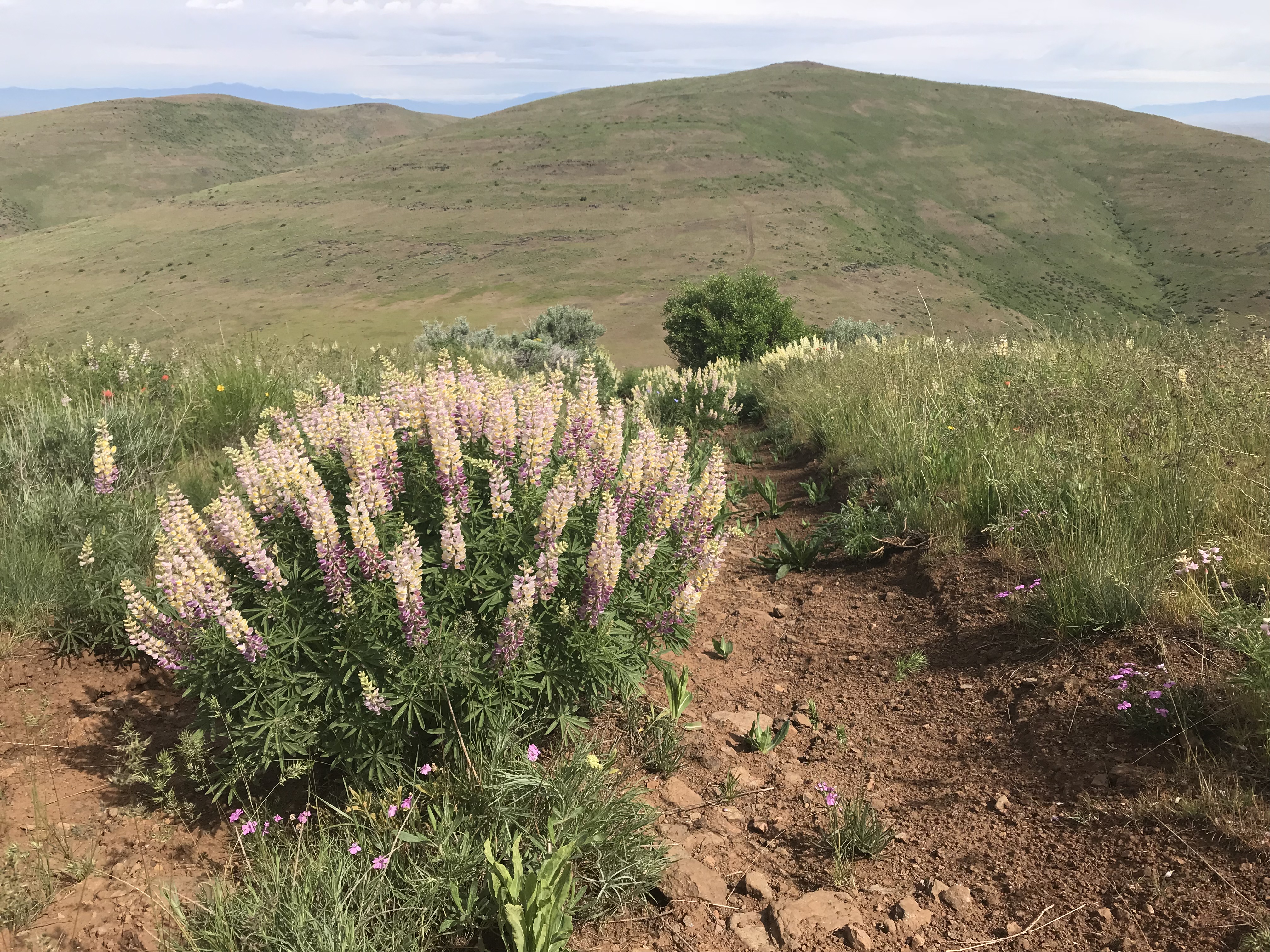
Willow Ridge as viewed from Peak 5208.
Access
Access this peak from Emmett, ID and ID-52, which runs north through downtown Emmett. From the junction of ID-16/ID-52, follow ID-52 north to a 4-way intersection in 3.3 miles. ID-52 turns east toward Horseshoe Bend, but continue straight through the intersection on the Black Canyon Road for 4.3 paved miles. When the road turns to gravel, continue for another 8.7 miles. Here, the road reaches a creek bottom at a junction. Take the left fork which climbs up Fourmile Creek. The Fourmile Creek Road is occasionally maintained and can be rough if not recently graded.
After 5.8 miles, the road reaches a pass which is signed designating the Payette-Washington County line. Continue another 1.7 miles to another pass where a 4WD road leads to the east. This road starts out as a 2-track road but eventually deteriorates into a difficult 4WD route better suited for hiking. It quickly crosses a rugged, washed-out irrigation ditch before proceeding up ridge that climbs east toward the Willow Ridge Crest. Your vehicle and driving skills (courage) will dictate how far you drive.
South Ridge, Class 2
The peak can theoretically be climbed from any direction, but private property limits access points. This route avoids private property issues and is a scenic and enjoyable ridge walk. From the main road, drive as far as your vehicles and driving skills allow. Park and follow the road up and east to the crest at 5,149 feet. From this point, turn north and follow the road north to Peak 5208. Descend the road to the next saddle and then follow it up the top of Willow Peak. Just before reaching the summit, there is a fence. In 2018, I could not get the gate to open because it was too tight. I crawled under the fence. The summit is a short distance from this point. There is a large rock cairn and a summit register on top.
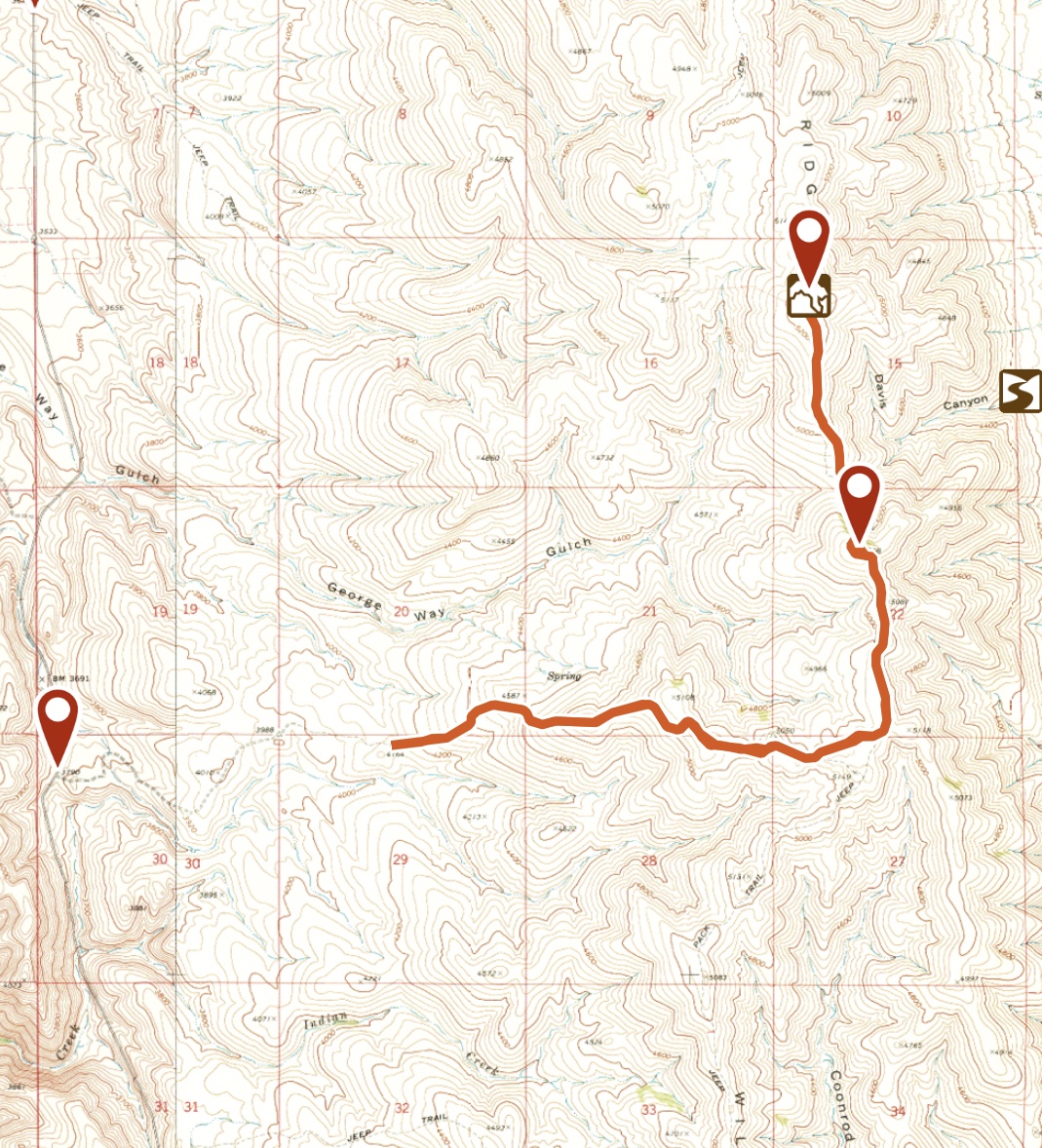
This is my GPS track for the hike. From my parking spot, it was 8.4 miles round trip with 1,800 feet of elevation gain. I don’t recommend driving any farther than my starting point unless you have a 4WD vehicle with exceptional off-road tires.
Additional Resources
Regions: West Mountains->WESTERN IDAHO
Mountain Range: West Mountains
Year Climbed: 2018
Longitude: -116.44929 Latitude: 44.20579