Elevation: 4,970 ft
Prominence: 502
This peak is not in the book. Published April 2021
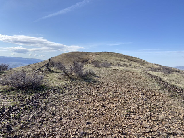
This peak is located north of Emmett, Idaho at the north end of Cherry Ridge and just south of Dodson Pass. Cherry Ridge is a long, twisting, up-and-down ridge that runs south from Dodson Pass to the Squaw Butte massive. This portion of the West Mountains is characterized by treeless, sagebrush-covered slopes with sweeping views. USGS Dodson Pass
Peak 4970
Access
Primary access is from the Sweet-Ola Highway. Google Maps gives you good directions to Dodson Pass, Washington County.
North Ridge, Class 2
Park on Dodson Pass. Dodson Pass is on private property. Fortunately, thanks to the generosity of the land owner and the Idaho Fish and Game Department, this private land is part of the Access Yes program and is open to the public. Private property open to the public under this program is subject to rules that vary from area to area, so familiarize yourself with the rules/restrictions before taking advantage of the program.
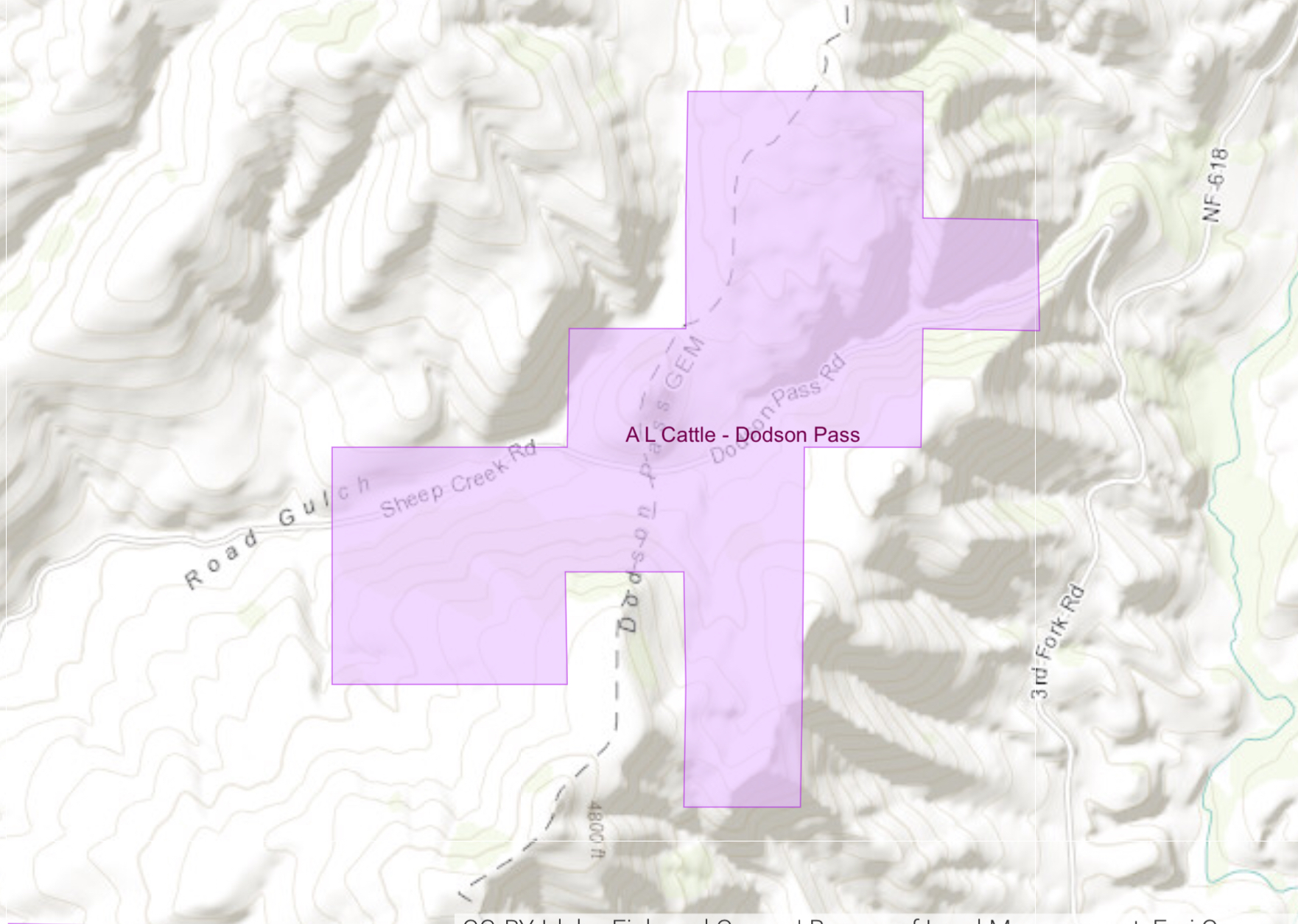
The Dodson Pass parcel covered by the Access Yes program
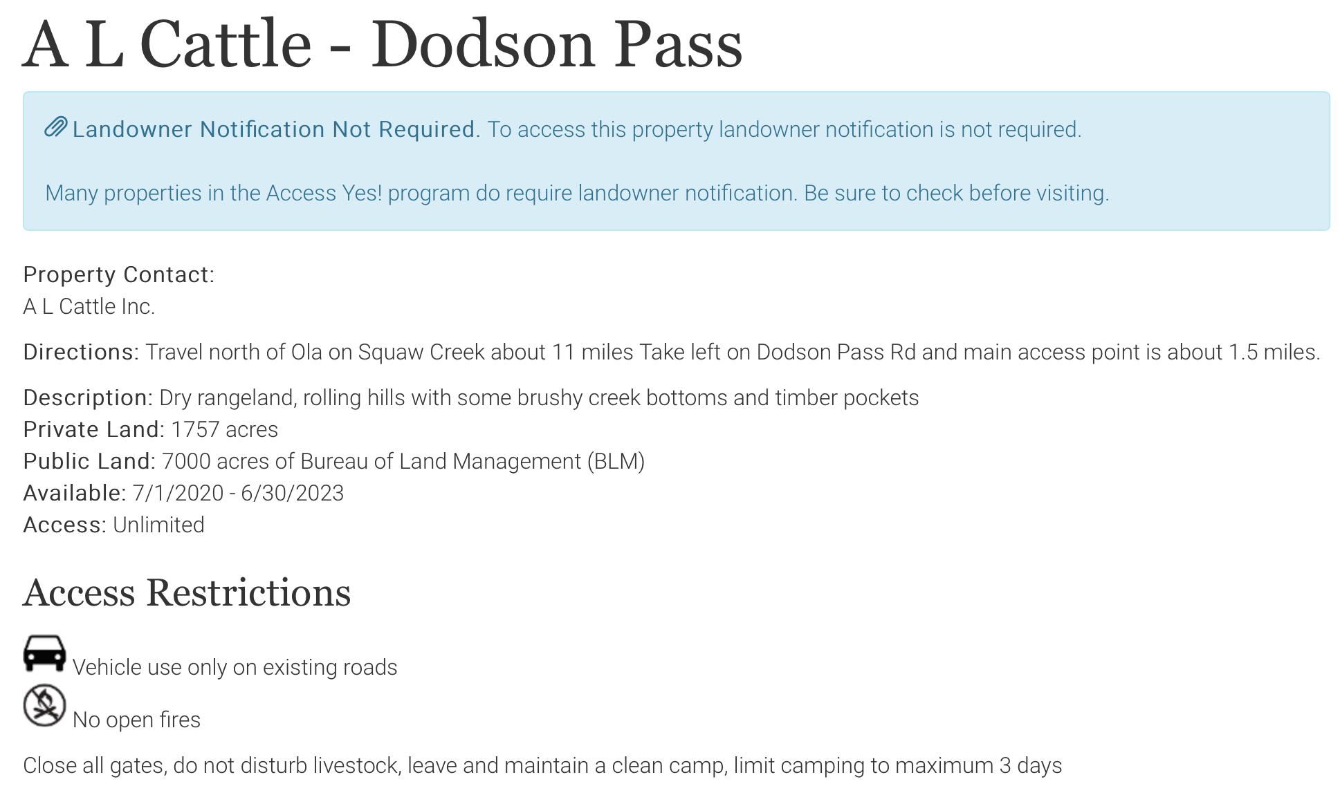
The rules governing the Dodson Pass parcel
From the pass, hike due south up the steep toe of Cherry Ridge. The route quickly reaches a steep, brushy section that is best bypassed on the east side of the thickest brush. Once above the brush, the route is straightforward. Cross over Point 4964 and follow the fence line past Point 4925. The fence line leads all the way to the summit of Peak 4970. You can use an old fire break and game trails in many places.
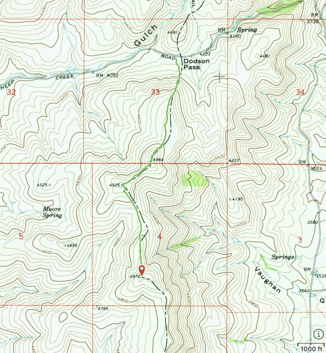
My GPS Track. The route covers 3.6 miles with 994 feet of elevation gain round trip.
Additional Resources
Regions: West Mountains->WESTERN IDAHO
Mountain Range: West Mountains
Year Climbed: 2021
Longitude: -116.34519 Latitude: 44.31309