Elevation: 4,657 ft
Prominence: 517
This peak is not in the book. Published November 2023
Indianola Benchmark is located at the southeast end of a narrow ridge that separates Squaw Creek from the Salmon River in the Bitterroot Mountains. It is most easily climbed from the Salmon River Road via its west shoulder. The south side of Indianola Benchmark has some rugged cliffs down near the Salmon River. The peak is a short distance southwest of the Indianola Guard Station. USGS Ulysses
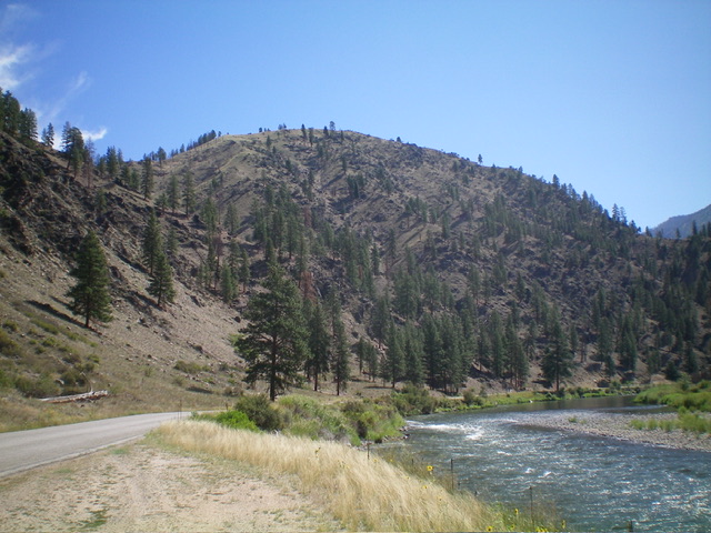
Indianola Benchmark (dead center) as viewed from the west, with the magnificent Salmon River right of center. Livingston Douglas Photo
Access
Same as for Peak 4550. This is the second leg of a 2-peak adventure that includes Peak 4550 and Indianola Benchmark. It covers 3.7 miles with 1,855 feet of elevation gain round trip.
Northwest Ridge, Class 2
The Climb
From the 4,140-foot connecting saddle with Peak 4550, scramble southeast up over Point 4332 on the narrow ridge crest then drop to a saddle at 4,180 feet. Continue southeast then south on the narrow ridge to reach the gentle summit of Indianola Benchmark. The ridge terrain is a mix of field grass, some ridge trees and deadfall, and a few rocky ridge outcrops (nothing serious). The summit of Indianola Benchmark has a small summit boulder with a triangulation wire wrapped around it. I could not locate the USGS benchmark. The summit hump is small and grassy.
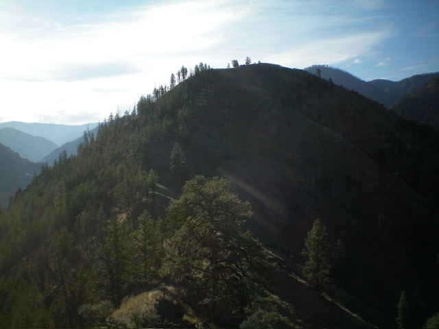
Indianola Benchmark as viewed from the connecting ridge with Peak 4550 to its northwest. Livingston Douglas Photo
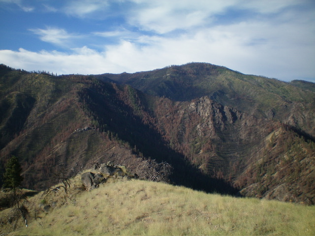
Summit view from atop Indianola Benchmark, looking south across the Salmon River at the mix of live and dead pines so typical of the Eastern Salmon River Mountains. Livingston Douglas Photo
West Shoulder, Class 2
The Descent
From the summit, descend briefly north on the ridge to reach the top of the magnificent west shoulder. Follow the open shoulder down to Salmon River Road. The shoulder is a mix of field grass, a few ridge pines, and minimal rock. It goes quickly. Once on the road, follow it west to the large roadside pullout and your awaiting vehicle. If you are climbing only Indianola Benchmark, there are two small roadside pullouts at the base of the west shoulder. The toe of the west shoulder is on the right/east side of a prominent gully.
Additional Resources
Regions: Bitterroot Mountains->NORTHERN IDAHO
Mountain Range: Bitterroot Mountains
Longitude: -114.1785 Latitude: 45.3983