Elevation: 4,550 ft
Prominence: 410
This peak is not in the book. Published November 2023
Peak 4550 is situated on a narrow ridge crest between Squaw Creek and the Salmon River in the Bitterroot Mountains. It is most easily climbed from Squaw Creek Road to its northeast. This area is a mix of private and public land, so be careful. This climb is entirely on National Forest land. USGS Ulysses
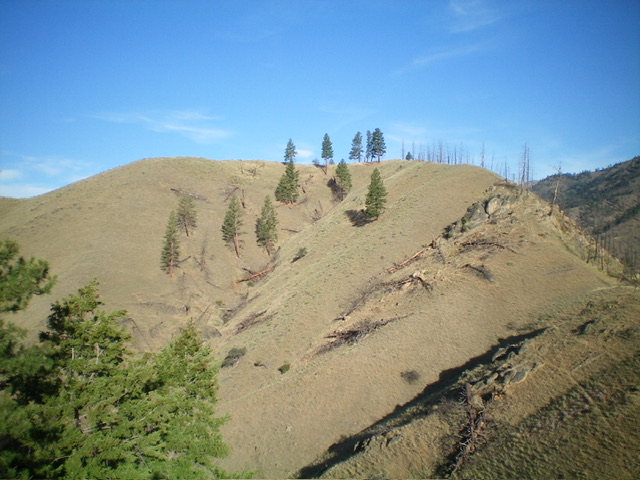
Peak 4550 as viewed from the southeast. Livingston Douglas Photo
Access
From US-93 at North Fork, drive west on FSR-030/Salmon River Road. At 10.0 miles, reach the Indianola Guard Station. At 12.0 miles, reach a nice pullout on the left/south side of the road alongside the Salmon River. Park here (3,465 feet; 45⁰24’00”N, 114⁰11’43”W). This is the first leg of a 2-peak adventure that includes Peak 4550 and Indianola Benchmark (4,657 feet). It covers 3.7 miles with 1,855 feet of elevation gain round trip.
South Ridge, Class 3
The Climb
From the roadside pullout, walk 0.2 miles west on Salmon River Road to just west of the toe of the south ridge of Peak 4550. Leave the road and scramble northeast up very steep grass to reach the crest of the ridge. Climb north up the steep, grassy ridge to quickly reach the crux of this climb: the extensive ridge rock (often steep and narrow) that dominates the ridge until it suddenly ends high up. The ridge then becomes an easy scramble up easy, grassy terrain that is no longer steep. As you climb higher on the ridge, the views of the Salmon River become more and more breathtaking. The summit is the final grassy hump and is on a ridge corner. There are a few small boulders on top but no summit cairn, nor any loose rocks with which to build one.
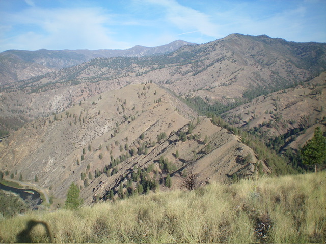
Peak 4550 (mid-ground) and its connecting ridge with Indianola Benchmark (right of center) as viewed from the summit of Indianola Benchmark. Livingston Douglas Photo
Southeast Ridge, Class 2
The Descent
From the summit, head southeast on the connecting ridge to Indianola Benchmark. Descend the ridge in open field grass and scramble up over Point 4320+. From there, follow the ridge east down to the 4,140-foot connecting saddle with Indianola Benchmark. This concludes the first leg of today’s 2-peak adventure. Indianola Benchmark is up next.
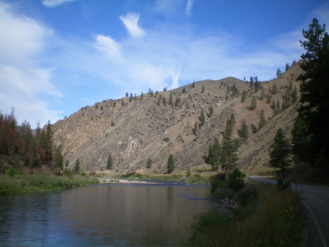
Peak 4550 (summit is right of center) and its rugged south ridge (skyline in center) as viewed from the Salmon River Road. Livingston Douglas Photo
Additional Resources
Regions: Bitterroot Mountains->NORTHERN IDAHO
Mountain Range: Bitterroot Mountains
Longitude: -114.1998 Latitude: 45.4065