Elevation: 8,718 ft
Prominence: 1,578
This peak is not in the book. Livingston Douglas added a new route and additional photos. Updated November 2023
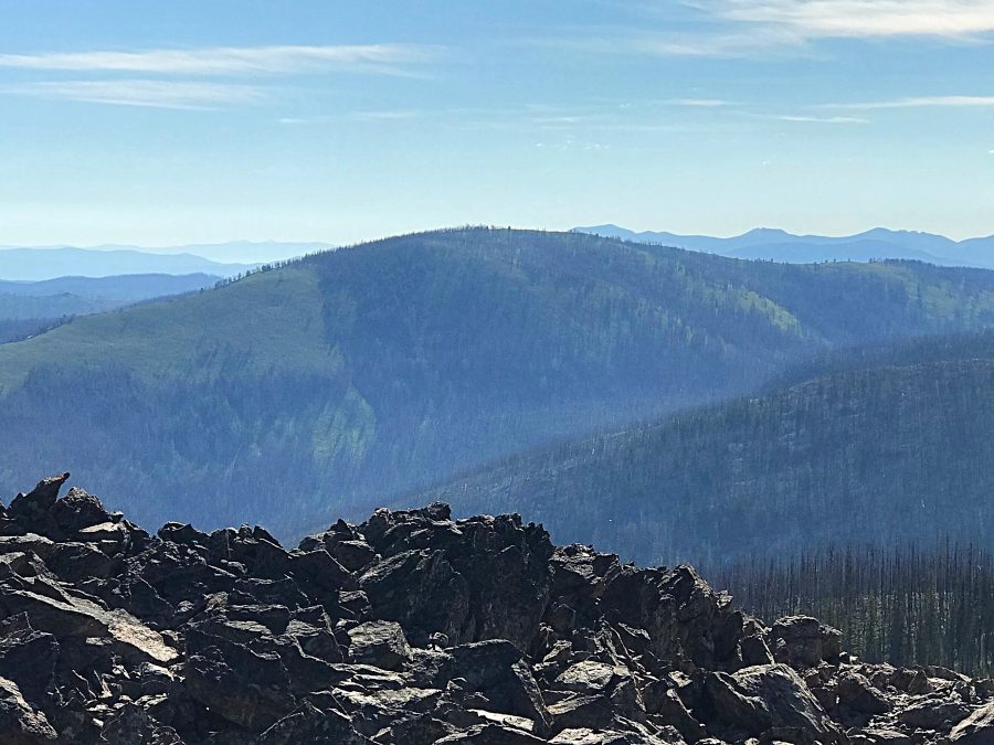
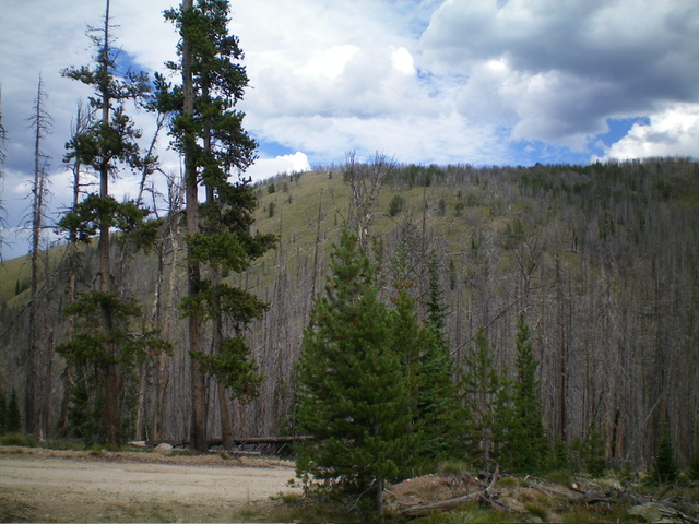
Johnson Benchmark is located on the Idaho/Montana border at the top of the Spring Creek drainage and due east of Blue Nose. USGS Shoup
Johnson Benchmark as viewed from Blue Nose
Access
Access is via the Spring Creek Road, FSR-038 which is reached from North Fork, Idaho via the Salmon River Road, FSR-30. Google Maps provides directions to this remote peak from North Fork, Idaho if you search for Blue Nose. FSR-38 reaches the divide just east of the peak at 7955 feet. The driving route is long and steep. It will take nearly two hours to reach the border. Check with the Forest Service for current conditions. It is wise to carry a chain saw as this is a burn area often with windy conditions that blow down the snags and block the road.
South Ridge, Class 2
There is a parking area on the west side of the road. FST-106 leaves on the east side of the parking spot. In 2019, there was no sign for the trail but it was easy to find. Follow the trail uphill until you are just below peak’s south ridge. Leave the trail and climb the open slopes to summit. Round trip is 2.5 miles with 739 feet of elevation gain.
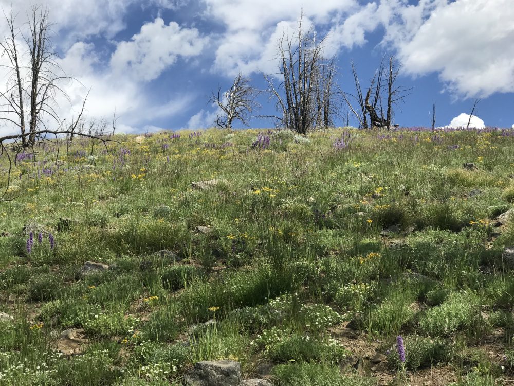
The slope above the trail leading to the summit
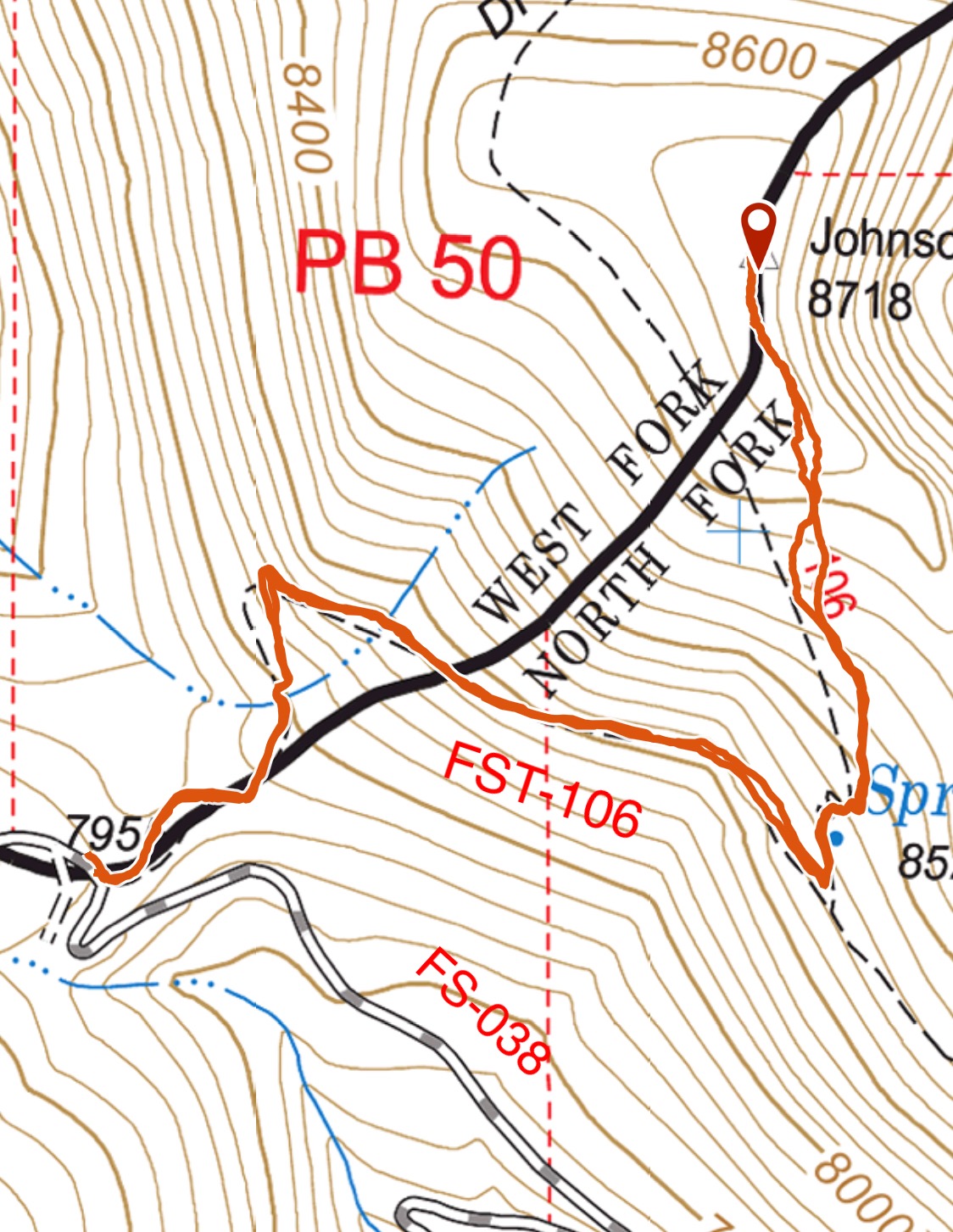
My GPS track
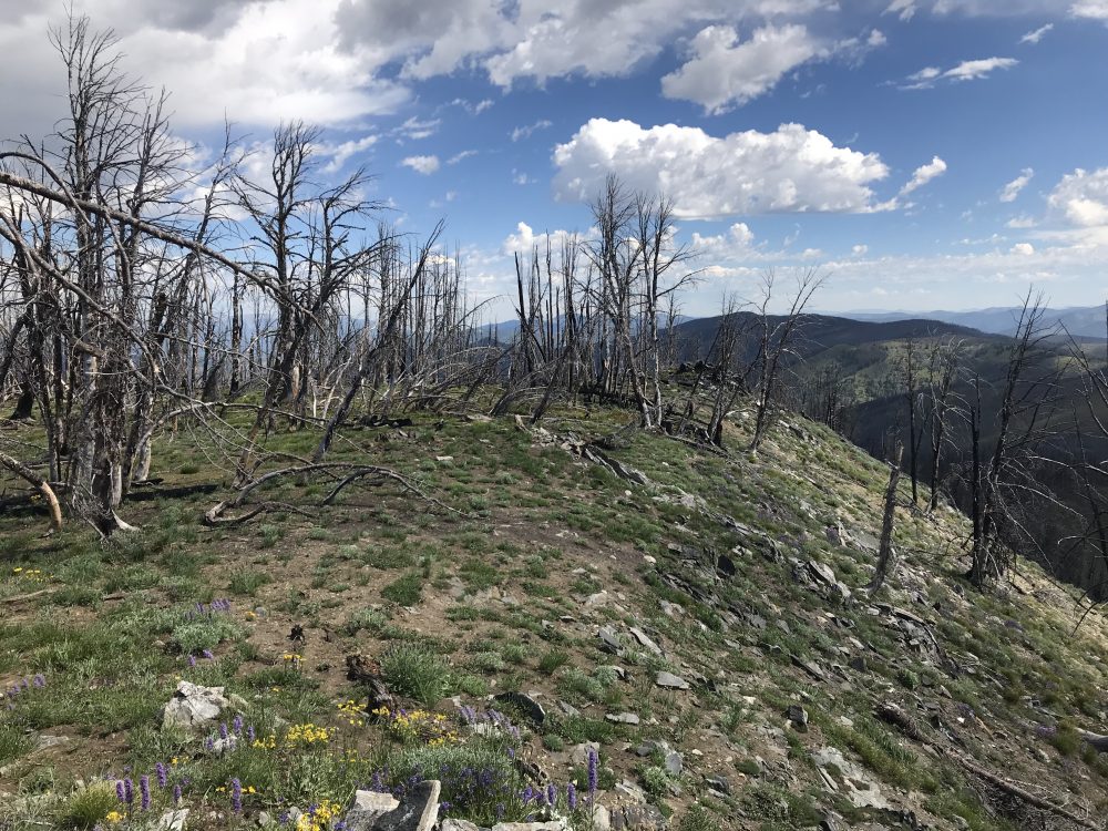
The summit of Johnson Benchmark
Southwest Ridge by Livingston Douglas
Johnson Benchmark as viewed from near the trailhead to its southwest. Livingston Douglas Photo
Access
From US-93 at North Fork, drive west on FSR-030/Salmon River Road for 16.3 miles to a signed junction with FSR-038/Spring Creek Road, just after passing the Spring Creek Campground on the left/south side of the road. Turn right/north onto FSR-038 and drive 10.2 miles to a large pullout at the signed trailhead for FST-106. Park here (7,955 feet). The trailhead is signed for the “Divide Trail” but this is NOT the Continental Divide Trail (CDT).
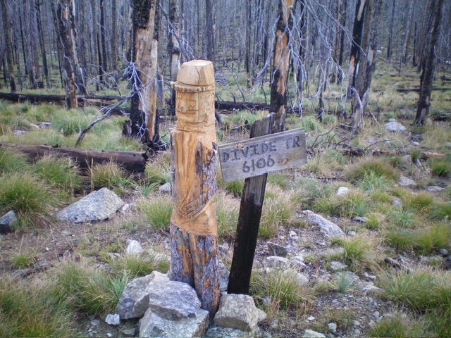
The trail sign and carved post along FSR-038 (start of climb). Livingston Douglas Photo
Southwest Ridge, Class 2
The Climb
From the trailhead, follow FST-106 as it heads northeast and descends 35 vertical feet to a saddle/pass in a burn area. Stay on the trail as it heads left/north then turns hard right/southeast. Leave the trail soon after this sharp turn since it is headed away from the summit of Johnson Benchmark. Scramble north-northeast up a steep but easy, grassy slope that quickly becomes more of a ridge with a left/west edge.
High up the slope eases considerably. In a flattish area at about 8,640 feet, head right/east up a tilted, grassy slope/shoulder to reach the narrow ridge crest summit of Johnson Benchmark. The summit has a modest cairn with a triangulation stick in it. The USGS benchmark is next to it. The minor ridge hump to the south of the summit is NOT higher. This climb covers 2.0 miles with 900 feet of elevation gain round trip.
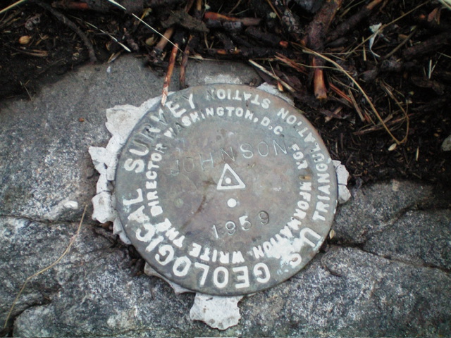
The USGS benchmark atop Johnson Benchmark. Livingston Douglas Photo
Additional Resources
Regions: Bitterroot Mountains->NORTHERN IDAHO
Mountain Range: Bitterroot Mountains
Year Climbed: 2019
Longitude: -114.30029 Latitude: 45.47519