Elevation: 9,518 ft
Prominence: 218
This peak is not in the book. Published November 2021
Keystone Mountain is an unranked hump on the northeast ridge of Ramshorn Mountain (9,895 feet). It sits above Merrimac Gulch and Keystone Gulch and has a road to the top coming up Keystone Gulch from Garden Creek. USGS Bayhorse
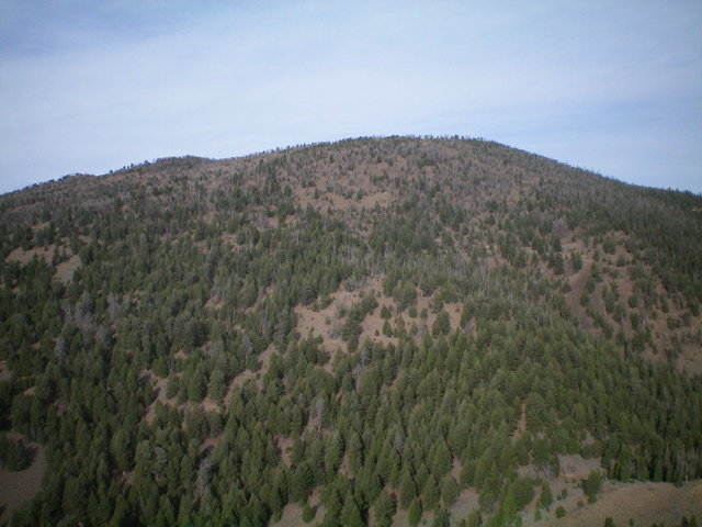
The forested east face of Keystone Mountain. The summit is at upper left of photo. Livingston Douglas Photo
Access
From the junction of US-93 and Main Street in Challis, drive west on Main Street (which becomes Garden Creek Road) for 4.9 miles to a signed junction with the Custer Motorway/FSR-070. Bear left here to stay on Garden Creek Road/FSR-069. At 6.6 miles, enter the Challis National Forest. At 6.9 miles, reach a signed junction with the Keystone Mountain Road/FSR-052. Park here (6,730 feet).
Northeast Face, Class 1
The Climb
From the road junction, follow steep, narrow, rocky Keystone Mountain Road (only suitable for ATVs and jeeps) as it switchbacks its way to the top. Be sure to continue southwest to reach the high point. The final section of the road/trail is not shown on the USGS topo map. From the summit, an ATV trail (not shown on the USGS topo map) continues west then southwest to reach the summit of nearby Ramshorn Mountain.
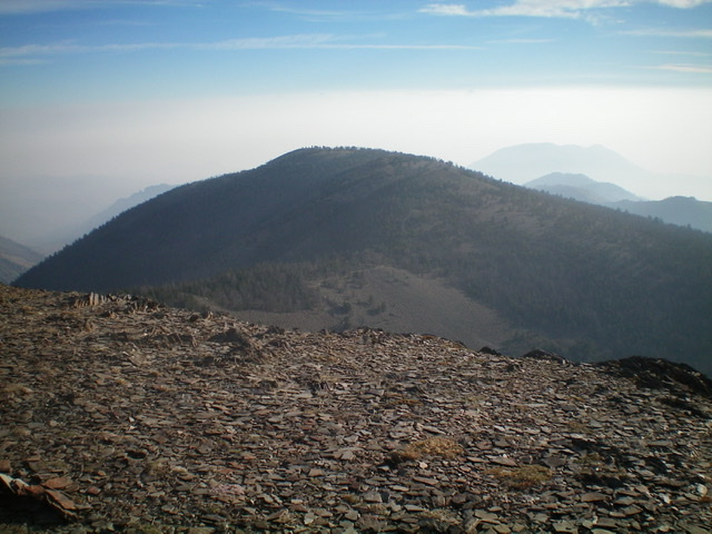
Keystone Mountain as viewed from Ramshorn Mountain to its southwest. The summit area is semi-open. Livingston Douglas Photo
Additional Resources
Regions: Eastern Salmon River Mountains->Salmon River Mountains->Southeast Corner Peaks->WESTERN IDAHO
Mountain Range: Eastern Salmon River Mountains
Longitude: -114.34501 Latitude: 44.43179