Elevation: 8,265 ft
Prominence: 666
Climbing and access information for this peak is on Pages 215-216 of the book. Published August 2019
Liberal Mountain is located northeast of Fairfield, Idaho and north of Cannonball Mountain. The summit forms the northeastern-most point of the Soldier Mountains. It is an excellent viewpoint for observing the surrounding mountains including the highest Boise, Smoky, and Boulder Mountains peaks. The book recommended climbing the peak from Wells Summit and this is still a viable route for those looking for a long hike. This update includes a shorter, more direct route to the summit. USGS Cannonball Mountain
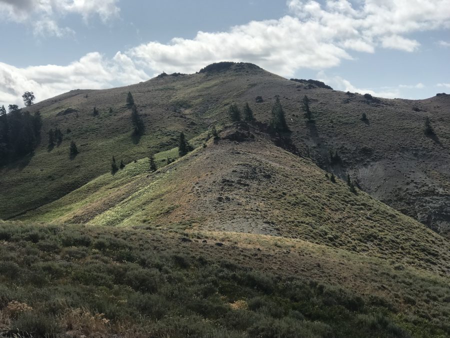
The summit viewed from the Northwest Ridge.
Access
Access is via the Cannonball Creek Road/FS-420 which is reached on the north side of Wells Summit via the Wells Summit Road/FS-095 [(A)[1.2) on Page 217]. Follow FS-095 over the summit for roughly 2 miles to the signed junction with FS-420. FS-420 proceeds past Cannonball Mountain to the base of Liberal Mountain in just over 4.0 miles. The road is a rough but improved road for its first 3 miles. The last mile deteriorates and a 4WD is recommended. The recommended parking spot is roughly 4.1 miles from FS-095 at a saddle by Point 7577.
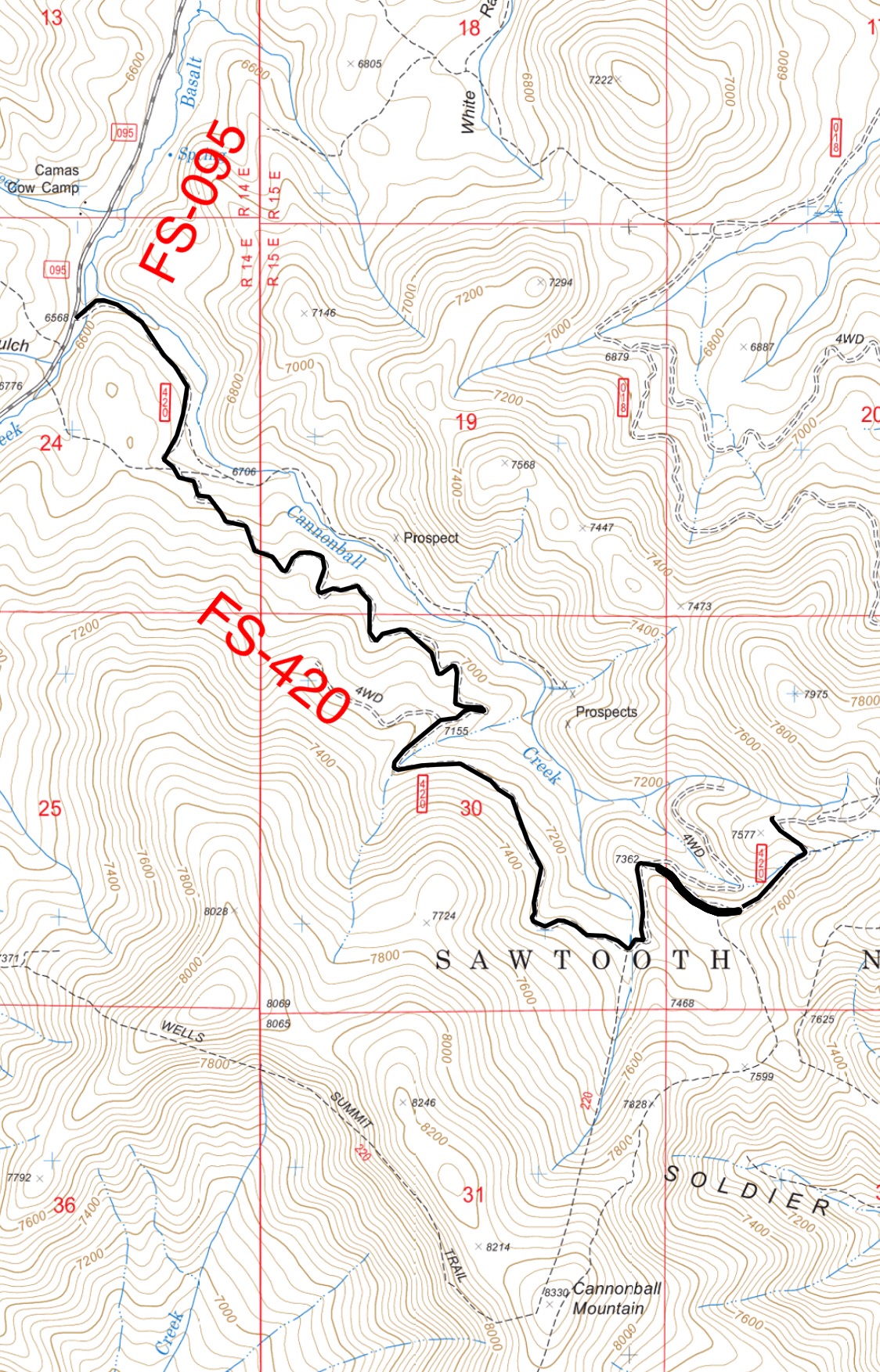
Cannonball Creek Road. The road continues on past the recommended parking spot to the top of the Northeast Ridge. It is not recommended that you drive this steep, loose section.
Northwest Ridge, Class 2
The northwest ridge is reached from the recommended parking spot on FS-420 by simply following the road to the ridge top. Once on top of the ridge follow it to the summit. The first section follows a fence line. The route then drops into a saddle where a trail that leads around the next high point to another saddle is found. Ascend the final slopes to the rocky summit.
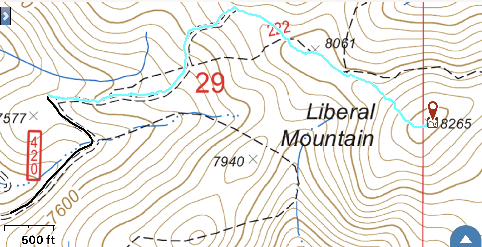
My GPS track from the recommended parking spot. The summit is a 1.0 mile and 552-foot climb from this point.
Additional Resources
Regions: Soldier Mountains->WESTERN IDAHO
Mountain Range: Soldier Mountains
Year Climbed: 2019
Longitude: -114.68609 Latitude: 43.47739