Elevation: 7,488 ft
Prominence: 838
This peak is not in the book. Published January 2023
Limerock Mountain is the high point of Wilson Ridge. It is located on the northeast side of Blackfoot Reservoir and is just north of Wilson Pass on State of Idaho land. This is the first leg of a 2-peak journey that includes Limerock Mountain and Crater Mountain (7,073 feet). This adventure covers 7.0 miles with 1,750 feet of elevation gain round trip. USGS Little Valley Hills
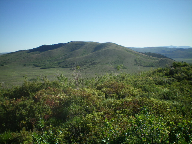
Limerock Mountain as viewed from Crater Mountain to its south. Livingston Douglas Photo
Access
From ID-34 just north of Henry, turn left/west onto [signed] Blackfoot North Access Road (shown as North Reservoir Road on the USGS topo map). Drive 11.3 miles to an unsigned 2-track road that heads right/east to Wilson Pass. Drive 1.9 miles east up the Wilson Pass Road to a grassy pullout. Park here (6,490 feet).The low quality 2-track road becomes quite rutted after this point.
West Spur/South Ridge, Class 2
The Climb
From the grassy pullout, hike east up Wilson Pass Road about ¾ mile to a large meadow at the base of the southwest side of Limerock Mountain. Leave the road at an unsigned junction here, with another 2-track road heading right/south. Hike northeast across an open field of easy, gapped sagebrush to reach an obvious shoulder (treeless) that heads northeast to the west spur, which climbs east to the south ridge. The climb up onto the west spur is a bit thick with sagebrush and other brush. The crest of the west spur goes quickly thanks to its short scrub and broken scree.
Once you reach the junction with the south ridge, follow an old 2-track northeast until it becomes a cattle trail, which soon ends. Continue north up the easy scrub on the ridge crest to reach the ridge hump that is the south summit of Limerock Mountain. Bash northward down a face of thick aspens to reach an open sagebrush saddle. Better yet, find an old road clearing through the aspens. This road clearing is on the left/west side of the face. Cross the sagebrush saddle (not too difficult) and climb north up the rocky outcrop that is the summit of Limerock Mountain. Stay on the ridge crest of just left/west of it for the easiest going. The summit of Limerock Mountain has a nice cairn with a triangulation post in it.
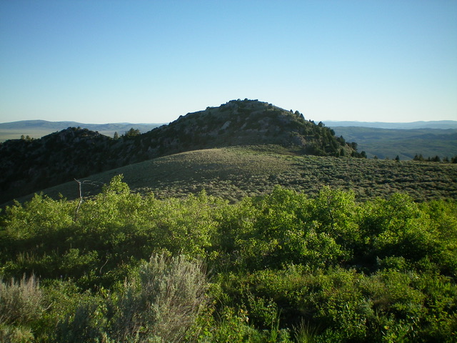
The summit hump of Limerock Mountain as viewed from the [lower] south summit. Livingston Douglas Photo
South Ridge/Southwest Spur, Class 2
The Descent
From the summit, return back down the south ridge and head southwest down an obvious spur ridge to return to the broad meadow at the base of the southwest side of Limerock Mountain. The southwest spur is a somewhat thick mess of tedious sagebrush and other brush. Look for a gap in the forest below to the right/west of the ridge crest. Once through the patch of forest, cruise across the easy sagebrush in the meadow to return to Wilson Pass Road and the unsigned junction. This concludes the first leg of today’s 2-peak journey. Crater Mountain is up next.
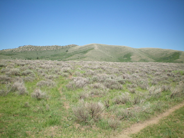
Limerock Mountain as viewed from the southwest. Livingston Douglas Photo
Additional Resources
Regions: Caribou Range->SOUTHERN IDAHO
Mountain Range: Blackfoot Mountains
Longitude: -111.6052 Latitude: 43.0107