Elevation: 4,327 ft
Prominence: 307
This peak is not in the book. Published November 2023
Linfor Hill is a forested peak that towers over 2,000 feet above the hamlet of Linfor to its west. CR-9 and the Coeur d’Alene River run along the west and northwest base of Linfor Hill. It is most easily climbed via FST-1319 and its east ridge. USGS Kellogg West
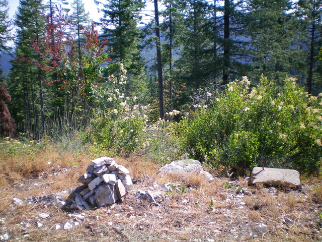
The newly-built summit cairn atop Linfor Hill and one of the concrete footers for a fire/communication tower that was once here. Livingston Douglas Photo
Access
Same as for Thomas Hill. This is the second leg of a 2-peak adventure that includes Thomas Hill (4,451 feet) and LinforHill. It covers 4.2 miles with 1,100 feet of elevation gain round trip.
Map Errors
FSR-606 is blocked by private property on the valley floor and does not even exist anymore there anyway. It is blocked by a gated closure just east of Thomas Hill high up on the ridgeline. Based on the road’s current condition, it probably has not been open to motor vehicles in many years.
East Ridge, Class 2
The Climb
From the forested, 4,020-foot connecting saddle with Thomas Hill, hike west up FST-1319 as it climbs up through a thick pine forest on the rounded east ridge of Linfor Hill. Leave the trail soon after it makes a sharp switchback right/northwest to skirt the east side of Linfor Hill. Bushwhack west up through a short but thick patch of pine forest to quickly reach a 2-track ridge road (shown on the USGS topo map). Follow this decent ridge road south then west as it curls around the south end of the summit cap of Linfor Hill.
The good ridge road ends here. Follow a weaker 2-track road north to the top of Linfor Hill. The summit has 2-3 concrete pilings (for a tower of some sort). I built a summit cairn atop the highest point. The summit is open so it offers some nice views, particularly from the 2-track road just below the high point. From the summit, return back to FST-1319. Follow it east back to FSR-606 then hike east along FSR-606 back to the road closure gate and your parked vehicle.
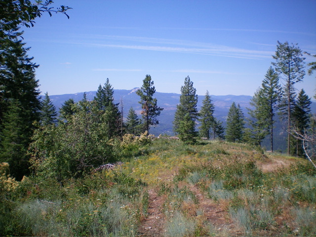
The summit area of Linfor Hill. Livingston Douglas Photo
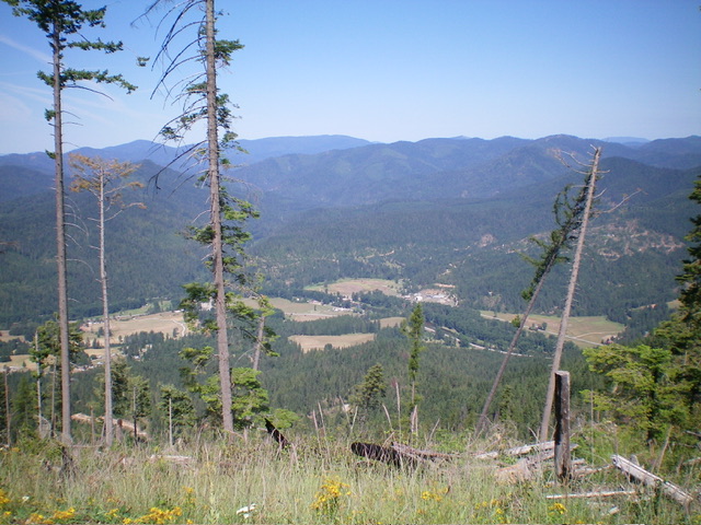
View from just below the summit of Linfor Hill. Livingston Douglas Photo
Additional Resources
Regions: Coeur d'Alene Mountains->NORTHERN IDAHO
Mountain Range: Coeur d'Alene Mountains
Longitude: -116.1954 Latitude: 47.6013