Elevation: 10,633 ft
Prominence: 1,173
Climbing and access information for this peak is on Page 307 of the book. The route in the book climbs the peak’s northeast face. Livingston Douglas provided the new route and updated access information found below. Updated October 2025
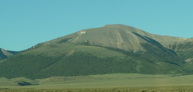
Meadow Peak is one of the most interesting Lemhi summits because of the large, high-altitude meadows found on its slopes. The peak sits east of the main Lemhi Range Crest and is graced with spectacular views of Bell Mountain. USGS Coal Kiln Canyon
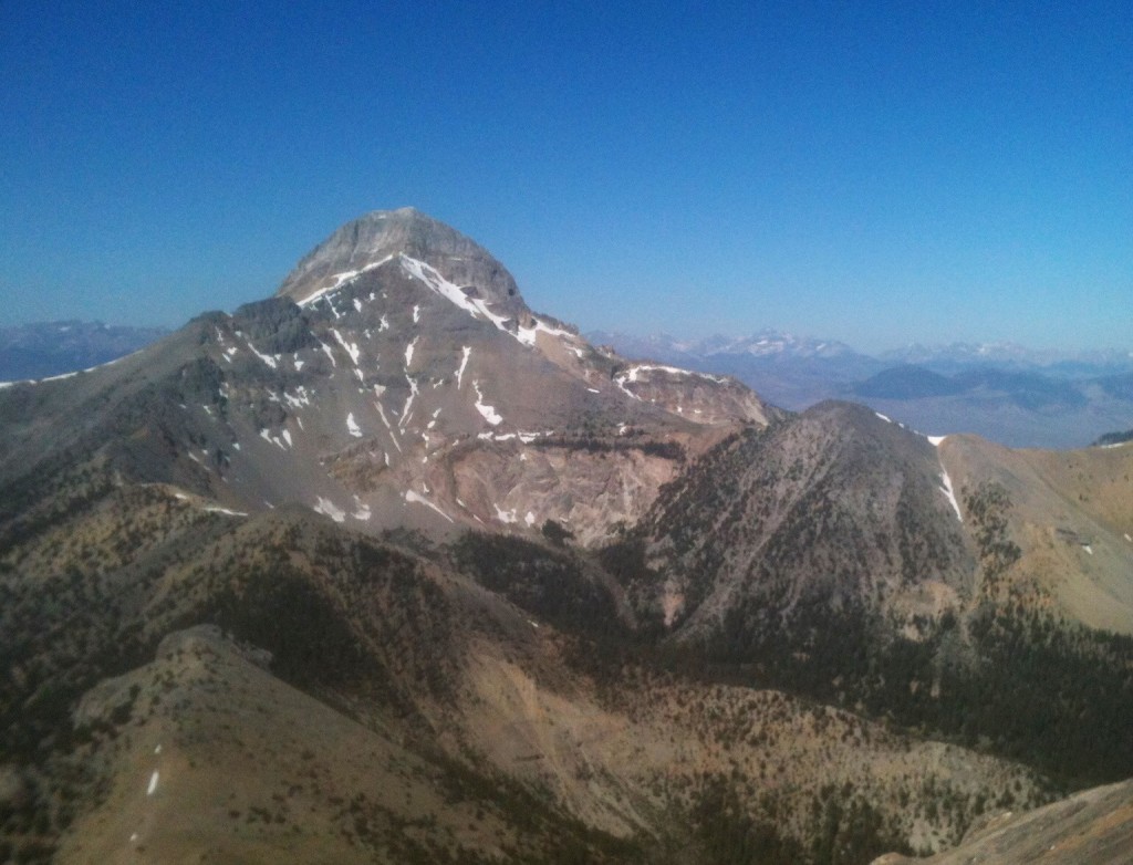
Meadow Peak as viewed from the southwest. Livingston Douglas Photo
East Shoulder/Northeast Face, Class 2 by Livingston Douglas
Access
Meadow Canyon Road is located along ID-28 in the Lemhi Valley exactly 11.5 miles north of the north entrance to the Birch Creek Campground and 2.0 miles south of Nicholia Road. Meadow Canyon Road is signed. Please note that the old [standard] drive to Meadow Canyon followed a road a few miles north of here that heads directly to the canyon. That road is now an unmaintained, badly-rutted 2-track road that is not advisable for driving a vehicle. This route follows a drivable set of roads to reach the mouth of Meadow Canyon.
Turn left/west onto Meadow Canyon Road. Reset your odometer here. Note that USFS Map Sheet Page 40 labels this road as “Keg Gulch Road,” but this is the correct road to be on. At 3.2 miles, turn left onto FSR-717 at a signed junction. At 5.0 miles, enter the Targhee National Forest at a cattle gate. At 5.7 miles, reach a “T” junction with FSR-699. Turn left/south here and drive another 0.1 miles to a signed junction at the mouth of Meadow Canyon. Park at this junction (7,545 feet).
The Climb
From the [signed] road junction at the mouth of Meadow Canyon, hike (or drive) northwest up FSR-699 to a flattish ridge plateau above the canyon. This road section is short but STEEP. When you reach this “plateau” area, continue briefly on FSR-699 and find an unsigned road junction. Go left/west here onto an old 2-track jeep road (shown on the USGS topo map). This old road leads gradually upward to a tall, red water tower that is surrounded by a fence and has a rectangular cattle cistern nearby. This is a very strange sight—I’ve never seen a water tower quite like this one! The old 2-track road ends here.
The east shoulder is obvious and lies just above you. Bushwhack southwest on easy scrub/grass to reach the crest of this rounded shoulder. Once on the ridge crest, follow an old 2-track road northwest up the shoulder. This road soon morphs into a foot path, which also soon dies out. Continue northwest then west up the easy, open short grass. Scattered pines join the mix higher up.
When you reach a flattish area at 9,100 feet, continue west to stand atop Point 9215. From Point 9215, cruise southwest slightly downhill (70 feet) to a gentle saddle located at the base of the massive northeast face of Meadow Peak. Scramble southwest directly up the face, weaving through a patch of pine trees early on. The terrain soon becomes mostly rock (talus/scree) and is steep. The pines/firs soon thin out, become widely scattered, and disappear.
Higher up, firm tundra joins the mix and the slope eases. You reach a flat, wide meadow—a field of easy tundra—at 10,250 feet. Cruise across this easy terrain to begin the final climb to the top. Scramble southwest up a steep slope of talus/scree to reach the elongated summit ridge crest. To reach the high point, follow the easy ridge crest northwest to the cairned summit. There is a magnificent view of nearby Bell Mountain from here.
Southwest Ridge, Class 2
Access
Same as for the east shoulder/northeast face
The Descent
From the summit, descend southwest down the obvious ridge. The terrain on the ridge is talus/scree with some minor ridge outcrops. The final drop to the saddle below is a steep boot-ski on gravel and broken scree. It is VERY FAST. I would not want to try to ASCEND this ridge from the saddle in this loose terrain. Once on the saddle at the base of the southwest ridge, descend southeast down a steep gully of loose scree and gravel. May you be wearing heavy boots for this adventure.
The gully has steep sides, making side-hilling an unattractive option. Thankfully, the gully lacks water and is free of downed timber. Descend the center of the gully to reach the pine forest below. Continue to follow this dry gully down through the forest to reach Meadow Canyon and intercept the [weak] Meadow Canyon Trail/FST-020. Hike down the trail to reach its genesis and the top of FSR-797. Hike down FSR-797 to return to your parked vehicle.

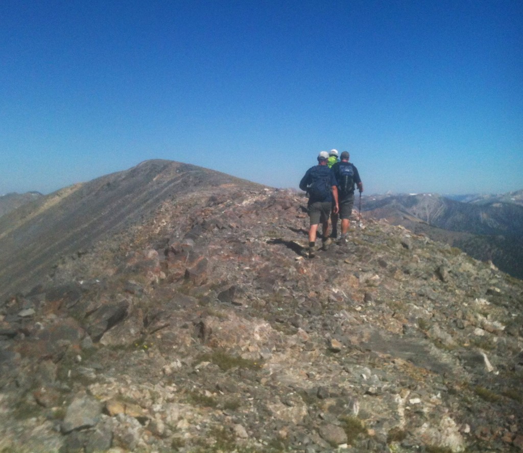
Meadow Peak’s summit ridge

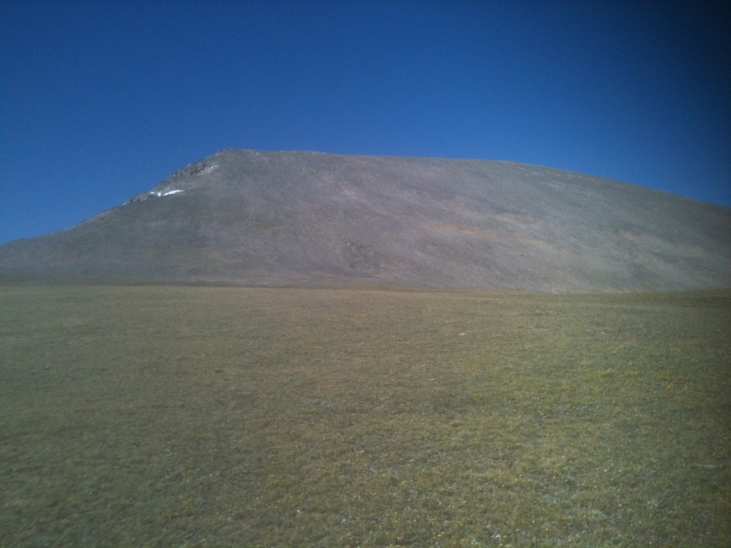
Meadow Peak from the high plateau on its east side
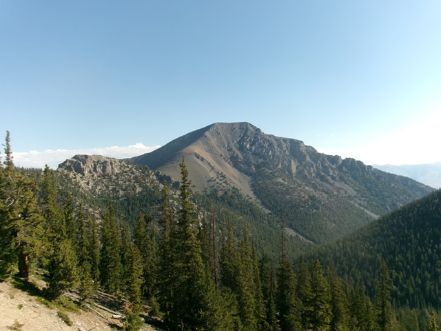
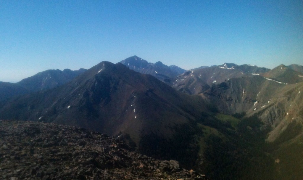
Bell Mountain as viewed from Meadow Peak
Looking south from Meadow Peak
Additional Resources