Elevation: 8,060 ft
Prominence: 800
This peak is not in the book. Published January 2023
Middle Mountain South is the high point on a long north-south ridgeline that begins just south of Oakley and extends all the way south into Utah. It is most easily climbed via its west ridge from Emery Creek Road. USGS Lyman Pass
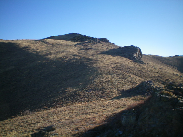
Middle Mountain South (just left of center) as viewed from Point 7377 on the west ridge (my ascent route). Livingston Douglas Photo
Access
From the end of ID-27 in downtown Oakley, turn right/west onto Main Street and drive 0.4 miles to a signed junction with Goose Creek Road (signed for the Oakley Reservoir, which is shown on maps as the Lower Goose Creek Reservoir). Turn left/south onto Goose Creek Road and reset your odometer. At 8.2 miles, reach [unsigned] Wilson Pass, the road crest for Goose Creek Road. There is an unsigned road junction here.
Continue straight/south on Goose Creek Road. At 10.0 miles, reach a signed junction with Wilson Gulch Road (right). Continue straight. At 13.9 miles, reach a signed junction with Emery Creek Road. Turn left/east onto Emery Creek Road and drive 1.8 miles to a “T” junction with a large parking area. Park at this junction (5,550 feet). GPS coordinates: 42⁰03’21”N, 113⁰53’57”W. Please be aware that Emery Creek Road is a narrow 2-track road with deep dirt. It is not drivable in wet conditions. It is extraordinarily dusty in dry conditions.
West Ridge, Class 2
The Climb
From the road junction, you can see the summit of Middle Mountain South in the distance to the left/north of the Emery Creek drainage. From the parking area near the road junction, hike northeast then east up the rounded, ill-defined west ridge until it becomes much better defined higher up. The terrain is sagebrush with a gravel/dirt base. There are some minor rocky areas and rocky outcrops, especially as you gain elevation on this ridge. Reach rocky Point 7377 and skirt its right/south side. It is an easy Class 3 scramble to the top of Point 7377 if you wish to climb it.
From Point 7377, bash up through unending sagebrush (with cattle trails to help) to reach a patch of mountain mahogany on the summit ridge and the upper west face. Weave through the mountain mahogany (or skirt it entirely on its left/north side) to reach the summit ridge. Once on the ridge, scramble left/north through dense mountain mahogany on the ridge crest to reach the rocky high point of Middle Mountain South. The summit has two cairns, a large triangulation post, and lots of triangulation wiring.
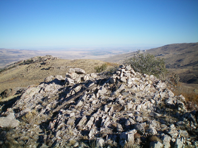
The rocky summit of Middle Mountain South, looking north. Livingston Douglas Photo
Southeast Ridge, Class 2
The Descent
From the summit, descend the rock-and-scrub ridgeline (initially clogged with mountain mahogany) south-southeast to reach easier scrub and an old 2-track road on the ridge. Follow the old 2-track southward, skirting the right/west side of Points 7761 along the way. The 2-track leaves the ridge to head right/west before reaching Point 7768. Leave the 2-track and contour south then southeast in thick sagebrush to skirt Point 7768. Once past the point, do a diagonal right/southeast descent to a fence row that heads down to the connecting saddle with Peak 7947. Follow the right side of the fence row on public land to reach the 7,500-foot connecting saddle which is in open, short scrub. This concludes the first leg of today’s 2-peak adventure. Peak 7947 is up next.
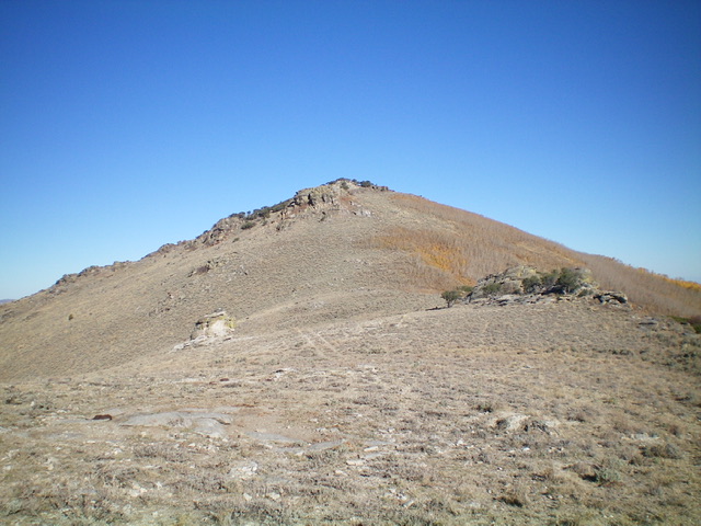
Middle Mountain South as viewed from the southeast ridge (my descent route). Livingston Douglas Photo
Additional Resources
Regions: Albion Range->SOUTHERN IDAHO
Mountain Range: Albion Range
Longitude: -113.85851 Latitude: 42.05989