Elevation: 8,610 ft
Prominence: 1,070
This peak is not in the book. There are two routes and mountain descriptions set out below. The first by Margo Mandella and the second by Livingston Douglas. Updated November 2021
Miller Peak by Margo Mandella
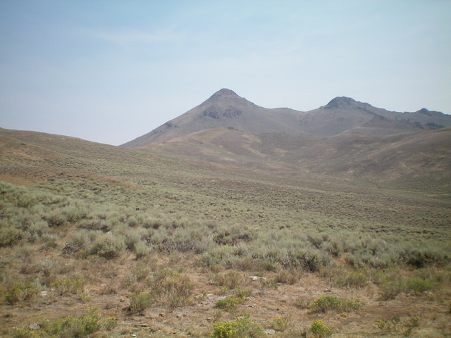
This distinctive 1k+ prominence peak is one of a handful of peaks that dominate the skyline in Antelope Valley west of Moore. Climb this peak from Bear Creek Summit and also consider climbing nearby Reserve Mountain. USGS Miller Peak
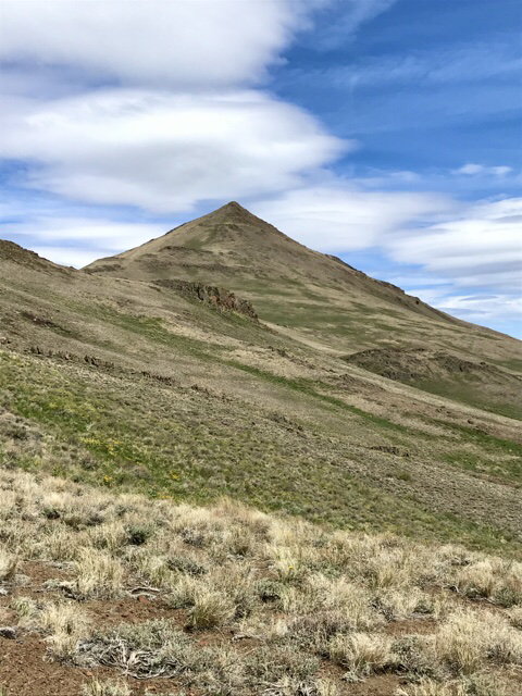
Miller Peak. Steve Mandella Photo
Access
Turn off US-93 10.5 miles north of Arco and follow Antelope Creek Road west into the mountains. At the Antelope Guard Station, take FSR-135/Bear Creek Road right/north to Bear Creek Summit. Park in the large pullout area.
Northwest Ridge, Class 2
From Bear Creek Summit, hike up along the fence row and cross to its right side when you reach the top of the first hill. Continue following the fence row. At about 7,600 feet, begin contouring toward the saddle at the base of Miller Peak’s northwest ridge. The summit block is steep but the footing is excellent. You can backtrack and call it a day or continue on to Reserve Mountain.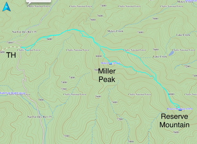
Miller Peak by Livingston Douglas
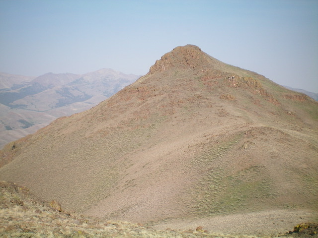
Miller Peak is a rocky summit that is located on the east side of Death Canyon and at the head of Coyote Canyon in the White Knob Mountains. Its south and west aspects are intimidating when viewed from a distance. It is most easily climbed via its northwest ridge from Bear Creek Summit.
Access
This is the first leg of a 2-peak adventure that includes Miller Peak and Reserve Mountain (8,304 feet). It covers 7.0 miles with 2,850 feet of elevation gain round trip.
Antelope Road (signed) is located on US-93 exactly 10.7 miles north of the junction of US-93 and US-20 in Arco. Turn left/west onto Antelope Road and drive 17.9 miles to a signed junction with FSR-135/Bear Creek Road. Turn right/north onto FSR-135 and drive 2.8 miles to a parking pullout just past the fording of Bear Creek. The signed junction with FSR-522 is at 2.9 miles but there is no place to park at that junction. Park at the aforementioned pullout (6,800 feet).
Southwest Ridge/South Face, Class 3
The Climb
From the parking pullout, hike north up FSR-135 for 0.4 miles to reach the toe of the southwest ridge. There is a grassy meadow (which cows seem to love) on the right/east side of the road with scattered willows surrounding [tiny] Death Canyon Creek. The meadow sits at the base of the southwest ridge and at the mouth of a gully that heads east. Leave FSR-135 and bushwhack across Death Canyon Creek to reach the meadow then follow the meadow north for a short distance to pass the eastern gully and reach the base of the southwest ridge.
Aim for a bare hump on the lower part of the ridge and bash through somewhat thick sagebrush and other veg to reach it via a face section then a minor shoulder to the right/east of the bare hump. Once atop this ridge hump, scramble northeast up the easy, open ridge on an old 2-track road until it ends at a rocky ridge outcrop. Continue northeast up the undulating ridge to reach the top of the southwest ridge and the base of the steep south face. Bushwhack north up through steep, somewhat-thick sagebrush and other brush, staying just right/east of some rocky ridge buttresses. Once past the ridge buttresses, the ridge rock is easier and is free of sagebrush.
Move left/west onto the ridge rock and scramble up it to the final, very rocky summit cap. Climb up the chunky rock, going right/east initially then left/west back to the middle of the summit cap. This is the Class 3 crux of the climb. Once past this section, the slope eases and the rock is easier and flatter. Scramble on Class 2 rock to reach the gentle ridge crest summit of Miller Peak. There is a decent cairn on top. You can probably keep this climb at Class 2 if you skirt the left/west side of the summit cap and contour around to the easy northwest ridge.
Miller Peak as viewed from the south-southeast. The left skyline (in mid-ground) is the southeast ridge. Notice the rocky buttresses on the south face. Skirt the right side of them to reach the steep face then the Class 3 summit cap finish. Livingston Douglas Photo
The rugged east side of the summit cap of Miller Peak. Livingston Douglas Photo
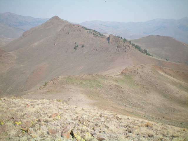
Miller Peak (left of center) as viewed from the summit of Reserve Mountain to its southeast. The connecting ridge is a tedious, weaving, undulating mess of rocky ridge outcrops and scrub. Livingston Douglas Photo
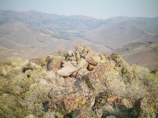
The summit cairn atop Miller Peak. Livingston Douglas Photo
East Face/Southeast Ridge, Class 3
The Descent
From the summit, head east and downclimb the Class 3 summit cap (blocky rock, rock towers, and crumbly chutes) to reach the gentle base of the east face. Follow the weaving, undulating, rocky ridge southeast to reach the 7,900-foot connecting saddle with Reserve Mountain. Stay left/north of the ridge crest to avoid ridge cliffs. The southeast ridge of Miller Peak is a tedious endeavor, much more so than the USGS topo map makes it appear to be. The connecting saddle is at the base of the southeast ridge and concludes the first leg of today’s 2-peak journey. Reserve Mountain is up next.
Additional Resources
Regions: EASTERN IDAHO->White Knob Mountains
Mountain Range: White Knob Mountains
First Ascent Information:
- Other First Ascent: Southwest Ridge/South Face
- Year: 2021
- Season: Summer
- Party: Livingston Douglas
Longitude: -113.69089 Latitude: 43.71609