Elevation: 8,304 ft
Prominence: 404
This peak is not in the book. There are two routes and mountain descriptions set out below. The first by Margo Mandella and the second by Livingston Douglas. Updated November 2021
Reserve Mountain by Margo Mandella
Reserve Mountain is one of a handful of peaks that dominate the skyline in Antelope Valley west of Moore. We climbed Reserve Mountain and Miller Peak from Bear Creek Summit. Other routes and approaches to Reserve Mountain (e.g., via Burnt Hollow) are possible. USGS Miller Peak
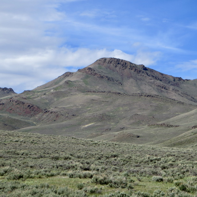
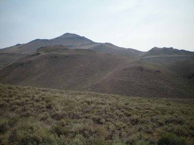
Reserve Mountain as viewed from Burnt Hollow. Steve Mandella Photo
Access
Turn off US-93 10.5 miles north of Arco and follow Antelope Creek Road west into the mountains. At the Antelope Guard Station, take FSR-135/Bear Creek Road right/north to Bear Creek Summit. Park in the large pullout area.

Most of the ridge between Miller Peak and Reserve Mountain. Steve Mandella photo.
Northwest Ridge from Miller Peak, Class 2
After climbing Miller Peak, either navigate the rock outcrops along the upper ridge or traverse a little lower on the peak’s northeast side around the outcrops and through small forest patches until you reach Reserve Mountain’s saddle at approximately 7,900 feet. Both the peak’s north face and northwest ridge have good footing and take similar time to ascend.
An alternative, faster route is to drop down from Miller Peak’s summit on its north/northwest side to pick up and connect a couple of well-travelled game trails that bypass the ridge and forest sections entirely. Use these trails to climb to the saddle at the base of Reserve Mountain’s northwest ridge and continue to its summit. We used these trails on our return to Miller Peak’s saddle and then backtracked our route to Bear Creek Summit.
Reserve Mountain by Livingston Douglas
Reserve Mountain is a pyramidal-shaped peak located southeast of Miller Peak in the White Knob Mountains. It sits at the head of Burnt Hollow.
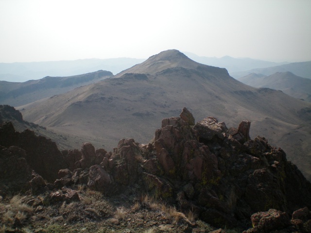
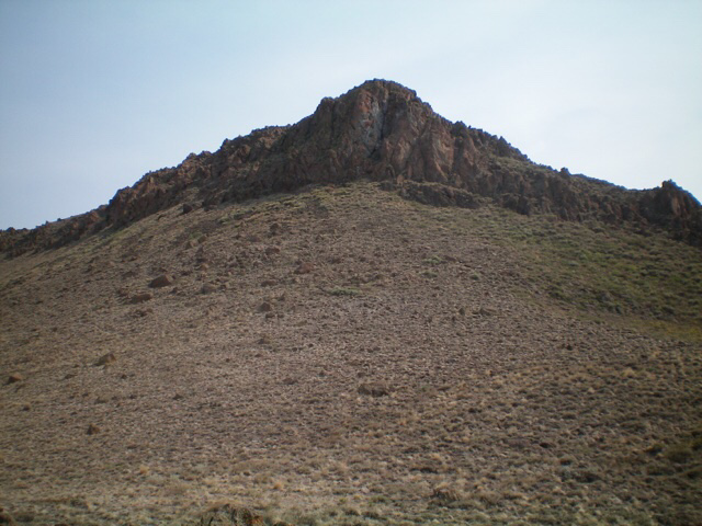
Reserve Mountain as viewed from the northwest. Livingston Douglas Photo
Access
Same as for Miller Peak. This is the second leg of a 2-peak adventure that begins and ends on Bear Creek Road. It includes Miller Peak (8,610 feet) and Reserve Mountain. It covers 7.0 miles with 2,850 feet of elevation gain round trip.
North Ridge, Class 2
The Climb
From the 7,900-foot connecting saddle, scramble up the meandering ridge southeast then south then southeast to the summit of Reserve Mountain. The ridge terrain is a combination of easy, open scrub and nettlesome ground boulders. There are two ups-and-downs along the way. The summit has a large cairn.
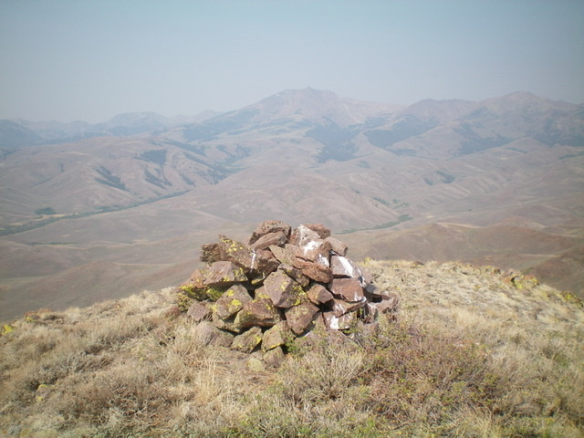
The large summit cairn atop Reserve Mountain. Livingston Douglas Photo
Southwest Ridge/Southwest Side, Class 3
The Descent
From the summit, descend southwest on the ridge crest then downclimb a steep headwall at about 8,000 feet. Stay to the left of the ridge crest to keep the downclimb at Class 3. Once at the base of this headwall, the ridge terrain becomes flatter, easier scrub and talus/scree. Be careful, however, because the talus/scree is notoriously loose. Aim for a visible saddle on a shoulder (with a 2-track road leading up to it from Burnt Hollow). Leave the southwest ridge to drop southwest to a gully (“Springs” on the USGS topo map). Cross the dry gully then contour at about 7,100 feet across a minor shoulder to reach Burnt Hollow (dry here).
Descend a steep face of scrub and loose scree/gravel down to Burnt Hollow. Cross the hollow/gully and do a diagonal upward left traverse to intercept the 2-track road. This road is not shown on the USGS topo map. Follow the 2-track road up to a saddle. Continue to follow the road west down across Coyote Canyon then up to another saddle and shoulder crossing. The road goes left/south here. Not sure where the road goes (I believe that I later intercepted the road down in a final gully, so it is probably good to continue to follow it), follow a cattle trail southwest down a dry gully that leads to a grassy meadow along Death Canyon and FSR-135. This meadow is just north of the FSR-522 junction and the parking pullout at Bear Creek. Cross the meadow and hike down FSR-135 for about 0.1 miles to your parked vehicle.
Looking back up the descent route of Reserve Mountain (summit is left of center). The southwest ridge is the right skyline. The descent route leaves it to descend diagonally to where I am standing. Livingston Douglas Photo
Looking back up at the steep headwall (Class 3 downclimb) on the upper southwest ridge. Livingston Douglas Photo
Additional Resources
Regions: EASTERN IDAHO->White Knob Mountains
Mountain Range: White Knob Mountains
First Ascent Information:
- Other First Ascent: Southwest Ridge/Southwest Side (Descent)
- Year: 2021
- Season: Summer
- Party: Livingston Douglas
Longitude: -113.67289 Latitude: 43.70589