Elevation: 8,666 ft
Prominence: 446
This peak is not in the book.
Missouri Ridge is located due south of The Pinnacles. Climbing directions for The Pinnacles are found on Page 121 of the book. The Missouri Ridge Route also works for ascents of The Pinnacles. USGS Edwardsburg
Take the Missouri Creek Trail until you reach a cabin. From the cabin, an old trail proceeds to the top of the Missouri Ridge and to a saddle between Missouri Ridge and The Pinnacles. From this saddle, turn south and proceed up the ridge to the high point of Missouri Ridge. The trail was in poor shape in 1995 and it is probably worse now. It was originally a 4WD road or logging road. You will find plenty of downed trees on the route. Class 2+
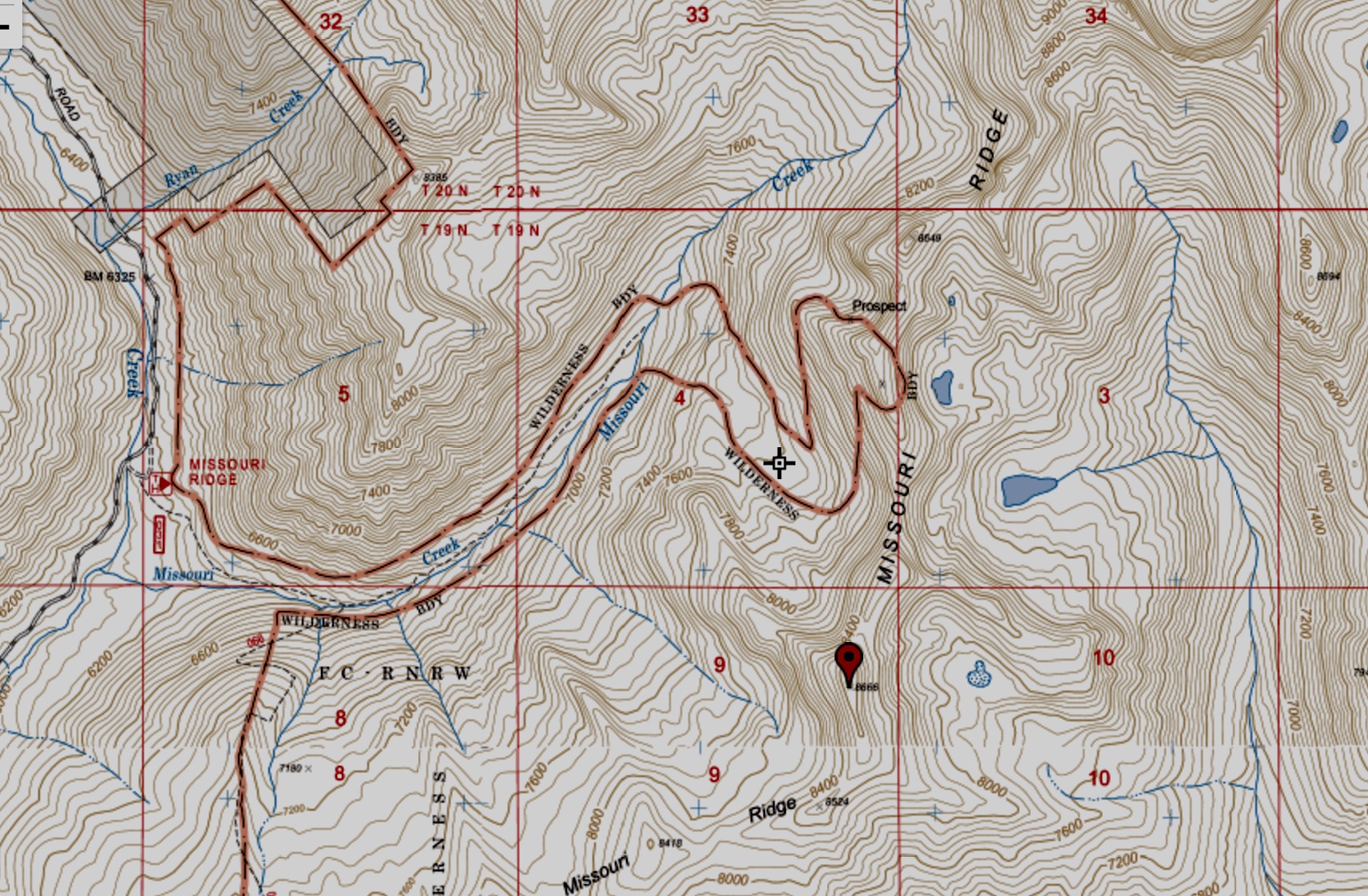
The Forest Service no longer shows the trail from the creek bottom to the ridge as a maintained trail. However, the boundary for the Frank Church River of No Return Wilderness excludes the trail corridor from the wilderness. Thus, this map gives you a good idea of where the trail runs.
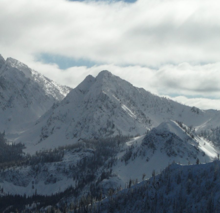
Missouri Ridge (November 2016). John Platt Photo
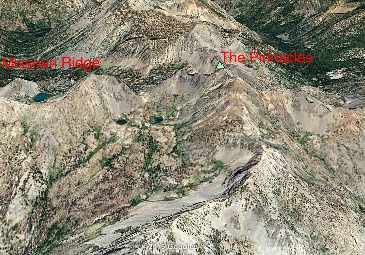
Missouri Ridge (left) and The Pinnacles (right) in this Google Earth image. The old trail ascends to the intervening saddle from Missouri Creek, which is the drainage behind Missouri Ridge.
Additional Resources
Regions: Big Creek to Red Ridge Peaks->Central Salmon River Mountains->Salmon River Mountains->WESTERN IDAHO
Mountain Range: Central Salmon River Mountains
Year Climbed: 1988, 1995
Longitude: -115.35529 Latitude: 45.00239