Elevation: 9,240 ft
Prominence: 960
Climbing and access information for Murphy Peak is on Page 126 of the book. Below is updated, more detailed information. Updated July 2018
Murphy Peak sits on the West Edge of the Frank Church River of No Return Wilderness. Access is good, but long. It takes 3.5 hours to reach the peak from McCall, Idaho. It is an hour from Yellow Pine, Idaho to Monumental Summit. USGS Rainbow Peak
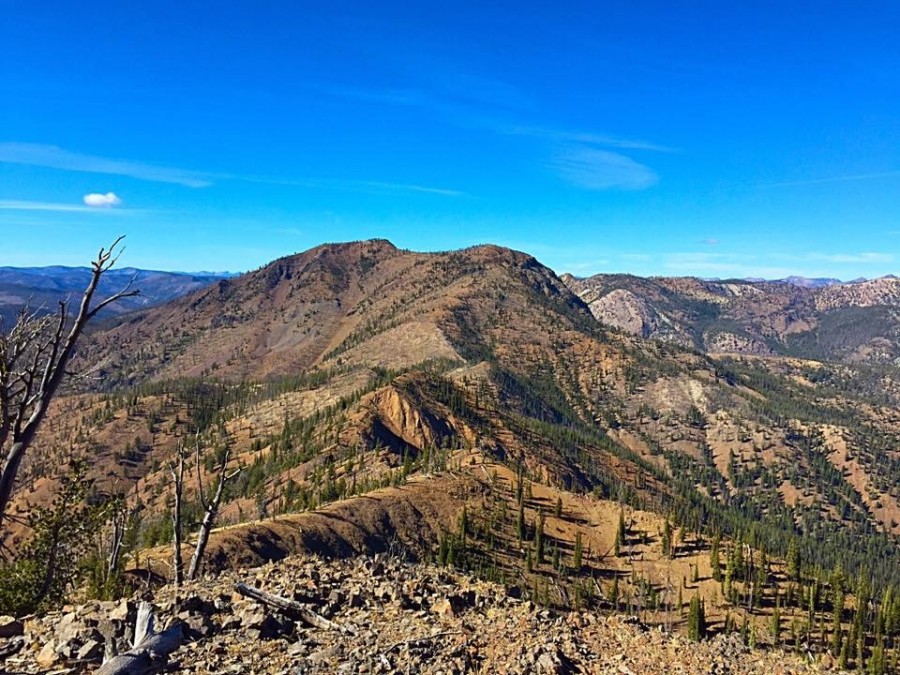
Murphy Peak as viewed from the south.
I climbed the route set out in the book with John Platt in 2015. We drove toward Monumental Summit and turned onto the Thunder Mountain Road just short of the pass. Although narrow, the road was in good shape. At 1.7 miles, the road took a hard left and we managed to park just off the road on this turn. From this point, we climbed straight up the peak’s West Slopes in roughly a mile with 1,000 feet of elevation gain. The slope was steep, tree-covered and mostly free of downfall.
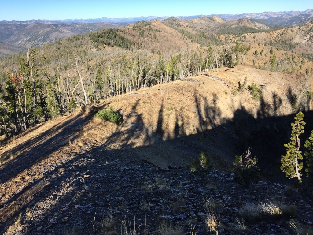
The North Ridge of Murphy Peak, just below the summit. The West Slopes are to the left.
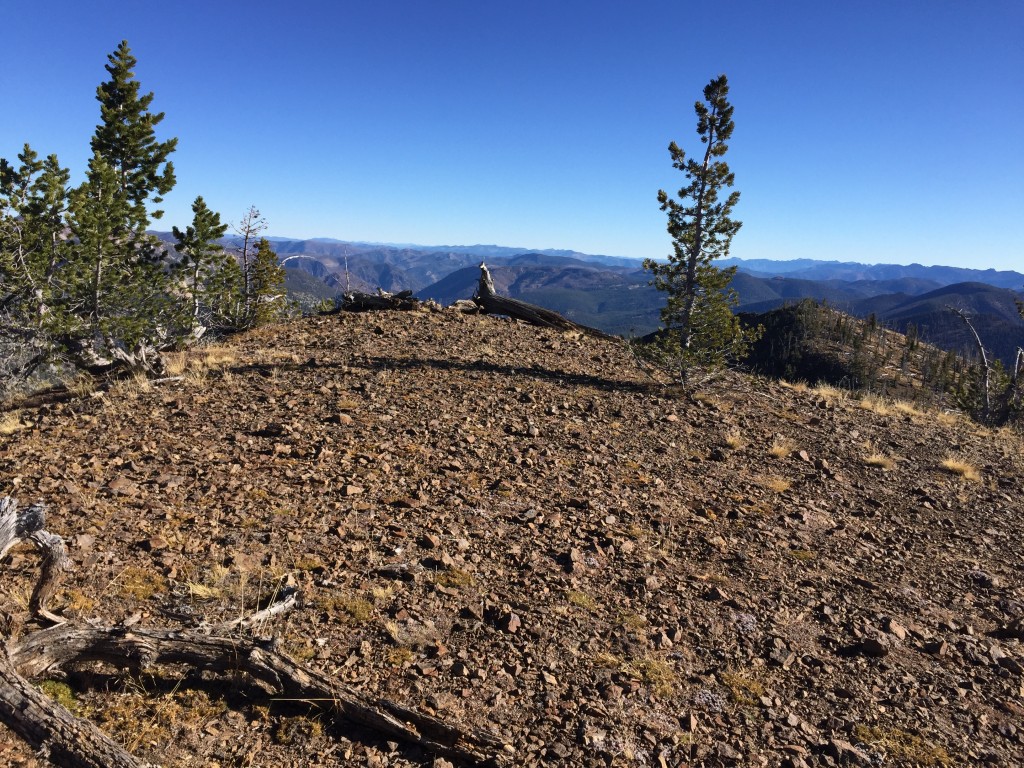
Looking east from the summit of Murphy Peak.
This peak can also be climbed by following the ridge south from Monumental Summit. This route is about 2.0 miles with 900 feet of elevation gain. We continued our trip by following the ridgeline south to Red Peak Benchmark.
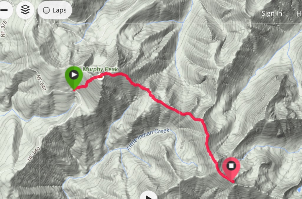
My GPS track for the climb up Murphy Peak and Red Mountain Benchmark.
Additional Resources
Regions: Big Creek to Red Ridge Peaks->Central Salmon River Mountains->Salmon River Mountains->WESTERN IDAHO
Mountain Range: Central Salmon River Mountains
Year Climbed: 2015
Longitude: -115.24929 Latitude: 44.89069