Elevation: 9,322 ft
Prominence: 2,974
Climbing and access information for this peak is on Page 112 of the book. Updated February 2020
North Loon Mountain is the crown of the Lick Creek Range. It is the 30th-most prominent Idaho summit. It is also a hard peak to reach. The ridge between South Loon Mountain and North Loon Mountain is not just tedious but is full of obstacles that will force climbers to drop down onto the ridge’s East Slopes. Keep in mind that just reaching the summit of South Loon Mountain is an ordeal.
John Platt‘s trip report covering both peaks in one day is linked below. His route covered 20.0 miles of mixed hiking and scrambling with 7,100 feet of elevation gain. The journey took 15 hours car-to-car. The route eventually ascended the peak’s East Ridge. The most humane way to climb the peak is by backpacking to Enos Lake and then ascending the East Ridge the next day. That route is set out below. USGS Enos Lake
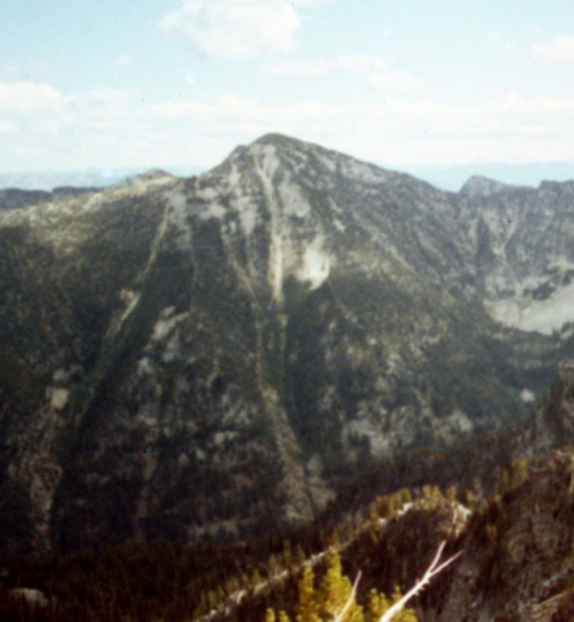
North Loon Mountain as viewed from South Loon Mountain. John Platt Photo
East Ridge, Class 2
Access
Take the FH-48/Lick Creek Road north from McCall to the Duck Lake trailhead. The trailhead is located just north of Lick Creek Summit [(B)(3) on Page 136]. The route from the Duck Lake trailhead to Enos Lake involves maintained and poorly maintained trails as well as a lot of difficult cross-country travel. Follow FST-085 north past Duck Lake to its junction with FST-084 [(B)(3)(c) on Page 136]. Hike FST-084 up to the top of the Lick Creek Crest at Loon Summit. Descend down to the small lake at the headwaters of Loon Creek.
From the lake, traverse over to FST-082 [(B)(3)(d) on Page 136]. Follow FST-082 up to 8,056-foot South Loon Saddle. From this saddle, start up the South Loon Mountain’s South Ridge. After gaining roughly 200 vertical feet, start a climbing traverse across South Loon Mountain’s South Face. Aim for a crossing of the peak’s Southeast Ridge at just over 8,800 feet. Cross the ridge and descend to Enos Lake. See the map below and use the link below to read John Platt’s trip report. This route covers 7.9 miles with 3,250 feet of elevation gain. Note: An alternative route to the upper Loon Creek drainage is to hike to Hum Lake and then from Hum Lake to Loon Creek [(B)(3)(d) on Page 136].
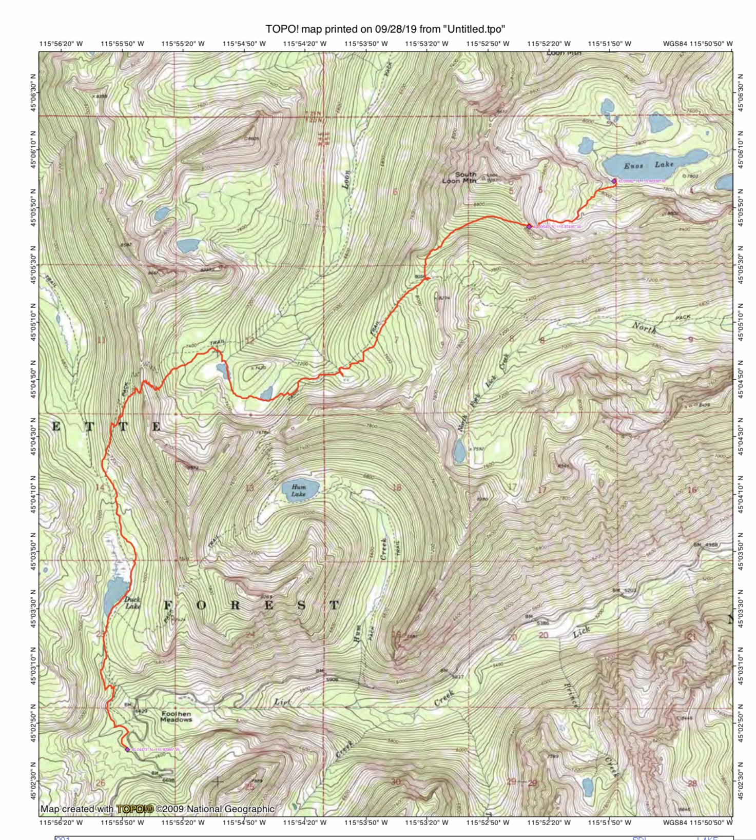
John Platt’s GPS track from the Duck Lake trailhead to Enos Lake. The route covers 7.9 miles with 3,250 feet of elevation gain.
Route
From the West End of Enos Lake, hike north past the 2 unnamed lakes below the East Ridge’s headwall. Climb the headwall, aiming for a point midway between the summit and Point 8986. Once on the East Ridge, climb it to the summit.
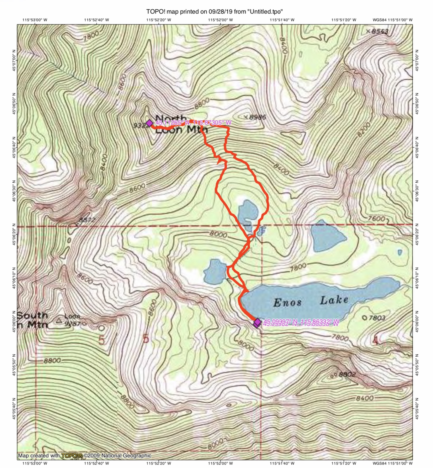
John Platt’s GPS track for his ascent of North Loon Mountain’s East Ridge.
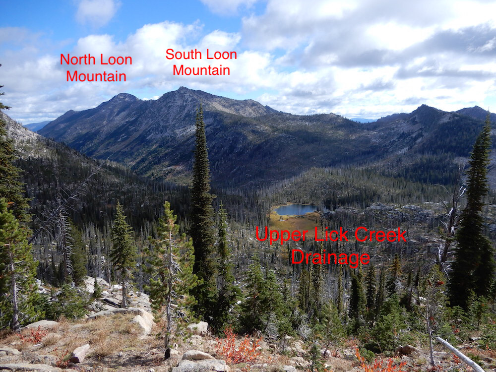
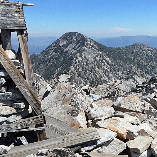
The view of North Loon Mountain and South Loon Mountain from Loon Summit. John Platt Photo
Additional Resources
Mountain Range: Western Salmon River Mountains