Elevation: 6,785 ft
Prominence: 325
This peak is not in the book. Published December 2020
Old Man Ridge is a nice, open ridge that is located just inside the Caribou National Forest boundary southwest of Freedom, WY. It offers expansive views. FST-024 (an ATV trail) goes to the summit from Deer Creek Road/FSR-156 and is the easiest ascent route. Old Man Ridge can be combined with nearby Peak 6780 for a more challenging two-peak trek. USGS Thayne West
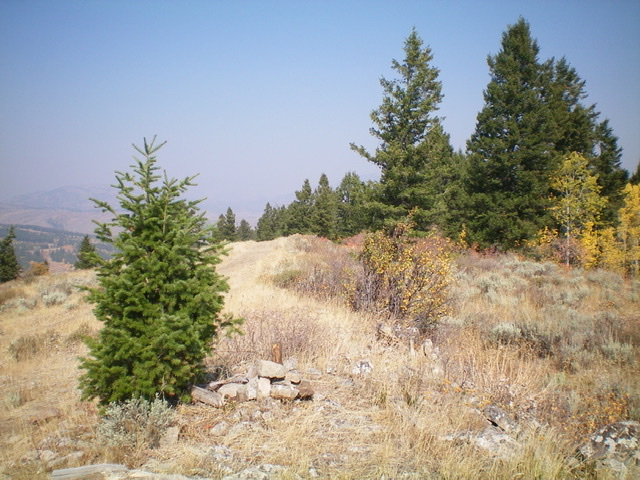
Looking up the southeast ridge of Old Man Ridge. The summit is not yet in sight. Livingston Douglas Photo
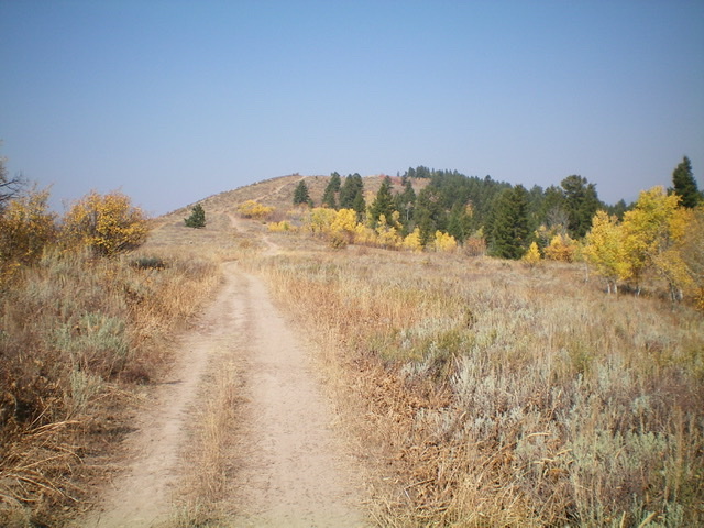
The summit of Old Man Ridge with its newly-rebuilt summit cairn, looking north. Livingston Douglas Photo
Access
Same as for Peak 6780. This is the second leg of a 2-peak journey that begins at Deer Creek Road/FSR-156. Please note that the USGS topo map fails to show the ATV trails on or near Old Man Ridge but the Caribou-Targhee National Forest Map does.
Southwest Face, Class 1
The Climb
From the 6,460-foot connecting saddle with Peak 6780, hike northeast up the steep ATV trail to reach the crest of Old Man Ridge and an unsigned trail junction. A short walk north from this junction puts you on the high point of Old Man Ridge. I rebuilt the torn-down summit cairn and put a stick in it. The open summit offers magnificent views of the surrounding area. This is one of the few Webster Range summits that does not require unpleasant bushwhacking.
Southeast Ridge, Class 2
The Descent
From the summit, follow FST-024 (an ATV trail/road) down the southeast ridge to about 6,400 feet where the trail turns sharply left/east to leave the ridge. Leave the trail here and follow a decent cattle/use trail on the brushy ridge crest. Head southeast then south in open scrub and scree to reach FSR-156. The descent gets a bit steep and loose as you approach the road, so be careful. Once on FSR-156, hike right/west up the road a short distance to return to its junction with FSR-023 and your parked vehicle.
Additional Resources
Regions: Peale Mountains->SOUTHERN IDAHO->Webster Range
Mountain Range: Peale Mountains
Longitude: -111.08369 Latitude: 42.96859