Elevation: 9,567 ft
Prominence: 1,067
This peak is not in the book. Published November 2023
Pass Benchmark is the high point on a ridgeline that sits south of Cruikshank Creek and east of Railroad Canyon in the Beaverhead Mountains. It rises significantly off the valley floor northeast of Leadore and has over 1,000 feet of prominence. USGS Reservoir Creek
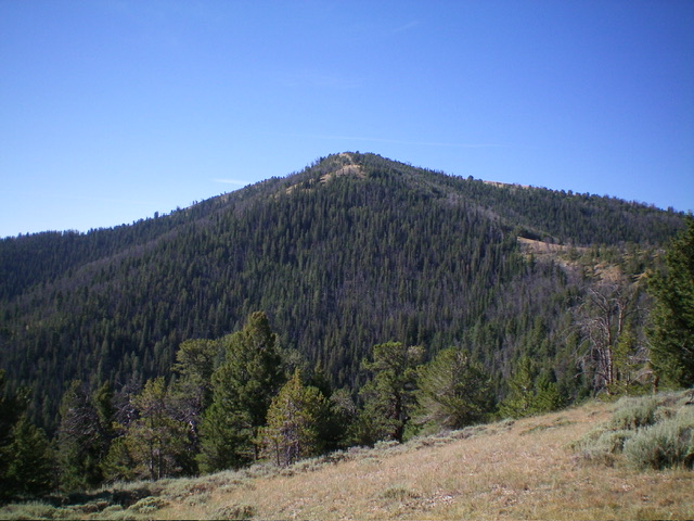
Pass Benchmark as viewed from the north. Livingston Douglas Photo
Access
Same as for Peak 9501Peak 9501. This is the second leg of a 2-peak adventure that includes Peak 9501 and Pass Benchmark. It covers 10.0 miles with 3,625 feet of elevation gain round trip.
Map Errors
The USGS topo map shows a 4WD road heading right/south from Cruikshank Road at 0.3 miles. There is a large parking area here but the road is now a foot trail only. The USGS topo map shows this 4WD road continuing all the way to the summit of Pass Benchmark (9,567 feet) but there is no road or trail high up on Pass Benchmark. The USGS topo map shows a foot trail on the southwest ridge of Peak 9501 but no such trail exists.
The USGS topo map fails to show the entirety of Wildcat Creek Road. From the south end of a large meadow, it continues left/east then left/north to head diagonally upward to cross the northwest ridge of Peak 9501 and continue eastward. The Salmon National Forest map shows only a short section of Wildcat Creek Road. It continues much farther up Wildcat Creek (and beyond) and is useful as a hiking trail.
East Ridge, Class 2
The Climb
From the 8,660-foot connecting saddle with Peak 9501, follow a game trail west up the ridge. Regrettably, the trail soon disappears. Continue climbing west up over Point 9014 which is a scrub hump, not a rocky mess as the USGS topo map suggests. From Point 9014, descend southwest for 200 vertical feet to a minor saddle. From the saddle, scramble west up the steepening ridge crest to reach the tilted summit plateau.
Stay just left/south of the forest’s edge on this ridge section. Follow a narrow game trail as it skirts the left/south side of the ridge crest and then disappears. Continue west up short scrub to reach the summit plateau. Head left/south past a repeater station and to the rocky high point. The summit of Pass Benchmark has two USGS benchmarks In ground boulders as well as the wreckage of a triangulation tripod.
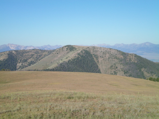
Pass Benchmark as viewed from Peak 9501 to its northeast. Livingston Douglas Photo
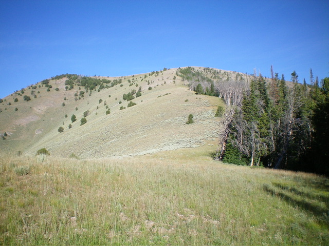
Looking up the final section of the east ridge, my ascent route. The summit hump is left of center. Livingston Douglas Photo
North Ridge, Class 2
The Descent
From the summit, descend north across the short scrub on the summit plateau. The ridge now steepens and narrows. Follow an old 2-track road (which gets better as you descend) down the ridge. This road bends left-ish/northwest to descend to an elongated saddle. Continue on this road as it heads north up to Point 8957 where it abruptly ends. From Point 8957, descend the semi-open ridge northeast to Point 8482 and then north a short distance down to an open saddle at 8,420 feet. Descend east from this saddle and bushwhack down through steep, but reasonable pine forest to intercept the grassy Wildcat Creek roadbed on the left/west side of the elongated meadow. Follow the grassy roadbed back to the gated road closure and then to the parking pullout area.
Additional Resources
Regions: Beaverhead Range->EASTERN IDAHO
Mountain Range: Beaverhead Range
Longitude: -113.2211 Latitude: 44.7138