Elevation: 9,501 ft
Prominence: 841
This peak is not in the book. Published November 2023
Peak 9501 is the high point on a ridge that separates Frank Hall Creek from Wildcat Creek. Peak 9501 and its neighbor Pass Benchmark (9,567 feet) are unusual in that they are both relatively high peaks that are in the foothills of the Beaverhead Mountains rather than up on the Continental Divide. Peak 9501 is most easily reached via its north ridge from a jeep road along Frank Hall Creek. USGS Reservoir Creek
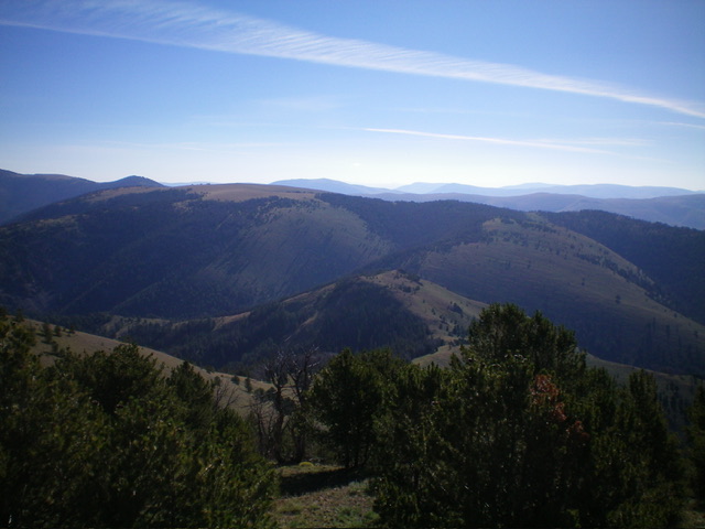
Peak 9501 (in mid-ground) as viewed from Pass Benchmark to its southwest. The summit is left of center. Livingston Douglas Photo
Access
From the signed junction of ID-28 and ID-29 in Leadore, drive northeast on ID-29. At 0.2 miles, continue straight at a 3-way junction. At 3.7 miles, Smokey Cubs Campground is on the left. At 4.2 miles, the pavement ends. At 8.1 miles, turn right/east onto [signed] FSR-130/Cruikshank Road. Drive 2.1 miles on Cruikshank Road to an unsigned junction with Wildcat Creek Road. Go right/southeast onto Wildcat Creek Road and drive 0.4 miles to a large pullout area that is about 0.1 miles before the gated road closure. This is the best place to park. It is at 7,105 feet and 44⁰44’58”N, 113⁰12’36”W.
Map Errors
The USGS topo map shows a 4WD road heading right/south from Cruikshank Road at 0.3 miles. There is a large parking area here but the road is now a foot trail only. The USGS topo map shows this 4WD road continuing all the way to the summit of Pass Benchmark (9,567 feet) but there is no road or trail high up on Pass Benchmark. The USGS topo map shows a foot trail on the southwest ridge of Peak 9501 but no such trail exists.
The USGS topo map fails to show the entirety of Wildcat Creek Road. From the south end of a large meadow, it continues left/east then left/north to head diagonally upward to cross the northwest ridge of Peak 9501 and continue eastward. The Salmon National Forest map shows only a short section of Wildcat Creek Road. It continues much farther up Wildcat Creek (and beyond) and is useful as a hiking trail.
Northwest Ridge, Class 3
The Climb
From the large pullout area, hike about 1-1/2 miles up Wildcat Creek Road (now a wide, grassy roadbed) to the top end of a long meadow. Follow the road left/east (then north) as it leaves the meadow to traverse the northwest side of Peak 9501. The road is now grossly overgrown with field grass, but is still useful for hikers. Follow this section of the road for about ½ mile to where it crosses the northwest ridge of Peak 9501 and provides easy entry into the thick forest at about 7,700 feet.
Leave the overgrown 2-track road and bushwhack right/southeast up the ridge through thick but manageable pine forest. It is fairly steep terrain in this initial section. Scramble up steep ridge rock (Class 3) from 84,00 feet to 8,750 feet. The ridge rock is easier than attempting to skirt the steep forested sides of the narrow ridge. Once past this rocky ridge section, bushwhack east then southeast up the semi-open, easy pine forest. Head south out of the forest and into easy, open scrub high up. Scramble southeast then east across the short scrub to reach the wide-open summit of Peak 9501. There is a large cairn on top with a stick in it.
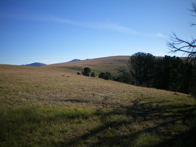
Peak 9501 (summit is in dead center) as viewed from high on the southwest ridge, my descent route. Livingston Douglas Photo
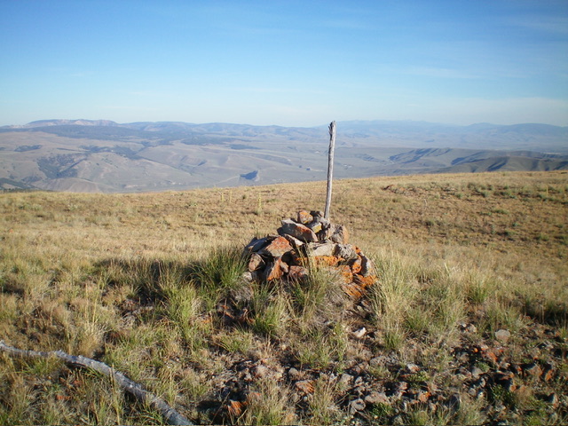
The summit cairn atop Peak 9501. Livingston Douglas Photo
Southwest Ridge, Class 2
The Descent
From the summit, descend west then southwest in easy, short scrub. Head left/south in open scrub as the ridge bends and enters a pine forest. Bushwhack south down through the pine forest to quickly reach a ridge saddle then scramble up forested Point 9305. From Point 9305, descend right/west down through pine forest to find a well-defined ridge and semi-open terrain. Leave the ridge and bushwhack west down to a critical saddle at 8,660 feet. There is an on-and-off use/game trail from Point 9305 down to this saddle. It is critical to NOT continue down the ridge after it bends right-ish/northwest. The 8,660-foot saddle is the connecting saddle with Pass Benchmark (9,567 feet). It concludes the first leg of today’s 2-peak adventure. Pass Benchmark is up next.
Additional Resources
Regions: Beaverhead Range->EASTERN IDAHO
Mountain Range: Beaverhead Range
Longitude: -113.1751 Latitude: 44.7250