Elevation: 10,014 ft
Prominence: 514
This peak is not in the book. Published November 2021
Peak 10014 is located at the head of both Bailey Creek and Burnt Aspen Creek. It towers over Kane Canyon to its west. It is most easily climbed via its southeast ridge from the Burnt Aspen Trail. This is the second leg of a 2-peak adventure that includes Peak 9020 and Peak 10014. It covers 7.0 miles with 3,050 feet of elevation gain round trip. USGS Phi Kappa Mountain
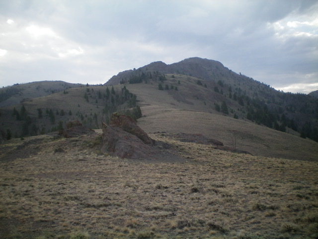
Peak 10014 as viewed from the base of the meandering west ridge. The summit is right of center. Livingston Douglas Photo
Access
Same as for Peak 9020. This is the second leg of a 2-peak adventure that begins on Kane Canyon Road.
West Ridge, Class 3
The Climb
From the 8,740-foot connecting ridge, follow the open ridge east-southeast then southeast to the gentle summit. The lower half of the ridge is a mix of easy scrub and sagebrush. The upper half of the ridge is a combination of rocky outcrops, some loose scree/gravel, and steep ridge rock. About halfway up the ridge, you must pass a large, rocky ridge buttress on its left/north side on ledges and knobby face rock (Class 3).
Just below the summit, climb straight up the ridge crest in a steep, rocky section of ridge (Class 3). This avoids the steep, loose scree/gravel in chutes and steep aretes on the right/south side of the ridge crest. The final push to the summit is on flatter scrub and sagebrush. The summit is a flat ridge crest with a decent summit cairn. There are numerous crumbly towers and aretes west and south/southeast of the summit. Be careful in choosing your descent route.
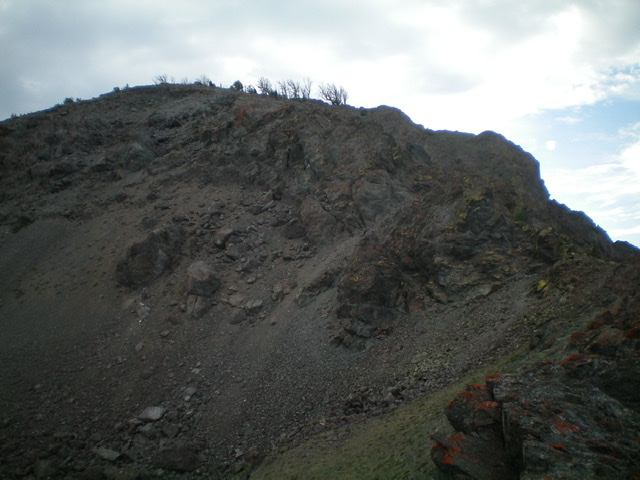
Looking up the steep, Class 3 section of the upper west ridge. Livingston Douglas Photo
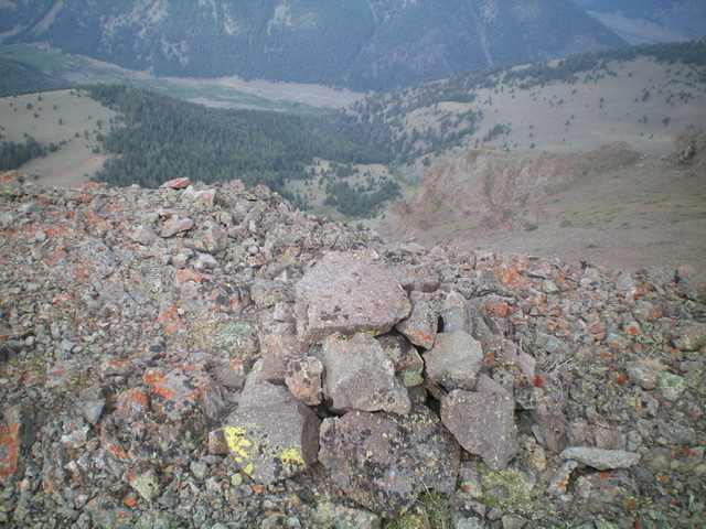
The summit cairn atop Peak 10014, looking west down into Kane Canyon. Livingston Douglas Photo
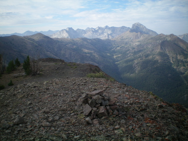
The summit area of Peak 10014 with higher Pioneer Mountains in the distance. Livingston Douglas Photo
Southwest Shoulder/West Face, Class 2
The Descent
From the summit, descend briefly south on the summit ridge. Drop right/southwest down a wide face of steep, loose talus/scree (plus some gravel). Boot ski much of this steep, loose terrain down to flatter, safer terrain below on the southwest shoulder proper. The shoulder is a mix of scrub and scree. It heads southwest initially but soon bends right/west. Stay in the semi-open terrain on the edge of a forest (which is to the right/north).
As you descend, the terrain flattens and becomes somewhat thick sagebrush with scattered pines. At Point 8698, the shoulder morphs into a face. Descend west down the forested face directly at Kane Creek. Find the Burnt Aspen Trail and follow it right/north back to the trailhead and then walk 0.1 miles north on Kane Canyon Road to your parked vehicle.
Additional Resources
Regions: EASTERN IDAHO->Pioneer Mountains
Mountain Range: Pioneer Mountains
Longitude: -114.13189 Latitude: 43.86349