Elevation: 10,094 ft
Prominence: 394
This peak is not in the book. The following historical information was contributed by Rick Baugher. “Peak 10094 is the highest peak on the Herd Peak quadrangle. This scenic tundra top heads Bartlett Creek, tributary to the North Fork Big Lost River. The peak is unofficially named after Jerome Bartlett, a native of West Virginia, who came to the Idaho Territory in the late 1880s to settle on 80 acres of bottom land along the North Fork Big Lost River. To the family of 7 children, this was known as ‘the upper ranch.’ The family also operated a ‘lower ranch’ along Big Lost River at Bartlett Point. Here the map shows another Bartlett Creek, where part of the original ranch still stands.” Use the link to Rick’s trip report set out below to read Rick’s additional historical information. Livingston Douglas revised and expanded on the route information as well as added new photos. Updated October 2025
Peak 10094 sits above the headwaters of Bartlett Creek, Little Burnt Creek, and Corral Creek in the northern Boulder Mountains. It is just east of Mystery Peak. Peak 10094 is most easily climbed from the trailhead at the mouth of Bartlett Creek. USGS Herd Peak
Peak 10094 as viewed from Point 9538 on the east ridge. Livingston Douglas Photo
Access
Approach the peak from the Trail Creek Road. Turn onto FS-444 just west of the Trail Creek/North Fork Big Lost River Road junction. Follow FS-444 north to Bartlett Creek. The road continues west up the Bartlett Creek drainage, but it is more suited to ATVs than passenger vehicles. In a saddle west of Peak 8291, the road intersects FS-544. Follow FS-544 west out from the road junction until it ends.
Map Updates
The USGS topo map fails to show the helpful ATV Trail (FST-4255) that curls around the south then west side of Peak 8291. It also fails to show the North Fork Trail that heads up the west side of the North Fork Big Lost River.
East Ridge, Class 2
The Ascent
From the trailhead, hike about 0.8 miles west up FST-4255 to a sharp right/north bend in the trail as it begins to head up a side drainage. Leave the trail here and descend 200 vertical feet in reasonable sagebrush to reach the toe of the east ridge from the base of the side drainage. If you can successfully bushwhack the thick willows in the Bartlett Creek drainage by leaving FST-4255 almost immediately after the trail crosses Bartlett Creek, you can avoid this extra 200 feet of uphill. I was unable to see a way through the willows early on, so I avoided the Bartlett Creek drainage.
Once at the toe of the east ridge, scramble west then southwest up the open, rounded ridge in gapped sagebrush. Higher up, the ridge bends right-ish/west and becomes forested. The forest bushwhack goes easily in a thinned forest (lots of signs of logging on this ridge) and has some game/use trails. There are some open areas of scrub mixed in with the pines. The underlying terrain is stable gravel and broken rock with minimal understory in the forest. The blowdown is not too bad. After a steep uphill bushwhack in the forest, reach open, rocky terrain and a ridge juncture just above tree line.
Scramble west on an up-and-down ridge section of easy scree/gravel with some rocky outcrops and talus. Reach rocky Point 9538 then drop to a thickly-forested saddle with lots of blowdown. Yes, the forest returns. This saddle also has some remains of old mines. One Idaho climber claims “no sign of previous human visitation” but there are ample signs of tree cutting, mining, and hunters.
The final push to the summit ridge is up a steep-ish, easy, gapped pine forest with a few massive down trees to work around. The ridge bends left-ish/southwest up this final hillside and is more of a ridge than the USGS topo map suggests. Once on the open tundra and broken rock of the tilted summit plateau, head left/south to the obvious, rocky outcrop that is the high point. It is at the south end of the plateau. I rebuilt the summit cairn and enlarged it. One Idaho climber labels the east ridge a “volcanic ridge” but it was mostly a scrub (or pine forest) climb with no rock at all until high up and, even there, I did not notice any volcanic rock.
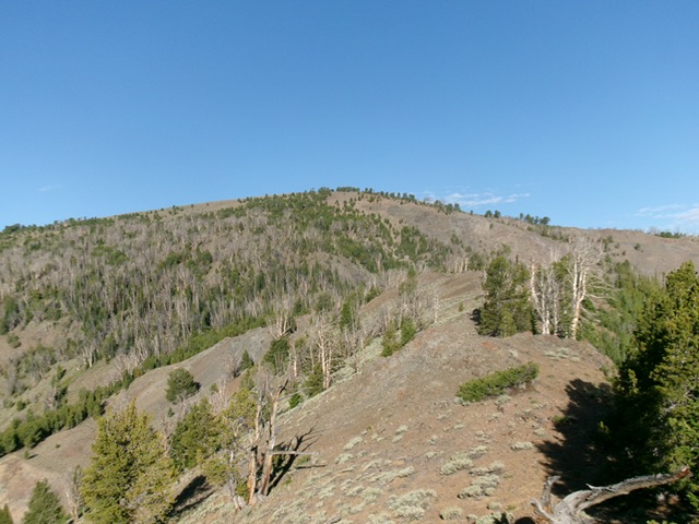
The east ridge (left of center) as viewed from the sharp bend in FST-4255. This was my ascent route. Livingston Douglas Photo
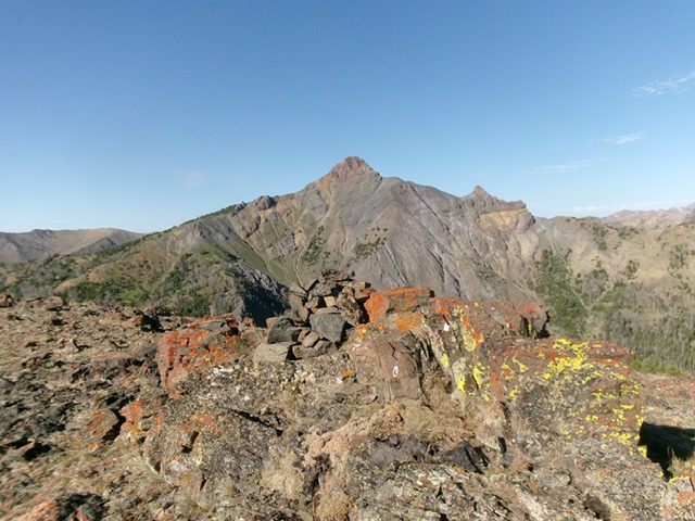
The rocky summit outcrop (and cairn) of Peak 10094 with Mystery Peak in the distance. Livingston Douglas Photo
East Ridge/Northeast Spur, Class 2
The Descent
From the summit, descend back down the east ridge and up over Point 9538. There are a series of ridge outcrops and boulders in this area. From Point 9538, descend a gradual, easy, rocky ridge section to reach a ridge juncture. Head left-ish/northeast at this juncture. The open, rocky ridge is magnificent. Follow the open ridge northeast down to about 9,200 feet where it becomes forested. Stay on a northeast trajectory in this thick-ish but easy forest and use game trails to assist in your downward progress.
Reach an open ridge section (visible from above) at about 8,800 feet, with Point 8702 at its right/east end. Work through easy sagebrush to reach rocky Point 8702, which is a minor rocky protrusion. Continue northeast then east down the ridge in open scrub (with a small patch of forest along the way) to cross a gully, come up over a minor ridge hump, then descend through a patch of pine forest to cross a saddle.
From this saddle, bushwhack in open scrub up to the top of the rocky outcrop/buttress that is Point 8265. From here, descend east in open scrub to reach a steep-ish, rocky drop into pine forest just underneath the visible ATV trail. This rocky section is a mix of scree/gravel, rocky outcrops/cliff bands, and scrub. Scramble 25 vertical feet up gravel and scrub to reach the ATV trail and follow it as it heads right/south. The trail heads uphill for another 35 vertical feet and then drops to reach the bend (the departure point from earlier in the day). Continue left/east on the ATV trail back to the trailhead in about 0.8 miles.
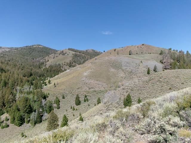
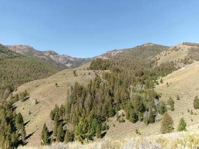
The northeast spur (right of center) as viewed from the sharp bend in FST-4255. This was my descent route. Livingston Douglas Photo
Rick Baugher Photos

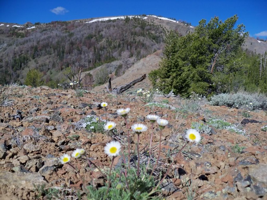
The view west to Bartlett Mountain. Erigeron (daisy) in bloom. Rick Baugher Photo
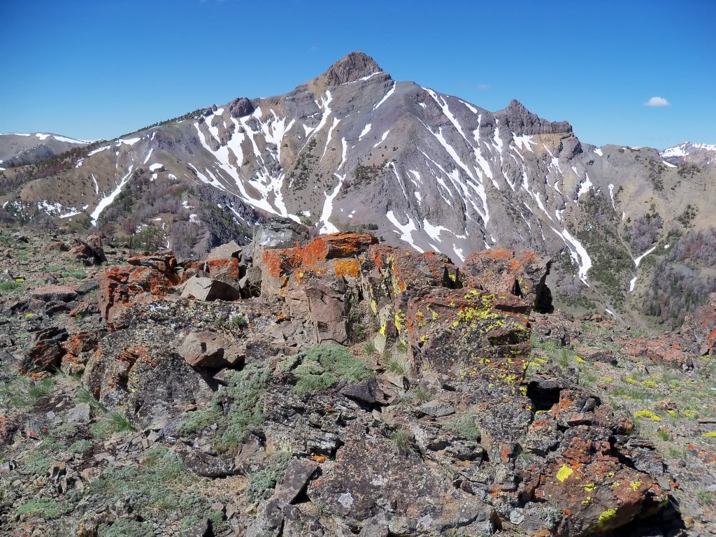
The view southwest to parent Central Idaho Nipple/Mystery Peak (10,785 feet). Rick Baugher Photo
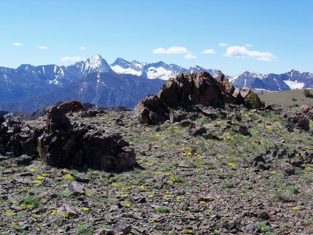
Pioneer peaks left to right include: Gabriel’s Horn, Devils Bedstead East (11,865 feet), Goat Mountain, Hyndman Peak, Salzburg Spitzl, Devils Bedstead West (11,051 feet), and the Phi Kappas. View from the uncairned summit of Bartlett Mountain. No sign of previous human visitation could be found above the 8,800-foot level. A discreet cairn was placed on 7/7/10. Rick Baugher Photo
Additional Resources
Regions: Boulder Mountains->EASTERN IDAHO
Mountain Range: Boulder Mountains
Longitude: -114.23901 Latitude: 43.90849