Elevation: 10,137 ft
Prominence: 317
Climbing and access information for this peak is on Page 212 of the book. Updated November 2022
Peak 10137 is located just southeast of Baker Peak on the main Smoky Mountain crest. USGS Baker Peak
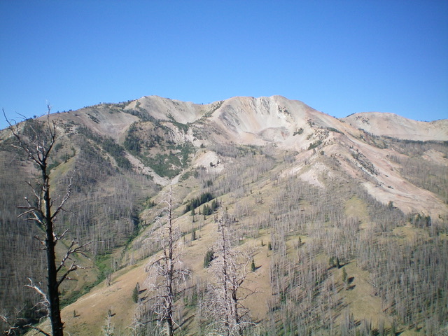
Peak 10137 (summit is left of center), its magnificent high summit ridge, and its east face as viewed from the east. Point 10120+ is just right of center. Livingston Douglas Photo
Access
Same as for Baker Peak. This is the second leg of a 2-peak adventure that includes Baker Peak (10,174 feet) and Peak 10137.
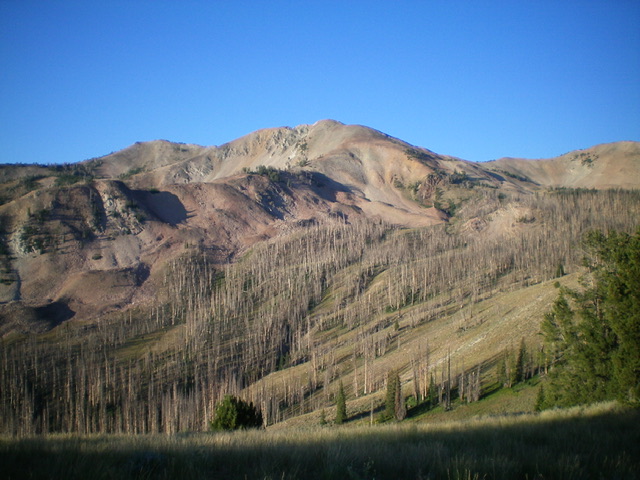
Peak 10137 (left of center) and Point 10120+ (dead center) as viewed from the northeast. Livingston Douglas Photo
North Ridge, Class 2
The Climb
From the 9,820-foot connecting saddle with Baker Peak, scramble east on either the narrow, choppy outcrops/talus of the ridge proper or up an easy, broken-rock slope then a talus slope to Point 10120+ (a rocky, narrow ridgeline point). I did the latter on the ascent and the former on the descent. From Point 10120+ (which measures only 10 feet lower than the true summit), scramble along a rocky, up-and-down, narrow ridge crest to reach a final saddle. From the saddle, head up over two more talus humps to reach the talus pile that is the summit of Peak 10137. The summit has a nice cairn with a stick in it.
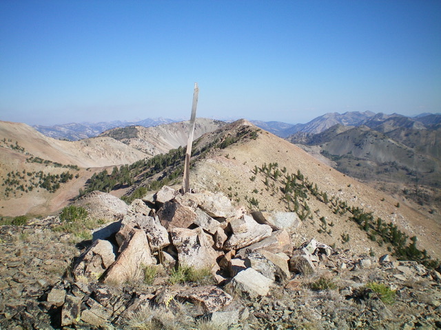
The summit cairn atop Peak 10137, looking north along the ridge (my ascent route). Livingston Douglas Photo
North Ridge, Class 2
Descent Back to Baker Lake Trailhead
From the summit, return to the 9,820-foot connecting saddle with Baker Peak. Rather than re-climb Baker Peak and descend its northeast ridge, descend directly north off the saddle on a use trail that switchbacks its way down through loose scree/gravel into Slide Rock Canyon. The helpful trail soon disappears but the terrain in Slide Rock Canyon is not difficult. Angle diagonally downward and left/north to reach the north side of the basin/canyon. Stay just left/north of the half-burnt pine forest in the basin. The terrain here is mostly short scrub or dirt/pine duff.
Keep heading down the basin/canyon until reaching the 8,800-foot level. At that point, begin a diagonal left/northeast traverse to reach the critical ridgeline west of Point 8905. The terrain is easiest from 8,800 feet to 8,700 feet. The terrain then becomes thicker scrub and is at a steeper angle to contour over onto the ridge. Once on the ridge, descend diagonally right/northeast down through the burnt forest to reach Baker Creek, aiming for the [visible] trailhead parking lot. Cross Baker Creek on a log and contour left/north to reach the Baker Lake Trail just above the parking lot. Follow the trail for a short distance down to the parking area and your vehicle.
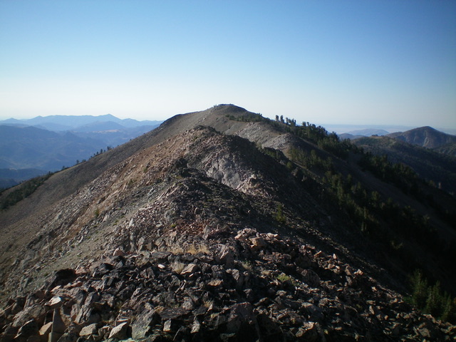
Looking along the choppy north ridge of Peak 10137 from Point 10120+. The summit is just left of center. Livingston Douglas Photo
Additional Resources
Regions: Smoky Mountains->WESTERN IDAHO
Mountain Range: Smoky Mountains
Year Climbed: 1989
Longitude: -114.66459 Latitude: 43.66279