Elevation: 10,199 ft
Prominence: 391
This peak is not in the book. The map elevation is 10,195 feet. LiDAR calculations place the elevation at 10,199 feet. The unofficial name was proposed by Rick Baugher. Derek Percoski climbed this peak in 2018 as part of loop that also included White Cap Peak. Livingston Douglas climbed the west face and descended the north ridge in 2024. Both of their routes are set out below. Updated November 2024
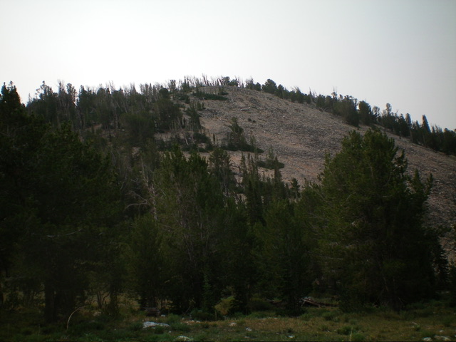
Peak 10195 is located west of the Lost River Range Crest and south of Leatherman Pass. Peak 10199 is one of several foothills on the southwest side of the Lost River Range. It sits on a ridgeline that separates Sawmill Gulch from Lone Cedar Creek. Peak 10199 is most easily climbed via its gentle north ridge. USGS Leatherman Peak
North Ridge by Derek Percoski
Access
Sawmill Gulch [(B)(8)(a) on Page 292]
North Ridge, Class 2 by Derek Percoski
The north ridge is easy Class 2. I suspect that you could get a horse or a mountain bike all the way to the summit. I remember thinking that the south contour looked taller than the spot elevation, which is a slight possibility. Trees block the view between the two potential high points and, of course, my eyes often deceive me. The West Face is all passable terrain, so the peak can be linked to anywhere on the Sawmill/Leatherman Trail, but you’ll likely encounter some steep dirt, especially down near the creek.
My track shows the clockwise loop I made with White Cap Peak. If I repeated the trip, I would do it almost exactly the same way. If I had descended White Cap slightly to the north (gully instead of ridge), I could have enjoyed more scree-skiing but, except for that, it was perfect.
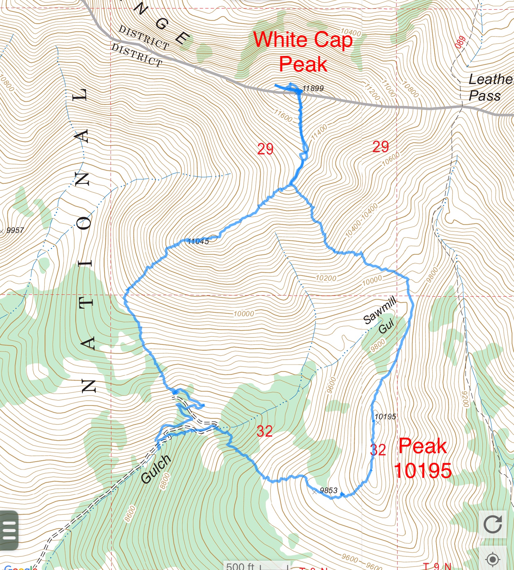
Derek’s GPS track. He ascended the north ridge and descended the rounded west rib slopes.
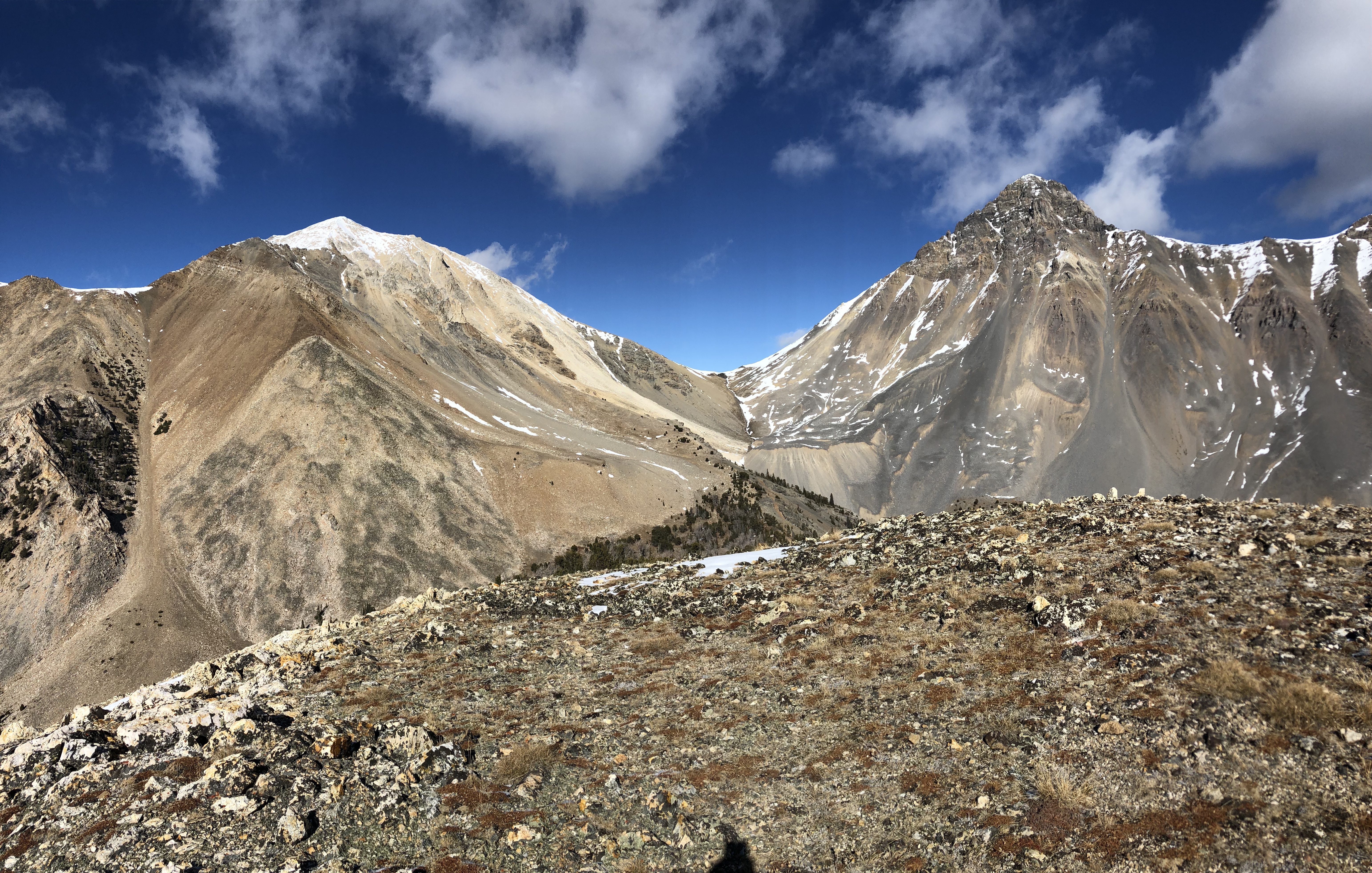
Looking to White Cap Peak (left), Leatherman Pass, and Leatherman Peak (right) from the summit of Peak 10199. Derek Percoski Photo
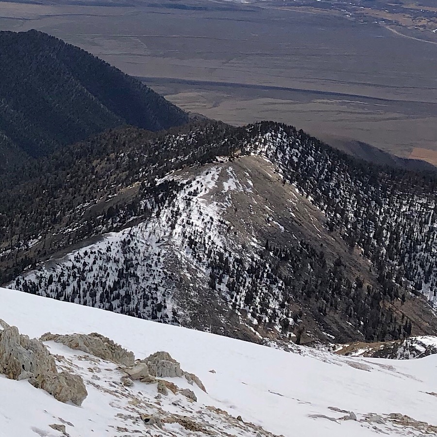
Mackay Reservoir and Peak 10199 (center) as viewed from White Cap Peak. Derek Percoski Photo
West Face and North Ridge by Livingston Douglas
Peak 10199 and its steep west face. This was my ascent route. Livingston Douglas Photo
Access
Sawmill Gulch Road/FSR-411 is a rugged, steep, rocky mess. I only made it 1.4 miles up the road in my 4WD Toyota Tacoma. There’s a decent pullout alongside the road there (7,300 feet and 44⁰03’08”N, 113⁰46’53”W). You will need a 4WD vehicle with high clearance and good tires after this point.
Map Errors
The USGS topo map fails to show much of Sawmill Gulch Road. The road continues up Sawmill Gulch to about 8,700 feet with a spur road that continues left/west up to an old mine. The USGS topo map also fails to show FST-089 (unsigned and unmaintained) which goes all the way to Leatherman Pass and beyond.
West Face, Class 2+
The Climb
From the roadside pullout, hike northeast up rocky, steep Sawmill Gulch Road to a sharp left bend and a large cairn. The left spur road goes up to an old mine. The cairn is the unofficial, unsigned beginning of FST-089. Hike up the forested, steep, and somewhat rocky foot trail as it follows the left/northwest side of Sawmill Creek. Leave the trail when it emerges from the forest and starts heading left/north, moving away from Sawmill Gulch. This open terrain is above a wet, grassy meadow that the trail passes through while climbing up through the pine forest.
Leave the trail and scramble right/east to the center of Sawmill Gulch across a slope of boulders/talus. Follow Sawmill Gulch northeast on a mix of tundra and embedded talus/scree to a flat, open meadow just above 9,600 feet. This meadow is just past the steep cliffs on the west face of Peak 10199. Leave this meadow and scramble right/southeast up a steep face of boulders, talus, and loose scree to reach scattered pines higher up. Continue southeast to intercept the semi-forested north ridge high up.
Once on the north ridge, head right/south up a ridgeline of easy pine forest with open rock near the summit (gravel, scree, and talus). The barren summit had a modest cairn which I built up sizably. As the USGS topo map indicates, the measured high point is the north summit hump. Visually, the south summit is clearly lower in elevation.
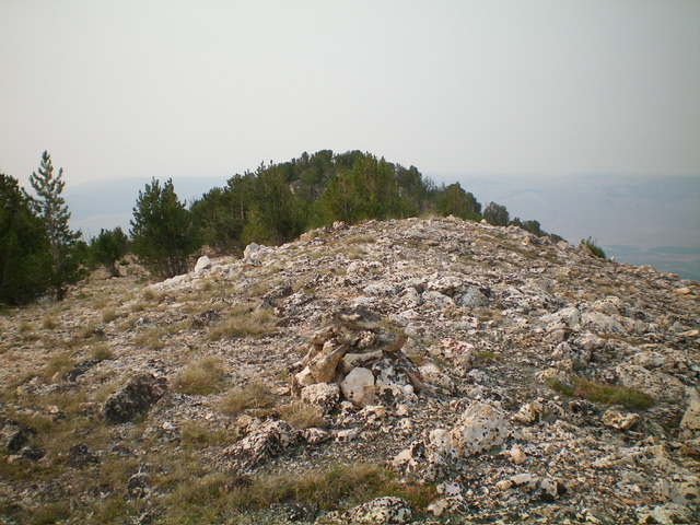
The summit of Peak 10199 with the lower, forested south summit in the distance. Livingston Douglas Photo
North Ridge, Class 2
The Descent
From the summit, descend the semi-forested north ridge at an easy grade down to an open ridge saddle at the head of Sawmill Gulch. The ridge terrain on the north ridge is a mix of scattered pines, tundra, and embedded scree/gravel—nothing difficult. This 9,820-foot ridge saddle is the connecting saddle with White Cap Peak (11,910 feet) to the northwest. From the ridge saddle, bushwhack west then southwest down into forested Sawmill Gulch. I found no trail in Sawmill Gulch here, only a cairned route that was difficult to follow. Descend Sawmill Gulch, staying to the right/west of the main creek to find the well-beaten trail lower down. Follow the foot trail southwest and back down to Sawmill Gulch Road. Follow the rocky, steep road southwest down to your parked vehicle.
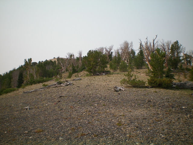
Looking up the north ridge at the summit hump. This was my descent route. Livingston Douglas Photo

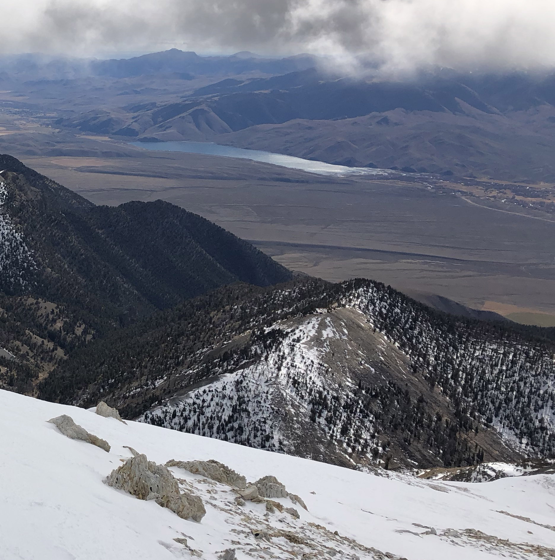
White Cap Peak as viewed from the summit of Peak 10199 to its south. Livingston Douglas Photo
Additional Resources
Regions: EASTERN IDAHO->Lost River Range
Mountain Range: Lost River Range
Longitude: -113.74909 Latitude: 44.06789