Elevation: 10,216 ft
Prominence: 295
This peak is not in the book. The elevation has been updated to 10,216 feet based on new LiDAR measurements. Larry Prescott climbed the peak from the east. Larry’s East Face Route is summarized here and a link to his site is provided below. Rick Baugher’s Southeast Ridge Route is also linked below. Livingston Douglas climbed this peak as part of a 4-peak adventure that includes Peak 10723, Gilmore Peak, Gilmore East, and Liberty Mountain. It covers 7.5 miles with 3,025 feet of elevation gain round trip. Updated November 2024
Liberty Mountain is located due east of ID-28 at Gilmore Summit and east of Meadow Lake. Livingston Douglas notes “Liberty Mountain recently lost its status as a ranked summit. It sits at the head of Liberty Gulch, hence its unofficial name.” Liberty Mountain is most easily climbed from Meadow Lake to its west. The high point is at the southeast end of a lengthy summit ridge. USGS Gilmore
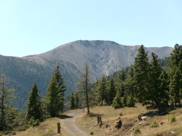
Liberty Mountain as viewed from Meadow Lake Road to its north, just above the hamlet of Gilmore. Livingston Douglas Photo
West Ridge and West Face by Livingston Douglas
Access
As noted above this peak was climbed as part of a 4-peak adventure that included Peak 10723, Gilmore Peak, Gilmore East and Liberty Mountain. This covers 7.5 miles with 3,025 feet of elevation gain round trip. The routes below can be accessed directly from Meadow Lake as well as from Gilmore Peak East. Primary access to Meadow Lake is from ID-28 at the small hamlet of Gilmore. From Gilmore, a good gravel road leads to Meadow Lake where there is a Forest Service Campground [(A)(6)(a) on Page 314].
West Ridge, Class 2
The Climb
From the 9,900-foot connecting saddle with Gilmore East, scramble northeast up chunky talus to reach a point where you can traverse right/east and bypass the northwest summit hump. Stay above the loose, rocky gullies on the south face when doing this traverse. Aim to reach the 10,060-foot saddle between the two summits. From the saddle, skirt (or climb) a few minor ridge humps on the way to the southeast/true summit. The summit hump had a modest cairn but a ridge hump about 50 feet to its east might actually be the high point. Stand atop both humps “just to be sure.”
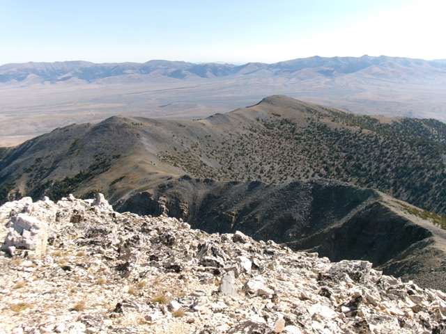
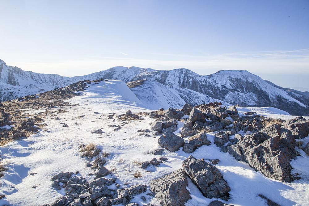
Liberty Mountain (in mid-ground with the summit hump just right of center) as viewed from Gilmore East to its southwest. Livingston Douglas Photo
West Face, Class 2+
The Descent
From the summit, return to the 9,900-foot connecting saddle with Gilmore East. From the north end of the broad saddle, descend an easy face of scree/gravel and scrub to a forested shoulder. The shoulder soon steepens as it follows a prominent dry gully to its right/northeast. Leave the shoulder when it becomes too rough and drop into the gully. Follow a goat trail in the gully. Descend steep-ish, loose scree and gravel on this goat trail for a little while.
When the gully steepens and narrows, go left/south onto a shoulder via a goat trail. Stay on this shoulder briefly then return right/north into the gully on a goat trail. Follow the gully briefly until it spills out into a wider area. Follow a goat trail left-ishonto a scree shoulder. This shoulder gets you down to the valley floor and the forested area just below the outlet stream coming from Meadow Lake. Cross the dry stream bed on boulders and talus.
Once across the stream bed, find a use trail that leads to a better foot trail along the north edge of Meadow Lake. Hike along this good use trail back to the Meadow Lake Campground and your parked vehicle. The west face looks ominous from the Meadow Lake Campground. The key to making it work is to find the “sweet spot” in between the wicked cliffs to the south and the very steep terrain to the north. Study the USGS topo map closely. Follow the area with the widest contours. The map is correct.
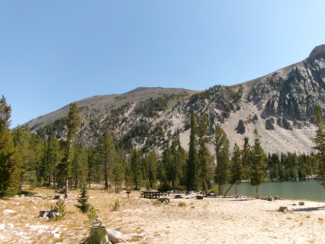
The steep west face/headwall of Liberty Mountain as viewed from Meadow Lake. This was my descent route. Livingston Douglas Photo
East Face by Larry Prescott
Access
Silver Moon Gulch 4WD Road
East Face
Larry accessed the east face via a 4WD road that is found just north of Silver Moon Gulch. This road ends approximately a mile from the summit. Larry reported: “The path to the east face of Liberty Mountain follows a well-defined creek bed. The going was easy without much brush. Soon the forest gave way to an open slope of rocks leading to the ridge of the mountain. I followed the ridge straight to the summit.”
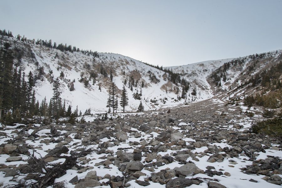
Ascending the east face. Larry Prescott Photo
Larry continues:
“The upper part of the steep ridge was a bit difficult. Deep snow made for slow going. I inched my way to the top, carefully crossed solid ice to open rocks, and then made for the summit.”
Larry’s Class 3 route ascends 1,800 feet of elevation in roughly 1.25 miles.
The view from the summit. Larry Prescott Photo
Larry’s route up Liberty Mountain’s east face
Additional Resources
Regions: EASTERN IDAHO->Lemhi Range
Mountain Range: Lemhi Range
Longitude: -113.29639 Latitude: 44.43129