Elevation: 10,735 ft
Prominence: 208
Climbing and access information for this peak is on Page 304 of the book. Based on LiDAR measurements the elevation of this peak has changed from the map figures. For those wishing for more route detail, Livingston Douglas has added more detailed route information and new photos. Updated December 2023
This peak is the officially named Gilmore Peak. When I climbed this peak on September 25, 2000 in winter-like conditions, I thought the next point east might be higher. I climbed it again in Summer 2013 and, once again, thought the east summit was higher. Based on LiDAR measurements, the peak’s east summit (Gilmore East) IS higher. The [lower] west summit is still an enjoyable climb and is probably the easiest way to reach Gilmore East. USGS Gilmore
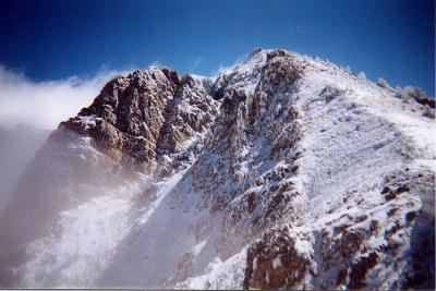
Gilmore Peak. John Platt Photo
Access
Primary access is from ID-28 at the small hamlet of Gilmore. From Gilmore, a good gravel road leads to Meadow Lake where there is a Forest Service Campground [(A)(6)(a) on Page 314].
Northwest Ridge, Class 2
The Forest Service trail from Meadow Lake to the ridgeline northwest of the peak was in good shape in 2013. Once at the saddle, a good game trail follows the west side of the ridge almost to the named west summit of the Gilmore Peak massif.
Northwest Ridge and Northeast Ridge by Livingston Douglas
Access
Same as for Peak 10724. This is the second leg of a 4-peak adventure that includes Peak 10723, Gilmore Peak, Gilmore East (10,744 feet), and Liberty Mountain (10,216 feet). It covers 7.5 miles with 3,025 feet of elevation gain round trip.
Northwest Ridge, Class 2
The Climb
From the 10,140-foot connecting saddle with Peak 10724, follow a good use trail southeast up the ridge crest (or close to it on its right/west side). The rocky ridge soon bends right-ish/south-southeast and narrows considerably. A narrow goat trail takes over and can be hard to follow amongst the many rocky ridge outcrops. Stay close to the ridge crest and use the highest of several goat trails on the right/west side of the ridge. At about 10,600 feet, the ridge bends left-ish/southeast. The ridge widens just below the summit hump, which is just a pile of talus/scree. Follow a goat trail up through the talus/scree to the gentle high point. There is a large cairn on top.
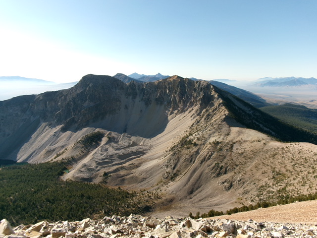
Gilmore Peak (ridge corner right of center) and Gilmore East (hump left of center) and the narrow connecting ridge with Peak 10724 (right of center). This was my ascent route.
Northeast Ridge, Class 2
The Descent
From the summit, the ridge traverse northeast to Gilmore East looks a bit rugged. There is a rocky, false summit hump between Gilmore Peak and Gilmore East. The summit of Gilmore East sits behind this more impressive rocky ridge feature. This could be a tedious scramble across the connecting, up-and-down, ridge crest.
From the top of Gilmore Peak, descend the rocky ridge northeast on reasonable ridge rock and a goat trail (of sorts). Skirt the right/southeast side of a large ridge outcrop on the way to the 10,540-foot connecting notch. This notch concludes the second leg of today’s 4-peak journey. Gilmore East (10,744 feet) is up next.
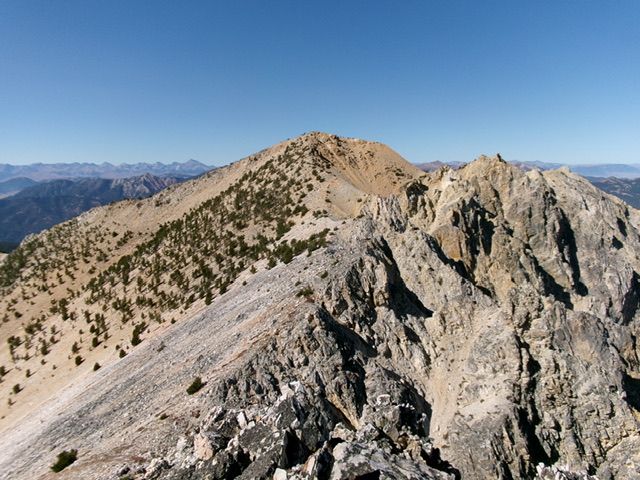
Gilmore Peak and its northeast ridge (dead center). This was my descent route. Livingston Douglas Photo
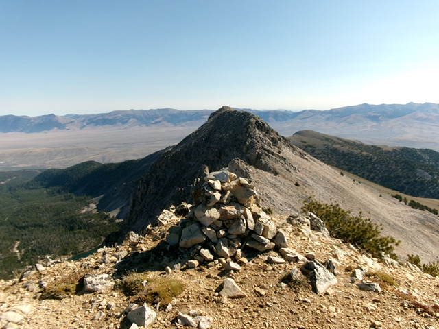
The summit cairn atop Gilmore Peak with Gilmore East in the background. Livingston Douglas Photo
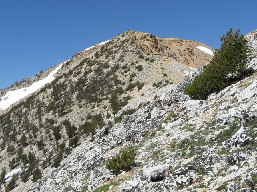
The northwest ridge of Gilmore Peak
Additional Resources