Elevation: 10,222 ft
Prominence: 482
This peak is not in the book. Updated June 2019
Steel Head Peak is located northwest of Lem Peak and west of the main Lemhi Range Crest. The West Side of the range in this area rises abruptly, necessitating a long, steep route. In 2005, Rick Baugher was the first to report a climb of the peak. Rick’s trip report is linked below. Jeff Hunteman climbed the peak in 2019. His trip report is set out below. Both climbed the peak from McKim Creek on the West Side of the range. This route avoids private property in the Allison Creek drainage. A better, but unverified, route may exist from Bear Valley Lakes on the East Side of the crest. USGS Allison Creek
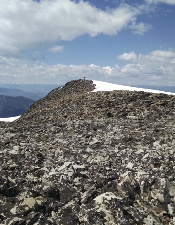
Looking toward the summit of Peak 10222. Jeff Hunteman Photo
Northwest Ridge, Class 2 by Jeff Hunteman
Access
Allison Creek would be best access but I am not sure on the status of an easement, if any, across a private property parcel in that drainage. We chose to access the peak out of McKim Creek via FS-018. This road leaves US-93 30.0 miles south of Salmon, Idaho and 29.0 miles north of Challis, Idaho.
Drive east up McKim Creek Road, past the private property until the road switchbacks to the left at a narrow drainage and climbs steeply, leaving the McKim Creek drainage in so doing. Park here (5,280 feet). An old Forest Service trail takes off from here. Just look closely at the back of the switchback and you will see the trail.
The Climb
Follow the trail, which has not been maintained but is still better than other alternatives. Not far in, you will come to a nice pack bridge on this unkempt trail to seemingly nowhere. Follow the trail until you arrive in the sage and aspen. Start to look for easy access to the little ridge just above and north of McKim Creek. The going gets difficult down in the drainage after a while.
Take this ridge and pass just above the highest clump of aspen you see on the ridge. Just above this clump, there is an excellent cow trail that heads south and back to McKim Creek. This trail passes through a fence gate and then leads to a water crossing. If it is Spring, you will probably get wet here, as we did. From the crossing, the route climbs the nice ridge on the south side of McKim Creek and passes the little pond visible on the topographic map. Take this ridge until it turns steeply up. Keep heading up to gain the main ridge between Allison Creek and McKim Creek. From there, head up the Northwest Ridge to the summit of Peak 10222.
We found a summit register. Rick Baugher was first there in 2005 and unofficially called this mountain Steel Head Peak. Another group climbed it in 2012. Our ascent in 2019 is only the third entry. Once on top, be sure to take the time to explore the ridge to the east as it overlooks the scenic headwaters of McKim Creek. Beware that this route starts in sagebrush and there are rattlesnakes, so plan accordingly.
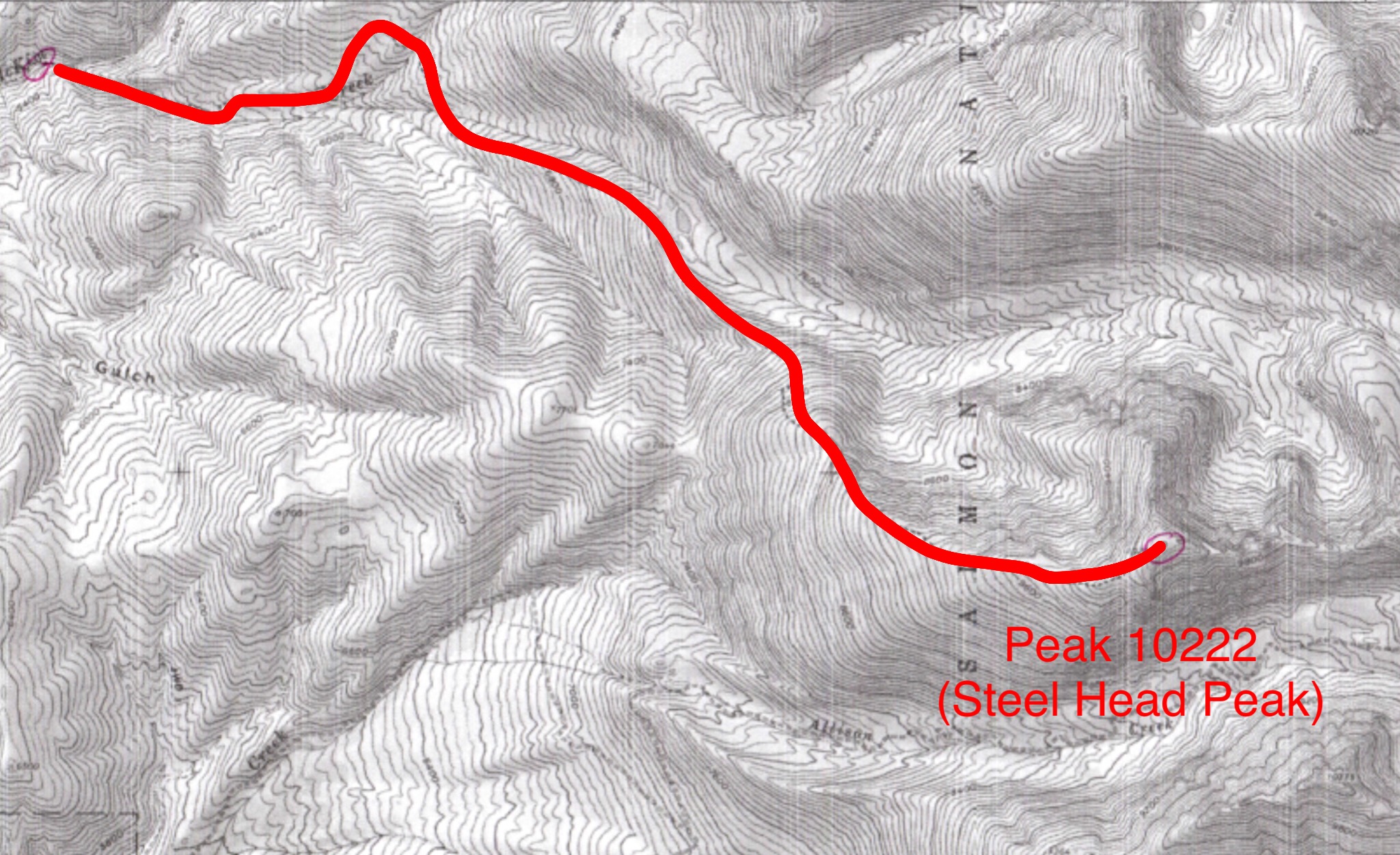
Jeff’s approximate route up the McKim Creek drainage and the Northwest Ridge.
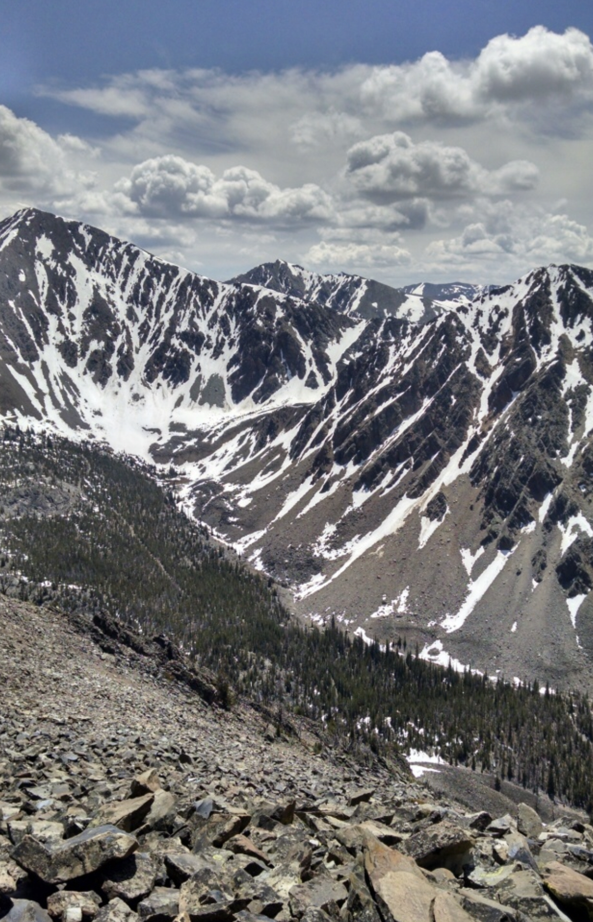
Lem Peak as viewed from the summit of Steel Head Peak. Jeff Hunteman Photo
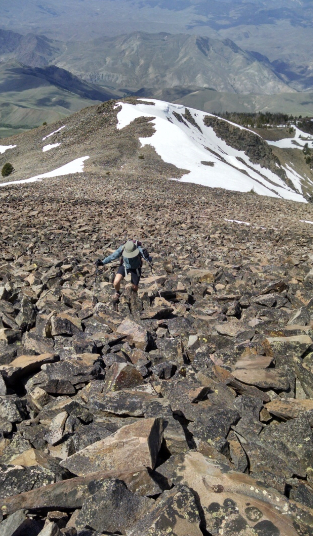
The top of the Northwest Ridge Route. Jeff Hunteman Photo
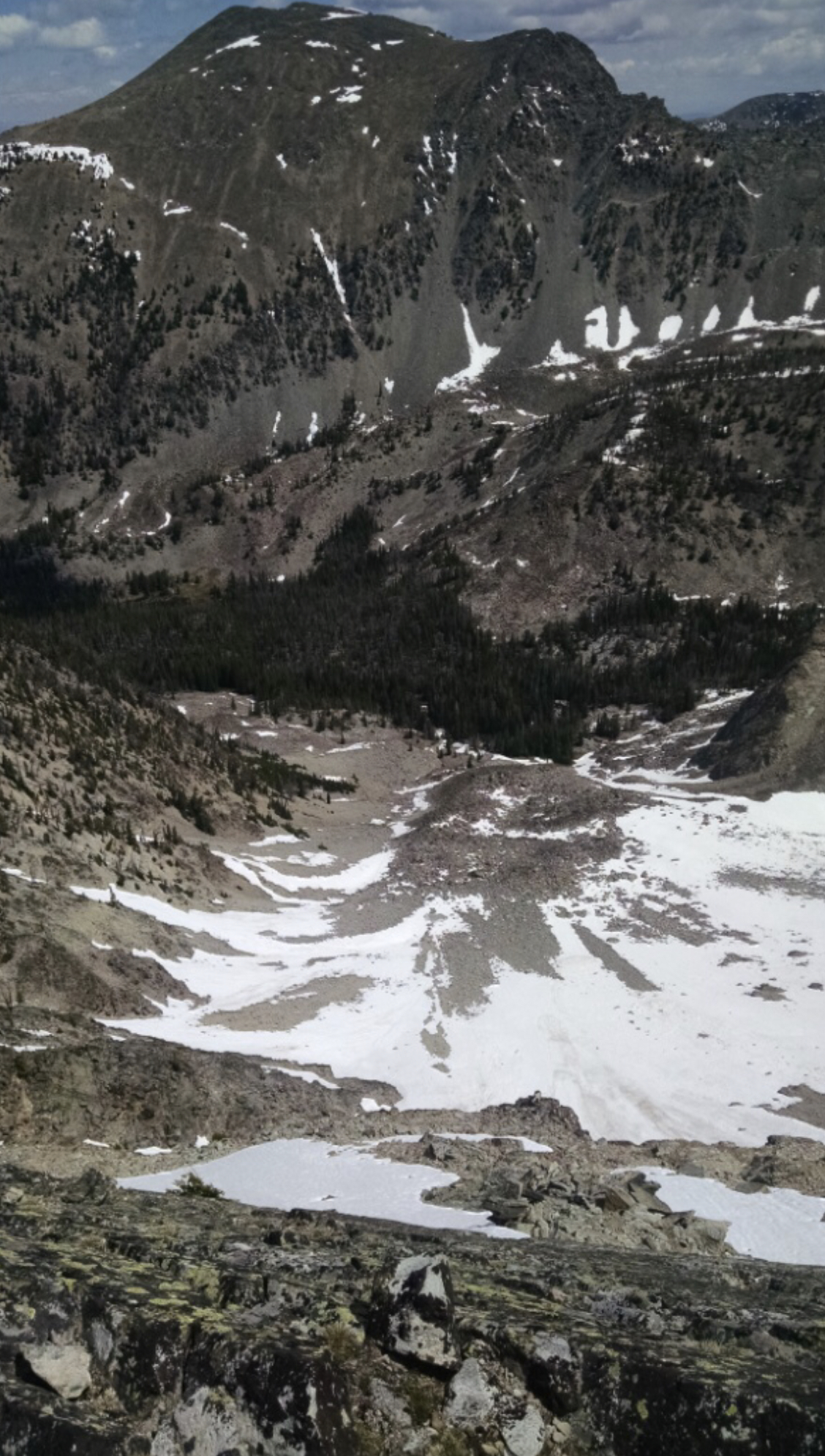
Looking down to the top of McKim Creek from the ridge just east of the summit. Jeff Hunteman Photo
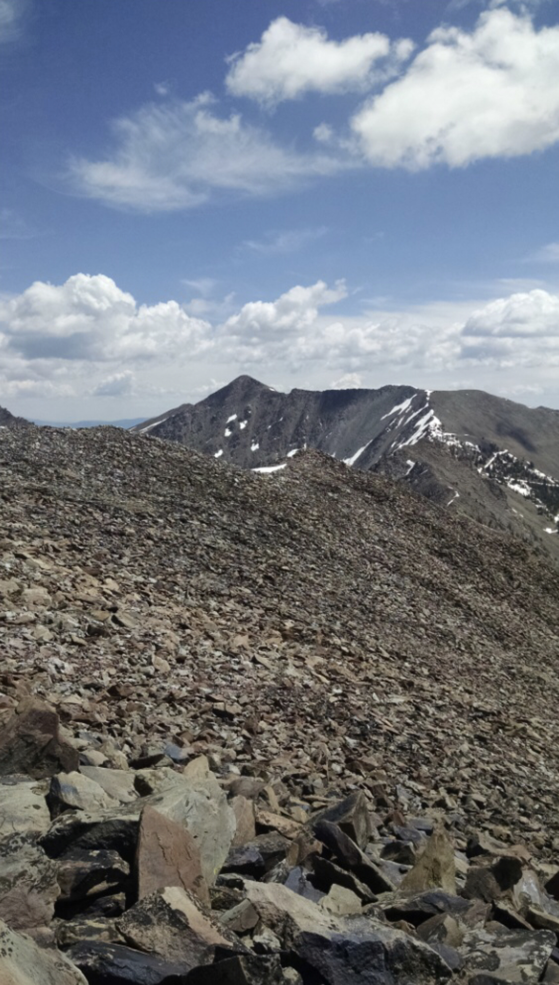
Looking east from the summit to the main crest of the Lemhi Range. Jeff Hunteman Photo
Additional Resources
Regions: EASTERN IDAHO->Lemhi Range
Mountain Range: Lemhi Range
Longitude: -113.89809 Latitude: 44.78809