Elevation: 10,300 ft
Prominence: 360
This peak is not in the book. Matthew Ward climbed a impressive mixed route on this peak’s lower eastern summit in 2020. Read about their route at this link: White Line Fever Updated August 2020. Derek Percoski and Daniel Todd climbed the peak on August 21, 2022 and provided the report found below. Published August 2022
Naturally, East Thompson Peak is located due east of Thompson Peak. The peak is a conglomeration of broken towers. USGS Stanley Lake
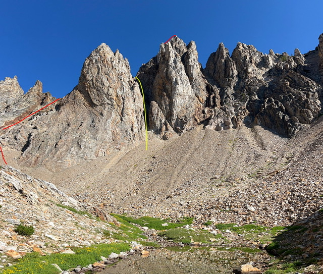
South face with our ascent and descent lines (see route description). Derek Percoski Photo
Access
Take the Fishhook Creek Trail [(A)(6)(d) on Page 207]. The trail ends abruptly and you must bushwhack another 1.5 miles west before climbing your way up into the basin below the south face.
South Face/West Ridge, Class 5.4
The general goal is to reach the west side of the summit block. The route is anything but straightforward. Expect serious route-finding challenges and several short low-5th-class sections no matter which way you go. Many of these are difficult to protect. We ascended the red path and descended the yellow path. The crux for both happened to be a chimney with an overhung chockstone. The yellow line is the most direct path to the summit, but I can’t speak of how difficult its crux is to ascend since we only descended it. This is not the next classic Sawtooth peak. Be prepared for a serious adventure!
There is also a couloir leading directly to the summit block on the north face. You pass over the top of it just before summiting but looking down the north face gully there’s no way to tell how difficult it is. That would eliminate bushwhacking from the approach (using the Williams/Thompson climbers’ trail), but a route up the north face would be experimental so you’re on your own.
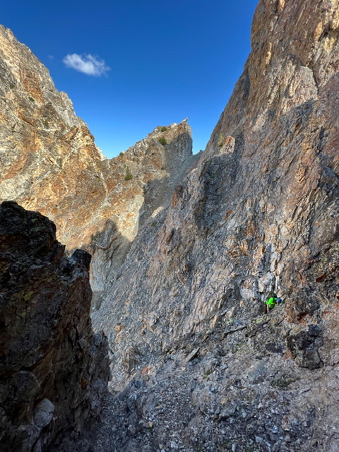
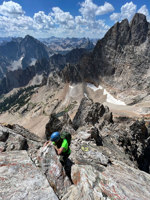
Daniel Todd scrambling with the Thompson/East Thompson saddle in the background. Derek Percoski Photo
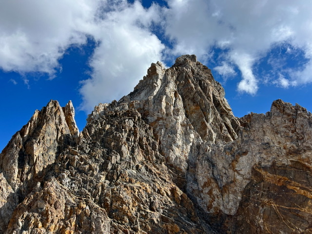
The summit block. Derek Percoski Photo

Daniel Todd and Derek Percoski on the summit. There was no sign of prior visitation. Derek Percoski Photo
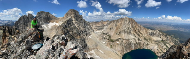
Summit pano view: Mickeys Spire, Thompson, Williams. Derek Percoski Photo
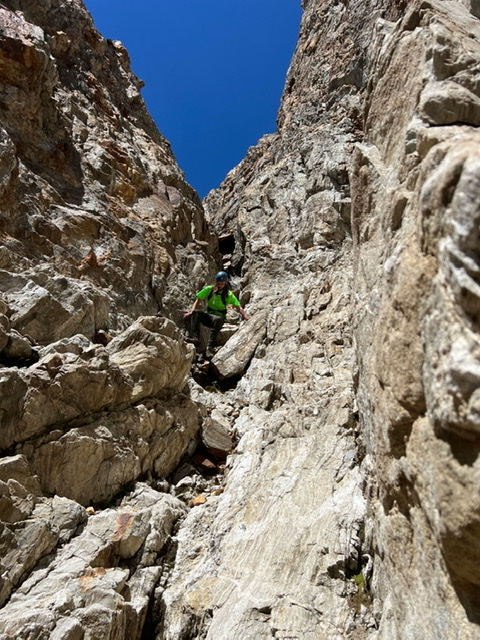
Daniel Todd climbing the summit block. Derek Percoski Photo
Daniel Todd descending the south gully/south face of East Thompson. Derek Percoski Photo
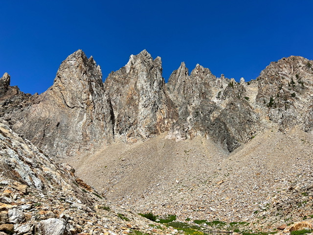
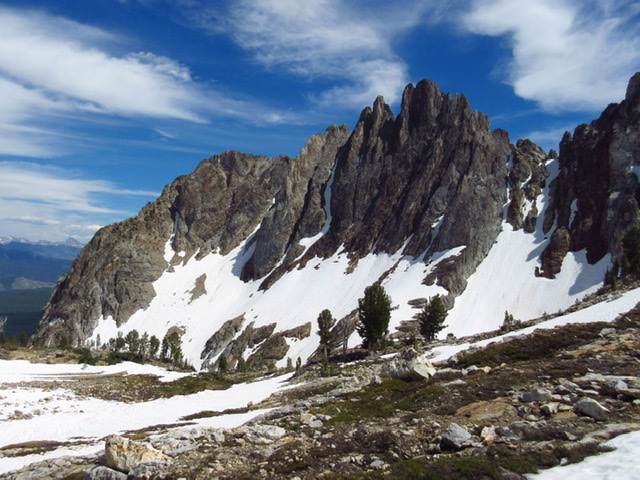
The south face of East Thompson. Derek Percoski Photo
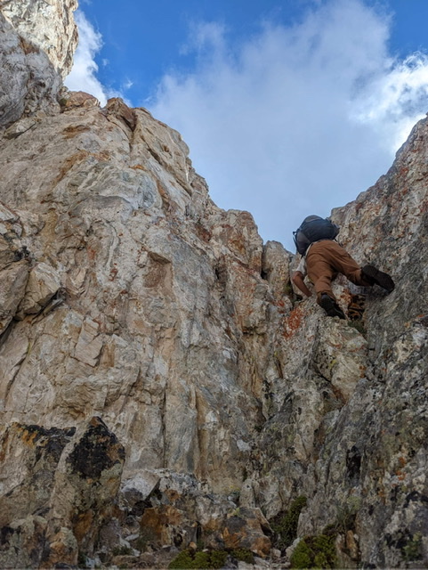
Derek Percoski midway up the ascent. Derek Percoski Photo
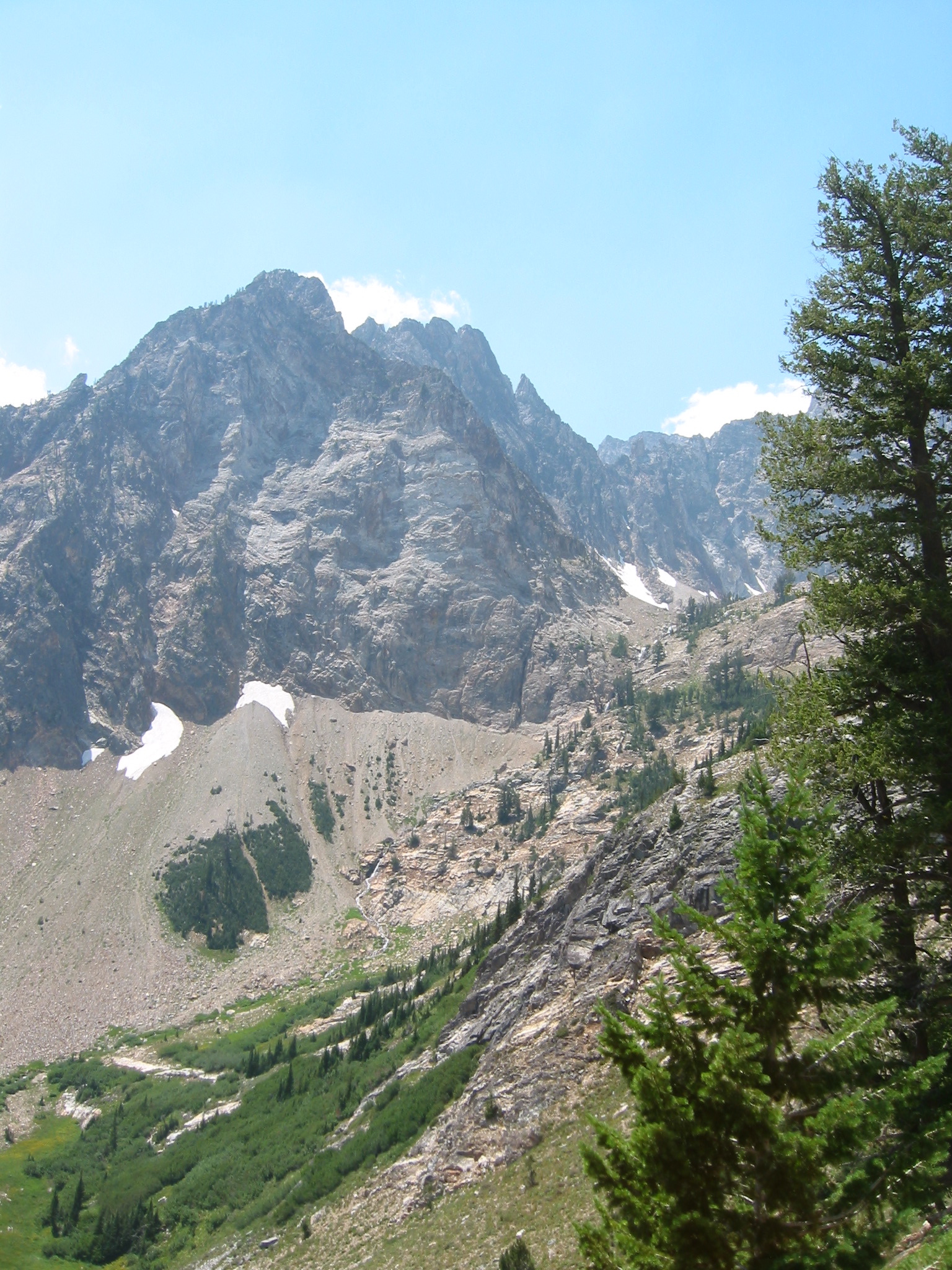
The north face of East Thompson. Derek Percoski Photo
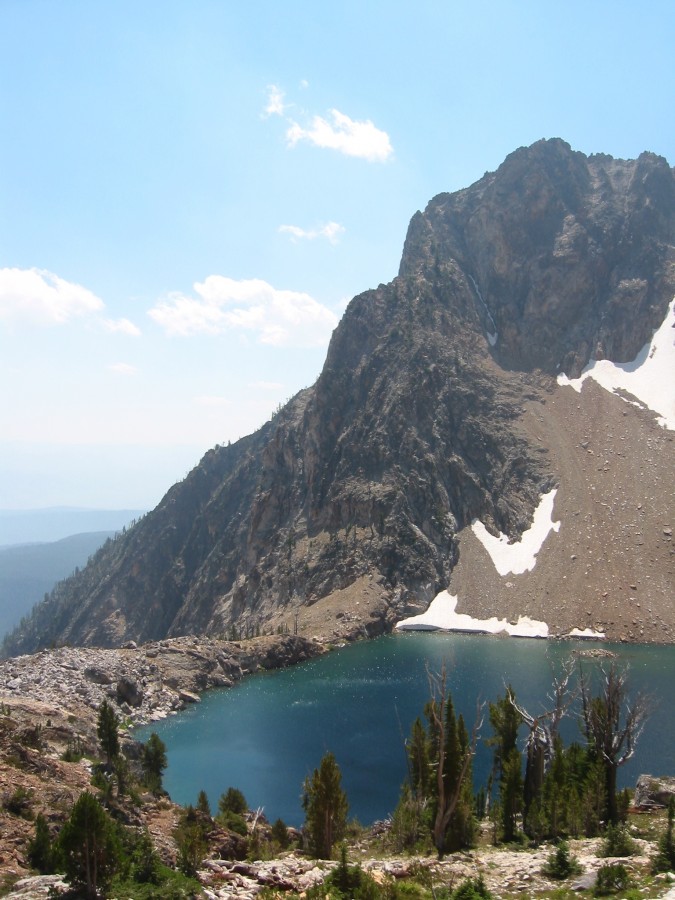
Peak 10300 from Fishhook Creek, with Thompson in the background. John Platt Photo
Peak 10300 from the north. John Platt Photo
Additional Resources
Regions: Crest: McGown to Alpen Peak->Sawtooth Range
Mountain Range: Sawtooth Range
First Ascent Information:
- First Ascent Year: 2022
- Season: Summer
- Route: Southwest Face/West Ridge
- Party: Derek Percoski and Daniel Todd
Longitude: -115.00229 Latitude: 44.14029