Elevation: 10,340 ft
Prominence: 320
This peak is not in the book. Derek Percoski likely made the first ascent. Livingston Douglas added photos. Updated November 2021
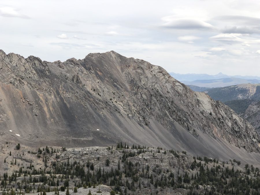
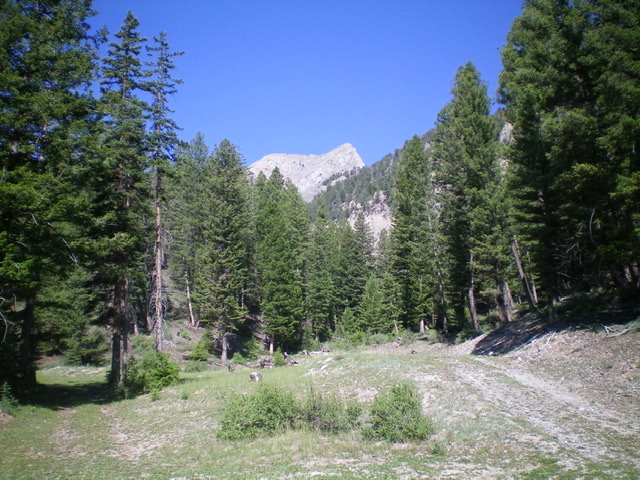
Peak 10340 is located a little over a mile SSE of Hope Peak via a ragged ridge. USGS Grouse Creek Mountain
Peak 10340. Derek Percoski Photo
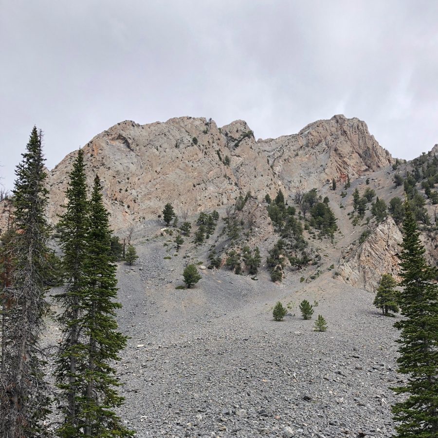
Peak 10340. Derek Percoski Photo
Access
Access these routes from Christian Gulch [(C)(4) on Page 294].
Routes by Derek Percoski
Southeast Face, Class 3
Drive up Christian Gulch Road/FS-115 and continue onto FS-409. FS-409 turns into a rugged 4WD road after 8,200 feet. At 8,400 feet, it does eventually smooth out but, at that point, it’s a narrow ATV trail so you’ll be brushing up against branches in a full-sized vehicle. I parked at 8,350 feet when I seemed to be driving slower than I could hike the road.
Hike the remainder of the road and continue cross-country a short distance until the South Gully [PHOTO 1] comes into view (8,560-foot contour). Climb the South Gully up to the notch [PHOTO 2] and from there you can connect to the Southeast Gully. It’s a simple and stable scramble the rest of the way to the summit.
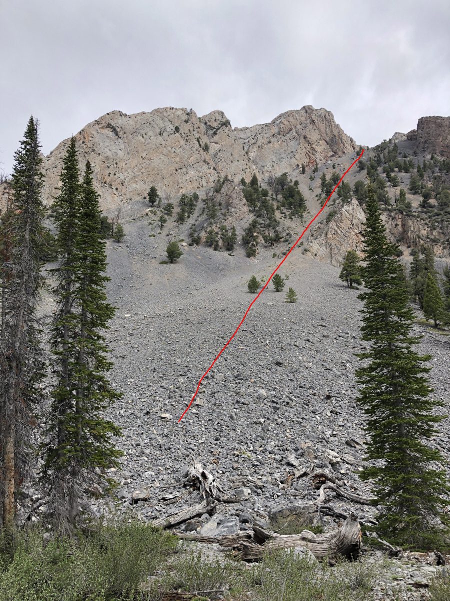
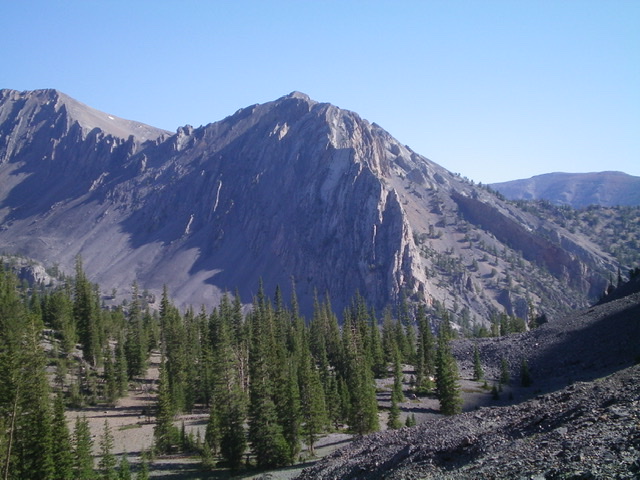
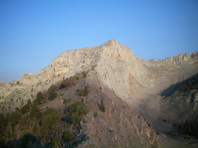
Peak 10340 showing the ascent line through the talus. Derek Percoski Photo
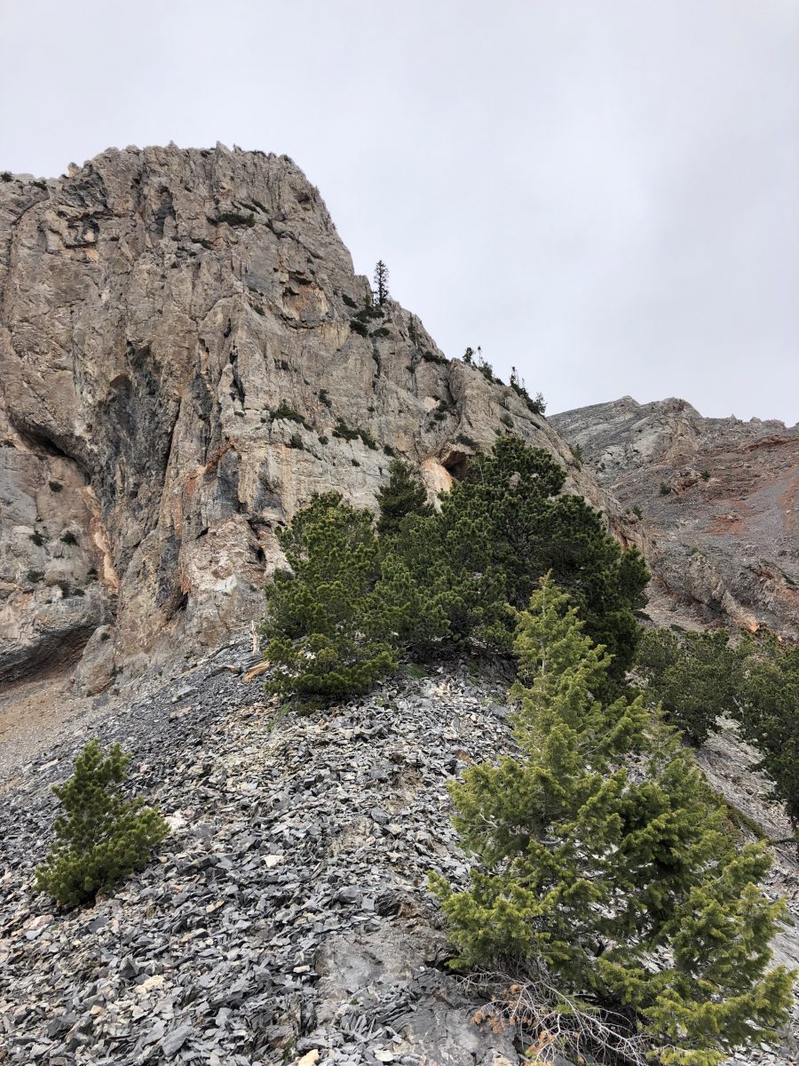
Derek Percoski Photo
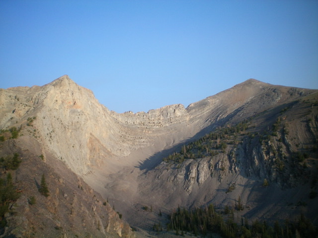
As you look down the Southeast Gully [PHOTO 3], you’ll wonder why you didn’t just come up that way. Unfortunately the bottom is blocked by a cliff. If you find a way through/around that cliff, you’ll have a more direct and less steep ascent.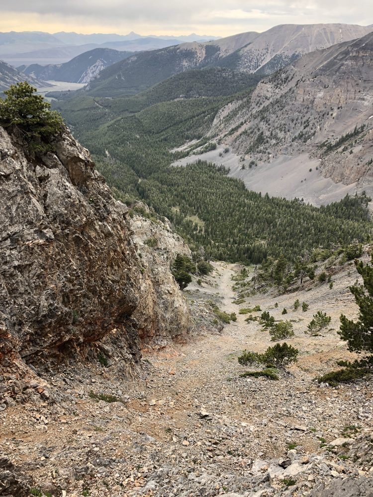
West Face, Class 2+
Don’t let that lower YDS rating trick you. This is NOT the way you want to climb Peak 10340. I used the West Face as a descent line so I could shortcut over to Mount Darcy, and it served that purpose just fine. The lower rating assumes you stick to the loose talus, and most of the way that’s your only option. There’s some workable scrambling terrain in the middle of the route, and you could possibly take that diagonally north to gain the ridge and traverse to the summit. For the most part, if you try to ascend the West Face, you’ll be clawing your way up talus that slides down with every step you take.
Derek’s GPS track. Note that the map does not show all the roads in Christian Gulch.
Judas Peak (dead center) and its rugged south ridge as viewed from the southwest. Livingston Douglas Photo
The south face of Judas Peak and its steep, gravelly south gully. Livingston Douglas Photo
View of intimidating Judas Peak from the parking area in Christian Gulch. Livingston Douglas Photo
Looking up the rugged east ridge of Judas Peak. The summit is in dead center. Livingston Douglas Photo
Judas Peak (left) and Hope Peak (right) and the rugged connecting ridge between them. Livingston Douglas Photo
Additional Resources
Regions: EASTERN IDAHO->Lost River Range->Pahsimeroi Range
Mountain Range: Lost River Range
First Ascent Information:
- First Ascent Year: 2019
- Season: Summer
- Route: Southeast Face
- Party: Derek Percoski
Longitude: -113.90739 Latitude: 44.31209