Elevation: 10,419 ft
Prominence: 439
This peak is not in the book. Updated October 2021
Wilson Creek Peak is located on the main Pioneer Mountains Crest west of Devils Bedstead West and just west of Peak 10380. The peak drops steeply down its southwest side to Wilson Creek. From the summit, the view down Wilson Creek and then Trail Creek frames Sun Valley and the Bald Mountain ski hill. USGS Phi Kappa Mountain
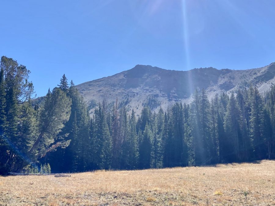
Wilson Creek Peak as viewed from the Summit Creek Trail. The north-northeast ridge is the left skyline.
Access
Access the peak from Trail Creek Road via the Summit Creek Trail [(A)(3)(a) Page 258]. This trail is well-used and maintained. Moose are often present in the meadows.
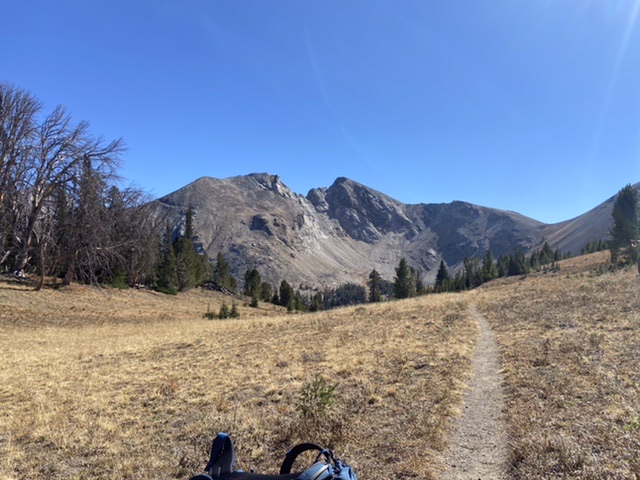
The broad saddle.at the base of Wilson Creek Peak’s north-northeast ridge. The Devils Bedstead West at the center of the photo.
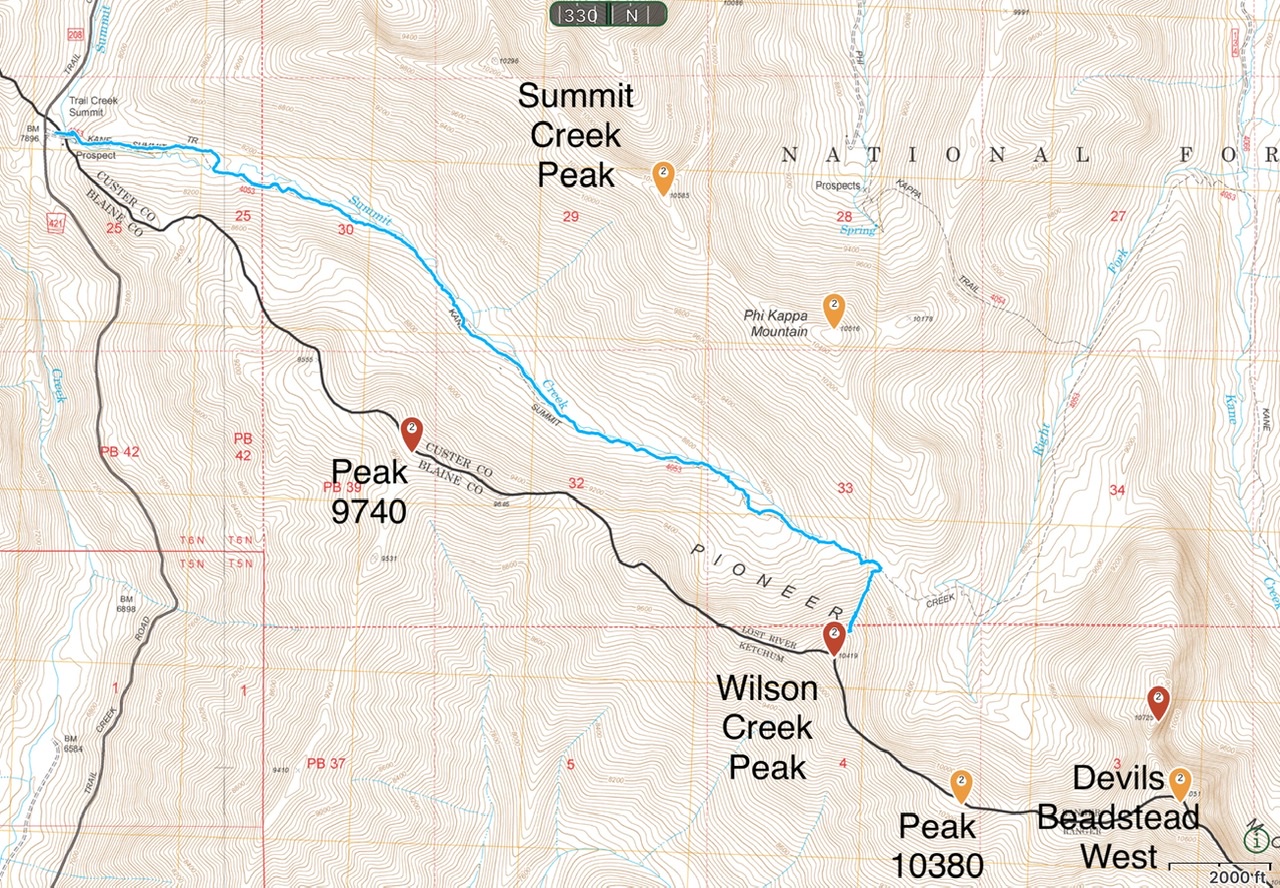
My GPS track. This route covered 8.8 miles with 2,355 feet of elevation gain round trip.
North-Northeast Ridge, Class 2+
Access this ridge from the Summit Creek Trail. Follow the trail to the broad saddle above the Right Fork Kane Creek. From the saddle, the north-northeast ridge climbs directly to the summit. The ridge begins climbing through widely-dispersed trees and then becomes steep, grassy slopes traversed in places by a game trail. The last several hundred feet of elevation gain crosses ragged rock. The route finishes by passing a vertical wall on the left side of the ridge.

The middle section of the ridge.
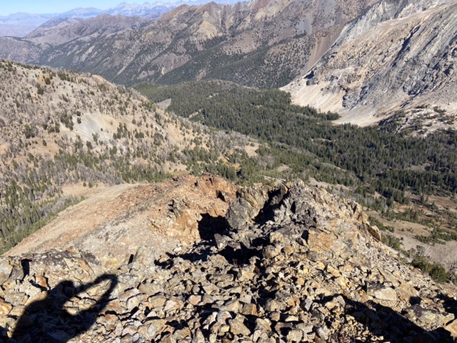
Summit Creek and the top of the north-northeast ridge as viewed from the summit.
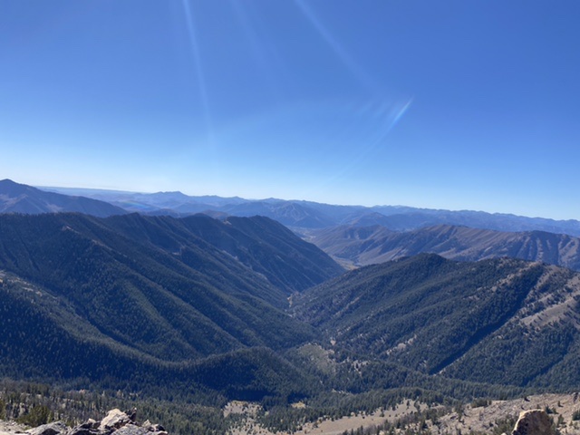
Looking down Wilson Creek and Trail Creek to Sun Valley and Bald Mountain.
You can also climb this peak from Peak 10380 via its south ridge and connecting it to Peak 10380. Several people have run the ridge from Wilson Creek Peak to the Devils Bedstead West.

Wilson Creek Peak from Devils Bedstead West. Dave Pahlas Photo
Additional Resources
Regions: EASTERN IDAHO->Pioneer Mountains
Mountain Range: Pioneer Mountains
Year Climbed: 2021
Longitude: -114.20539 Latitude: 43.797659