Elevation: 10,540 ft
Prominence: 440
This peak is not in the book. I believe that Rick Baugher first identified the peak as Hemingway Peak. Livingston Douglas added commentary to the peak’s introductory paragraph, new route descriptions, and new photos. Updated December 2024
Hemingway Peak is located a mile west-northwest of Peak 10598. It sits above the headwaters of both the West Fork Trail Creek and the East Fork of the North Fork Big Wood River in the Boulder Mountains. Because the West Fork Trail is mostly gone, it is much more difficult to reach this peak. An unpleasant forest bushwhack and tedious rock scramble are required to stand atop this peak. USGS Rock Roll Canyon
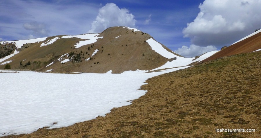
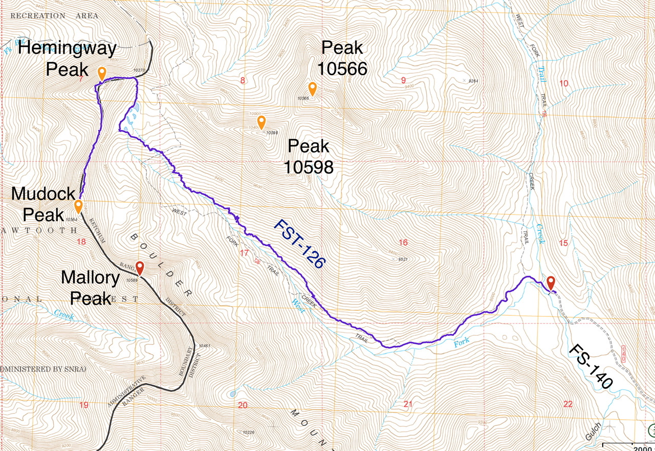
Hemingway Peak. Dan Robbins Photo
Access
Park Creek Road, FS-140 and the Trail Creek Loop Trail, FST-126 [(B)(1)(a) Page 242]. The Trail Creek Loop Trail, FST-126 has not been maintained in many years. Furthermore, trail is not in the location shown on the FS topographic map. See the map below. The tread is easy to follow until roughly 9,000 feet. After that point, there are cairns marking the route until tree line. Expert route finding skills are recommended.
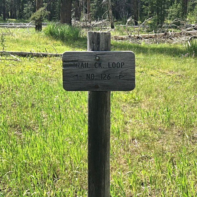
This sign is located a hundred yards from the trailhead. Go left.
East Ridge, Class 2+
Follow Trail Creek Loop Trail to the tarn filled basin below Hemingway Peak which is south of the peak’s east ridge. Climb to the saddle on the east ridge using a goat trail. Once on the ridge, follow the ridge to the summit.
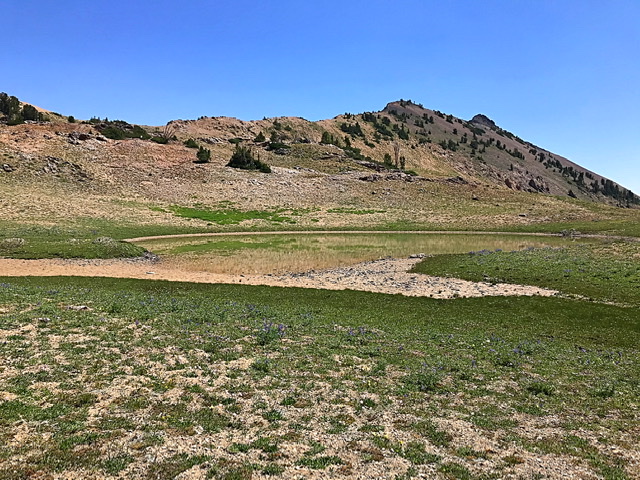
There are several small ponds in the uppermost reaches of the West Fork Trail Creek. This pond sits just below the saddle on Hemingway’s east ridge.
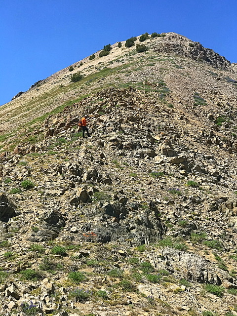
The east ridge is steep but obstacle free
My GPS track to Hemingway and Murdock Peaks. It 9s 4.9 miles with 2,500 feet of elevation gain to the top of Hemingway Peak. It is another 0.5 miles with an additional 350 feet of elevation gain to the summit of Murdock Peak.
East Face/South Ridge and South Ridge Full by Livingston Douglas
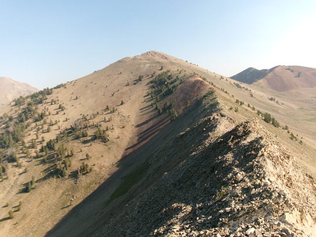
Hemingway Peak and its south ridge (right of center). This was my descent route. Livingston Douglas Photo
Access
Park Creek Road/FSR-140 and the West Fork Trail (also known as the Trail Creek Loop Trail/FST-126) [(B)(1)(a) on Page 242 of the Book]. Park at a campsite near the West Fork Trailhead in the road loop. This parking spot is at 7,820 feet and 43⁰50’44”N, 114⁰17’54”W. This is the first leg of a 3-peak adventure that includes Hemingway Peak, Murdock Peak (10,564 feet), and Mallory Peak (10,589 feet). It covers 10.5 miles with 3,800 feet of elevation gain round trip.
East Face/South Ridge, Class 2+
The Climb
From the [signed] West Fork Trailhead, follow the trail briefly to a fording of Trail Creek. Walk upstream on a use trail for about 100 feet to a footbridge/log crossing of the creek. Once across the creek, follow a use trail downstream to rejoin the West Fork Trail. Continue west on the trail for about 100 yards to a fork in the trail and a trail sign for “Loop Trail #126.” Go left/west here for the West Fork of this loop. This unmaintained foot path is difficult to follow in the open areas of grass/scrub. The trail flames out at about 8,700 feet and becomes a poorly-cairned “route.” The sporadic cairns soon disappear as well.
Bushwhack northwest up the right/northeast side of the West Fork creek drainage in a mix of thick pines, deadfall, and brush. This is not fun but the creek drainage is even worse. When the right side of the creek becomes too thick, has numerous, minor shoulders to cross, and gets marshy, angle left/west to cross the narrow West Fork creek drainage at about 8,950 feet. Scramble west up out of the drainage onto a forested ridge. Follow this ridge using game trails in the young, thick pines, finding some open patches of grass to keep advancing higher.
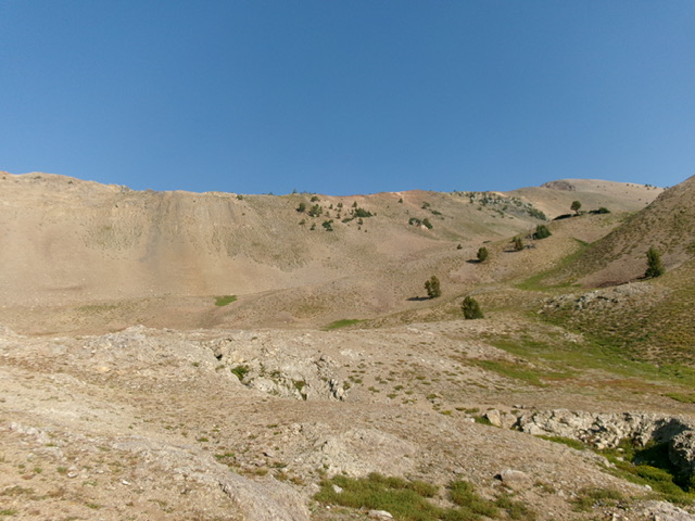
Emerge from the pine forest into semi-open terrain at about 9,250 feet. Make faster progress now in a mix of scattered pines, grass, and scrub. Higher up, go through a final patch of pine forest then reach an upper basin of scree with rolling shoulders of talus/scree. Stay on the left/south side of the dry drainage. This drainage is the left/west of two forks of the headwaters of the West Fork Trail Creek. The Lopez Route follows the right/east fork. There are no high ponds on my route. From the high, rocky basin, climb up the east face of the south ridge in a small patch of scattered pines (Class 2+). The ground talus and tree roots helped with traction on this steep, loose face of scree and gravel.
Reach the south ridge on a weak, diagonal goat trail (with switchbacks). Once on the ridge, follow the easy, open ridge of stable scree to reach a final Class 2+ pitch up a chute onto the high summit ridge. From the top of the chute, scramble a short distance right/northeast to reach the summit of Hemingway Peak. The summit has a decent cairn.

Looking up the south ridge from my ridge entry point. This was the final leg of my ascent route. Livingston Douglas Photo
South Ridge Full, Class 2+
The Descent
From the summit, return south down the ridge crest all the way to the 10,100-foot connecting saddle with Murdock Peak (10,564 feet). The south ridge narrows as it drops below 10,200 feet. The connecting saddle is quite narrow as well. With the exception of the Class 2+ chute high up on the south ridge, the ridge is easy Class 2 work on stable scree. The connecting saddle concludes the first leg of today’s 3-peak journey. Murdock Peak is up next.
The lengthy south ridge of Hemingway Peak. My ascent route climbs up the patch of scattered pines (dead center) to reach the south ridge from the high basin. Livingston Douglas Photo
Additional Resources
Regions: Boulder Mountains->EASTERN IDAHO
Mountain Range: Boulder Mountains
Year Climbed: 2020
Longitude: -114.3547 Latitude: 43.8461