Elevation: 10,942 ft
Prominence: 362
This peak is not in the book.
Purgatory Peak is located due north of Devils Bedstead East. It is an easy peak to grab if you are on your way back from climbing its bigger neighbor. Two routes are discussed below. USGS Phi Kappa Mountain
South Ridge, Class 2 by Judi Steciak
This peak is located less than a mile north of Devils Bedstead East. The summit provides a fantastic foreshortened view of routes up its impressive neighbor as well as the Boulder Lake Cirque. Follow the approach for Devils Bedstead East [(C)(1)(a) and (a.1) on Page 259], but turn north instead of south at the 10,600-foot saddle.
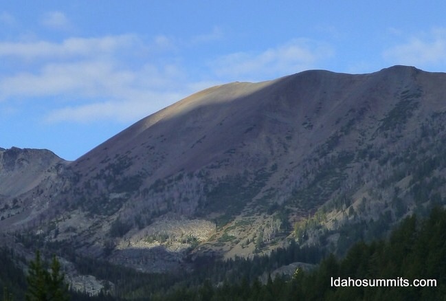
Purgatory Peak. Dan Robbins Photo
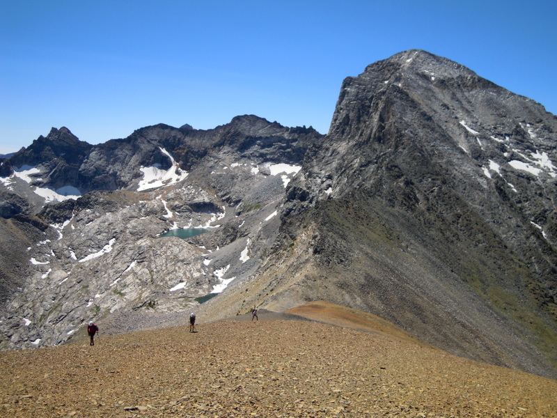
The talus-covered ridge of Purgatory Peak with the Devils Bedstead East in the background. Carl Hamke/Judi Steciak Photo
West Face/North Ridge, Class 2+ by Livingston Douglas
Access
FST-057/Boulder Lake Trail [(C)(1)(a)]
The Climb
Hike up the Boulder Lake Trail to a flat meadow (9,040 feet) that is located about 3/4 mile north of Boulder Lake. You are now standing due east of the summit of Peak 10942. Scramble west up a narrow gully between cliffy rock bands to reach an open scree/gravel slope above tree line. Fight your way up the loose gravel and scree to reach the summit ridge at about 75 yards north of, and 50 vertical feet below, the summit high point. Stroll south up the North Ridge to reach the gentle, but small, broken-scree hump that is the summit.
The summit offers a beautiful view southward to Devils Bedstead East and its imposing Class 3 north ridge, my favorite Idaho ridge scramble. To the southeast, you have an amazing view of Boulder Lake, its upper snow-filled basin, and the Steciak/Hamke ascent route for Boulder Lake Peak (11,080 feet), one of the infamous “Missing 11ers.”
The Descent
I descended a different route, a modified version of my ascent route. From the summit, follow the ridge northward to a flat ridge area at 10,500 feet (easy Class 2). Leave the ridge here and descend northeast to reach the head of a small stream drainage (shown on the Phi Kappa Mountain quadrangle) that will guide you down to the Boulder Lake Trail. Follow the active stream steeply down to the trail, moving from side to side as necessary and occasionally picking up a game trail to help you. This creek drainage it much steeper than the USGS map implies, so it’s a solid Class 2+ route, perhaps marginal Class 3. Follow the Boulder Lake Trail back to the trailhead.
Additional Resources
Regions: EASTERN IDAHO->Pioneer Mountains
Mountain Range: Pioneer Mountains
First Ascent Information:
- Other First Ascent: West Face/North Ridge
- Year: 2016
- Season: Summer
- Party: Livingston Douglas
Longitude: -114.14732 Latitude: 43.81035