Elevation: 4,124 ft
Prominence: 264
This peak is not in the book. Paul Jurczak added an additional route. Livingston Douglas added an access update and additional photos.
Highland Peak is located roughly 1.8 mikes north of Lucky Peak Dam. ID-21 circles the southern base of the mountain and Highland Valley Road crosses the peak’s North Slopes. This peak has great views of Lucky Peak Reservoir and the Boise Mountains. Two routes are set out below. USGS Lucky Peak
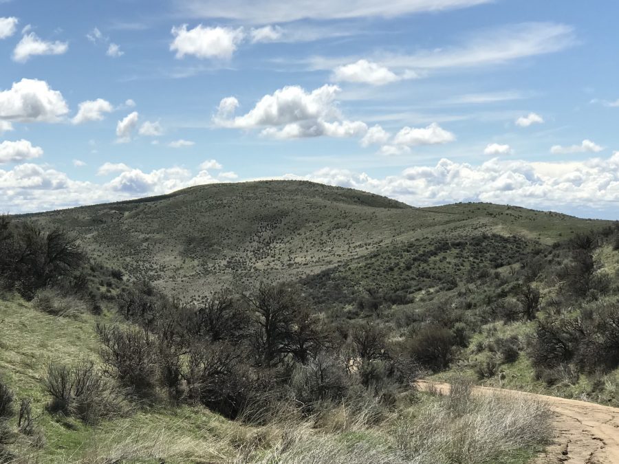
Highland Mountain as viewed from the north.
Access Update by Livingston Douglas
Highland Mountain is on Idaho Fish and Game Land. However, it sits above an Archery Range and hiking it from its north side is clearly prohibited due to the archery range (see photo of signage). Hike it at your own risk.
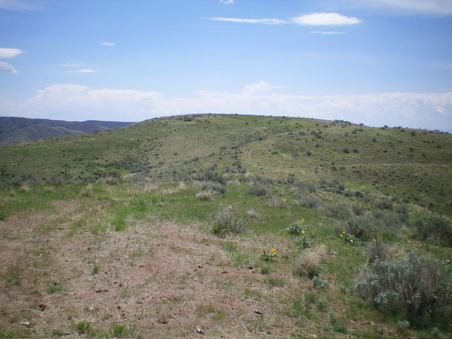
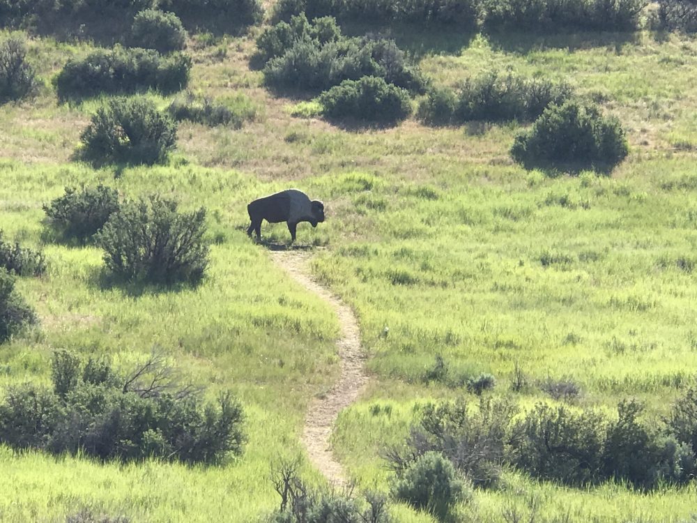
The elusive summit hump of Highland Mountains comes into view. Livingston Douglas Photo
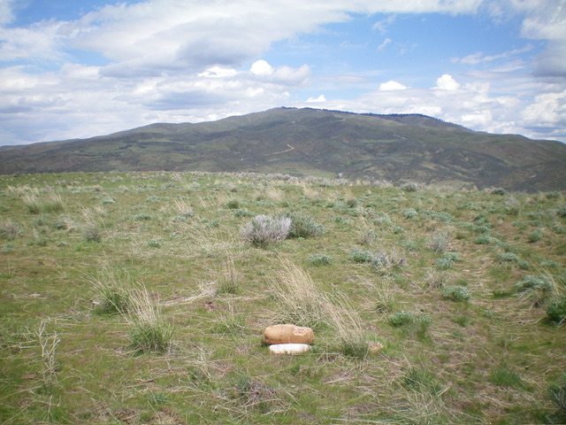
The gentle summit of Highland Mountain with Lucky Peak in the distance. Livingston Douglas Photo
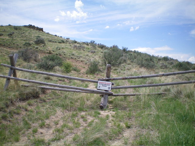
The old 2-track road to the summit is now a “danger” area with entry prohibited by Idaho Fish and Game. Climb this mountain at your own risk. Livingston Douglas Photo
Highland Valley Road/North Ridge, Class 1
This route is accessed from ID-21, approximately 2.4 miles north of Lucky Peak Dam. Keep your eyes peeled for the turn off on the West Side of the highway, which is signed as Highland Valley Road. There is room for five vehicles to park at the intersection. The Idaho Fish and Game Department closes this road to vehicles annually during the Winter. Most years, it reopens April 15th (something to look forward to other than taxes). Pay attention to signs on the gate, as the road may occasionally be closed at times to hikers and mountain bikers. A little farther up the road, you will reach a cattle guard and a second parking area (see the route orientation map below).
Continue past the the second parking area to a junction 1.3 miles from the highway. A right turn at this junction will take to to Shaw Mountain/Lucky Peak. Please note that the Idaho Fish and Game Department built an archery range at this junction in 2019. The trail described below is still open but you may have company after May 1st when the range opens for the season. The exact boundaries of the range are unclear, but please avoid conflicts with archers and hike this peak before the range opens.
Continue straight through a gate for about 1,000 vertical and then turn left/south onto an old 4WD road that climbs up the peak’s North Ridge to the summit. The area past this junction is closed to everything mechanical. Round trip stats from the highway: 4.6 miles with 560 feet of elevation gain.
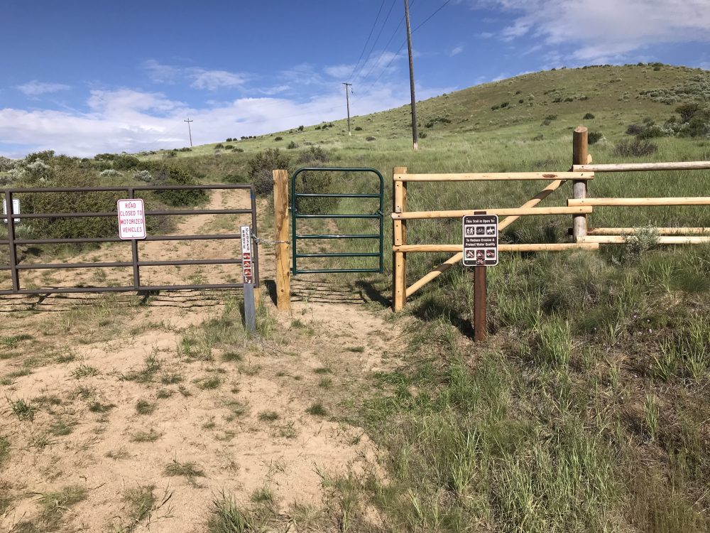
The start of the trail is also the start of the trail to the archery targets.
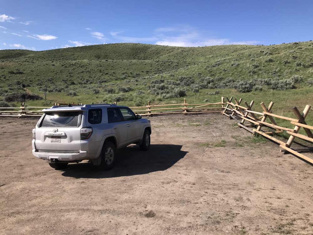
The new parking area is large enough for a lot of vehicles.
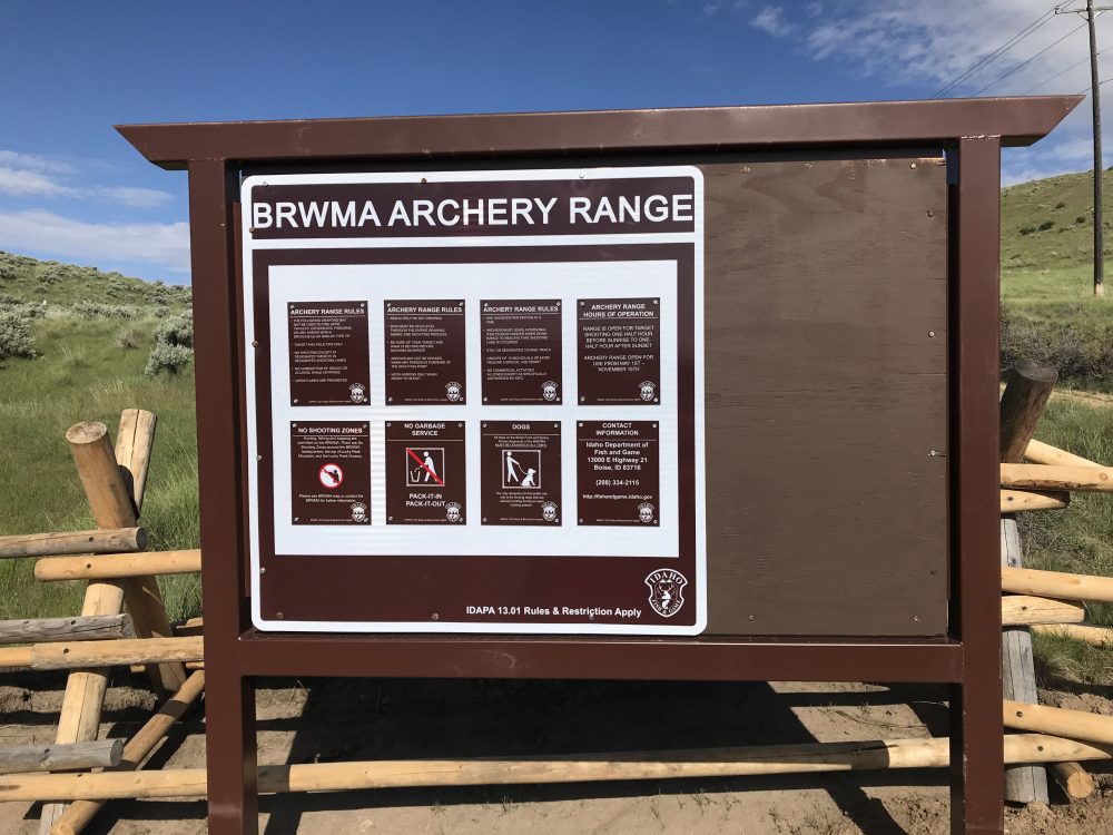
The rules.
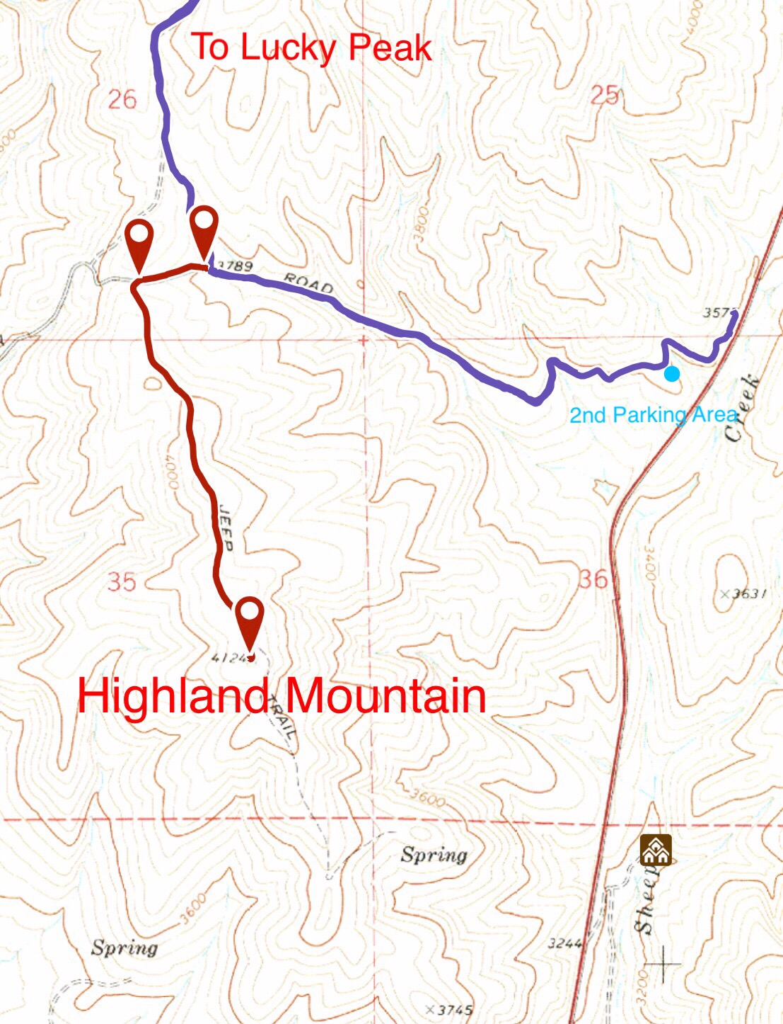
The route to the summit uses the Highland Valley Road (blue) for the first 1.3 miles and then an old 4WD road closed to mechanical contraptions for the final mile.
An example of the life-like targets found on the archery range.
West Highlands Valley Trail/North Ridge, Class 1 by Paul Jurczak
This route uses the Ridge-to-Rivers West Highland Valley Trail #11 to access the peak’s North Ridge. This route is accessed from East Highland Valley Road which is reached via Warm Springs Avenue. Google Maps will give you directions. The route is shown on the map below. Note that there is an unofficial trail located north of the main trail that provides an alternate path.
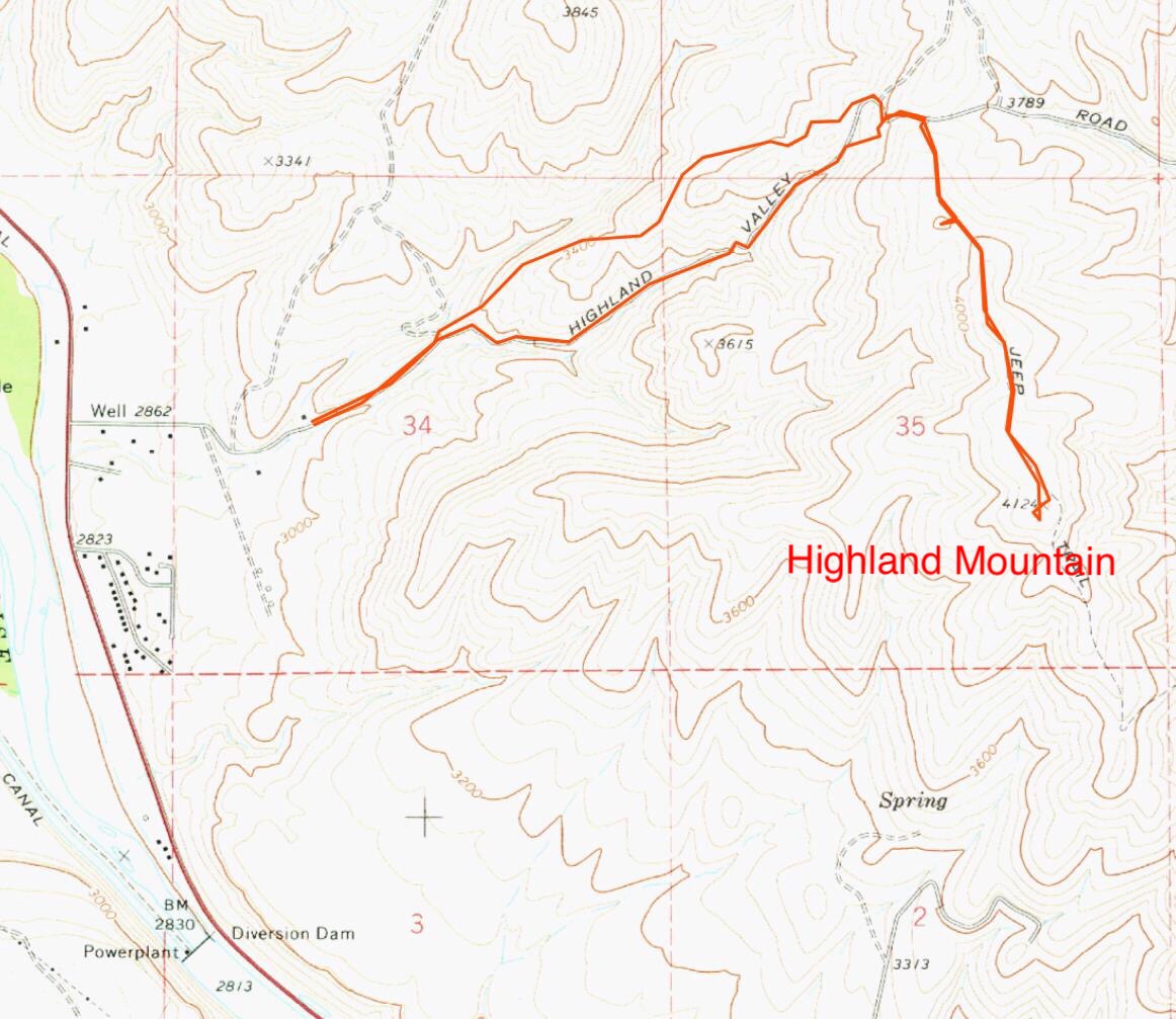
Paul Jurczak’s GPS track for the West Highland Trail approach to the peak’s North Ridge. Paul’s route is 5 miles round trip.
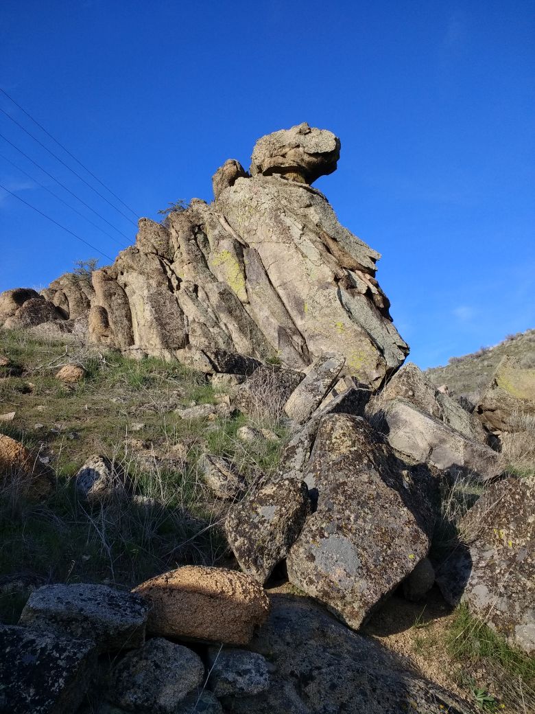
One of the granite outcrops next to the trail I use to practice climbing. Paul Jurczak Photo
Additional Resources
Regions: Boise Mountains->WESTERN IDAHO
Mountain Range: Boise Mountains
Year Climbed: 2019
Longitude: -116.0595 Latitude: 43.5506