Elevation: 4,258 ft
Prominence: 328
This peak is not in the book. Jason Floyd was the first peakbagger to explore the western access to this peak. Jason also climbed Peak 4584 from this access point via the peak’s northwest face and then continued on to Peak 4584. His route for both peaks covers 8.75 miles with 2,350 of elevation gain and includes an ascent of Point 4095 on the west side of Castle Creek. I followed Jason’s road access route but climbed the peak via a different hiking route a week later. Published March 2021
Peak 4258 is a remote summit in a relatively unknown section of the Owyhee Mountains. The peak is located southwest of Grand View, Idaho. This peak, along with neighboring Peak 4584, is found at the northern end of a complicated ridge system that descends from Doyle Mountain and Black Butte. Castle Creek is located on the west side of this ridge system with Hogpen Gulch to the east. USGS Antelope Spring
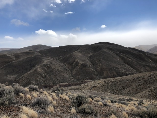
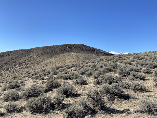
This photo of both peaks is taken from the route back to Point 4095. Peak 4258 is in the foreground on the right. Peak 4584 is to the left rear as viewed from the bench above and west of Castle Creek. Jason Floyd Photo
Access
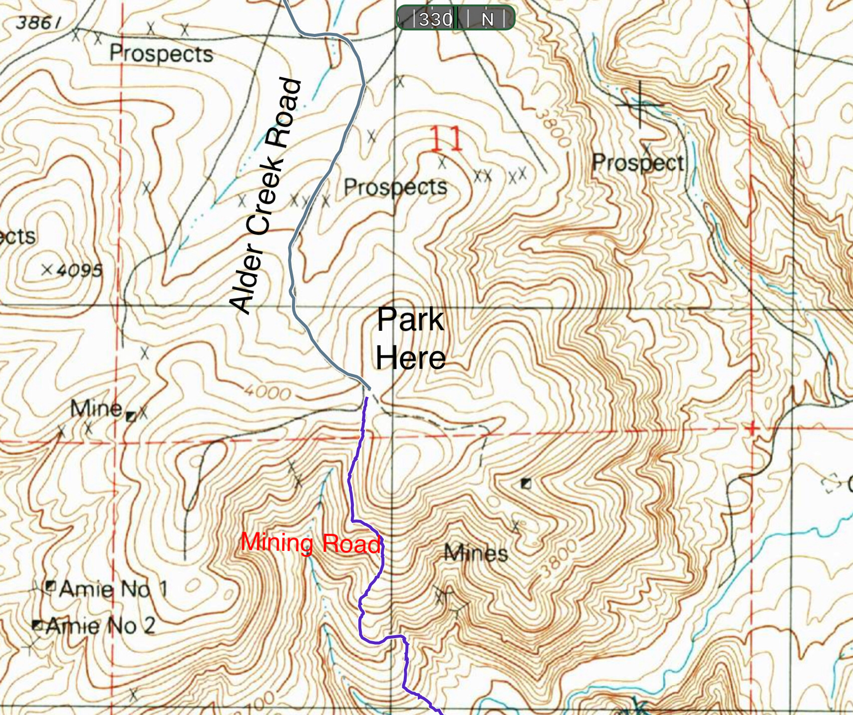
Primary access is from ID-78. Leave the highway at either end of the Oreana Loop Road and follow the loop road to its junction with Alder Creek Road. From this junction, follow Alder Creek Road south for 7.2 miles to the junction shown in the second photo below where Spivey Road heads off to the east. The elevation at this point is 3,761 feet. The road to this point is in good condition and should be passable for 2WD vehicles. [Note: Jason parked at this spot.]
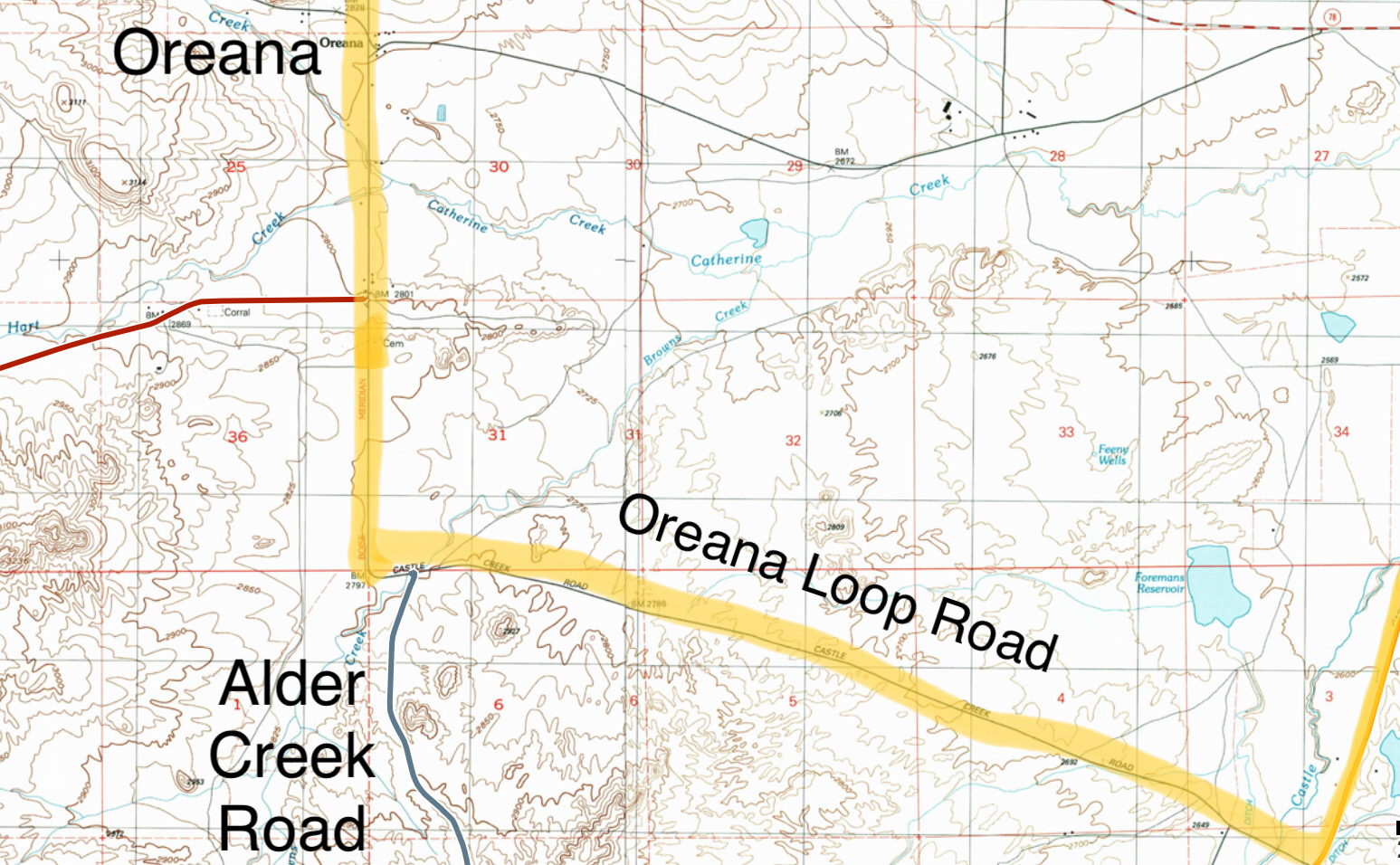
The Oreana Loop Road makes a sharp left/east turn about 2 miles south of Oreana. Make a right turn about 500 feet east of this bend onto Alder Creek Road. I drove about 7 miles south on Alder Creek Road and parked.
At this point, Alder Creek Road continues south, the Spivey Road runs east and a 2-track trail runs between the two roads. Park at this point if you do not have a 4WD. If you have a 4WD, you can continue south on the 2-track for another 1.8 miles to a ridge top where there is a junction.
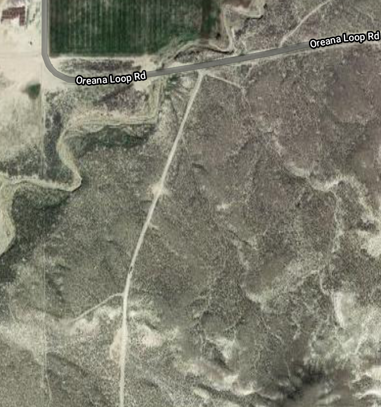
At this point there is a road sign, bent over flat, on your left. Park here. From this spot, one road runs east and another runs south along the ridge. A third road is not apparent. It runs between the two roads. This seldom-used mining road goes due south from the parking area. The road quickly becomes visible as it starts its descent down to Castle Creek. It is a very steep road. While it may be 4WD drivable, I recommend that you walk the road. The road loses 550 feet of elevation as it descends down to the creek. Near the bottom of the drainage, the road ends at a fence. Cross over or under the fence and continue down to the willow-infested creek. While not obvious, there is a way through the willows. Look for a lone tree on the opposite side of the creek. It’s one of the few trees in the area! During Spring runoff, you will have to wade the creek. The climb starts at this point.
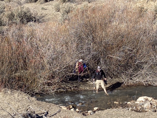
Wading Castle Creek in mid-March.
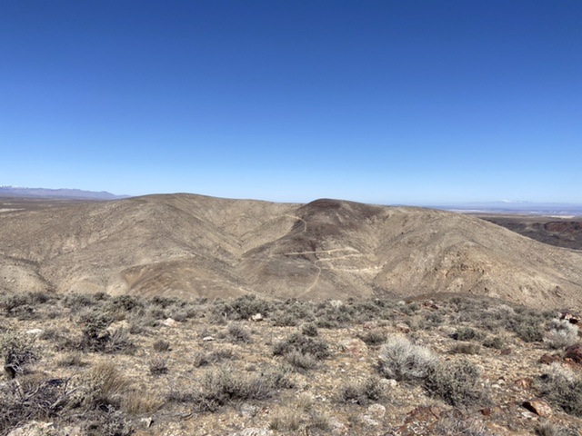
This photo taken from Peak 4258’s Northeast Ridge shows the mining road that descends from the parking area to Castle Creek.
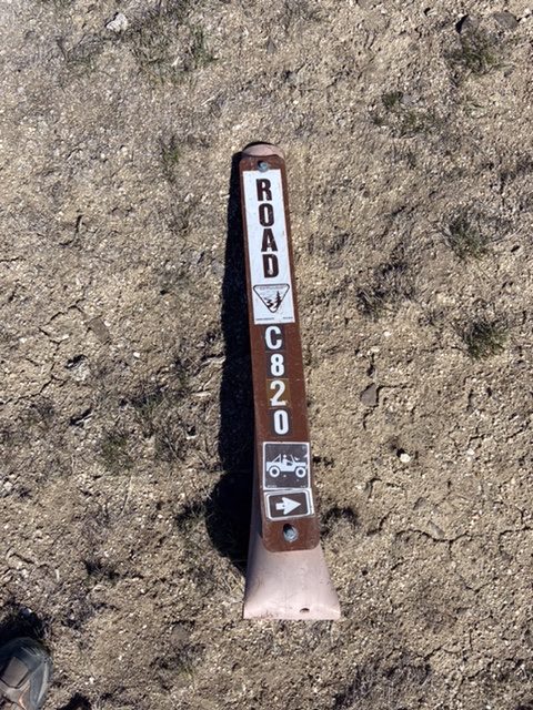
The flattened road sign at the parking area.
Northeast Ridge, Class 2
As you descend the mining road, the peak’s Northeast Ridge forms the skyline across Castle Creek. From the crossing, hike southeast to a broad rib that climbs southeast to the top of the Northeast Ridge. Follow the ridge to the summit. One-way distance is just under two miles with 850 feet of elevation gain.
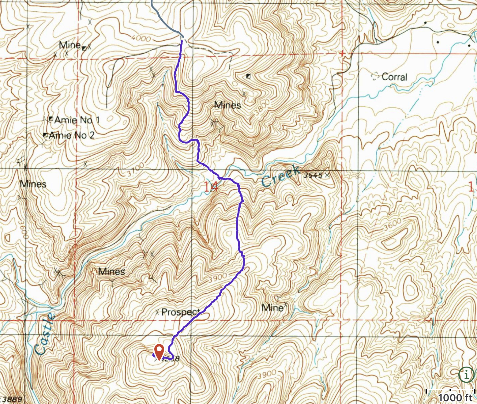
The route from the parking area to the summit.
The top of the broad Northeast Ridge looking toward the summit.
Northwest Face, Class 2 by Jason Floyd
Hike up stream to the base of the stream. Cross the creek and ascend the peak’s northwest face to the summit. From the summit, I continued on to Peak 4584. On the way back, I took a more direct northern route to avoid additional elevation gain. My GPS track for both peaks is set out below.
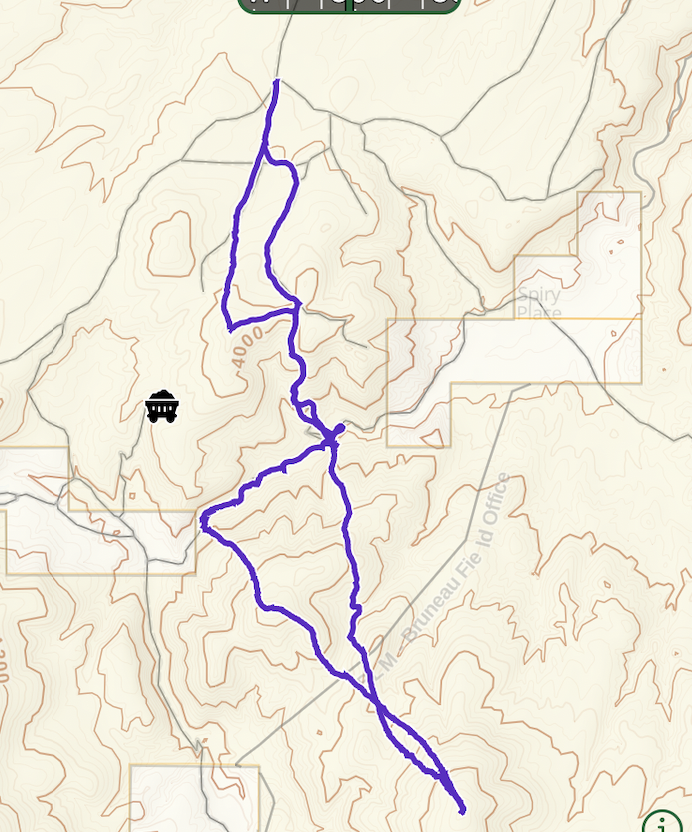
Jason’s GPS track
Additional Resources
Regions: Owyhee Mountains->SOUTHERN IDAHO
Mountain Range: Owyhee Mountains
Year Climbed: 2021
Longitude: -116.42789 Latitude: 42.89269