Elevation: 4,584 ft
Prominence: 394
This peak is not in the book. This page covers the problematic east side approaches to this peak and Peak 4258. This peak can be climbed from the west, albeit by a longer hike, Published March 2021
Peak 4584 is an attractive summit in a relatively unknown section of the Owyhee Mountains. The peak is located southwest of Grand View, Idaho. This peak, along with neighboring Peak 4258, is found at the northern end of a complicated ridge system that descends from Doyle Mountain and Black Butte. Castle Creek is located on the west side of this ridge system with Hogpen Gulch to the east. The summit is an Owyhee Batholith granite outcrop. The views from the top are exceptional and include the Silver City Range front, the Snake River Plain and the Danskin, Trinity and Boise Mountains. USGS Antelope Spring
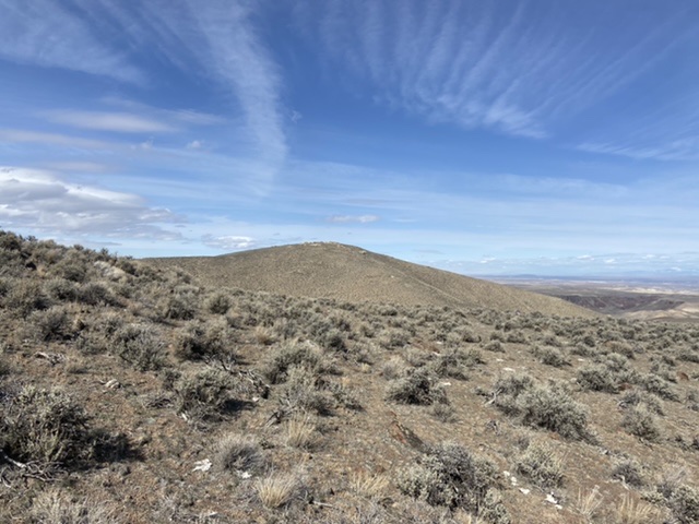
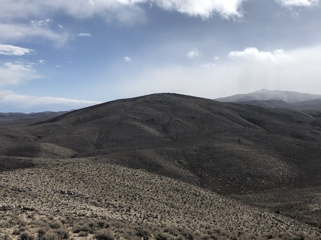
Peak 4584 as viewed from the south
Access
Like many Owyhee summits, access to Peak 4584 is problematic. The most direct access route crosses private property. The second option uses a 4WD road that is degenerating into an ATV track as time passes. A third option is a lot longer and requires a crossing of Castle Creek which will be difficult in high water (See Peak 4258 for this option). The following descriptions provide an overview of the access options but does not include a lot of detail. The overview map below will also help but you are encouraged to do your own research. I do not recommend either route.
Option One—Hogpen Gulch Road. After accessing the peak via Option Two (set out below), we decided to try this route hoping access across the private property was possible. This decision was taken because the Option Two route was so difficult. We did not encounter any “No Trespassing” signs as we crossed the private property.
This option starts 10.0 miles east of Grand View. Turn off ID-78 onto the Oreana Loop Road. Follow this paved road southwest to the point where it makes a sharp turn to the west. Continue south at this point on the Poison Creek Cutoff Road (which parallels Castle Creek). Continue south to a junction where the Poison Creek Cutoff Road turns sharply southeast. Head south at this junction on a good gravel road that leads to a ranch. At the point where the road swings west toward the ranch house. There is a steel gate blocking the road. The unsigned Hogpen Gulch Road continues south through this gate. The gate is not posted or locked and there is no doubt that this is private property.
Go through this gate and follow the road north. You will have to pass through six more gates in the next couple of miles as well as many cows. Leave the gates as you find them and do not harass the cattle. Stay on the road. Close all the gates. Once past the private property, the road shows signs that it is frequently traveled and was graded at sometime in the past. Continue south on the main, most-worn track until the road reaches a junction just below Lower Birch Springs. Take the right hand fork and follow the road up to a saddle just before the road reaches Lower Hogpen Springs. Park at this saddle. The total distance from ID-78 is 15.8 miles. A high clearance vehicle and dry conditions are recommended for using this road.
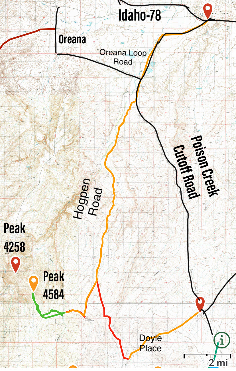
Grand View area access. The red line from Doyle Place running north is the 4WD road.
Option Two. This option leaves the Poison Creek Cutoff Road at a 4-Way intersection and follows a fair, sometimes maintained Doyle Mountain Road southwest to what is designated on maps as Doyle Place. Search for Doyle Place, Idaho on Google Maps and you will get good directions to the start of a 4WD road that leads south to Hogpen Road (Option One). Turn north onto the very rugged 4WD road shown in the map below and follow it to the Hogpen Road. The condition of this road is better suited to ATVs. We drove it with three 4WD mid-size pickups equipped with skid plates and AT tires. It is a rough road with several potentially dangerous sections. I don’t recommend this route. Once you reach the Hogpen Road, make a sharp left hand turn and follow it as described in Option One above.
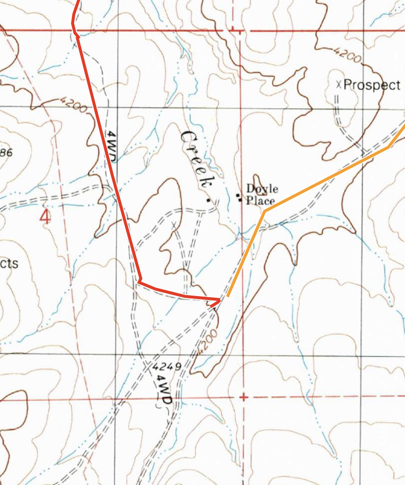
The junction southwest of the Doyle Place ruins
South Face, Class 2
This is big, open country and you can follow any number of lines to get to the base of the peak’s north face. I recommend the route shown in the map below. From the parking spot, leave the road and drop down on a trail that parallels the north side of a fence line. Follow this trail west along the fence line, crossing Hogpen Gulch and then head uphill. At the top of the ridge, turn north and cross the broad intervening ridge until you can drop down to the saddle below the peak’s south face. Ascend the face to the summit. My GPS recorded 4.4 miles round trip with 900 feet of elevation gain.
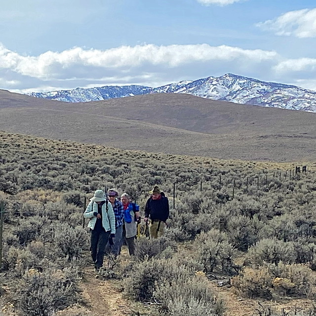
Following the fence line trail back from Peak 4584
Northwest Ridge, Class 2
Descend Peak 4258’s South Ridge to the saddle on Peak 4584’s Northwest Ridge. Follow the Northwest Ridge to the summit. This route will run over 8.0 miles with significant ups and downs in both directions.
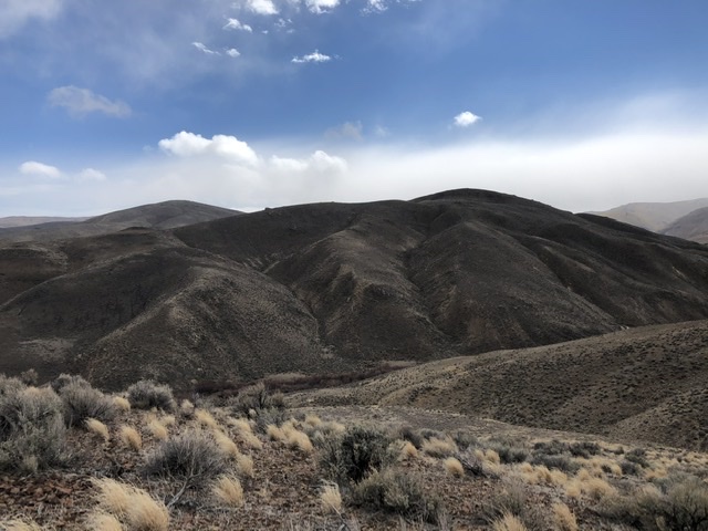
Peak 4584 viewed from Peak 4258. Jason Floyd Photo
This photo taken from above Castle Creek. Peak 4258 is in the foreground on the right and Peak 4584 is in the rear left as viewed from the bench above and west of Castle Creek. Jason Floyd Photo
Additional Resources
Regions: Owyhee Mountains->SOUTHERN IDAHO
Mountain Range: Owyhee Mountains
Year Climbed: 2021
Longitude: -116.41309 Latitude: 42.88109