Elevation: 4,602 ft
Prominence: 542
This peak is not in the book. You should be familiar with Idaho’s trespassing law and respect property property. Read Trespassing and the Idaho Code, A Primer by Margo Mandella. Published April 2021
This peak is located west of Shafer Butte and southeast of Horseshoe Bend, Idaho. It is situated on a section of public land that is surrounded by private land. This peak is a great early-season training jaunt with plenty of scenic views from its big, grassy summit. USGS Cartwright Canyon
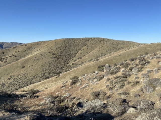
The summit of Horseshoe Hill
Access
Because of the neighboring private property, there is only one available approach to the summit. Leave ID-55 at the south end of Horseshoe Bend at its junction with Harris Creek Road. This road is signed for Placerville. Follow Harris Creek Road east for 3.2 miles to its junction with Shafer Creek Road. Turn onto Shafer Creek Road and follow it for 0.3 miles. At the Harris Creek Creek/Shafer Creek junction, there is a sign that states “NO ACCESS Private Property Both Sides of Highway.” While this sign is accurate for most of land along Shafer Creek, it is misleading because (as shown in the map below) there is public land that crosses the road. This patch of public land is where you can legally park and access Horseshoe Hill.
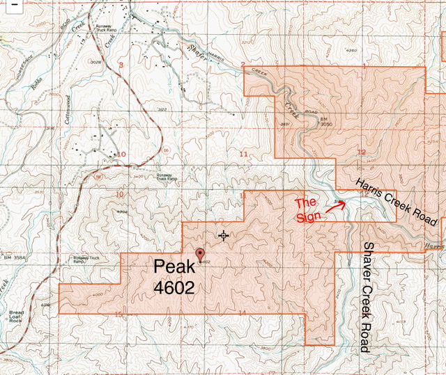
This map shows the land status for Peak 4602. Park and hike only on public land. BLM-managed land = Tan. Private land = White.
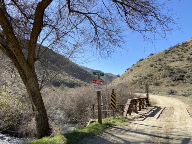
The beginning of the Shafer Creek Road and the inaccurate sign. If the sign was located farther up the road at the south end of the BLM land, it would be accurate.
East Ridge, Class 2
The public land on the peak’s east side is STEEP and is made up of a series of ribs and gullies. Start up the middle rib located on public land. After gaining roughly 200 feet, the rib becomes more defined. Just keep climbing. There are several spots where the slope briefly moderates. Catch your breath and keep climbing. At 4,400 feet, the slope eases and there are good game trails that lead around the south side of a granite-encrusted high point. On the other side of this point, there is a 2-track leading to the summit. There is another intervening high point that can be bypassed on game trails on its west side.
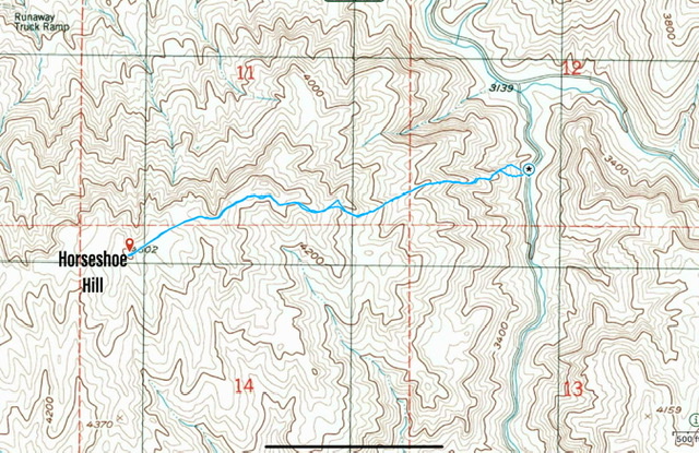
My GPS track. This route covers 2.7 miles with 1,230 feet of elevation gain round trip.
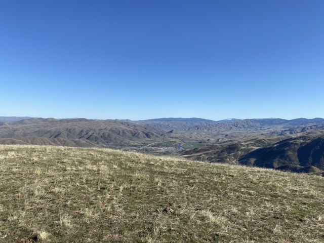
The summit area looking toward Horseshoe Bend
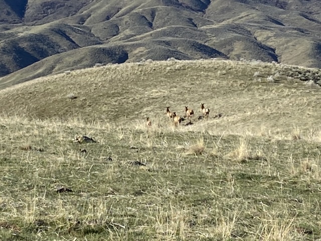
Elk just below the summit
Additional Resources
Regions: Boise Mountains->WESTERN IDAHO
Mountain Range: Boise Mountains
Year Climbed: 2021
Longitude: -116.19201 Latitude: 43.86359