Peak 4620

Elevation: 4,620 ft
Prominence: 320

Find Nearby Peaks

This peak is not in the book. Also see the Owyhee Mountains Peaks List for all of the peaks in this range. Updated April 2019

The access road described below was recently posted as a “PRIVATE ROAD.” The road crosses about 50 feet of private property and then enters public lands. Check with the BLM before using the access road: +1 (208) 384-3300

Jason Floyd climbed the peak from east via the Coyote Grade Road. His route description is set out down the page. Updated January 2021


This peak is located about a mile southeast of Buck Mountain. Climb this peak from Buck Peak via the connecting ridge. From the low point between the two peaks, it is a 320 foot climb to the summit. This peak has a distinctive summit block composed of fairly sturdy volcanic rock. The summit block is a Class 3 climb. I climbed it by following its base to the west until I found a couple of easy steps that lead over the wall. See the Buck Mountain page for directions and additional information. USGS Soldier Cap

The summit block of Peak 4620 from the north.

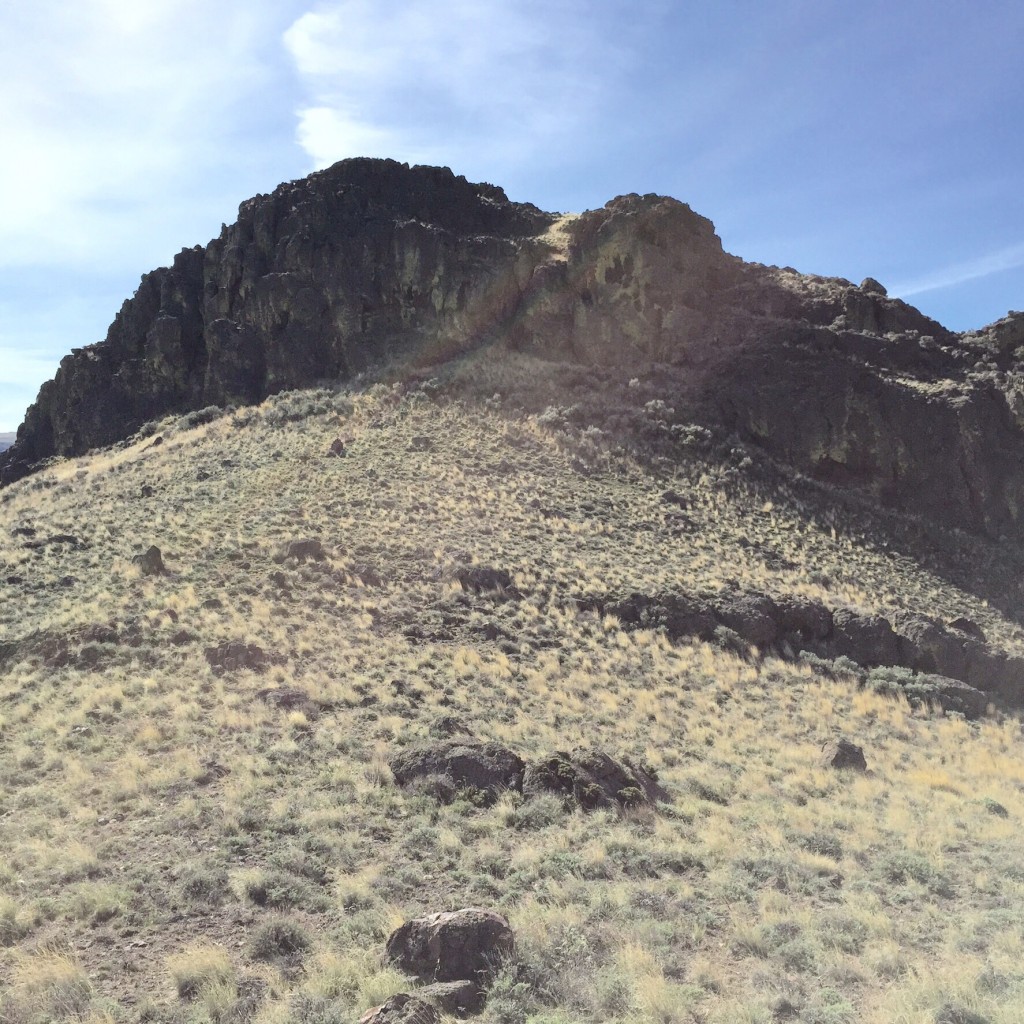
The summit block of Peak 4620 as viewed from the north.

Peak 4620 viewed from the summit of Buck Mountain with higher Owyhee Mountain terrain rising behind it.

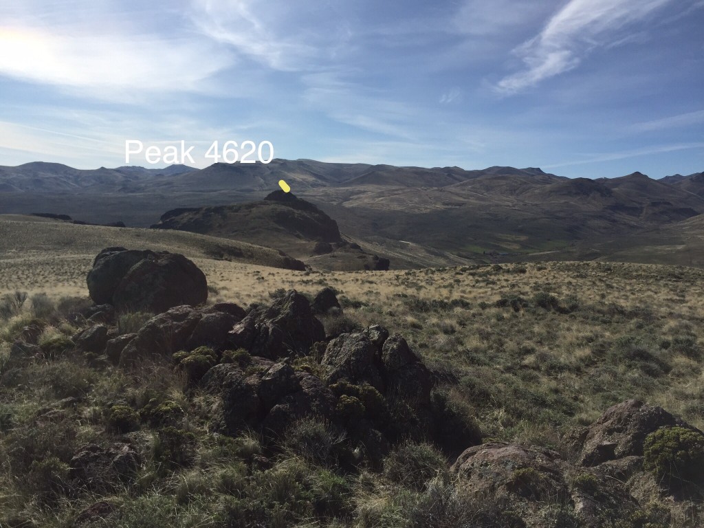
Peak 4620 as viewed from the summit of Buck Mountain with higher Owyhee Mountain terrain rising behind it.

My GPS a track for Buck Mountain and Peak 4620.

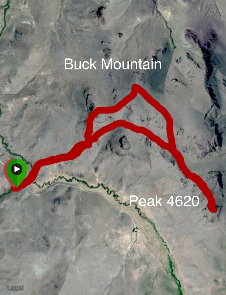
My GPS track for Buck Mountain and Peak 4620.

Eastern Access and Route by Jason Floyd

Access

To avoid Private Property issue currently plaguing the West Side Approach use the Coyote Grade Road. (Use the link for additional access information and a map.)
From  ID-78 about 5 1/2 miles east of Marsing turn Right on Clark Road .
At 3.0 Miles the road turns to dirt this is Coyote Grade Road. Reset your odometer and go 7 1/2 miles, keeping right at the powerlines a mile up the road and staying right at about 7 miles. I parked at the 7.5 mile marker where the road turned and there was a nice area to park. Note: This road must be dry or frozen or dry to be safely driven.

Peak 4620 and Buck Mountain, Class 3 and Class 2

I hiked up the road a short distance and angled southwest towards Peak 4620 (see the map below). The top of the peak is a nice class three climb with a few ways up and down. I left a Summit register on Peak 4620.
From Peak 4620 I headed West down climbing to the saddle and the easy slopes up to the broad ridgeline of Buck Mountain. Gaia app was showing the Peak to the west as the high point and List Of John was showing the Middle Peak as the High Point. I did both to be safe and the middle peak is 50 feet higher though I highly recommend climbing the west peak as well as it has amazing views. I did not see a summit register.

Jason’s GPS track.

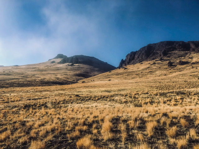
Peak 4620 viewed from the north. Jason Floyd Photo

Additional Resources

Mountain Range: Owyhee Mountains

Year Climbed: 2015

Longitude: -116.86749   Latitude: 43.368689

Photos:

Comments are closed.