Elevation: 4,744 ft
Prominence: 617
This peak is not in the book. Elevation and prominence figures have been updated based on LiDAR measurements. Livingston Douglas added a new route and additional photos. Updated October 2025
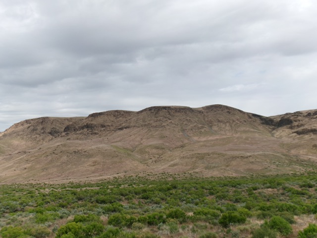
Peak 4744 sits north of the former village of Reynolds, Idaho. The summit is the culmination of a long south-to-north trending ridgeline that forms the eastern wall of the impressive Reynolds Creek Canyon. The paved Reynolds Creek Road, which does not actually follow Reynolds Creek, parallels the peak’s eastern flank. In addition to the route set out below, there are undoubtedly numerous lines one could follow from the road to the summit. USGS Wilson Peak
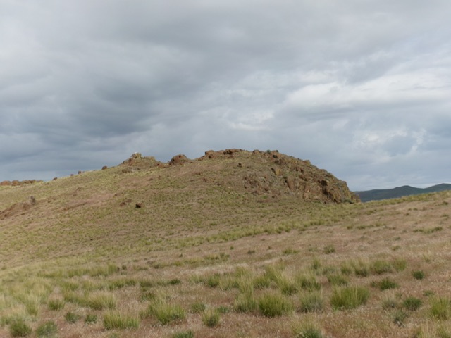
Reynolds Peak. Livingston Douglas Photo
Access
Use the Reynolds Creek Road directions [(A)(1) on Page 346] to access the peak. This road leaves ID-78 1.1 miles east of the ID-45/ID-78 junction. Follow the road south for 7.8 miles. Turn right/west onto a rough side road (high-clearance vehicle recommended) and continue following the road west to a junction in 0.8 miles. Park here. See map.
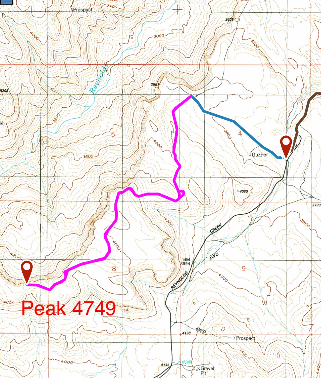
My GPS track. The blue line is the driving route from the Reynolds Creek Road to the parking area. The pink line is the hiking route.
North Ridge, Class 2
From your parking spot, a 4WD road heads south toward the summit. The road quickly turns into a ATV trail as it weaves its way south along the peaks broad, rolling ridge. The trail eventually drops off the ridge. Leave the trail and stay near the ridge crest until you reach the summit. This route has great views along its entire distance, with Soldier Cap standing to the northwest adding an exclamation point to your view. From the parking spot, the route covers 5.4 miles round trip with 850 feet of elevation gain.

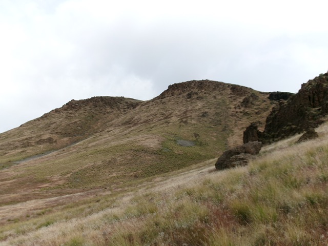
Following the ridge south toward the summit on a snowy March day. The summit does not come into view until the last 200 yards of the hike.
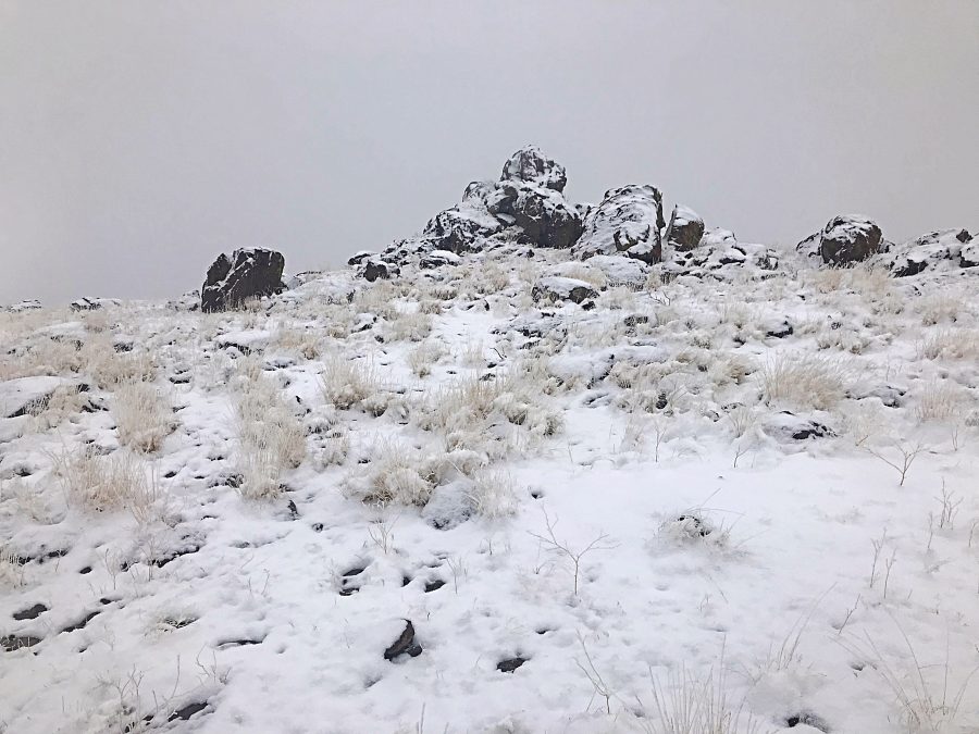
This outcrop is the highest point of Reynolds Peak. Circle around the north side where you will find a tall step that leads to the top. There is a summit register.
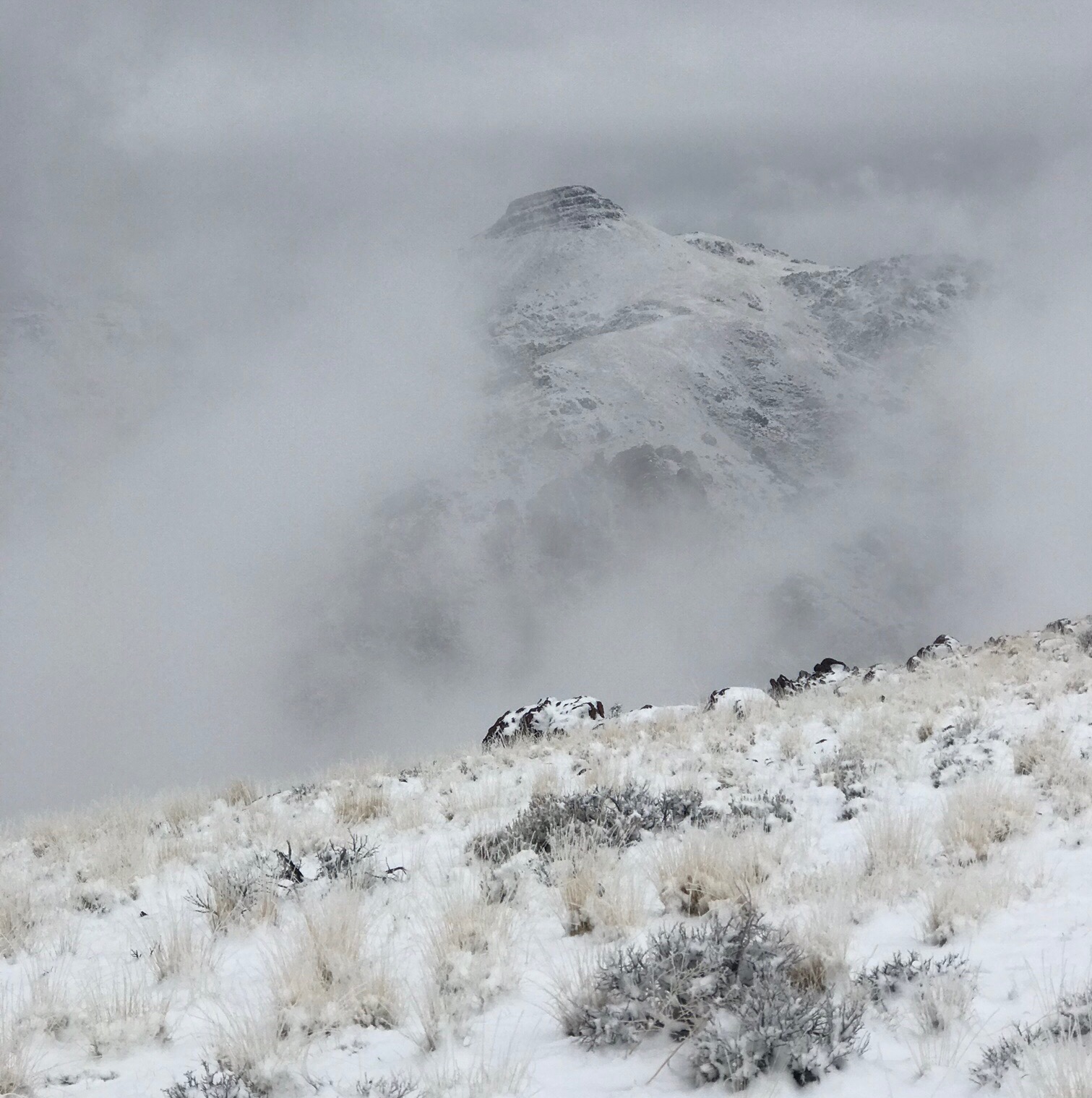
Soldier Cap as viewed from near the summit of Reynolds Peak on a snowy March day.
South Face/East Ridge by Livingston Douglas
Reynolds Peak and its lengthy south side. My ascent route climbs up from just left of the massive, rocky gully on the far right of the photo. Livingston Douglas Photo
Access
Reynolds Creek Road [(A)(1) on Page 346]. See my Access directions for Chalky Butte. From the Chalky Butte parking spot, drive another 4.1 miles southwest up Reynolds Creek Road to a major crest in the road at a high saddle. There is a large parking area on this saddle and an ATV trailhead on the east side of the road. Park here [4,138 feet; 43°15’25.3”N, 116°42’36.5”W]. This is the closest access point for a climb of Reynolds Peak.
Map Updates
The USGS topo map shows many spurious roads in this area and fails to show the actual ATV/MC trails in this area. Don’t rely on it.
South Face/East Ridge, Class 2
The Climb
From large parking area, cross to the south side of a cattle guard/fence row and scramble west with a slight bias to gain elevation as you cross multiple small side gullies in a mix of loose talus/scree and field grass, with thick patches of tumbleweeds in most of the gullies. Skirt the south side of a massive buttress/face on the east side of the rugged (and lengthy) east face of Reynolds Peak. Keep going until you reach a climbable gully that heads right/north-northwest to the high ridge between two gentle ridge humps.
Stay to the right/east side of this gully in steep-ish but easy field grass and loose underlying talus. Cross the gully high up and move to its left/west side on a shoulder of sorts to reach the flattish summit plateau. The summit is still a good 0.3 miles away to the west-northwest. Descend 50 vertical feet on an easy, grassy connecting ridge to approach the summit. The summit block is obvious from a distance. Scramble up to the top of the highest boulder and sit/stand on it. When I descended from the summit, I stayed lower in the traverse back to Reynolds Creek Road. This was an easier, less rocky, and less angled line than my ascent route.
The two ridge humps just east of the high point of Reynolds Peak. Climb the gully between them. Livingston Douglas Photo
The elusive, rocky summit hump of Reynolds Peak finally comes into view. Livingston Douglas Photo
Additional Resources
Regions: Owyhee Mountains->SOUTHERN IDAHO
Mountain Range: Owyhee Mountains
Year Climbed: 2019
Longitude: -116.73189 Latitude: 43.26139