Elevation: 5,436 ft
Prominence: 885
This peak is not in the book. Also see the Owyhee Mountains Peaks List for all of the peaks in this range. Livingston Douglas added a new route and new photos. Dan Krueger shared his thoughts on Winter access. Updated October 2025
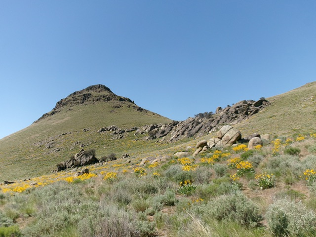
This a good peak to climb in the Spring along with its neighbor Wilson Peak. This area burned hot in 2016 and burned off most of the brush, leaving wide-open country. The ridge between Wilson Peak and Soldier Cap is studded with attractive granite outcroppings that offer a lot of untapped bouldering opportunities. The views from the ridge are rewarding. USGS Soldier Cap
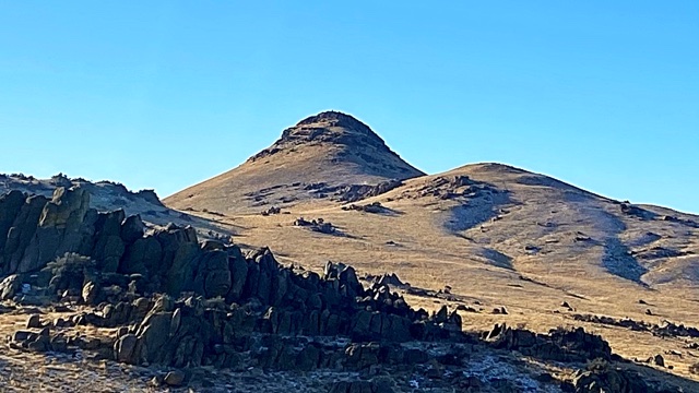
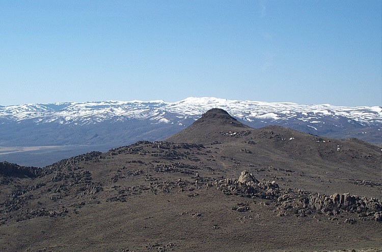
Soldier Cap’s northern aspect
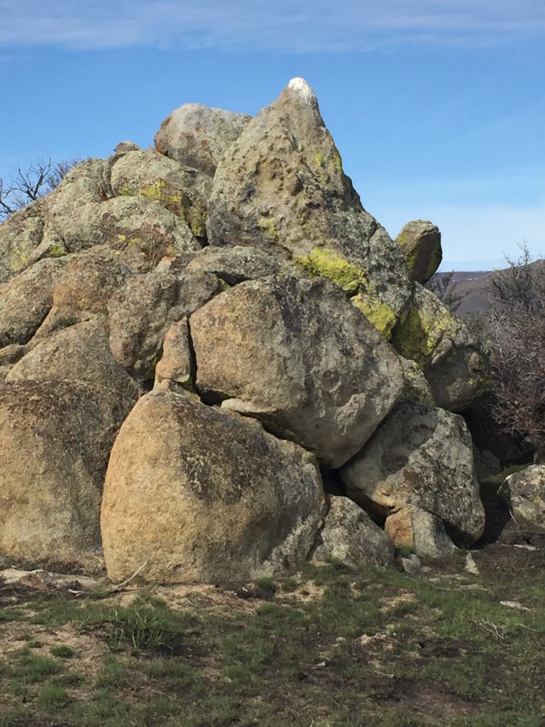
One of the many granite bouldering options found on the ridge. This one is a favorite site for raptors.
Access
You can climb to Soldier Cap’s summit block from almost any direction but, based on access considerations, climbing the peak from the Wilson Creek Road is recommended. A 4WD road leaves the Wilson Creek Road 10.2 miles from ID-78 and climbs to the summit of Wilson Peak. Follow this 4WD road toward Wilson Peak. In roughly a mile you will reach a junction with another 4WD road. Turn onto this road which climbs to the broad saddle between the two peaks and follow the ridge to the northern base of the summit block.
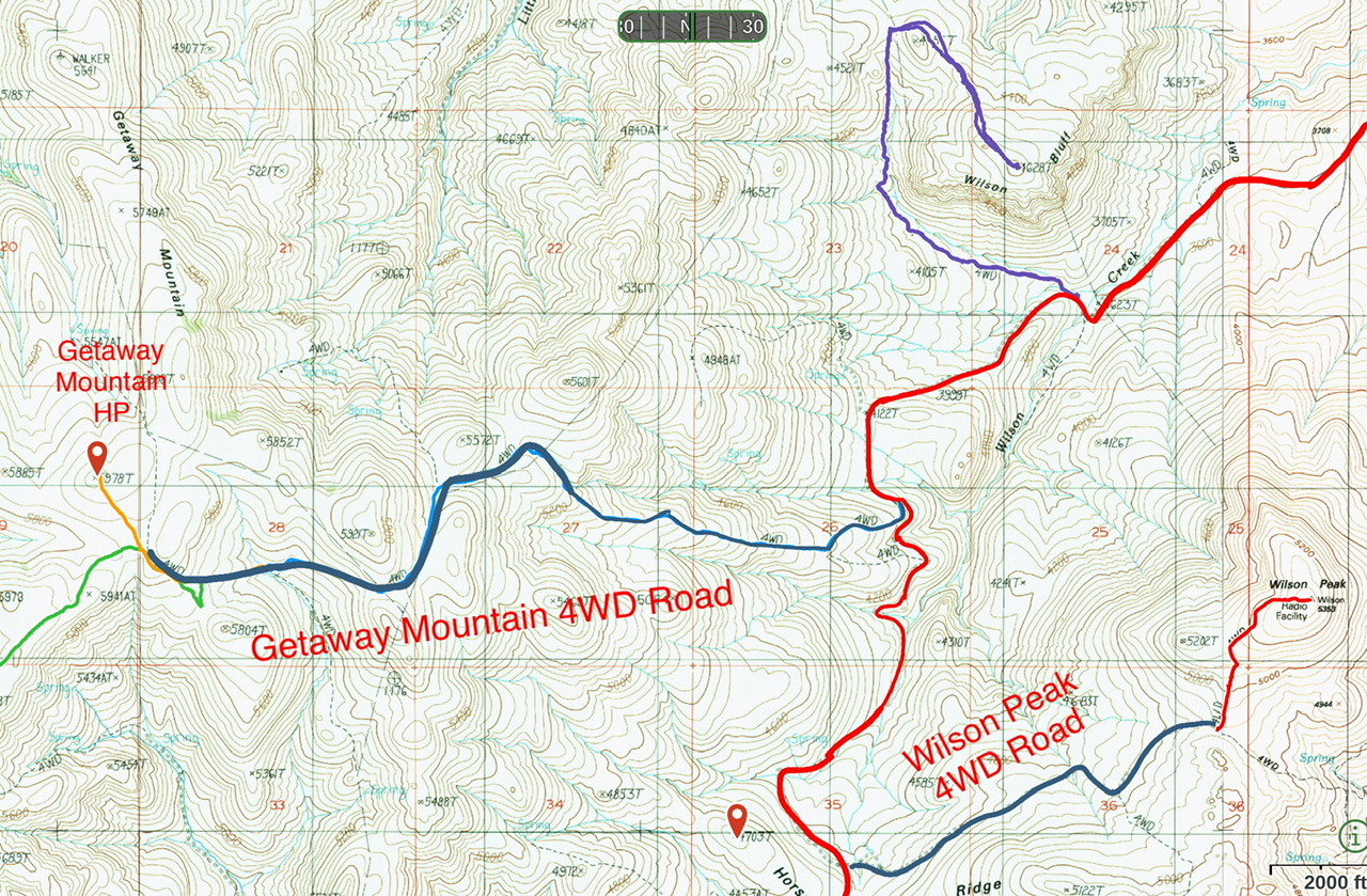
This map shows the upper section of the Wilson Creek Road (in red), the hiking route to the top of Wilson Buff, the Getaway Mountains 4WD Road and the Wilson Peak 4WD Road.
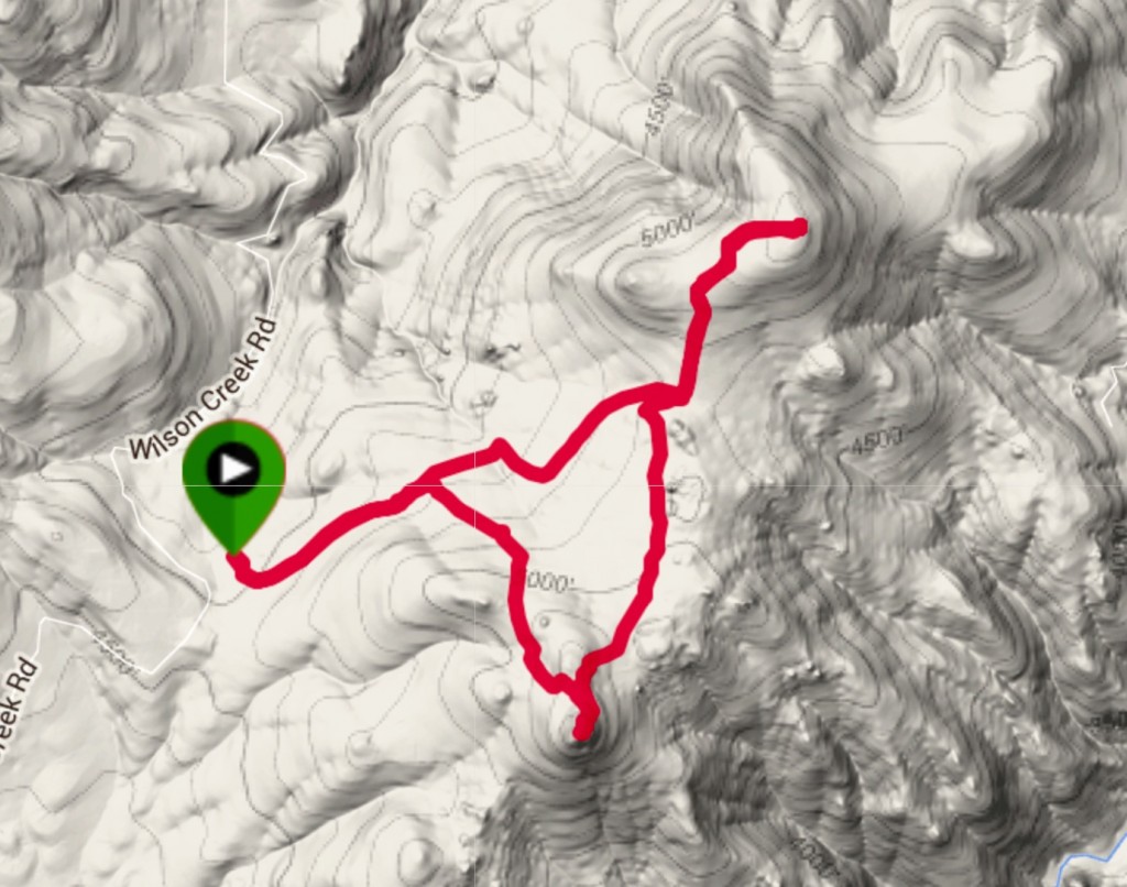
My GPS track for Wilson Peak and Soldier Cap
East Face, Class 2
The summit block is Class 2+ on its east side. From the last saddle at the base of the northern base of the summit block, climb up to the east face at a moderate angle, aiming for a point where the solid rock formation begins. There is a 3-foot step to climb and a fairly steep ramp cutting up to the left. Climb up the ramp to a ledge which then levels off and traverses just below the base of the summit ridge. Follow the ledge until you see a large cairn. Climb another easy 3-foot step just before the cairn, turn right and walk to the summit.
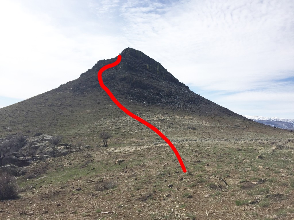
The approximate route I followed up the summit block
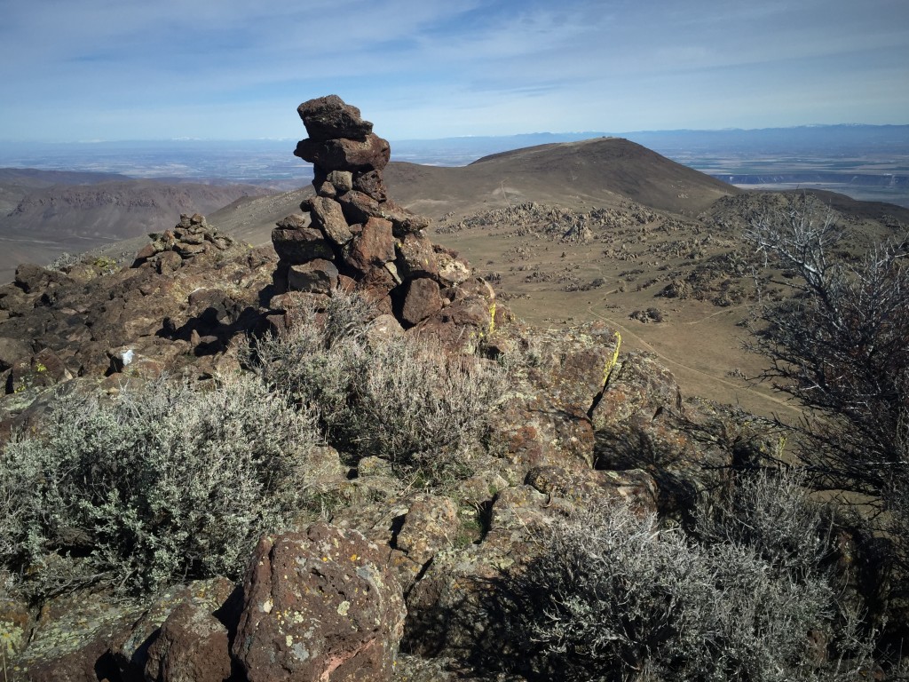
There are four large cairns on the summit ridge. This one is on the high point. There was a summit register with a new notebook as of March 2016.
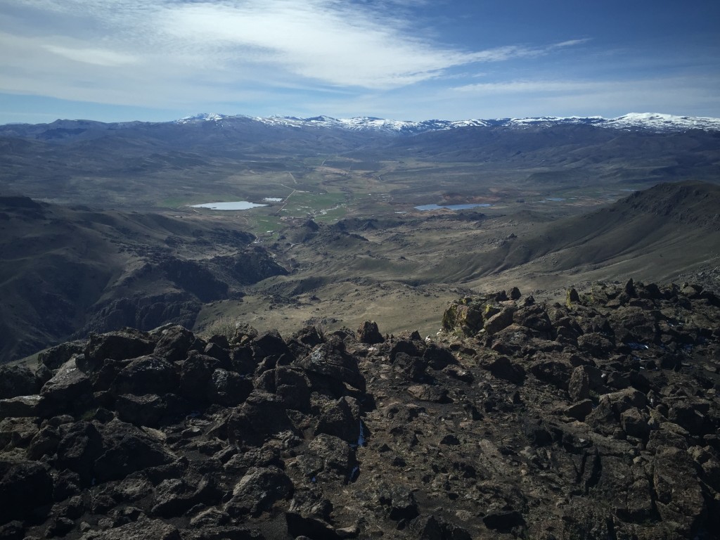
The view from the summit looking in to the Reynolds Creek drainage, with the Silver City Range on the skyline.
West Spur/North Ridge by Livingston Douglas
The upper north ridge of Soldier Cap (skyline in center and right of center). This was my descent route. Livingston Douglas Photo
Access
See the Wilson Creek Access page. Drive 10.3 miles up Wilson Creek Road (signed as “Wilson Road” at ID-78) to a saddle on Horse Race Ridge. Park here in a nice pullout/campsite on the west side of the road [4,552 feet; 43°17’13.7”N, 116°46’43.6”W]. Do not drive this far up Wilson Creek Road in wet conditions. It is a muddy, rutted mess and would be impossible to navigate.
West Spur/North Ridge, Class 2
The Climb
From the saddle on Wilson Creek Road, bushwhack east up through easy field grass on a rounded shoulder (the west spur). As the ridge gains definition and become rockier, stay well below it on its south side to skirt past all of the bumps on the crest of the west spur. Cross easy, angled field grass to reach the north ridge of Soldier Cap pretty high up. Once on the north ridge, scramble south up a mix of talus/boulders and field grass to reach a final, short scramble up a minor chute to the rocky summit cap. There are several cairns on top, the largest of which is at the south end of the small summit cap. Stand atop all of the potential high point boulders.
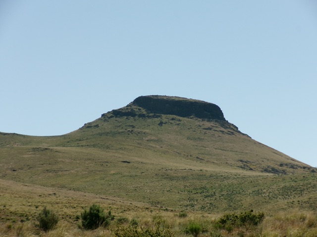
Soldier Cap in all its “cap-like” glory as viewed from the northwest. The north ridge (the final leg of my ascent route) is the left skyline. Livingston Douglas Photo

The other summit rocks atop Soldier Cap. This may be the actual high point. Livingston Douglas Photo
Winter Access by Dan Krueger
I’ve had my eye on these peaks on the horizon for a while, found them on your website and followed the link to Dan Robbins’ site. I followed his very good directions and climbed them this past weekend. There was only a few inches of snow on these peaks and it was a very enjoyable hike (no snowshoes required). I was a little disappointed after reading on Dan’s site that Soldier Cap was Class 3. I was looking forward to that, but I’d say its more like Class 2 with one Class 3 move – simple, even in the snow. These peaks are definitely climbable year-round.
The main reason I’m writing this is to point out the condition of Wilson Creek Road. I drove out in the morning and it seemed like a simple drive on a dirt road. Well, that’s because it was FROZEN. When I arrived back at my truck at 2:00PM, the road had thawed into a muddy mess that was nearly impassable and almost got me into a lot of trouble. My truck is a 4WD with traction/stability control and even driving very slowly I nearly slid off twice. I eventually made it back, but I felt more scared driving that road than free climbing Class 4 Castle Rock. Lesson learned. I don’t know if you will be doing any updates to your site, but if you do, a word of caution about Wilson Creek Road would help potential climbers avoid possibly serious trouble.

Soldier Cap. Dan Krueger Photo
Soldier Cap and Wilson Peak as viewed from the valley. Dan Krueger Photo
See Dan Robbins’ trip report for directions to this peak.
Soldier Cap as viewed from Wilson Peak. Dan Robbins Photo
Additional Resources
Regions: Owyhee Mountains->SOUTHERN IDAHO
Mountain Range: Owyhee Mountains
Longitude: -116.7569 Latitude: 43.2833