Elevation: 4,960 ft
Prominence: 300
This peak is not in the book. Livingston Douglas revised this page. From the summit of Macks Peak, he continued on to Cervidae Peak. This page includes his descent route from Macks Peak to the low point in the traverse to Cervidae Peak. Both Livingston and I added additional photos.Updated November 2023
This peak is located about a mile northeast of Cervidae Peak. It is another good training peak to climb early in Spring since it is close to Boise and is free of snow often as early as February. The standard route climbs the peak’s south ridge. The peak can be climbed from almost any direction. I climbed it by following the connecting ridges from Cervidae Peak and then descended the south ridge. Michael Tilden added a more difficult way to climb the south ridge to the website. Read about his route at this link: Till Dawn Ridge. Dan Robbins’ trip report is linked below. USGS Arrowrock Dam
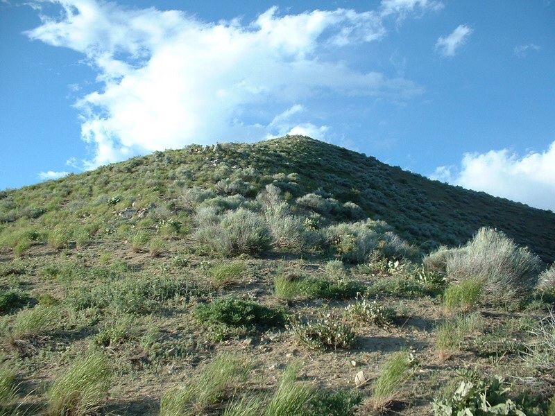
Macks Peak. Dan Robbins Photo
Access
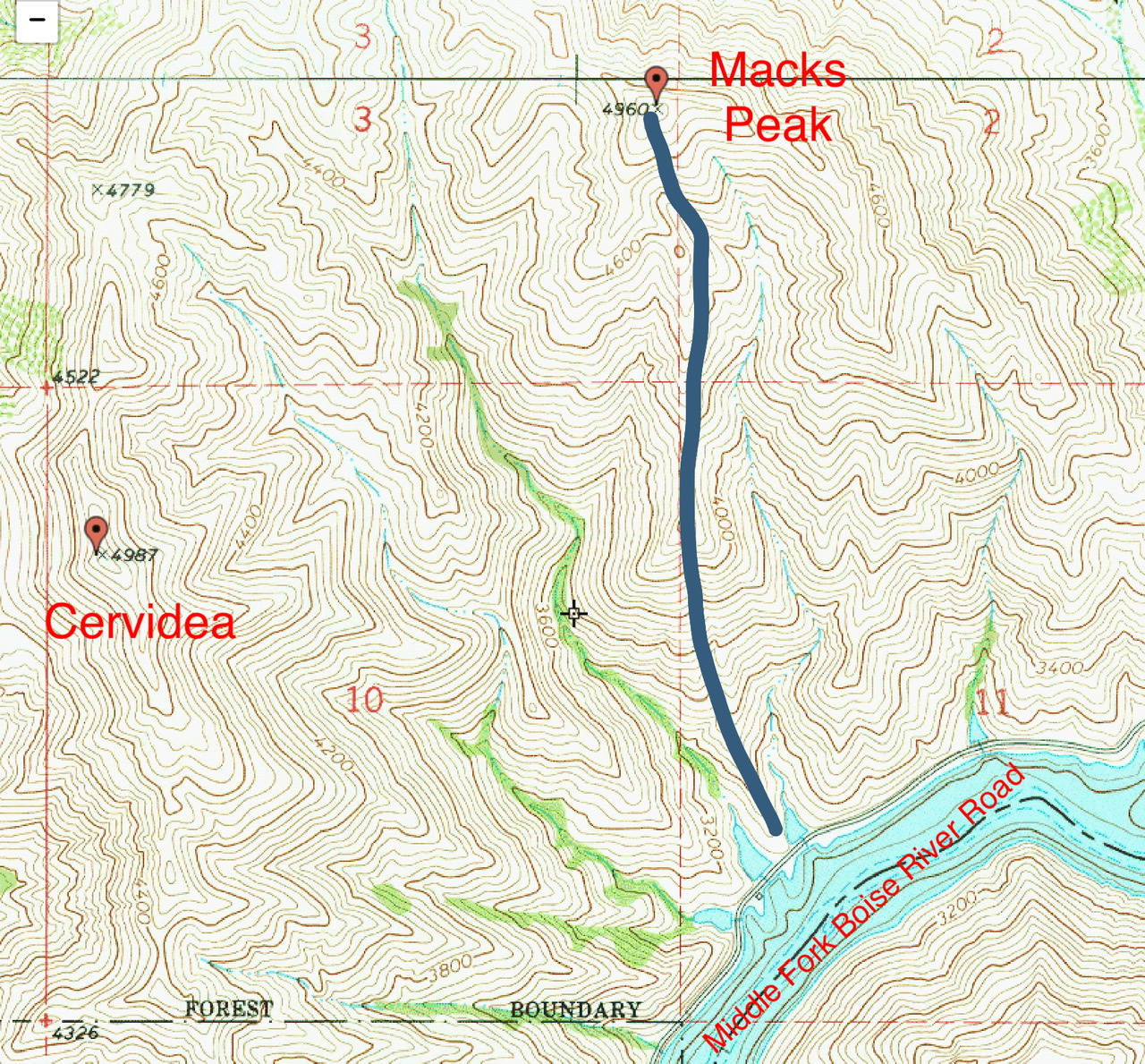
Refer to (C) Middle Fork Boise River Road/FS-269 on Page 154. Follow ID-21 from Boise toward Idaho City. Just after crossing the high bridge over the reservoir, turn right onto the Middle Fork Road heading towards the Springs Shore Marina and Atlanta. At 3.6 miles, the road reaches the Naked Rock Recreation Site. Park at the [signed] recreation site (3,085 feet; 43⁰36’23”N, 115⁰57’13”W).
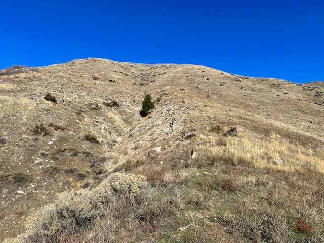
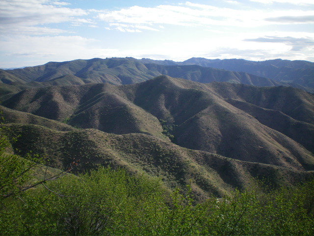
The bottom section of the south ridge of Macks Peak (dead center) as viewed from the Naked Rock Recreation Site. This is the correct ridge/shoulder to begin the climb. Livingston Douglas Photo
South Ridge, Class 2
The Climb
It would be easy to accidentally climb the wrong ridge of the several that interface with Middle Fork Road near the Naked Rock Recreation Site. And there are three (3) ponds in close proximity to be considered, so climbing “between the two ponds” is confusing. Which two ponds?? (See the map down the page.)
To make matters worse, the correct ridge is separated by a nonexistent “pond” on its right/east side and a dried-up “pond” on its left/west side. Both of these “ponds” are shown as water bodies on the USGS topo map. Ironically, the only actual pond is the third pond which is farther south and is the terminus of the southeast spur of Cervidae Peak.
From the Naked Rock Recreation Site, walk northeast on Middle Fork Road for about 100 yards to the toe of the gentle base of the south ridge of Macks Peak. There is a “Naked Rock” road sign here (for westbound drivers on FSR-268). An obvious use trail heads north up the ridge in open scrub terrain. The use trail is narrow but good in some areas. However, it is weak or nonexistent in other areas. The ridge bends right-ish/north at 4,200 feet then noticeably left/northwest at 4,600 feet. Higher up, the ridge heads markedly right/north to reach the well-cairned summit of Macks Peak.
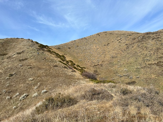
This photo shows the steepest part of the climb. The use trail in this section included tiny switchbacks, sections of deep sandy loam and disappears in places.
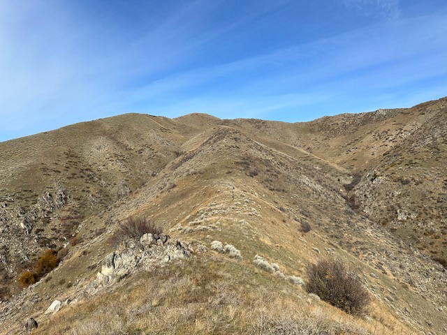
The ridge’s pitch finally moderates after a mile of climbing. The summit is just left of center.
The two final climbs to the summit (just right of center) are shown in this photo.
Looking down the south ridge from the summit of Macks Peak. Livingston Douglas Photo
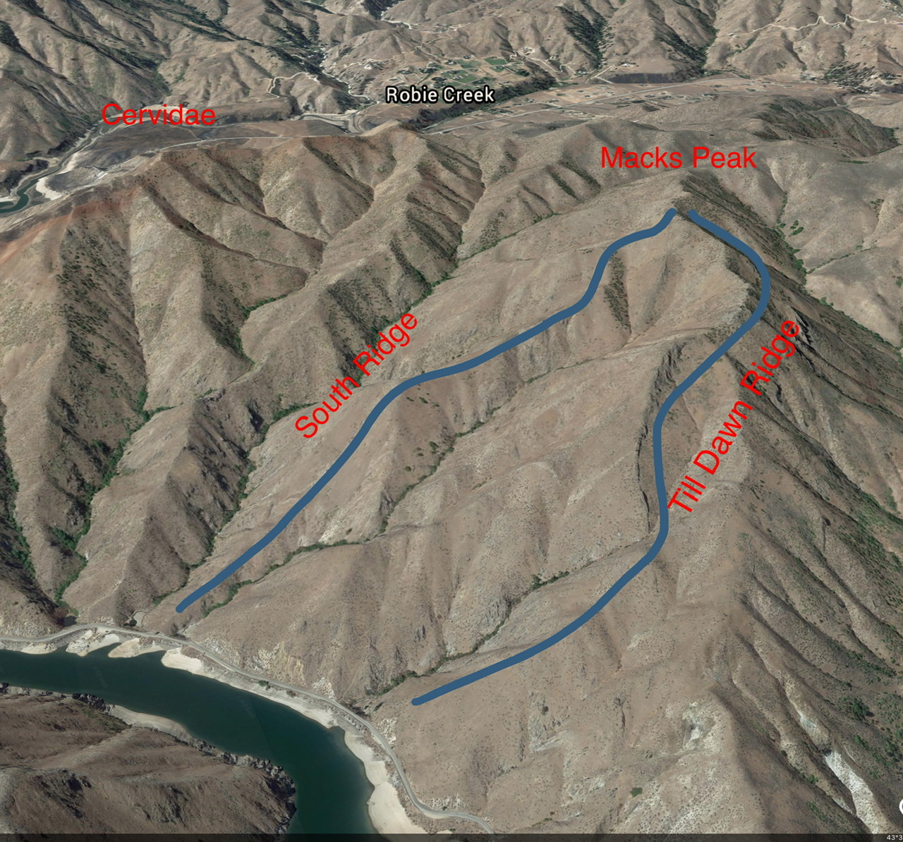
A Google Earth Image of Macks Peak
The South Ridge route (blue line) is brutally steep as it climbs 1,940 feet in 1.2 miles.
Northwest Ridge/West Face, Class 2
The Descent
This descent is part of a 2-peak adventure that includes Macks Peak and Cervidae Peak (4,987 feet). This journey covers 5.5 miles with 2,825 feet of elevation gain round trip. From the summit of Macks Peak, follow the open ridge northwest on a use trail to a minor saddle then up over an elongated ridge hump. At the north end of this ridgeline hump, descend west down a shoulder then face of scattered sagebrush to reach the major drainage that separates Macks Peak from Cervidae Peak. This gulch is the terminus of the first leg of today’s 2-peak journey. Cervidae Peak is up next.
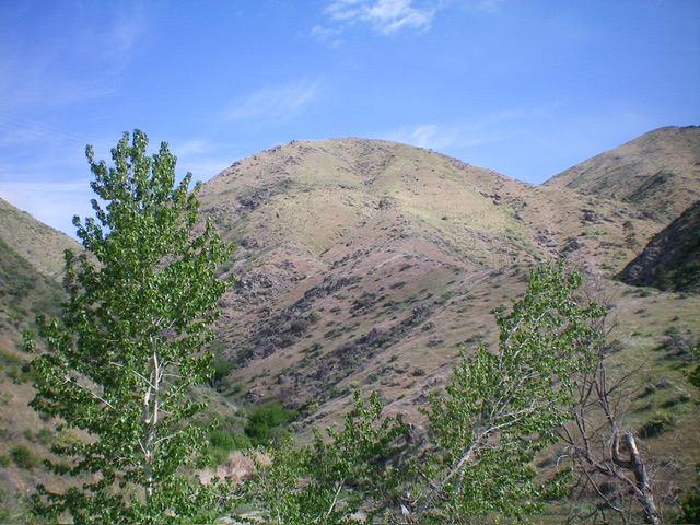
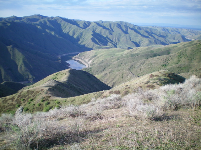
Macks Peak (dead center in mid-ground) as viewed from Cervidae Peak to its southwest. Livingston Douglas Photo
Additional Resources
Regions: Boise Mountains->WESTERN IDAHO
Mountain Range: Boise Mountains
Year Climbed: 2004 2023
Longitude: -115.9568 Latitude: 43.6243