Elevation: 4,987 ft
Prominence: 367
Climbing and access information for this peak is on Page 146 of the book. Livingston Douglas added two new routes to this page. Updated November 2023
Cervidae Peak is located in the Boise Mountains just north of Lucky Peak Lake. The peak’s name originated with Dan Robbins and, thanks to Dan’s efforts, the name was adopted by the U.S. Board of Geographic Names in 2015. In scientific taxonomy, the family Cervidae is commonly referred to as “the deer family” and consists of at least 47 different species. Many mule deer are found in the area and on this peak year-round. Cervidae Peak is one of the 4 Grand Slam Peaks. The other three peaks are Mount Heinen, Kepros Mountain and Shaw Mountain. Of the 4 peaks, Cervidae Peak is the most popular and sees hundreds of ascents each year. I believe that Cervidae Peak has been climbed every month of the year.
I first hiked to its summit in 1990 and have climbed it many times since and from many different directions. The summit register records climbs in most months. It is a hot climb in the Summer and there is no available water. The West Side Route from ID-21 (in the book) is no longer accessible because of a recently-installed deer fence. This page focuses on the most popular route (the Southeast Ridge). Also see John Platt’s trip report. USGS Arrowrock Dam
Access
Cervidae Peak is located north of Lucky Peak Dam. ID-21 runs along the West Side of the peak and FS-269/Middle Fork Boise River Road runs along the East Side of the peak. Follow ID-21 for 6.1 miles past the dam. Turn right after crossing the high bridge over Mores Creek onto FS-269. Follow FS-269 past the Spring Shores Marina for 2.0 miles. There is a large, unsigned parking area on the right/south side of the road. The trail starts across the road. There is a large bar gate. Go past the gate, turn right, and walk into a bulldozed area. The trail leaves this area on your left.
Southeast Ridge, Class 2
The Southeast Ridge Route climbs to the summit in 2.1 miles with a 1,700-foot net elevation gain. The rolling terrain along the way adds around 300 feet of elevation gain on a round-trip climb. I have rated the climb as Class 2 because the trail is a use trail rather than a maintained trail. There is a good tread the entire distance. According to my GPS on a recent ascent, my total elevation gain (round-trip) was 2,054 feet.
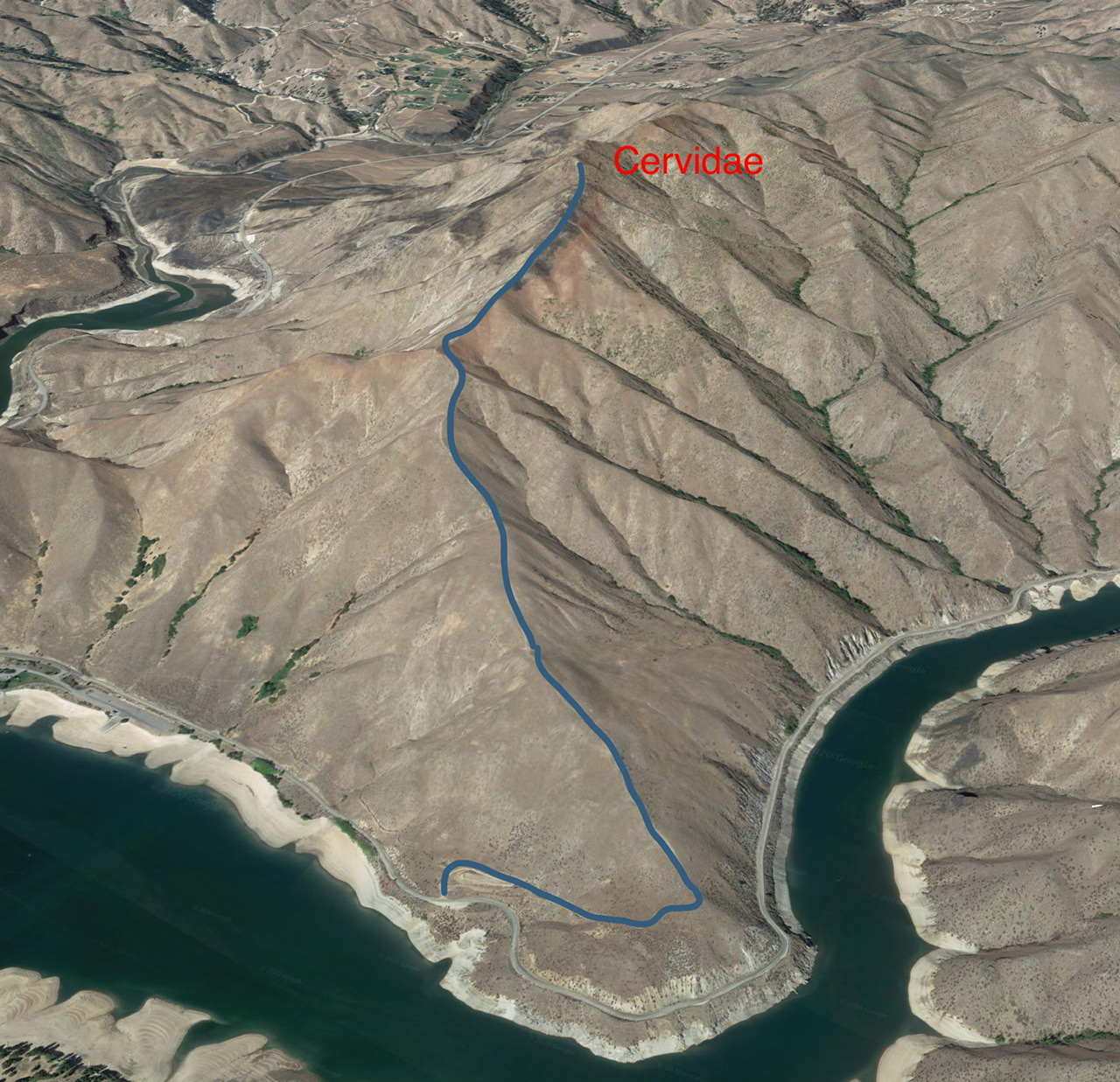
The Southeast Ridge Route is shown on this Google Earth Image.
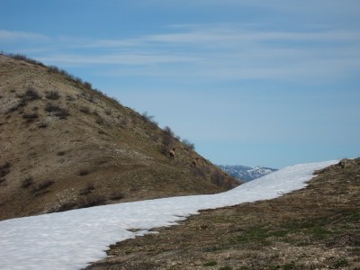
The route leaves the trailhead and contours up and over to the Southeast Ridge. The route climbs up the ridge and alternates from steep to less-steep “steps” to the main ridge. Follow the main ridge north and descend to a saddle. From the saddle, the route steadily ascends the remaining distance to the summit.
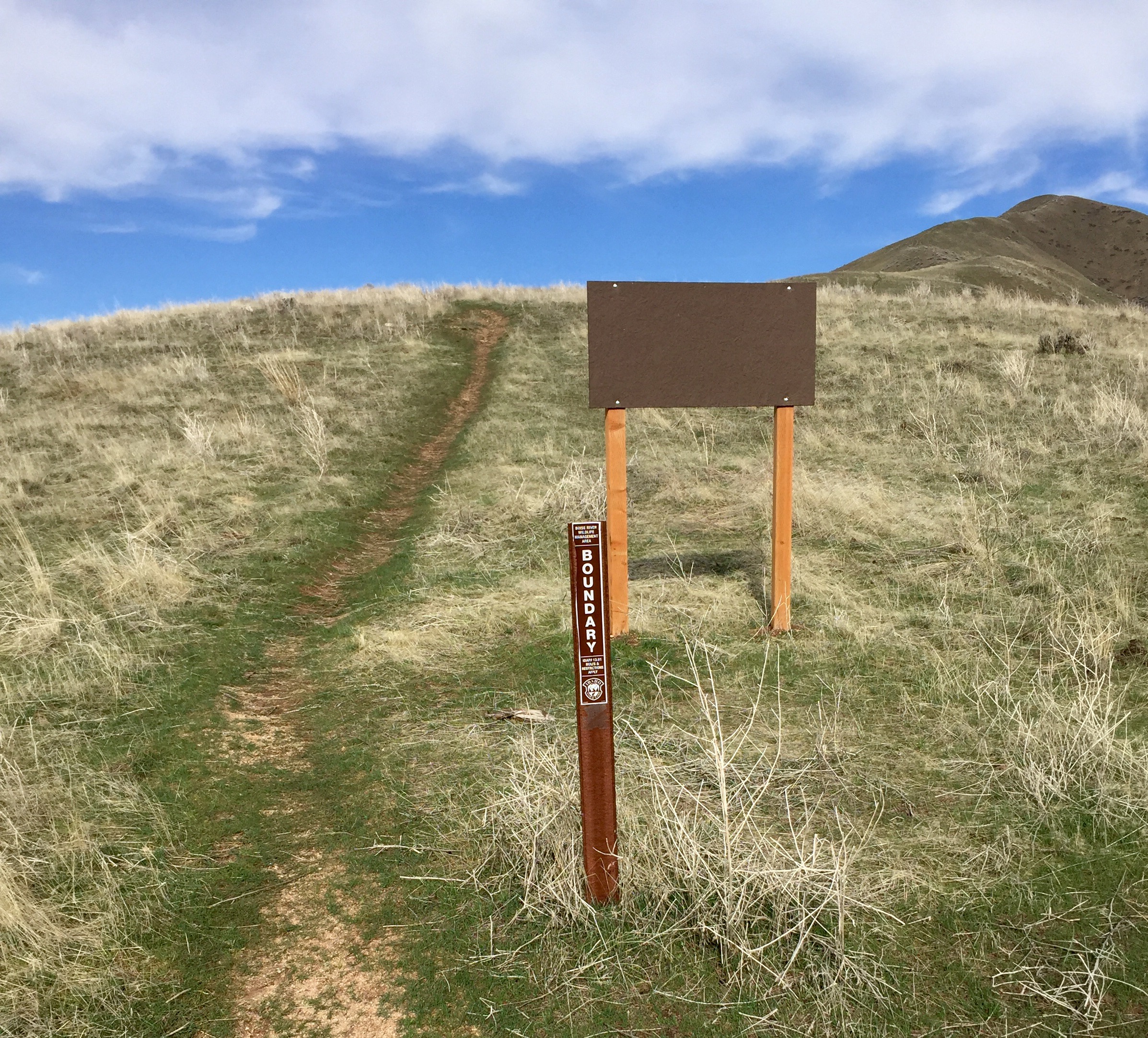
Idaho Fish and Game manages the land around the peak. Fish and Game recently installed these two signs partway up the trail. In March 2017, there was nothing posted on the large signboard.
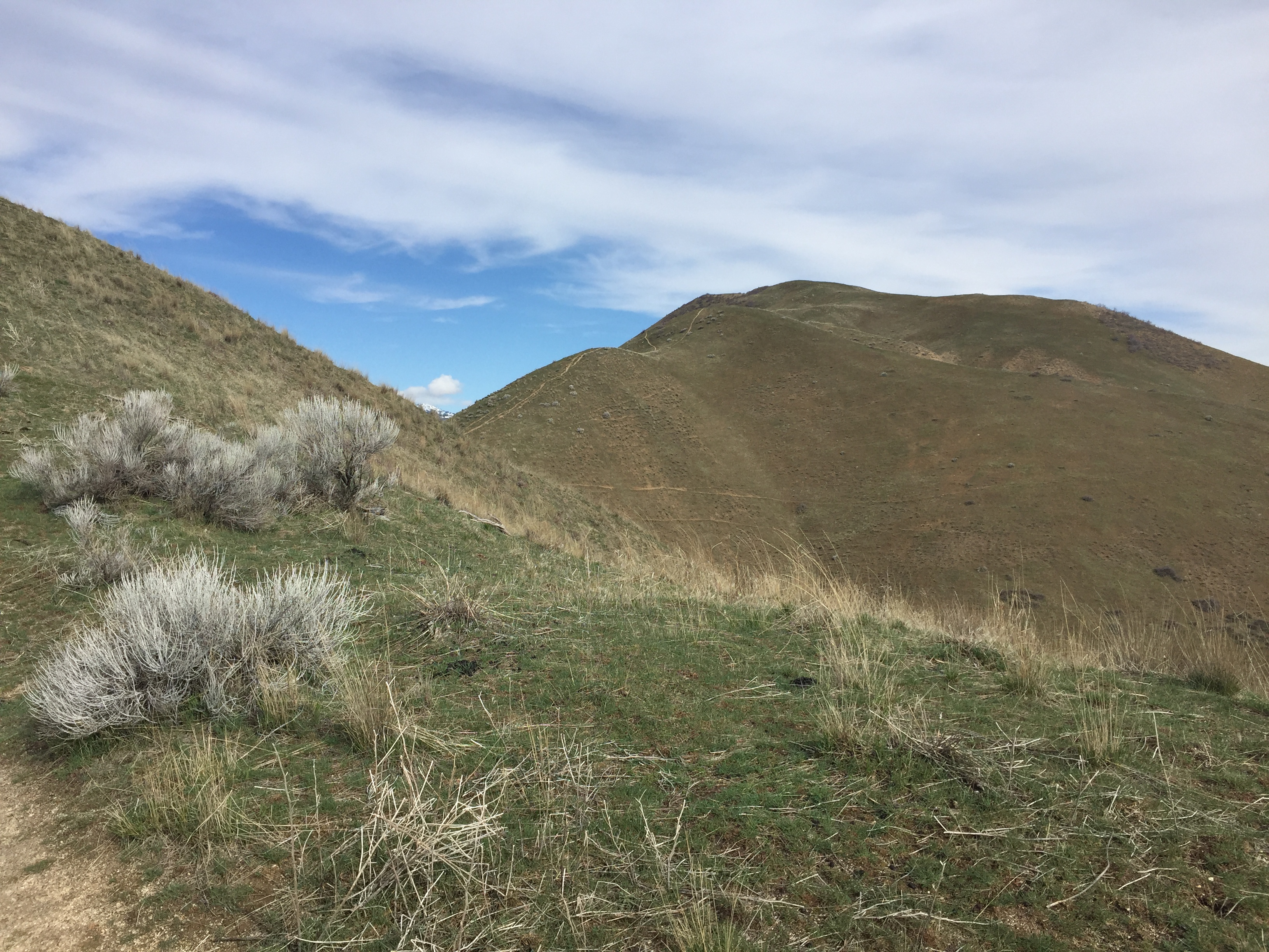
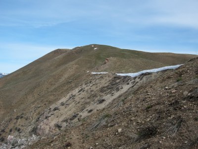
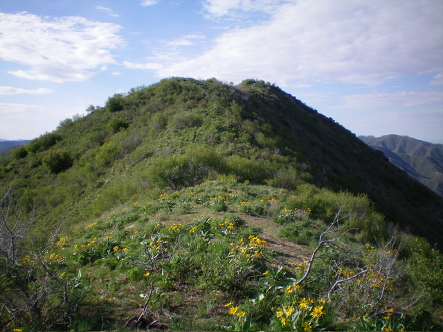
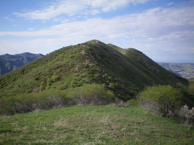
This photo was taken near the main crest. The summit is left of center.
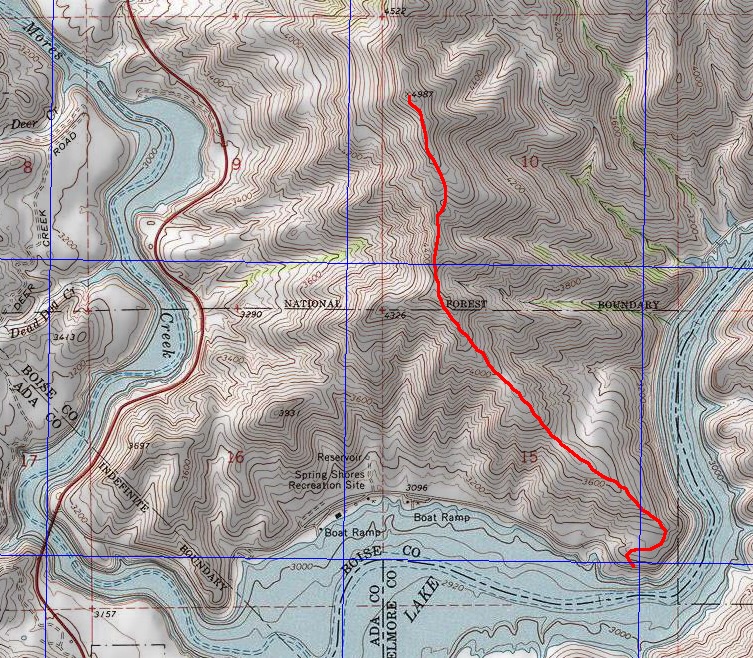
John Platt’s map shows the popular Southeast Ridge Route. This route is not in the book. It’s a bit longer than the Spring Shores Route set out in the book coming in at just under 4.0 miles round-trip.
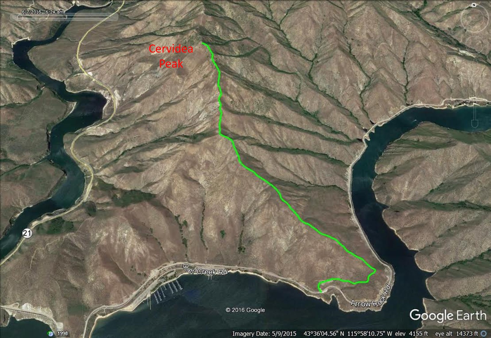
My GPS track for the Southeast Ridge Route superimposed on a Google Earth Map.
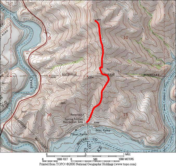
This map shows the steepest route (Spring Shores Route) on the south side of Cervidae Peak.
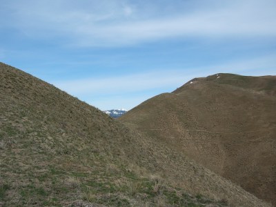
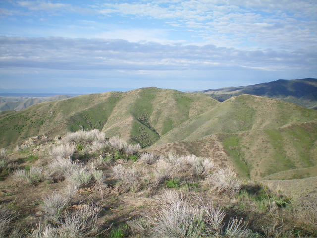
On the main crest approaching the summit.
Further along the main crest, approaching the summit.
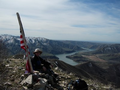
The summit of Cervidae Peak, facing south.
East Face/North Ridge and South Ridge/Southeast Spur by Livingston Douglas
Cervidae Peak as viewed from Macks Peak to its northeast. The summit is in dead center. Livingston Douglas Photo
Access
Same as for Macks Peak. This is the second leg of a 2-peak adventure that includes Macks Peak (4,960 feet) and Cervidae Peak. This journey covers 5.5 miles with 2,825 feet of elevation gain round trip. It begins at the Naked Rock Recreation Site along FSR-268/Middle Fork Road.
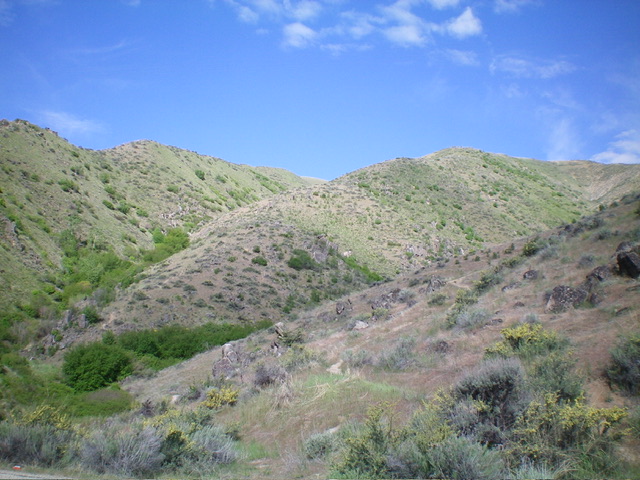
The brushy summit hump of Cervidae Peak is close at hand. Its north side is thick with bushes and other foliage. No trail here. Livingston Douglas Photo
East Face/North Ridge, Class 2
The Climb
From the large gulch that separates Macks Peak from Cervidae Peak, bushwhack west up through a mix of sagebrush and willows using numerous elk trails to help navigate the unpleasant terrain. Reach the crest of a side ridge just south of Point 4853. While the terrain on this route isn’t exactly enjoyable, it sure beats the longer, up-and-down ridge route from Macks Peak that avoids the gulch entirely.
From the side ridge, contour west (and slightly down) on elk trails to reach the north ridge of Cervidae Peak at a minor saddle that is southwest of Point 4853. Follow an on-and-off, usually-weak elk trail on the ridge crest through a few ridge humps and minor ridge saddles to finally reach the willow-clad summit of Cervidae Peak. The elk trail is sometimes nonexistent, hence the Class 2 rating. The summit had no summit cairn but the high point is semi-open with nearby willows. A well-beaten trail comes up the south ridge to the summit from Middle Fork Road.
Looking up the north ridge of Cervidae Peak. Point 4922 is in dead center. The summit hump is just right of center. Livingston Douglas Photo
South Ridge/Southeast Spur, Class 2
The Descent
From the summit, follow the well-beaten use trail down the south ridge to reach an ill-defined juncture with the southeast spur at about 4,750 feet. Leave the wonderful ridge trail and scramble left-ish/south-southeast then southeast on the obvious spur. This spur is very visible from high up but is not so visible at the south ridge departure point. Do NOT mistakenly descend the [higher] east spur which leads into a narrow gully. And do NOT descend the [lower] east ridge/spur, which is rockier and more rugged and has some ridge outcrops to navigate. Making the correct choice here is critical.
The southeast spur is open and steepens quickly. It heads directly down to the largest of three ponds near the Naked Rock Recreation Site, which soon becomes visible from the spur. An on-and-off game trail appears when the ridge steepens. It becomes stronger as you descend but it is mostly on steep, loose dirt. The east spur (and game trail) ends in a flat, small meadow on the right/south side of the small creek drainage that empties into the large pond.
Follow an obvious game trail left/north across the small stream in a minor gap in the thick, tall willows. Continue on this trail as it skirts the west end of the pond and reaches the crest of a shoulder on the left/north side of the pond. Follow the trail down the shoulder to Middle Fork Road just left/north of the pond. Walk a short distance left/northeast along the road to return to the Naked Rock Recreation Site and your parked vehicle.
The southeast spur of Cervidae Peak (in mid-ground) as viewed from Middle Fork Road. This was my descent route. Livingston Douglas Photo
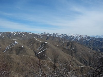
Looking north from the summit toward Mount Heinen
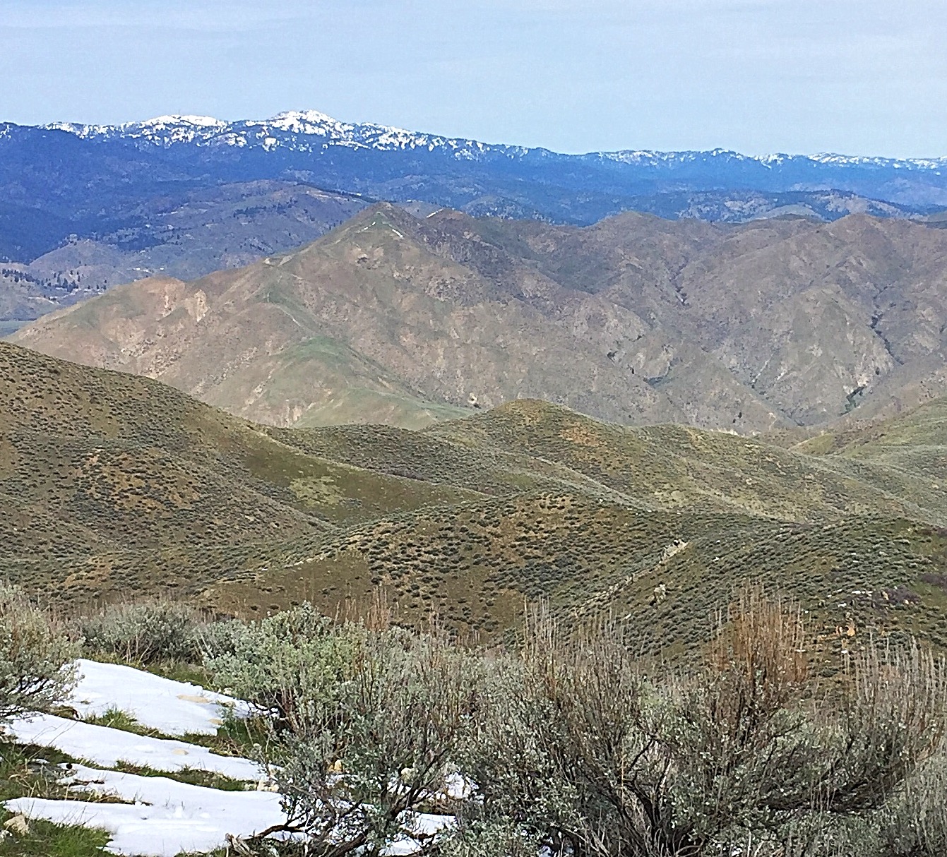
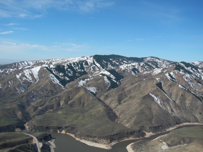
Cervidae Peak (foreground) as viewed from Kepros Mountain with Shafer Butte on the horizon
Shaw Mountain as viewed from the summit of Cervidae Peak
Additional Resources
Regions: Boise Mountains->WESTERN IDAHO
Mountain Range: Boise Mountains
Year Climbed: 1990, 1991, 1996, 1997, 1998, 2000, 01, 02, 03, 04, 05, 06(X2), 07, 08(X2), 09(X8), 2010, 2011, 2012, 2013, 2014, 2015