Elevation: 5,165 ft
Prominence: 575
This peak is not in the book. Also see the Owyhee Mountains Peaks List for all of the peaks in this range. Elevation and prominence figures are updated based on recent LiDAR measurements. Livingston Douglas added a new routes and photos. Updated October 2025
Peak 5165 is the high point on a complex north-south ridge that forms the eastern side of the upper Reynolds Creek drainage. This unnamed peak sits one mile south of Windy Point, the only named feature on the ridge. USGS Reynolds

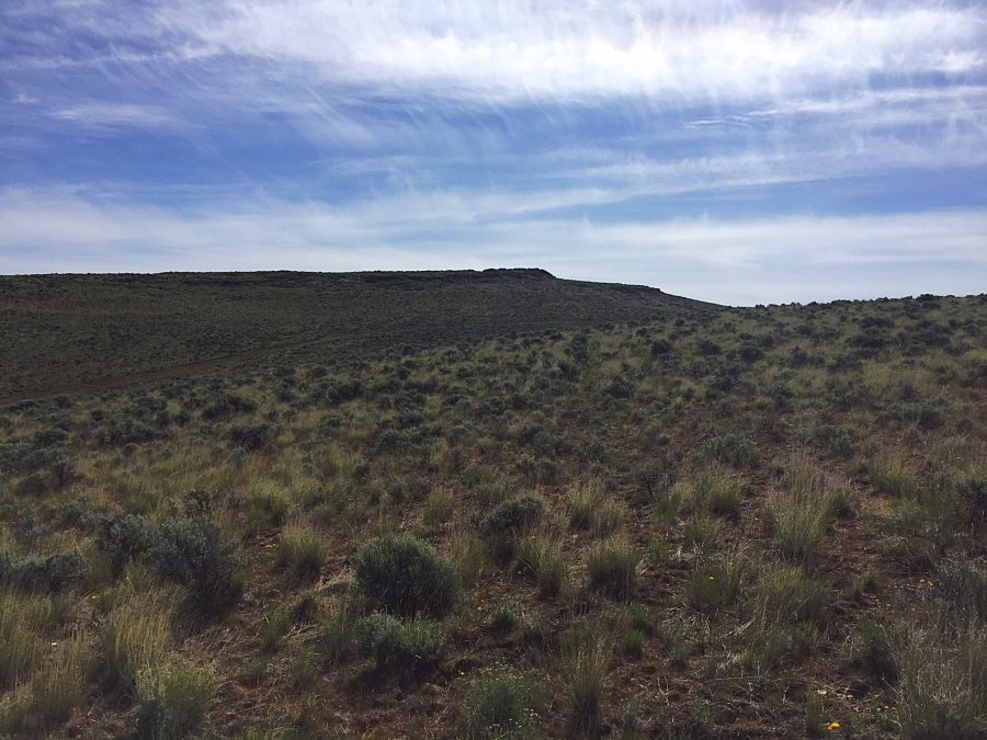
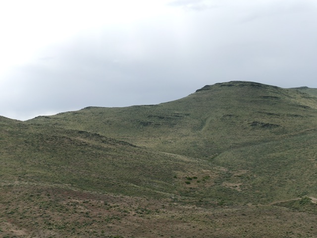
Peak 5165 as viewed from the west
Access
The ridge can be reached from either the Reynolds Creek Road (which leaves ID-78 just south of its junction with ID-45) or from the Rabbit Creek Road/Reynolds Stage Road (which leaves ID-78 at the north end of Murphy). The latter road is the quickest access but both roads are well maintained.
West Ridge, Class 2
The peak and the entire ridge consists of open terrain. Therefore, an ascent can be made from any direction. We climbed the peak via a ridge on its western side. The Rabbit Creek Road/Reynolds Stage Road runs between Murphy and Reynolds. The BLM has designated a two-track which runs along the west side of the ridge containing Peak 5180 as Road #P100. Access this signed road a mile or so east of the Reynolds cemetery. You need a 4WD vehicle to navigate this road.
Jon Fredland and I followed Road #P100 for 2.0 miles and parked just short of a rough gully crossing which I did not want to drive across. We then proceeded along the road on foot for 0.25 miles to peak’s rounded West Ridge. We hiked up the ridge for 1.5 miles and 800 feet of elevation gain to the summit. Just below the summit, you will find a fire break and a fence with a conveniently-placed gate. There are nice views in all directions from the summit.
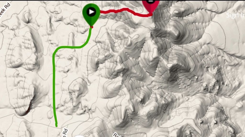
My GPS track (red) and the approximate route of the approach road (green).
South Ridge, Class 2
The peak’s long south ridge provides a scenic route to the summit. Access the road from Rabbit Creek Road/Reynolds Stage Road. There is no definitive spot to start the hike as the open terrain lets you climb the peak from any place in the vicinity of where the road crosses the 4,586 pass on the peak’s. The route I took is shown in the map below. There are fences on the ridge. The best option is to stay on the west side of the fence that follows the ridgeline north. You will have to cross over or under fences twice along the way.
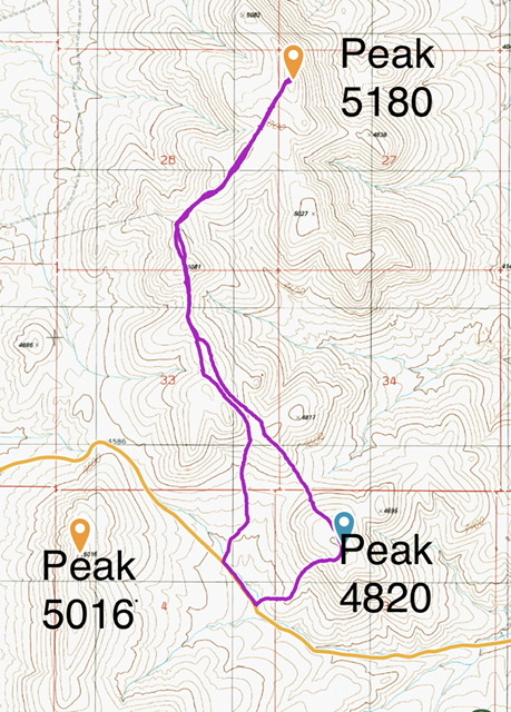
My GPS track for Peak 4820 and Peak 5180/5165. The Reynolds Stage Coach Road/Rabbit Creek Road is shown in gold.
North Ridge and Northwest Shoulder by Livingston Douglas
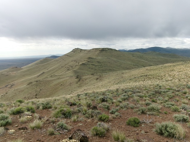
Peak 5165 as viewed from the north. Livingston Douglas Photo
Access
Same as for Windy Point. This is the second leg of a 2-peak adventure that includes Windy Point (5,085’) and Peak 5165. It covers 5.7 miles with 1,675 feet of elevation gain round trip.
Map Updates
The USGS topo map shows many spurious roads in this area and fails to show the actual ATV/MC trails in this area. Don’t rely on it.
North Ridge, Class 2
The Climb
From the 4,820-foot connecting saddle with Windy Point, scramble south then southeast up a laborious ridge of boulders/talus and sagebrush to reach the rocky summit. Cross under a stiff, high cattle fence on the way.
Northwest Shoulder, Class 2
The Descent
From the summit, descend west down a sagebrush and boulder/talus face section. Cross under a stiff, high cattle fence then cross an old unmapped road to reach the sagebrush-covered northwest shoulder. Descend this shoulder (which has minimal rock) northwest then west to find a low, easy spot to cross a dry gully and contour northwest to reach the east line of the ascent route for Windy Point. Skirt below a 2-hump headwall in so doing. Retrace the ascent route across a minor dry gully then over a ridge as you head west to reach the parking/pullout area on Reynolds Creek Road. Use gaps and lanes in the thick-ish sagebrush to quickly reach the road.
A profile of the north ridge of Peak 5165. The summit is at far right. This was my ascent route. Livingston Douglas Photo
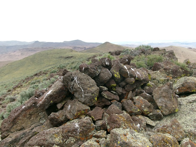
The large summit cairn atop Peak 5165. Livingston Douglas Photo
Additional Resources
Regions: Owyhee Mountains->SOUTHERN IDAHO
Mountain Range: Owyhee Mountains
Year Climbed: 2016
Longitude: -116.70689 Latitude: 43.19401