Elevation: 5,185 ft
Prominence: 365
This peak is not in the book. Published June 2022
Peak 5185 sits just west of Pixley Creek. USGS Pixley Basin
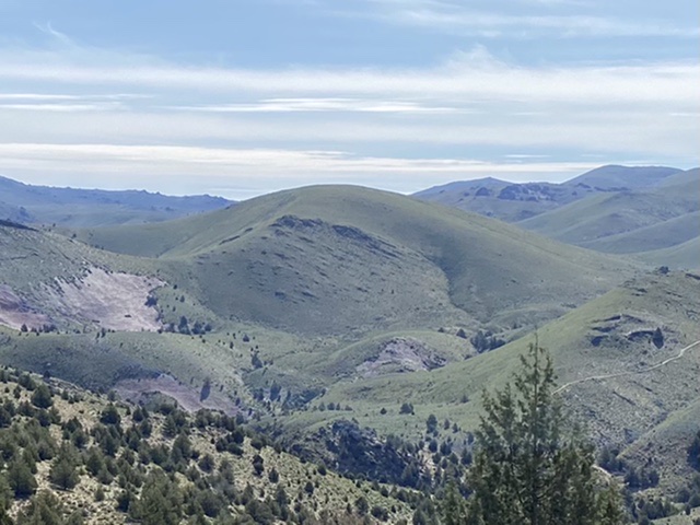
Peak 5185 as viewed from Savage Peak
Access
Primary access information for this peak and its surroundings is found at the following link: Castle Creek Area Access
A seldom-used 2-track road runs west from Castle Creek/Pixley Basin Roads. This road definitely requires a 4WD. The road has an intimidating start and then mellows for a bit. If you continue past Peak 5185 on this road, it gets progressively worse as you continue west. Use this road to reach the south side of the peak at approximately 4,840 feet elevation to start your climb.
Southeast Ridge, Class 2
This is a simple one. The summit is a third of a mile and 353 feet above your parking spot. Simply hike northwest up the poorly-defined ridge to the broad summit dome. The most difficult part of this ascent is determining the high point.
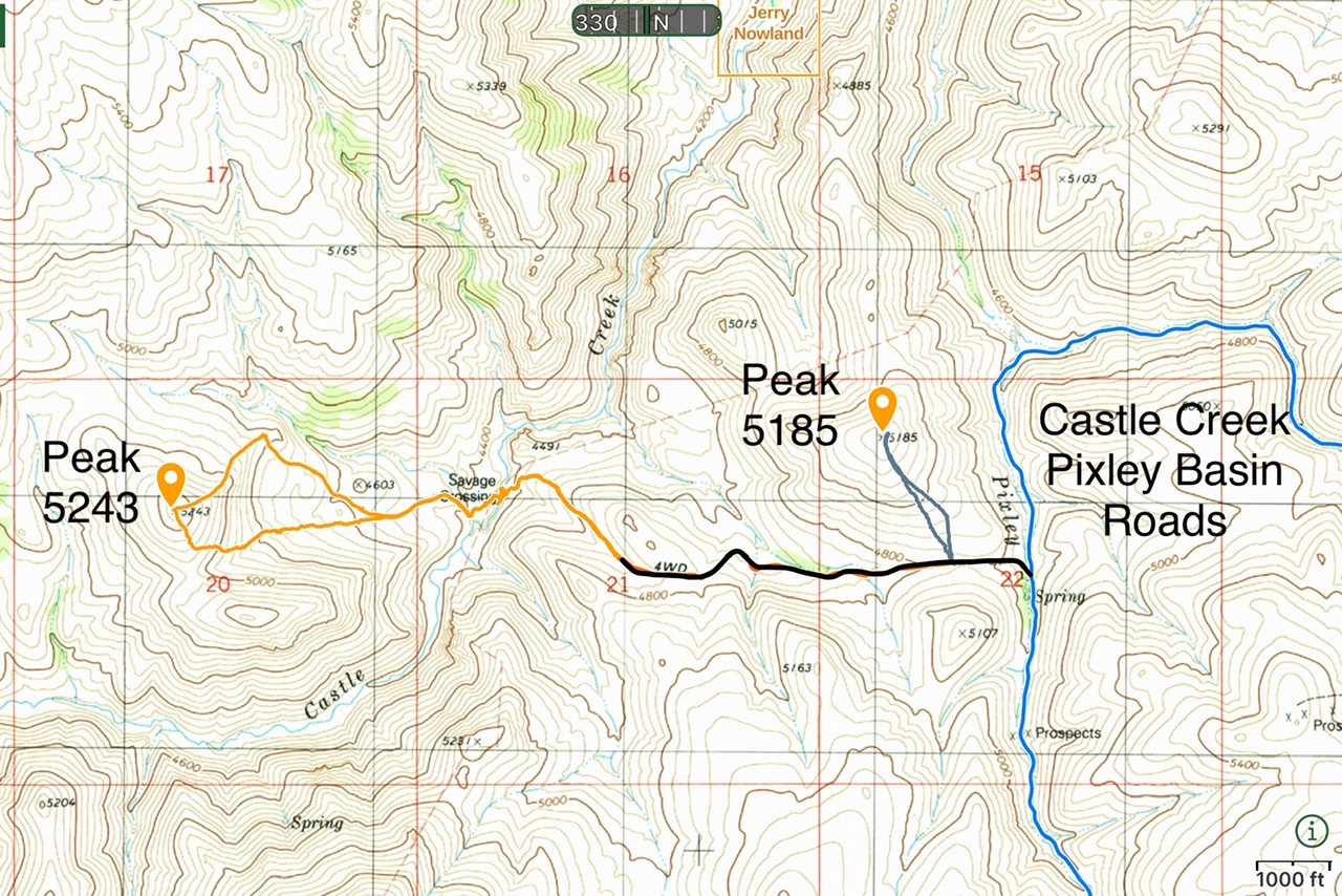
Access and GPS routes for Peak 5185 and Peak 5243
Additional Resources
Regions: Owyhee Mountains->SOUTHERN IDAHO
Mountain Range: Owyhee Mountains
Year Climbed: 2022
Longitude: -116.45029 Latitude: 42.80639