Elevation: 5,186 ft
Prominence: 286
This peak is not in the book. Published November 2023
Peak 5186 is a seldom-climbed, ridgeline summit that sits above the confluence of Wagonhammer Creek and the North Fork Salmon River. This area is a mix of private and public land, so be careful. Peak 5186 is most easily climbed via its west ridge and southwest spur from US-93. USGS North Fork
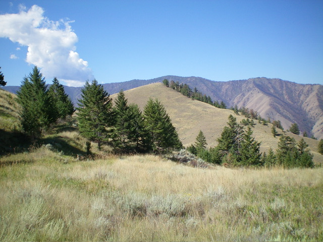
Peak 5186 as viewed from Wagonhammer Gulch to its north. Livingston Douglas Photo
Access
Same as for Peak 5362. This is the third leg of a 3-peak adventure that includes Peak 5362, Peak 5602, and Peak 5186. It covers 8.5 miles with 3,500 feet of elevation gain round trip.
Map Errors
No maps show the ridge road that covers much of the ridge traverse from Peak 5602 to Peak 5186.
Northeast Ridge, Class 2
The Climb
From the 4,900-foot connecting saddle with Peak 5602, scramble west then southwest up easy grass/scrub to reach the summit. The summit is the western of two closely-positioned ridge humps. I found the remnants of a summit cairn so I rebuilt it on the high point. The summit offers a magnificent view of the Salmon River Valley below.
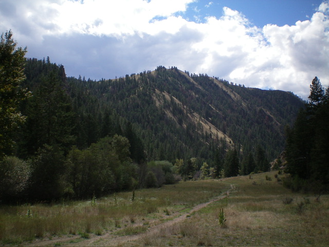
Peak 5186 (dead center) as viewed from the ridgeline to its east. Livingston Douglas Photo
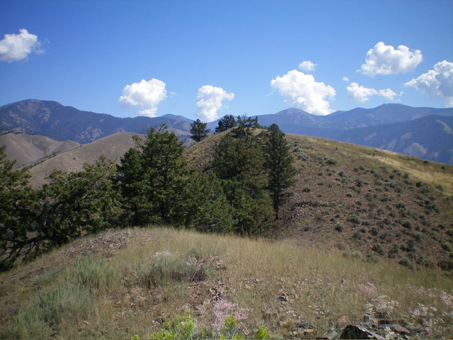
The elusive summit hump of Peak 5186 (dead center) as viewed from high on the west ridge. Livingston Douglas Photo
West Ridge/North Spur, Class 3
The Descent
From the summit, descend west on the semi-open ridge crest. Drop down a steep, grassy face section at 5,000 feet with loose, hidden talus/scree to reach a flat, grassy ridge section. Continue west to where the ridge narrows and US-93 can be seen to the left/south, with the Wagonhammer RV Campground down below. Just as the ridge begins to get very rocky and narrow, leave the west ridge and descend right/north on a steep, grassy shoulder. You will soon see the Wagonhammer Creek Trailhead parking area down below.
Lower down, the shoulder becomes too steep and rocky. Leave the shoulder and descend right/east into a dry gully in very steep, loose rock/scrub/grass (plus some forest). This is Class 3 work. The gully becomes a shoulder and then a face as you approach the valley floor. Angle right/east to avoid steep talus/scree slopes directly above the trailhead area. Stay in easier grass/scrub. Once on the valley floor, cross a dry streambed (with some willows to bash through) to reach FST-137 about 75 yards above the trailhead. Follow the trail west back to the trailhead and parking area.
Additional Resources
Regions: Beaverhead Range->EASTERN IDAHO
Mountain Range: Beaverhead Range
First Ascent Information:
- Other First Ascent: West Ridge/North Spur (Descent)
- Year: 2023
- Season: Summer
- Party: Livingston Douglas
Longitude: -113.9423 Latitude: 45.3907