Elevation: 5,243 ft
Prominence: 303
This peak is not in the book. Published June 2022
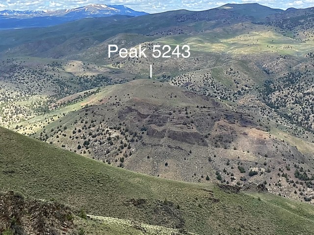
Savage Peak, named after nearby Savage Crossing, is another out-of-the-way Owyhee Mountains peak. If you like remote, seldom-visited peaks, this summit is for you. USGS Pixley Basin
Savage Peak as viewed from Black Butte
Access
Primary access information for this peak and its surroundings is found at the following link: Castle Creek Area Access
A seldom-used 2-track road runs west from Castle Creek/Pixley Basin Roads. This road definitely requires a 4WD. The road has an intimidating start, mellows for a bit, but then gets worse as it continues west. Ideally, follow this road east to its end at the creek and park. However, unless you have an ATV, UTV, dirtbike, or horse, I recommend stopping after traveling a mile from Pixley Creek, at approximately 4,680 feet in elevation (the spot where the black line ends on the map below). This is where the road begins its descent to Castle Creek and Savage Crossing. Turning around beyond this point will be difficult.
Northeast Ridge and Southeast Ridge Traverse, Class 2
From the parking spot above Castle Creek, follow the road down to Savage Crossing. During Spring, you must wade Castle Creek. The traverse is shown on the map below. Immediately after wading the creek, you will encounter two fences with gates. Pass through both gates. From this point, the northeast ridge route follows an ATV track. Higher up the drainage, the track crosses through another fence with a gate. Once you reach the northeast ridge, turn southwest and follow the track to the summit. Cross the fence one more time near the summit. This time, there is no gate. The southeast ridge avoids the last two fence crossings.
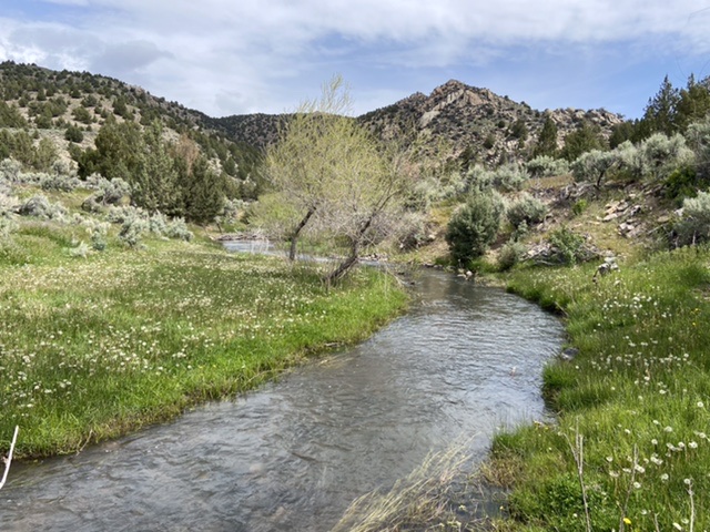
Savage Crossing is anything but savage
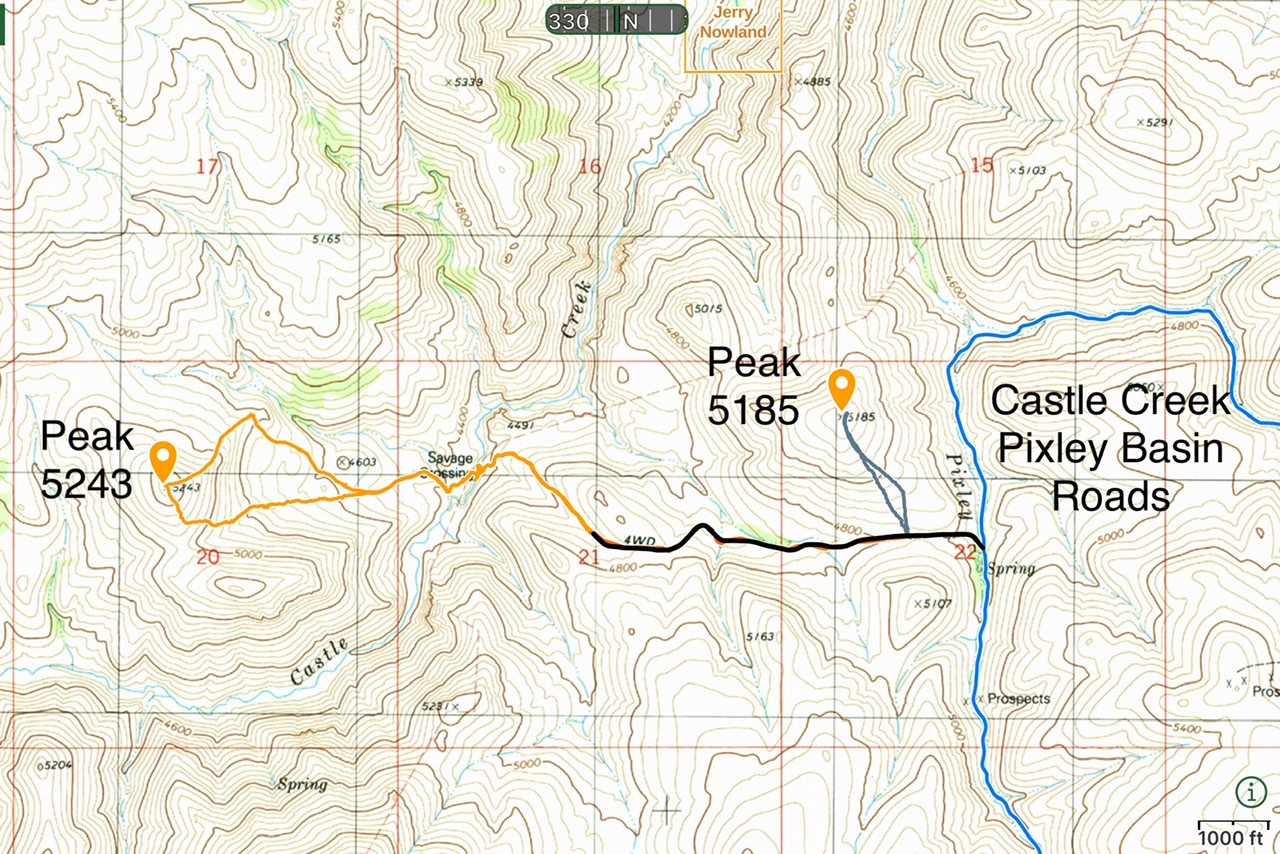
Access and GPS routes for Peak 5185 and Peak 5243
Additional Resources
Regions: Owyhee Mountains->SOUTHERN IDAHO
Mountain Range: Owyhee Mountains
Year Climbed: 2022
Longitude: -116.48501 Latitude: 42.80369