Elevation: 5,273 ft
Prominence: 403
Livingston Douglas provided the new route information and additional photos found down the page. Updated December 2019
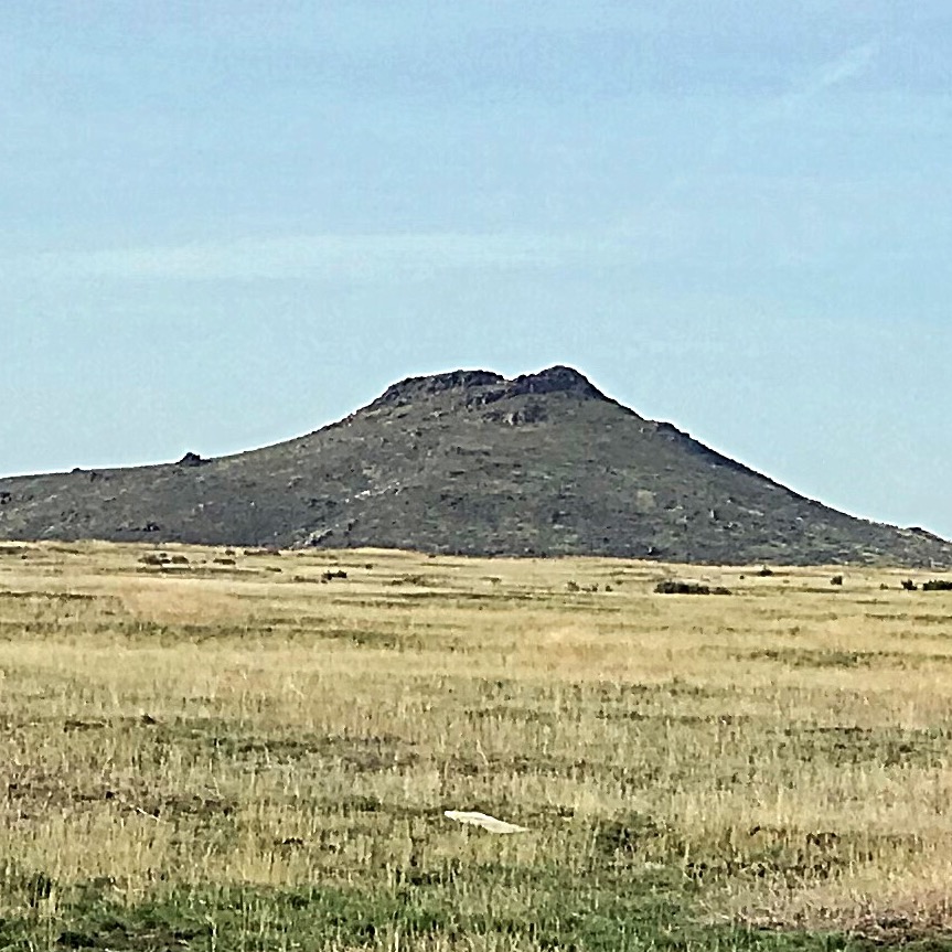
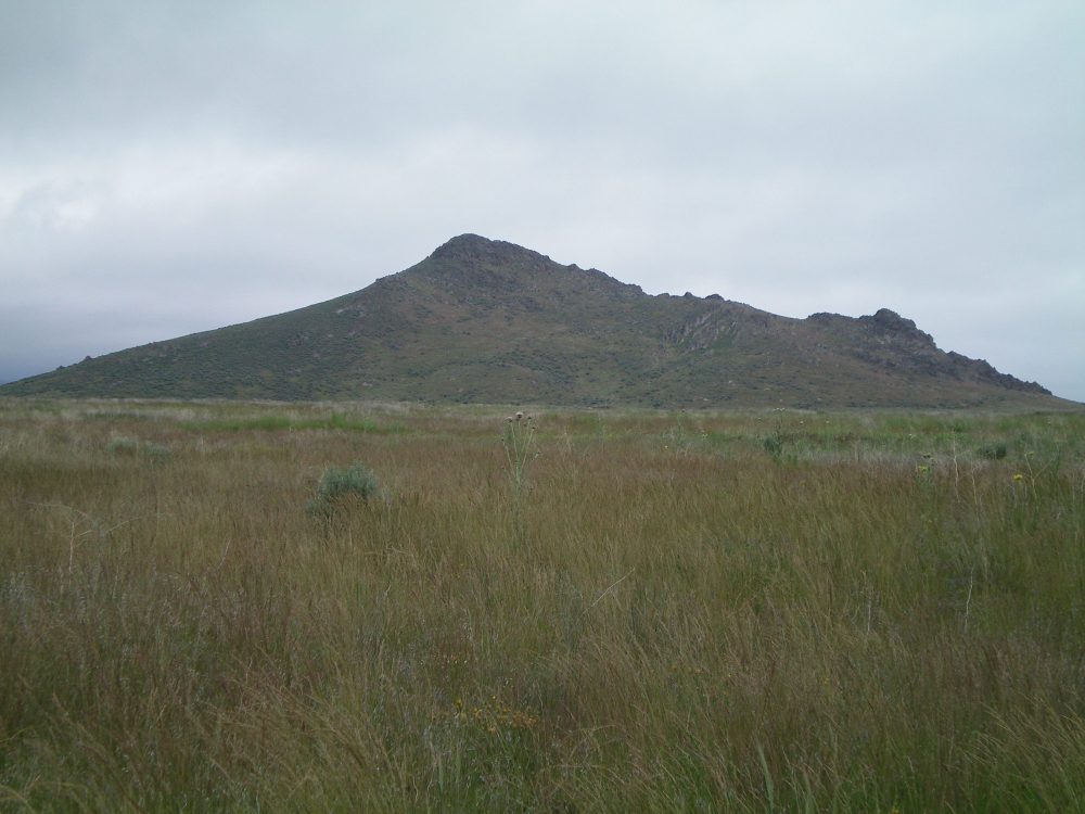
Peak 5273 is a rugged Snake River Plain butte that is located east of Wedge Butte and ID-75. The butte is capped by cliffs and spires. USGS Shoshone Ice Cave
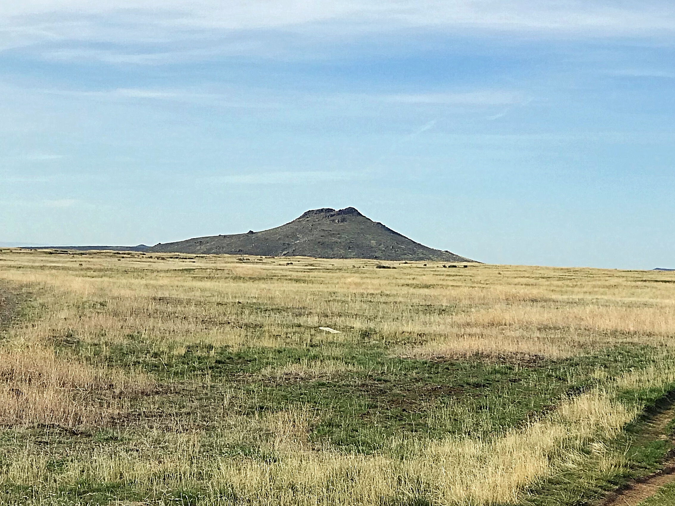
Peak 5273 as viewed from the north
Access
Peak 5273 is accessed from ID-75 where the Picabo Desert Road (a BLM road) leaves the highway. This junction is exactly 7.0 miles south of the US-20/ID-75 junction. The BLM road goes over a cattle guard and runs east along the south edge of the butte. This road receives occasional maintenance but will be very difficult to navigate when wet. Follow the road east. Just before you reach a small butte on the south side of the road, a 4WD road runs north along the butte’s west slopes. When dry, this road is suitable for high-clearance vehicles. See the map below.
I climbed Peak 5273 via its north slopes to work around the crown of cliffs that protect the summit. The route leads around the cliffs on the peak’s northwest corner and then runs up to the base of a higher set of cliffs. From this point, climb west on grassy slopes to the summit block. A short Class 3 scramble gets you on top.
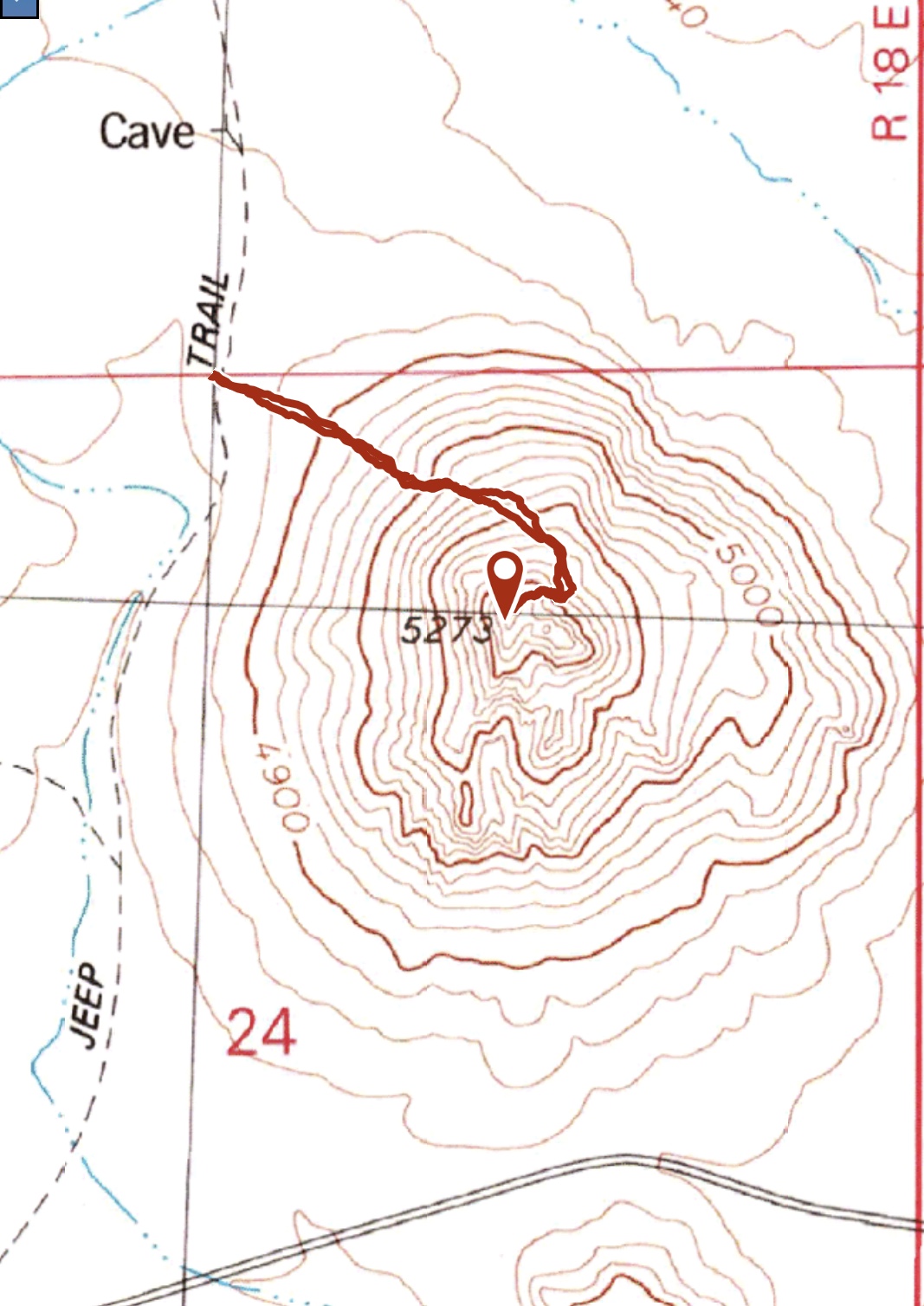
My GPS track
West Face, Class 3 by Livingston Douglas
Due to muddy conditions, I only made it 0.3 miles up the Picabo Desert Road and parked alongside the road. The elevation here is 4,805 feet.
The Climb
Hike east then northeast along Picabo Desert Road, going left/east-northeast at an early, unsigned road junction. After this junction, the road bends left/northeast and follows a dry gully that separates Wedge Butte from Peak 5273. About a mile up this gully, you will have passed Point 4944 to the east. Leave the docile, flat gully to do a cross-country scramble across the easy, open desert scrub/grass on relatively flat ground. Aim straight east at the summit of Peak 5273.
As you approach Peak 5273, you must drop slightly to a dry gully with a jeep road in it. You might see a portable “shepherd’s shack” farther north up this jeep road in a flat meadow at the base of the northwest face of Peak 5273. Hopefully, you won’t be accosted by guard dogs protecting a herd of sheep as I was. I did not see or hear any sheep so the guard dogs took me by surprise. Cross the road/gully. You are now at the base of the rocky west face of Peak 5273.
Scramble up the Class 2+ boulders and face rock of the west face to reach the small, rocky summit. There was no summit cairn on top so I built one. I could now see the herd of sheep to the north of my ascent path across the desert. I was also accosted by an angry swallow (swooping down to just above my head numerous times and screeching wildly) when I was climbing up the boulders on the west face. It was windy and the weather was unsettled. Clouds now shrouded the upper aspects of Wedge Butte to the west. All in all, this was shaping up to be a great day. All of this abuse for an unnamed, albeit ranked, butte in the lonely desert terrain of the Snake River Plain? Yikes.
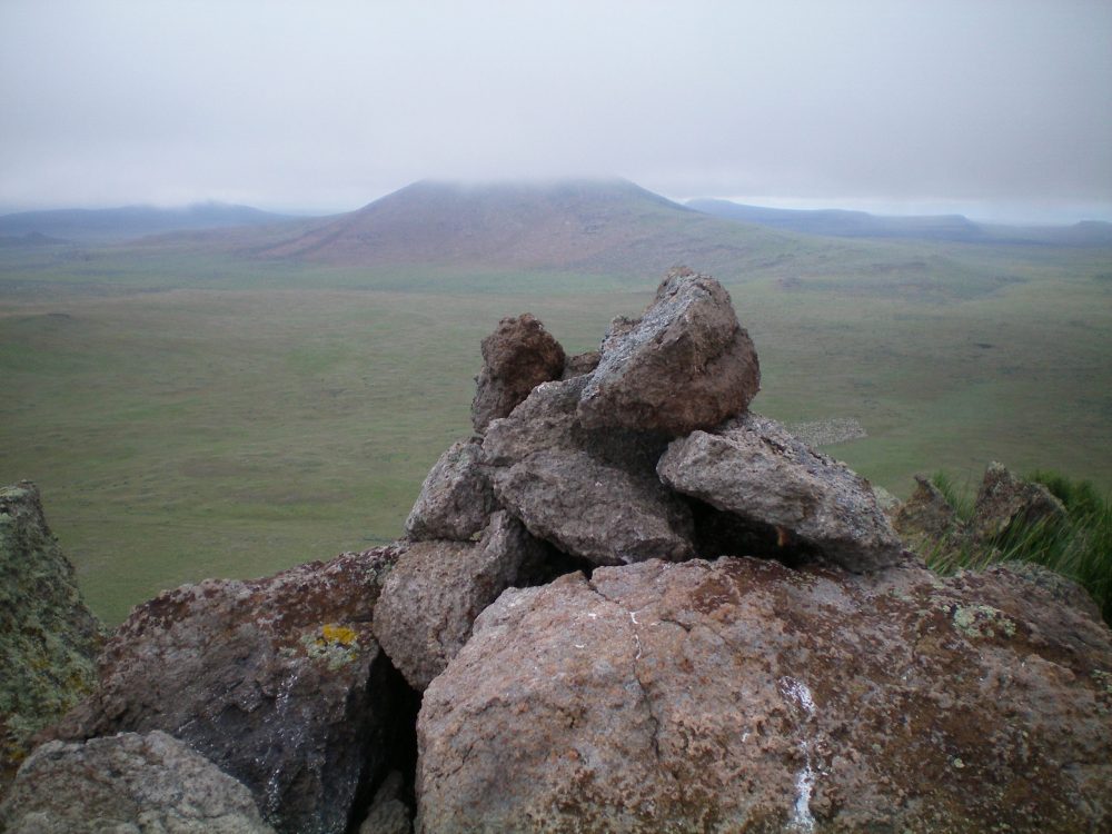
The newly-built summit cairn atop Peak 5273 with cloud-shrouded Wedge Butte in the background. Notice the herd of sheep down on the valley floor (just right of the cairn—look closely). Livingston Douglas Photo
Peak 5273 as viewed from the open, grassy field to its west. Livingston Douglas Photo
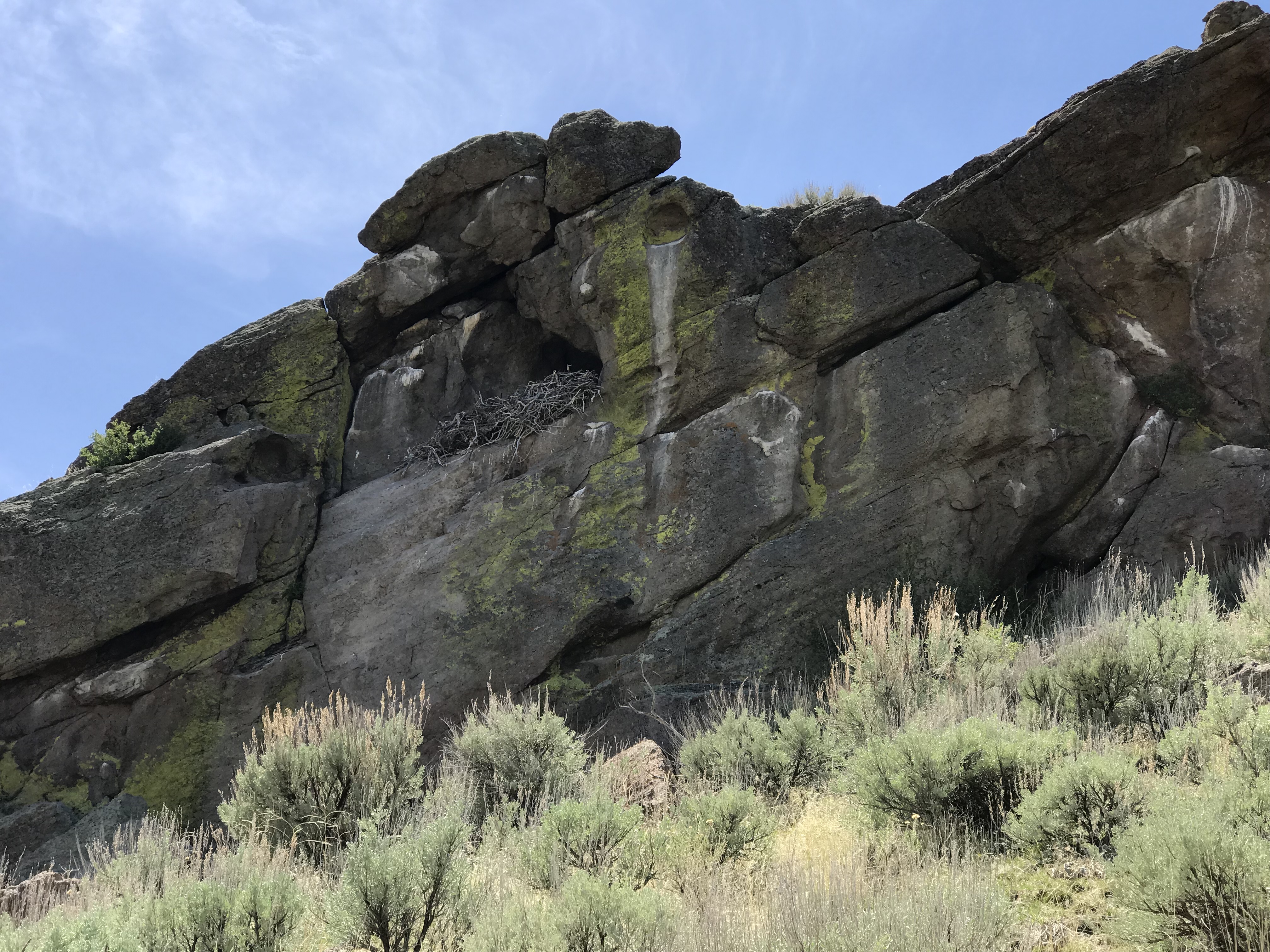
An eagle’s nest (?) near the summit.
Additional Resources
Regions: SNAKE RIVER PLAIN
Mountain Range: Snake River Plain
Year Climbed: 2018
Longitude: -114.26189 Latitude: 43.24079