Elevation: 5,416 ft
Prominence: 396
This peak is not in the book. Livingston Douglas added a new descent route and new photos. Updated October 2025
Peak 5416 is located northwest of Prairie, Idaho. It sits on the divide that separates Little Rattlesnake Creek to the north from Rattlesnake Creek to the south and which culminates on the summit of Rattlesnake Mountain to the east. This out-of-the-way peak is an outstanding early-season destination. This area was burned during a massive forest fire in the 1990s. The Forest Service’s rehabilitation efforts have worked well, as the peak’s slopes are now covered by an attractive mix of trees, brush, grasses, and forbes. USGS Long Gulch
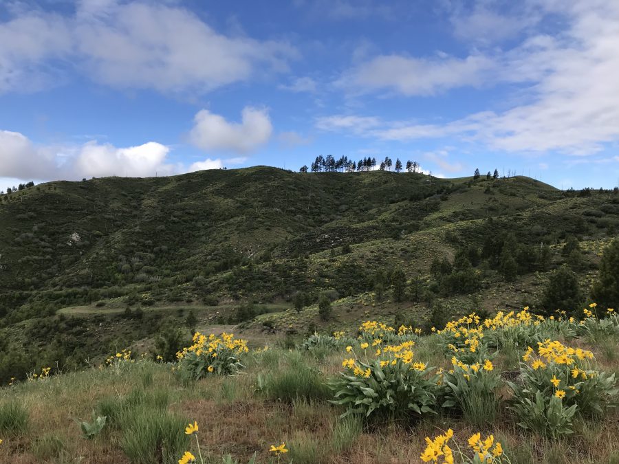
Little Rattler as viewed from the east
Access
This peak is reached from Rattlesnake Creek. Rattlesnake Creek can be accessed from the Middle Fork Boise River and Slide Gulch Road [(C)(1.1) on Page 154] or the South Fork Boise River Road [(E)(2.1) on Page 155]. The road that runs between the Middle and South Forks is called the Slide Gulch Road in the north and the Long Gulch Road in the south. They are the same road.
If approaching from the South Fork, turn left/north at the 3-way junction just south of the Y-Not Store. Follow either approach to the Tipton Flat Road/FS-216 junction. This road runs from the junction up Rattlesnake Creek to the site of the Tipton Flat Campground in 4.0 miles. Although the campground was destroyed by the fire, the site still has several nice camping spots. In two miles, you reach an unmarked junction with FS-219. FS-219 is gated and closed to all motor vehicles.
Google Maps will give you directions for the Middle Fork approach. Search for Tipton Flat Campground. I recommend approaching from the South Fork. Search for The Long Gulch Road, Elmore County.
East Ridge, Class 2
Follow FS-219 as is winds its way up to the ridge east of the summit. The road is in good condition and is perfect for a mountain bike approach. Once on the top of the ridge, follow the road west to the base of the peak’s east ridge. Leave the road and follow a combination of game trails and the old fire break to the summit. The upper slopes are mostly open. You can leave the road at 4,400 feet and take a more direct line to the top as shown on the GPS track below.
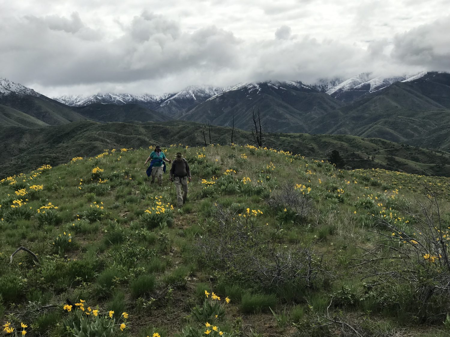
Hiking up the east ridge
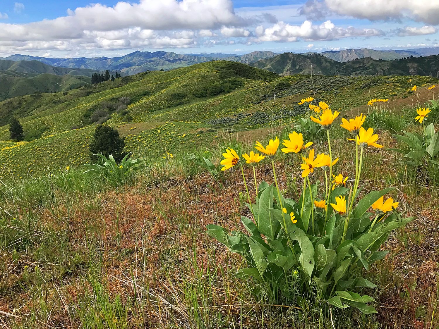
The view from the summit looking southwest
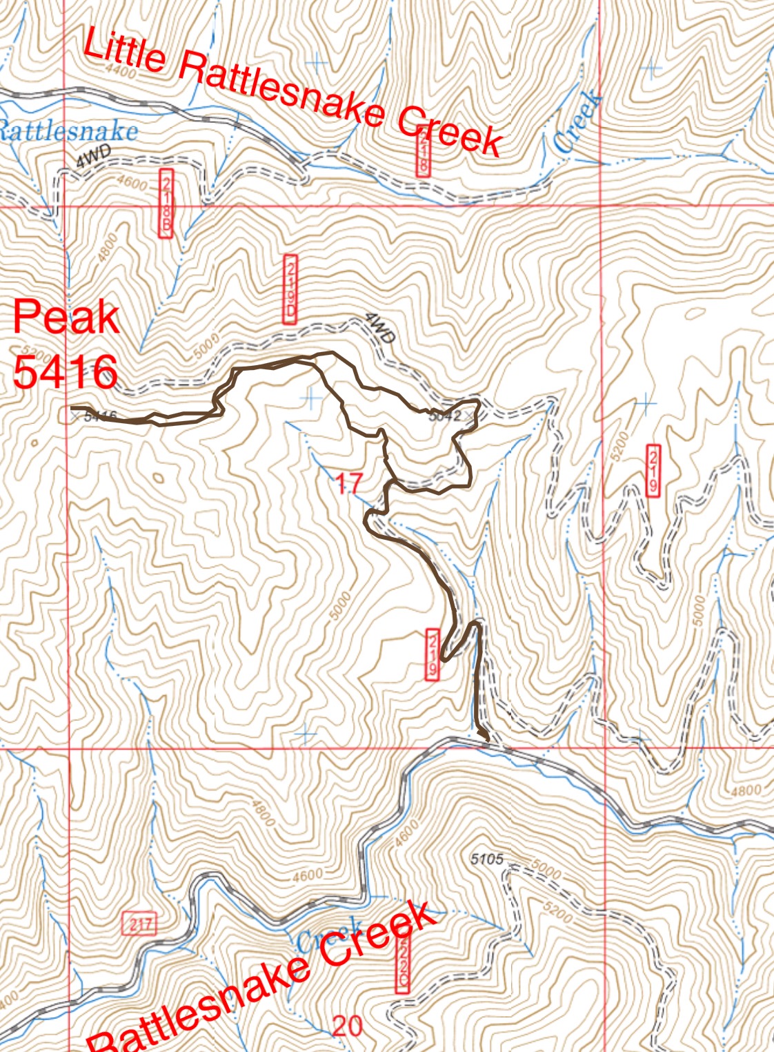
My GPS track recorded 3.8 miles and 839 feet of elevation gain round trip.
Southeast Ridge, Class 2 by Livingston Douglas
The Descent
From the summit, head east then southeast down the semi-open ridge. This bushwhack is easier than the east ridge, though it has a few ups and downs. Leave the ridge at an indistinct ridge corner at 5,300 feet. Descend east on a rounded shoulder which becomes a face of scrub and field grass. Farther down, drop right/south into an easy veg gully. Come up over a minor ridge to then descend to FSR-219. The southeast ridge is a shorter, more direct way to the summit of Little Rattler.

The scrub-covered summit hump of Little Rattler (left of center) as viewed from high on the southeast ridge. This was my descent route. Livingston Douglas Photo
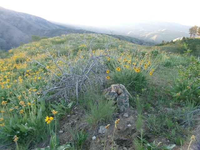
The summit of Little Rattler with its newly-built summit cairn. Livingston Douglas Photo
Additional Resources
Regions: Boise Mountains->WESTERN IDAHO
Mountain Range: Boise Mountains
Year Climbed: 2019
Longitude: -115.65839 Latitude: 43.59669